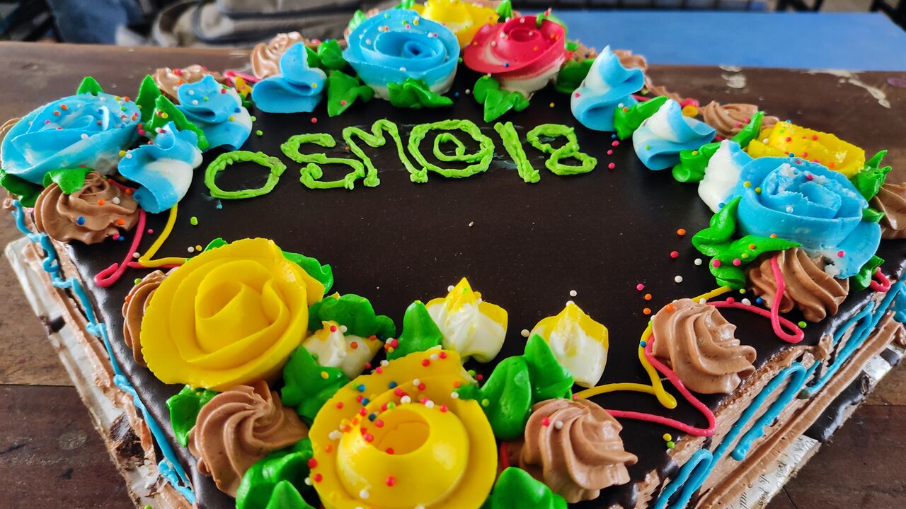
Cake for OpenStreetMap’s 18th anniversary, celebrated by OSM Bangladesh at BSMRSTU (Bangabandhu Sheikh Mujibur Rahman Science and Technology University). Photo by Sawan Shariar, CC-BY-SA 4.0
This Sunday, 7th of August 2022, we are celebrating 18 years of OpenStreetMap!
Celebrations started the previous week and will continue for one more week. So, how do you plan to celebrate? 🙂
Planning to organise an online or in-person event? Please add your event to the OSM wiki! If wiki editing isn’t your thing, email communication@osmfoundation.org with your event details and we’ll add it 🙂
You could post why you love OpenStreetMap 🙂 Remember to use the hashtag #OpenStreetMap18 on social media.
Posting photos of celebrations? If your photos are accompanied with the text “CC-BY-SA 4.0” (or another open license), we can add them to the OSM wiki (or feel free to add them yourself! ~ register here).
Or you could post a photo of yourself holding a written message 🙂
You can use your video room even after the birthday, for any OSM-related event.
Community members in low-bandwidth environments may benefit from using BigBlueButton’s low-bandwidth settings.
Please add your event to the OSM wiki! If wiki editing isn’t your thing, email communication@osmfoundation.org with your event details and we’ll add it 🙂
Join us!
Observance of the anniversary of the creation of OpenStreetMap is held on or about the 9th of August, which is the anniversary of the registration of the OpenStreetMap.org domain name. The concept of OpenStreetMap predates the domain name registration, but that seems a suitable anniversary date 🙂
Do you want to translate this and other blogposts in another language..? Please send an email to communication@osmfoundation.org with subject: Helping with translations in [language]
OpenStreetMap was founded in 2004 and is an international project to create a free map of the world. To do so, we, thousands of volunteers, collect data about roads, railways, rivers, forests, buildings, and a lot more worldwide. Our map data can be downloaded for free by everyone and used for any purpose – including commercial usage. It is possible to produce your own maps which highlight certain features, calculate routes, etc. OpenStreetMap is increasingly used when one needs maps that can be very quickly, or easily, updated.
Are you attending State of the Map in person (in Italy) or online? Here are some ideas on how to actively participate/contribute to the conference in person or online!
1. Help out as a volunteer
Volunteers are the driving force of OSM and SotM conference. Would you like to help by volunteering to ensure the SotM is as smooth as possible? Here are the roles you can help with:
In-person Volunteers (Note: You must be physically present in Italy)
Conference setup (volunteers must be already at 18 August available)
Deadline for submission is 12 August 202216 August 2022
3. For technique-oriented people, you can help as part of the video team!
Please reach out to the SotM Working Group via sotm [at] openstreetmap [dot] org
4. Be the SotM 2022 photographer(s)
The person(s) could generally take some photos in the name of SotM organization team and also should take the group photo. We kindly as ask the released photos have CC licence (*) so we can use them later in the SotM context.
(*) under an open license (CC-BY-SA 3.0 or later recommended or CC0)
5. Organize a self-organized session
Besides the main programme, we will offer space for self-organized sessions (or Birds of Feather / BoF). We have set up the OSM wiki page https://wiki.openstreetmap.org/wiki/State_of_the_Map_2022/self-organized_sessions, where you can sign up for a self-organized online session. For the on-site self-organized session, we will set up a whiteboard where you can reserve your timeslot and room at the conference venue. You can brainstorm for your session topic as early as now!
6. Check the SotM 2022 Programme schedule and plan which sessions you are attending
We have a variety of tracks (general, academic, workshops) and topics in our programme schedule https://2022.stateofthemap.org/programme/ so you can plan as early as now which talks/sessions you are attending as well as list your questions to the speaker(s)!
Did we miss anything? If you have participated in SotM conferences before, let us know how and share your experiences in the comment/reply!
Do you want to translate this and other blog posts into your language…? Please email communication@osmfoundation.org with the subject: Helping with translations in [your language]
The State of the Map conference is the annual, international conference of OpenStreetMap, organised by the OpenStreetMap Foundation. The OpenStreetMap Foundation is a not-for-profit organisation, formed in the UK to support the OpenStreetMap Project. It is dedicated to encouraging the growth, development, and distribution of free geospatial data for anyone to use and share. The OpenStreetMap Foundation owns and maintains the infrastructure of the OpenStreetMap project. The State of the Map Organising Committee is one of our volunteer Working Groups.
OpenStreetMap was founded in 2004 and is an international project to create a free map of the world. To do so, we, thousands of volunteers, collect data about roads, railways, rivers, forests, buildings, and a lot more worldwide. Our map data can be downloaded for free by everyone and used for any purpose – including commercial usage. It is possible to produce your own maps which highlight certain features, calculate routes, etc. OpenStreetMap is increasingly used when one needs maps that can be very quickly, or easily, updated.
The State of the Map working group is delighted to announce that the call for venues for 2023 is now open!
State of the Map 2022 in Florence and online is approaching. We – the State of the Map (SotM) working group – are co-working with an awesome local team based in Italy. They found the venue. Checked the technical conditions for video and more. They ordered catering. The social event is planned. Next steps will be the managing of all volunteers in all roles and shifts. Not too easy 🙂
So we take some time and start thinking about State of the Map 2023.
We are looking for a local team that wants to bring OpenStreetMap to their home town. Do you have any suitable locations in your city? Can it host 300 or 500 people? And .. this cannot be too expensive as SotM wants to stay affordable for the community. How is the catering managed? How easy can attendees and participants travel your city?
We can help you investigate and develop a suitable bid. Please contact us.
Do you want to translate this and other blog posts into your language…? Please email communication@osmfoundation.org with the subject: Helping with translations in [your language]
The State of the Map conference is the annual, international conference of OpenStreetMap, organised by the OpenStreetMap Foundation. The OpenStreetMap Foundation is a not-for-profit organisation, formed in the UK to support the OpenStreetMap Project. It is dedicated to encouraging the growth, development, and distribution of free geospatial data for anyone to use and share. The OpenStreetMap Foundation owns and maintains the infrastructure of the OpenStreetMap project. The State of the Map Organising Committee is one of our volunteer Working Groups.
OpenStreetMap was founded in 2004 and is an international project to create a free map of the world. To do so, we, thousands of volunteers, collect data about roads, railways, rivers, forests, buildings, and a lot more worldwide. Our map data can be downloaded for free by everyone and used for any purpose – including commercial usage. It is possible to produce your own maps which highlight certain features, calculate routes, etc. OpenStreetMap is increasingly used when one needs maps that can be very quickly, or easily, updated.
Did you miss the deadline for the Call for participation for State of the Map 2022 but still want to get a chance to present your latest news and inventions around OpenStreetMap? Like previous years, we have reserved some slots for Lightning talks.
Lightning talks are quick 5-minute talks about any topic related to OpenStreetMap. Since SotM 2022 will be our first attempt at doing a hybrid conference, there are two options for holding a lightning talk:
In-person lightning talk in Firenze: These are traditional lightning talks held during one of the Lightning talk sessions at the conference. The registration for in-person lightning talks opens on 19 August when the State of the Map 2022 conference starts. You can register for a slot directly at the conference venue.
Pre-recorded lightning talk: Like in the two previous years, we offer the opportunity to submit a short video with a pre-recorded lightning talk. So if you don’t make it to Firenze, you can still participate with a lightning talk and present your topic to a wider audience.
Submission for pre-recorded lightning talks is now open. We are looking forward to your videos about any topic related to OpenStreetMap. The deadline to register and upload pre-recorded lightning talks is 12 August 2022 23:59:59 UTC
For more details and to register a pre-recorded lightning talk, please visit the OpenStreetMap Wiki
Do you want to translate this and other blog posts into your language…? Please email communication@osmfoundation.org with the subject: Helping with translations in [your language]
The State of the Map conference is the annual, international conference of OpenStreetMap, organised by the OpenStreetMap Foundation. The OpenStreetMap Foundation is a not-for-profit organisation, formed in the UK to support the OpenStreetMap Project. It is dedicated to encouraging the growth, development, and distribution of free geospatial data for anyone to use and share. The OpenStreetMap Foundation owns and maintains the infrastructure of the OpenStreetMap project. The State of the Map Organising Committee is one of our volunteer Working Groups.
OpenStreetMap was founded in 2004 and is an international project to create a free map of the world. To do so, we, thousands of volunteers, collect data about roads, railways, rivers, forests, buildings, and a lot more worldwide. Our map data can be downloaded for free by everyone and used for any purpose – including commercial usage. It is possible to produce your own maps which highlight certain features, calculate routes, etc. OpenStreetMap is increasingly used when one needs maps that can be very quickly, or easily, updated.
Mastodon (aka “The Fediverse”) is a distributed social media network, based on the ActivityPub internet standard. It’s been featured on the New York Times, Vice and Wired. Think of Twitter, but based on open internet protocols, and allowing each community to define its own rules and build its own local community. The Fediverse has a reputation of being nicer and more respectiful than some of the more combative social media spaces.
The en.osm.townMastodon Mapstodon instance was set up in July 2018 and has been steadily used by hundreds of OSMers over the years. Since the start, we’ve been using the excellent service from Masto.host to host this little corner of the fediverse. Some of the Mapstodon users have been spreading flyers at in person State of the Map conferences. Since this little community has been constantly active and helping each other, the OSMF decided to step up and help support this, and fund it directly.
The server was founded & administred by @amapanda@en.osm.town, with moderation from others. (Although Amanda is on the OSMF Board, this is separate from the Board). While the OSMF is funding this project, there will be no change to the moderation & administration of the server. The OSMF “supports, but does not control” OpenStreetMap.
The OpenStreetMap Foundation is a not-for-profit organisation, formed to support the OpenStreetMap Project. It is dedicated to encouraging the growth, development and distribution of free geospatial data for anyone to use and share. The OpenStreetMap Foundation owns and maintains the infrastructure of the OpenStreetMap project, is financially supported by membership fees and donations, and organises the annual, international State of the Map conference. Our volunteer Working Groups and small core staff work to support the OpenStreetMap project. Join the OpenStreetMap Foundation for just £15 a year or for free if you are an active OpenStreetMap contributor.
Building on the previous State of the Map culture, we love to hear what has been done with OpenStreetMap data, but we also love to see more, SotM 2022 invites you to submit a poster today.
Your poster could show how well your home region is mapped; it could be a beautiful new style or map. It might focus on a community project or statistics; it might be a poster explaining and inviting people to OpenStreetMap. What is important is that we want it to be about OSM. We are also welcoming academic posters about research around OpenStreetMap data.
Please email sotm@openstreetmap.org with a description of your poster. For example, the background of the project or whatever you consider important to mention in the context of the poster – all that you would tell people if you show them your poster. We will publish this text together with the poster on the SotM website.
Please also mention the filename of the uploaded poster in your email, so that we can know which of the uploaded posters is yours.
Timeline
Deadline: 31 July 2022
The SotM team hopes to shortlist up to 20 posters that will be published on our website and some other SotM channels under CC BY SA 3.0 (or later)
Do you want to translate this and other blog posts into your language…? Please email communication@osmfoundation.org with the subject: Helping with translations in [your language]
The State of the Map conference is the annual, international conference of OpenStreetMap, organised by the OpenStreetMap Foundation. The OpenStreetMap Foundation is a not-for-profit organisation, formed in the UK to support the OpenStreetMap Project. It is dedicated to encouraging the growth, development, and distribution of free geospatial data for anyone to use and share. The OpenStreetMap Foundation owns and maintains the infrastructure of the OpenStreetMap project. The State of the Map Organising Committee is one of our volunteer Working Groups.
OpenStreetMap was founded in 2004 and is an international project to create a free map of the world. To do so, we, thousands of volunteers, collect data about roads, railways, rivers, forests, buildings, and a lot more worldwide. Our map data can be downloaded for free by everyone and used for any purpose – including commercial usage. It is possible to produce your own maps which highlight certain features, calculate routes, etc. OpenStreetMap is increasingly used when one needs maps that can be very quickly, or easily, updated.
The State of the Map Working Group is happy to announce that tickets and program are now accessible through the SotM 2022 website at https://2022.stateofthemap.org/programme/
Tickets OSM contributors and enthusiasts can now purchase tickets to attend the SotM conference in person or online, via https://2022.stateofthemap.org/tickets/.
There are two different ways you can attend this year:
Florence Ticket This is the ticket to attend the conference in person in Florence. This ticket includes meals at the conference’s breaks and social events. If you are contributing to OpenStreetMap as a hobbyist, you may choose the discounted Community Ticket. Otherwise please get a Regular Ticket.
Venueless Ticket This is the ticket to attend the conference remotely. This will give you access to the conference talks, and a chat to interact with other participants and allows you to send questions to speakers during Q&A sessions.
Early Bird Ticket We are offering limited Early bird tickets at a discounted price until 1 July 2022 at 23:59 UTC. Regular ticket price will apply after.
Program (General Track) We thank everyone who submitted their proposal to speak and organize a session at SotM 2022! We received a lot of amazing proposals and we are delighted to share the first version of our programme for the General Track, now accessible via https://2022.stateofthemap.org/programme/
We will provide continuous updates on the programme (including the Academic Track Programme).
Stay tuned for more updates about State of the Map 2022! For any questions, do not hesitate to contact us at sotm [at] openstreetmap.org or join the Telegram channel to interact with other SotM conference-goers at https://t [dot] me/sotm2018
See you in Firenze and online! The State of the Map Working Group
Do you want to translate this and other blog posts into your language…? Please email communication@osmfoundation.org with the subject: Helping with translations in [your language]
The State of the Map conference is the annual international conference of OpenStreetMap, organised by the OpenStreetMap Foundation. The OpenStreetMap Foundation is a not-for-profit organisation formed in the UK to support the OpenStreetMap Project. It is dedicated to encouraging the growth, development and distribution of free geospatial data for anyone to use and share. The OpenStreetMap Foundation owns and maintains the infrastructure of the OpenStreetMap project, and you can support it by becoming a member. The State of the Map Organising Committee is one of our volunteer Working Groups.
OpenStreetMap was founded in 2004 and is an international project to create a free map of the world. To do so, we, thousands of volunteers, collect data about roads, railways, rivers, forests, buildings, and more worldwide. Our map data can be downloaded for free by everyone and used for any purpose – including commercial usage. It is possible to produce your own maps which highlight certain features, calculate routes etc. OpenStreetMap is increasingly used when one needs maps that can be quickly or easily updated.
We all know and love the OpenStreetMap data model with its nodes, ways, and relations and the open tagging that has allowed OpenStreetMap to be so innovative. But the data model also shows its years and some improvements might be possible. There is a lot we don’t want to change. Especially the open tagging model has proven itself. We might think of some small improvements, but the core idea of allowing any number of key-value (string) tags has worked amazingly well.
But there are some pain points due to the way we organize our data. The biggest problem is that geographic location is only available to nodes and not higher-level geographic objects like ways and relations. This means that accessing the location of, say, a way always means we have to follow the references to the member nodes of that way. This makes processing OSM data extremely cumbersome and resource-intensive. The other major pain point often talked about is the missing “area” datatype. We use work-arounds like closed ways and multipolygon relations, but that has always been problematic, because we can’t be sure that those objects are actually valid polygons.
The OSMF Engineering Working Group (EWG) has commissioned me (Jochen Topf) to write a study over the next months outlining the problems with our current data model, possible improvements and their impact on our systems. Any changes to our data model will, of course, have a large impact on our mappers, the data users, our software and on the whole OSM ecosystem. So the study will also suggest ways to move forward implementing those changes step by step.
You are welcome to contact me via email at jochen@topf.org if you want to discuss any of this. After my talk at the State of the Map in Milano in 2018 in which I already outlined some of the issues with the data model, I created the osm-data-model repository. Feel free to comment there. After my preliminary study I will expect there will be a more formal discussion process where we can decide as a community which (if any) changes we want and how we are going to implement them.
The OpenStreetMap Foundation is a not-for-profit organisation, formed to support the OpenStreetMap Project. It is dedicated to encouraging the growth, development and distribution of free geospatial data for anyone to use and share. The OpenStreetMap Foundation owns and maintains the infrastructure of the OpenStreetMap project, is financially supported by membership fees and donations, and organises the annual, international State of the Map conference. Our volunteer Working Groups and small core staff work to support the OpenStreetMap project. Join the OpenStreetMap Foundation for just £15 a year or for free if you are an active OpenStreetMap contributor.
Last March saw the launch of the Pin je punt project (“Pin your point”). The aim of this tourism-focused mapping campaign is to augment OpenStreetMap with points of interest for hikers and cyclists, specifically in the Belgian region of Flanders. Pin je punt is a collaboration between Toerisme Vlaanderen/Visit Flanders (the region’s official tourism administration), the provincial tourism organisations and OpenStreetMap Belgium.
A partnership like this has a lot of potential to increase awareness about OpenStreetMap, and convince organisations and individuals to hop on the OSM train. So of course we wanted to know more. How did this collaboration come about? What has been achieved? And what can OSM as a community learn from a project like this?
To get an answer to these questions, we sat down with Pieter Vander Vennet (OSM Belgium) and Jos Pyck (project manager for Pin je Punt at Visit Flanders). This post is a reflection of those conversations.
Pieter Vander Vennet
Jos Pyck
What is the goal?
The Flemish tourism agencies want to enrich OpenStreetMap with as many points of interests as possible in the following categories:
Charging stations for e-bikes
(Public) toilets
Benches and picnic tables
Observation towers
Bicycle repair stations
Bicycle rentals
Playgrounds
The data should be complete enough so it can be used to improve route planning applications for hikers and cyclists, possibly even printed maps.
How did it start?
Back in the winter of 2020-2021, Visit Flanders was contacted by route planning developers looking for datasets to improve their services for cyclists and hikers. Triggered in large by the COVID pandemic, this target audience had grown into a large community with varying needs: hikers in search of public toilets now that restaurants and bars were closed, young families looking for playgrounds, e-bikers in need of charging stations, …
Unfortunately, no Flemish dataset was available to meet these requirements. The Flemish tourism organisations did have open datasets, but they were incomplete and spread across the five provinces. The solution? Using OpenStreetMap to unify, improve and maintain these different datasets.
Through the local cyclist organisation Fietsambassade Gent, Visit Flanders came into contact with Pieter Vander Vennet, who had developed the MapComplete editor and had already worked with a couple of government agencies. They formed a core working group with other OSM Belgium users Joost Schouppe and Seppe Santens (also ICT manager at the West-Flemish tourism organisation Westtoer, the only provincial agency with previous OSM experience). And just like that, Pin je punt was born.
How is the data added to OSM?
The existing datasets of the provincial tourism organisations were loaded and the objects converted into notes, which can be validated by users one by one. Of course new data points can be added as well. Validation and editing occurs in a custom theme in Pieter’s MapComplete tool, enabling users to edit specific POI categories in OSM in a user-friendly way. This makes it the perfect fit for the Pin je punt campaign, which is also aimed at users without OSM experience. Visit Flanders invited all Flemish province and municipality employees to start editing, and even launched a media campaign to reach the general public. (The promo video featuring a former Flemish radio presenter (in Dutch only) is, as far as Pieter knows, the first professional commercial encouraging contributions to OpenStreetMap!)
Of course, as new users are attracted, it is important to keep an eye on the quality of their work. For that reason, volunteers of the Belgian OSM community monitor the edits made in Pin je punt.
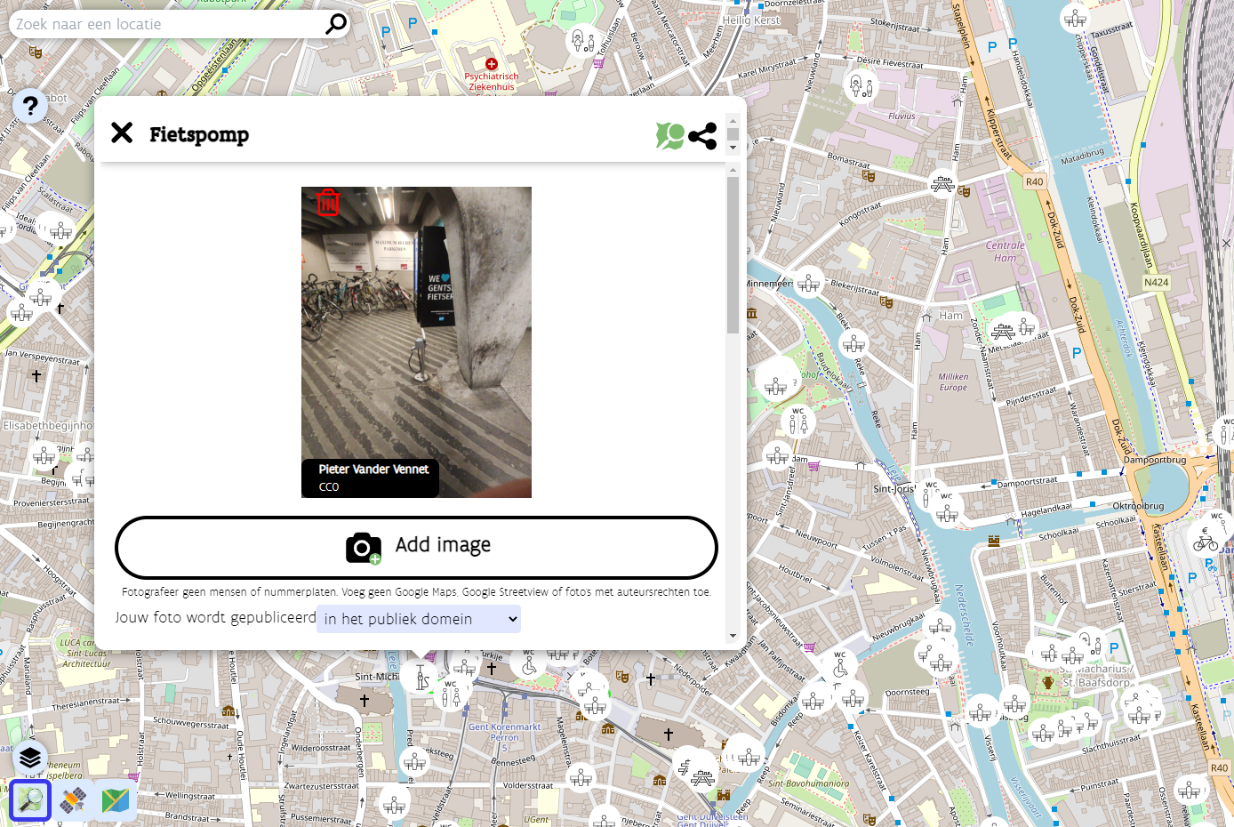
A bicycle pump in the Pin je punt MapComplete theme
What are the results and takeaways?
The Pin je punt campaign officially concluded at the end of April 2022. During the 1,5-month-long project run, the imports of the provincial datasets and the edits made by many tourism organisation employees and other users resulted in about 1,500 new points being created in OpenStreetMap. Since the Pin je punt MapComplete theme remains available, these users can continue to improve the data in their municipalities.
But the potential effects of Pin je punt extend far beyond an increased number of POIs for hikers and cyclists. The campaign also has the capability to increase awareness about OpenStreetMap and its possibilities outside of the OSM community, and to encourage more organisations to start using OSM.
Pin je punt has convinced one person in particular of OpenStreetMap’s strengths: project manager Jos Pyck of Visit Flanders. He used to be sceptical about using OSM, as he–despite his GIS background–deemed it far too technically complex. But this campaign has turned him into a true OSM believer. He’s impressed by the sheer size of the database and the fact that anything can be captured in it. And his pleasant experience with the helpful community even resulted in Visit Flanders becoming a corporate member of OSM Belgium.
Jos is very interested in expanding the Pin je punt theme with more tourism-related layers in the future, for instance bars, restaurants, drinking fountains, … He has even made it his mission to encourage other government agencies and municipalities to invest (more) in OSM, instead of setting up and maintaining their own limited, siloed databases. The five provincial tourism organisations involved in Pin je punt are already on board. Four of them had no previous experience with OpenStreetMap, and this project convinced them that the OSM community can produce a dataset superior to theirs. The experience really lowered the barrier for them to use OSM again in the future. Hopefully the results of Pin je punt can win over other public organisations as well.
Collaborations like these can also be a learning experience for the OpenStreetMap community. As a former outsider, Jos Pyck had some interesting insights to share. Though he is now an avid fan of OSM, he still believes it is difficult for newcomers to start using the map, as they are intimidated by how technical it looks. This outsider perspective had a positive impact on the look and feel of the MapComplete theme created for Pin je punt. While Jos’s team members were trying out the first versions of the theme, they formulated some comments about the user-friendliness of the tool. Pieter Vander Vennet took their feedback to make the tool as simple, easy to use and promotable as possible. Note that it can be reused outside of Flanders–the project team already saw some edits popping up in the rest of Belgium, the Netherlands, France, the UK, …
One particular observation Jos made while venturing into the world of OpenStreetMap, is the small number of women in the community. He points out that his colleagues who tested the MapComplete theme were all female and therefore had a different perspective on usability, which helped tweak the tool substantially. According to Jos, OSM would very much profit from getting more women on board.
Want to find out more?
This blog post points to many interesting links providing more information about the Pin je punt project and the people involved. If you have any additional questions, feel free to reach out to Jos Pyck, Pieter Vander Vennet and Joost Schouppe at pinjepunt@toerismevlaanderen.be.
Want to contribute?
Though the Pin je punt project officially concluded at the end of April, all contributions to help cyclists and hikers in Flanders are still very much welcome. So don’t hesitate to head to the Pin je punt MapComplete theme (in Dutch only) and start mapping!
Do you want to translate this and other blog posts in another language? Please send an email to communication@osmfoundation.org with the subject: Helping with translations in [language]
Thanks to the support of corporate donors, the OpenStreetMap Foundation has been able to hire its first employee, who is starting on 1 May 2022. Grant Slater and Guillaume Rischard, the Foundation’s chairman, sat down for a virtual chat.
Hi! Tell us about you?
Hi! I’m Grant Slater, and I’m the new Senior Site Reliability Engineer (SRE) working for the OpenStreetMap Foundation. I’m originally from South Africa, and now live in London (UK) with my wife Ingrida and our son Richard.
What do you do in OSM? Where do you like to map?
I’ve been mapping since 2006, mostly in the Southern Africa and in the United Kingdom. I have a strong interest in mapping the rail network of South Africa; holidays “back home” often involve booking railway trips across the country, with a GPS in hand.
My latest toy is an RTK GPS base station and rover. I’ll soon be mapping my neighbourhood with centimetre-level accuracy.
For the last 15 years, I’ve been part of the volunteer OpenStreetMap Operations Team who install and maintain the servers and infrastructure which runs the OpenStreetMap.org website and many other related services.
What are your plans for the new SRE job?
My main objective will be helping improve the reliability and security of the project’s technology and infrastructure.
One of my goals will be to improve the project’s long-term stability as we grow. OWG can’t work without volunteers, and I will be improving the Operation Team’s bus factor by also improving our processes, documentation, and by smoothing the path to onboarding new team members.
I will be helping to drive forward modernising the project’s infrastructure by reducing complexity, paying-down technical debt, and reducing our need to maintain undifferentiated heavy lifting, by tactically using Cloud and SaaS services, where suitable.
Is there anything else you’d like to say?
With time, I would like to see OpenStreetMap introduce new tools and services to improve our mappers’ access to opted-in passively collected data to improve the mappers’ ability to map and detect change.
Gamification! OpenStreetMap should always remain a fun and gratifying experience for all. We’re building an invaluable and unique dataset with far-reaching consequences for which we should be incredibly proud. Happy Mapping!


.svg)