Category Archives: OSMF Working Groups

Local Chapters Congress – Live & Online in 2022!

By: Local Chapters & Communities Working Group (LCCWG) 

The Local Chapters & Communities Working Group (LCCWG) tries to organize a yearly in-person and a yearly virtual Local Chapters Congress. For obvious reasons, events in 2020 and 2021 could only happen virtually. But in 2022 we managed to do both! This post covers about both the virtual and IRL (in real life) congresses.

State of the Map Florence – Community Meet IRL!

On August 19, at the State of the Map in Florence, Italy, the LCCWG hosted an in-person (woo hoo!) mini-Congress. If you missed it, here are some of the ideas that arose from a fruitful and fun discussion. We hope you will consider joining the next session in late 2023!

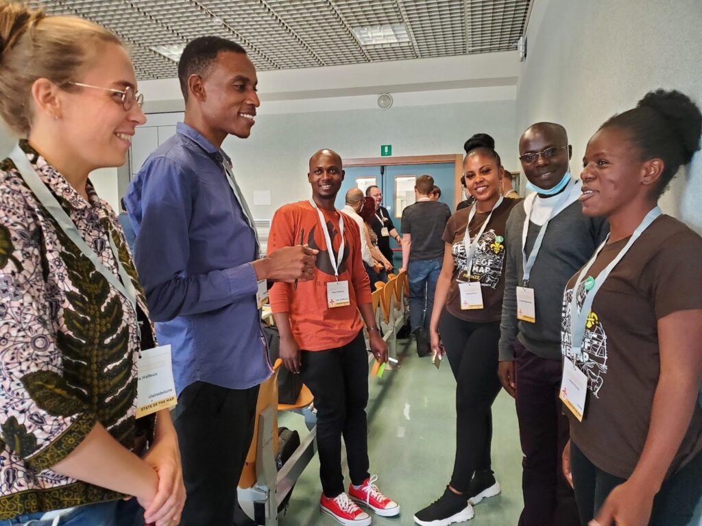
We started the session by dividing up into continents – and every continent was represented! It turned out many people from the same regions didn’t know one another. 

Next we heard Allan Mustard, Tobias Knerr and Jean-Marc Liotier talk about the role of chapters from the OpenStreetMap Foundation perspective. 

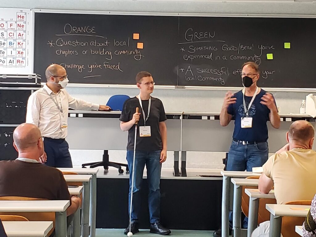
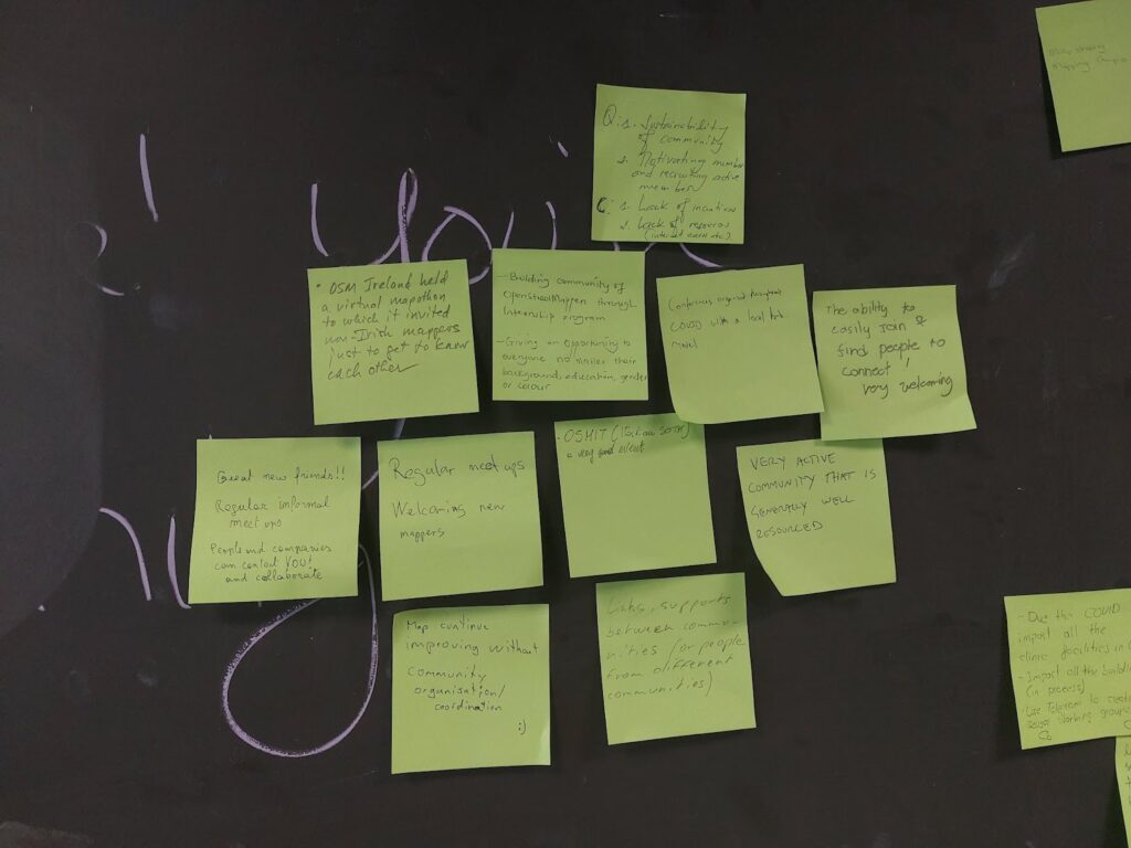
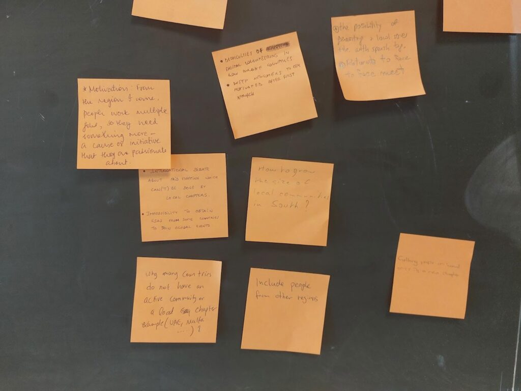
Next we passed out two colors of sticky notes and asked participants to share things that have worked in their communities or challenges they have faced. There were many great answers, and many common threads.

Where have you seen success gathering community?

In terms of having an organization, some groups found that having several dedicated chat rooms on specific topics helpful. Other groups found it simpler to move organizational stuff to open source software like Collabora, LibreOffice, LimeSurvey. Many folks had success linking with their local government and holding local events, like State of the Map. Other common threads were around community building and mapping projects. Community building around the world seems to have more success when the focus is on building relationships, working together with other communities and having regular informal meetings. All participants strive to keep their spaces open and welcoming. 

Often communities are contacted by local authorities who want to help keep OSM data up to date. This can lead to partnerships for mapping projects, such as mapping health infrastructure for covid, mapping buildings and addresses, following up on Notes and just new mappers heading out to contribute on their own. 

What’s Difficult About Organizing Community?

On the other sticky note, folks shared things that were more difficult. A general theme seemed to be growing pains – how do you get started? Once you have a little group, how do you formalize? When you become a Local Chapter, how do you find new goals for the community to work towards? In some regions, getting volunteer work at all is difficult. In others, it’s mostly about keeping people on board for longer.

Another common difficulty was the institutional and financial challenges associated with having a local group. How do you finance your organization? How do you handle commercial activities? In our session there were discussions about the limits to paid mapping by local chapters, the growing pains moving from an informal to a formal group, the procedure to become a Local Chapter and when requests from outsiders or handling management as a volunteer can be too time consuming. 

Other challenges included how to decide between open channels Vs closed channels (where many folks tend to be already, like WhatsApp), having too many different channels, getting visas to attend global events, engaging volunteers in low income countries, and reconvening in-person after COVID.

When it comes to mapping – often that’s the least of a Chapter’s worries! Though in some countries, incentives for volunteers and lack of resources like decent internet connections are a barrier. Another challenge can be to get people facing the same direction to achieve common mapping goals, or to decide on which mapping tools to use. And there’s more and more quality open data that allows you to improve OpenStreetMap – but it is so much work to put it to use.

Local Chapters Congress – Community Meets Online

On November 12, 2022 the global OSM community gathered for the 3rd annual virtual Local Chapters and Communities Congress 2022. Leaders and members of various OSM communities, whether they are officially recognized Local Chapters of the OSM Foundation or just a regular user group of OSM mappers, came together to share stories and learn from each other.

There were lightning talks, presentations by LCCWG members and lots of great discussions. OSM Italia presented a fun video about the SotM in Florence. Adrés Gómez talked about how the Colombia community is successfully dealing with huge amounts of Notes – and how the project is expanding to other countries. Janet Chapman talked about Crowd2Map Tanzania. Then we heard about the new Discourse forum that lives at community.openstreetmap.org. To close off, we heard from a bunch of communities from around the globe.

You can check out the full agenda on the wiki and watch presentations from the day on this youtube  playlist


The OpenStreetMap Foundation is a not-for-profit organisation, formed to support the OpenStreetMap Project. It is dedicated to encouraging the growth, development and distribution of free geospatial data for anyone to use and share. The OpenStreetMap Foundation owns and maintains the infrastructure of the OpenStreetMap project, is financially supported by membership fees and donations, and organises the annual, international State of the Map conference. Our volunteer Working Groups and small core staff work to support the OpenStreetMap project. Join the OpenStreetMap Foundation for just £15 a year or for free if you are an active OpenStreetMap contributor.
Reminder: Call for Feedback on the Data Model

Data Model Study

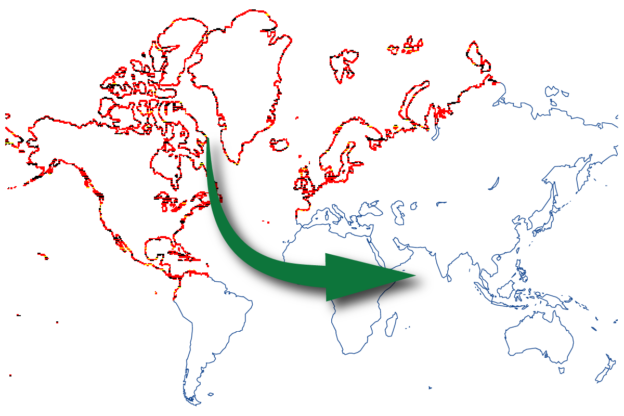
The Engineering Working Group of the OpenStreetMap Foundation commissioned a study in the beginning of 2022 on how to improve the existing data model. Jochen Topf has delivered the results of this study, including recommendations on how to make the OpenStreetMap data model more computationally efficient and more accessible.

Two key suggestions have been made:

  • introducing an area datatype for representing polygons
  • getting rid of untagged nodes

Community Consultation

In order to decide the next steps in this process we want to have more discussions with the community of developers as the proposed changes impact OpenStreetMap software which directly or indirectly depends on the data model.

Potential benefits

Less Mess for Areas

Some mappers may be surprised to hear that OSM does not already have an Area data type. After all, the iD editor prominently features buttons for drawing points, lines and areas. Once mapped, these areas usually appear on the map as expected. The OSM wiki documents whether a tag is typically used on areas, and even Overpass Turbo lets you use areas in your query.

Behind the scenes, however, these areas are represented as ways or relations. Each tool working with OSM data uses its own set of rules to guess whether a particular way represents a line or an area. Making areas a proper part of the OSM data model would lead to a consistent interpretation across applications, enable the API to prevent broken areas from being uploaded, and may eventually lead to support for partial downloads of very large areas.

Keeping OSM Processing Accessible

Currently, ways are made up of references to nodes, and we rely on these references to determine how ways connect to each other. Resolving the coordinates to these node references is a costly process within the OpenStreetMap toolchain as it takes hours to days, even on capable hardware.

In the future, we might model ways as a simple list of coordinates – depending on the exact implementation we end up with. This would offer large performance benefits, but getting rid of untagged nodes would be a significant change.

At first glance, performance improvements may not seem particularly exciting. But how easy it is to work with our data directly impacts how useful OpenStreetMap is to the world at large. As Jochen observes: “The goal is to keep OSM as that great resource that can be used not only by multi-billion-dollar companies but by the student who wants to create a map of the world on their notebook or the activist with their donated second-hand computer.”

Better OSM History

Many mappers are disappointed when they realise how few things the history tab of the website can actually show. There are many tools, like OSMCha and Achavi, that offer much more, but still require a certain degree of proficiency to use them.

You might ask why, and the answer is very technical – the location of a single version of a way is, in many cases, not defined. It is the reason that change tracking remained an expert discipline with relatively newbie-unfriendly tools. By changing the data model we will move away from that barrier, and subsequently we can expect substantially better tools, but not before we get proper coordinates and versions for ways.

Minutely Vector Tiles Generation

While there are quite a number of matured vector tile generators nowadays, a couple of problems are still open.

  • One is which features shall go into the vector tiles for openstreetmap.org
  • The other is how to reconcile minutely updates with vector tiles for performance at an acceptable level.

That task gets an order of magnitude easier if you can not only truly parallelise the generation of tiles, but also elide the first expensive step to figure out to which tile a changed way belongs.

We might be able to find someone who encapsulates the raw computing power necessary to do this. But even if so, this is a highly nondesirable degree of dependence on that partner.

So yes, vector tiles for openstreetmap.org are in principle possible without this data model change, but at a so much higher cost that only specialized hardware will be able to keep up with minutely changes.

Have Your Say about the Future

Some kind of change is inevitable. The growth of the OSM database is outpacing speed improvements in hardware, and the ID-based model means that the whole process cannot be parallelized with full speedup. Keeping up with changes was easily possible in the past, but needs needs more and more tricks now. There is a point in the future where also specialized hardware will suffice to keep up with minutely changes.

However, there are many possible approaches to meeting this challenge. Now is the opportunity for the developer community to share your opinion about the way forward.


The OpenStreetMap Foundation is a not-for-profit organisation, formed to support the OpenStreetMap Project. It is dedicated to encouraging the growth, development and distribution of free geospatial data for anyone to use and share. The OpenStreetMap Foundation owns and maintains the infrastructure of the OpenStreetMap project, is financially supported by membership fees and donations, and organises the annual, international State of the Map conference. Our volunteer Working Groups and small core staff work to support the OpenStreetMap project. Join the OpenStreetMap Foundation for just £15 a year or for free if you are an active OpenStreetMap contributor.
Introducing the Communities Tab on OSM.org

There’s a new way to find and connect with OSM communities.

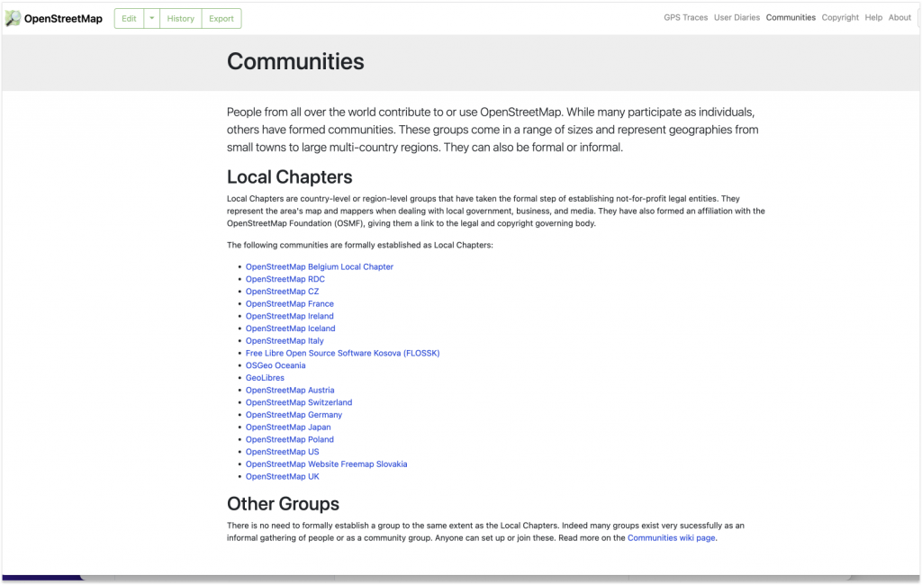
In the upper right corner of OSM.org, you can now see a “Communities” tab that links to a single, centralized location that lists formal Local Chapters, as well as the other OSM communities. Given how many communities there are and how fast OSM is growing, it’s a good time to add a prominent way to connect.

According to LCCWG member Joost Schouppe, the new tab “is probably the most visible change on osm.org since the addition of Notes.”

Once you have navigated to the new “Communities” page, you’ll see that the data for the Local Chapters listings is dynamically delivered via the OSM Community Index (OCI). In fact, the most difficult aspect of the project was figuring out how to integrate the OCI data into the page rather than just adding a simple list of Local Chapters as static content. As website maintainer Andy Allan noted, “The latter would have been quick and easy, but using the OCI means it is automatically updated when new Chapters are added, and it also means we are reusing all the translations for the Chapter names from the 46 different languages that we already support.”  

While there is not currently a way to dynamically capture all of the other, less formalized communities, the addition of the “Other Groups” section highlights their existence and points the way to more information.  

“It’s just a start” says LCCWG member Adam Hoyle, who also worked on the project.  “Ideally this can grow into an even better centralized page for people and communities to find each other.“ 

Showing a list of Local Chapters is only scratching the surface of what can be done, now that the various underlying technical challenges have been solved. For example, when new mappers set their home location on their profile, they could be shown a list of local forums, mapping groups, and communication channels customised to their location could immediately be shown on their personal dashboard. 

The key to shipping additional improvements to the “Communities” page is having volunteers to help out. ”All this community information is in OCI already, so we now need people to help expand our integration,“ says Allan. Schouppe adds that “this particular issue has been on the LCCWG agenda since October 2020, and Adam started working on it in January 2021. It goes to show that, because we are all volunteers, it takes a lot of time and effort to evolve the osm.org website, but it can be done.”

→ To contribute to the development of OSM.org, please visit the main Github and/or this issue, which highlights the many existing pull requests and gives ideas for how to contribute.

→ To help the LCCWG with their efforts to help local communities grow, please join one of their channels.

 I’d like to thank Adam Hoyle for his work and patience while we worked  through getting the technical foundations in place, which took a while but sets us up for the future; and also to the team behind OCI who made some changes to their side of things to help us get the translations  fully working more easily.-Andy Allan


The OpenStreetMap Foundation is a not-for-profit organisation, formed to support the OpenStreetMap Project. It is dedicated to encouraging the growth, development and distribution of free geospatial data for anyone to use and share. The OpenStreetMap Foundation owns and maintains the infrastructure of the OpenStreetMap project, is financially supported by membership fees and donations, and organises the annual, international State of the Map conference. Our volunteer Working Groups and small core staff work to support the OpenStreetMap project. Join the OpenStreetMap Foundation for just £15 a year or for free if you are an active OpenStreetMap contributor.

Engineering Working Group Call for Proposals

The Engineering Working Group (EWG) would like to announce a call for proposals for the following project: Adding the ability to mute users on the openstreetmap.org website.

About the project

Users who receive unwanted messages to their openstreetmap.org message inbox currently have to report the message writer and wait for an administrator to take action. This feature will make it possible for anyone to painlessly mute (ignore) private messages from another user.

For more details about the project, including how to apply and proposal requiements, please see the Engineering Working Group Project Funding Repository on Github. Click on “Ability to mute other users” under the Projects section or visit this link for for a list of deliverables.

Understanding the project funding process

Before submitting a proposal make sure to also read the Engineering Working Group’s Project Funding Proposal Framework for a general overview of the process. Should you have any questions about the funding process please reach out to the Engineering Working group at engineering@osmfoundation.org.

About the Engineering Working Group

The Engineering Working group is charged with, among other things, handling software development paid for by the OSMF, putting out calls for proposals on tasks of interests, offering a platform for coordination of software development efforts across the OSM ecosystem, and managing OSM’s participation in software mentorship programs.

The Engineering Working Group meets once every 2 weeks. Meetings are open to all and all are welcome. Questions? Please send an email to engineering@osmfoundation.org. We are a small group and are still welcoming new members!


About OpenStreetMap

The OpenStreetMap Foundation is a not-for-profit organisation, formed to support the OpenStreetMap Project. It is dedicated to encouraging the growth, development and distribution of free geospatial data for anyone to use and share. The OpenStreetMap Foundation owns and maintains the infrastructure of the OpenStreetMap project, is financially supported by membership fees and donations, and organises the annual, international State of the Map conference. Our volunteer Working Groups and small core staff work to support the OpenStreetMap project. Join the OpenStreetMap Foundation for just £15 a year or for free if you are an active OpenStreetMap contributor.
Towards an improved data model for OpenStreetMap

We all know and love the OpenStreetMap data model with its nodes, ways, and relations and the open tagging that has allowed OpenStreetMap to be so innovative. But the data model also shows its years and some improvements might be possible. There is a lot we don’t want to change. Especially the open tagging model has proven itself. We might think of some small improvements, but the core idea of allowing any number of key-value (string) tags has worked amazingly well.

But there are some pain points due to the way we organize our data. The biggest problem is that geographic location is only available to nodes and not higher-level geographic objects like ways and relations. This means that accessing the location of, say, a way always means we have to follow the references to the member nodes of that way. This makes processing OSM data extremely cumbersome and resource-intensive.
The other major pain point often talked about is the missing “area” datatype. We use work-arounds like closed ways and multipolygon relations, but that has always been problematic, because we can’t be sure that those objects are actually valid polygons.

The OSMF Engineering Working Group (EWG) has commissioned me (Jochen Topf) to write a study over the next months outlining the problems with our current data model, possible improvements and their impact on our systems. Any changes to our data model will, of course, have a large impact on our mappers, the data users, our software and on the whole OSM ecosystem. So the study will also suggest ways to move forward implementing those changes step by step.

You are welcome to contact me via email at jochen@topf.org if you want to discuss any of this. After my talk at the State of the Map in Milano in 2018 in which I already outlined some of the issues with the data model, I created the osm-data-model repository. Feel free to comment there. After my preliminary study I will expect there will be a more formal discussion process where we can decide as a community which (if any) changes we want and how we are going to implement them.

The OpenStreetMap Foundation is a not-for-profit organisation, formed to support the OpenStreetMap Project. It is dedicated to encouraging the growth, development and distribution of free geospatial data for anyone to use and share. The OpenStreetMap Foundation owns and maintains the infrastructure of the OpenStreetMap project, is financially supported by membership fees and donations, and organises the annual, international State of the Map conference. Our volunteer Working Groups and small core staff work to support the OpenStreetMap project. Join the OpenStreetMap Foundation for just £15 a year or for free if you are an active OpenStreetMap contributor.
You’re invited to the 2021 Local Chapters and Communities Congress

The LCCWG is excited to invite OpenStreetMap local chapters and community organisers and leaders to the 2021 Local Chapters and Communities Congress!

Local Chapters & Communities Congress poster – please share widely!

The LCCC 2021 is a virtual event where leaders and members of various OSM communities, whether they are officially recognized Local Chapters of the OSM Foundation or just a regular user group of OSM mappers, come together to share stories and learn from each other.

Last year, 35 community leaders came together from more than 20 different countries and the LCCWG is asking you to spread the word far and wide so that even more communities come to exchange knowledge and build networks this year!

The LCCC takes place online on 06 November from 1200 – 1500 UTC and you can find more details on the OSM wiki, here.

Looking for moderators for OSM lists!

In December, the OpenStreetMap Foundation (OSMF) Board asked for help to instate a moderator team for the OSMF-talk and talk mailing lists. This task was passed to the Local Chapters and Communities Working Group (LCCWG) who subsequently set up a moderation subcommittee to lead this work.

Over the last 9 months, the subcommittee has led efforts to revise the Etiquette Guidelines and Process for Moderation but it will be the role of the Moderation team to put this guidance into practice and continue to define moderation practices in OSM spaces.

Volunteers are needed from all corners of the global OpenStreetMap community to participate in this Moderation Team to lead efforts to keep the lists safe, welcoming, and inclusive. The moderators will help to steer conversations on topic and encourage effective and respectful communication on the OSMF-talk and talk mailing lists.

Interested? Please complete this form and a member of the subcommittee will be in touch. The goal is to have a team in place by the OSMF election season (aiming for the end of October), so don’t delay!

Join the OSMF Engineering Working Group to support the OSM developer ecosystem

To support the development of open source software around OpenStreetMap, the OSM Foundation has recently launched the Engineering Working Group (EWG). The group intends to support open source software projects with direct funding, mentorship programs, and by offering a platform for coordination.

Why this working group?

OpenStreetMap relies on a vast ecosystem of open source software. This includes the tools used by mappers to understand and contribute data, the software powering our database servers and website, the libraries and frameworks used by developers to build consumer-facing applications around OSM data, and many of these applications themselves.

The development teams creating these software products are generally independent entities, separate from the OpenStreetMap Foundation (OSMF). This is by design: The OSM community values do-ocracy and decentralization, so the OSMF does not manage software projects. However, that does not mean there is no room for the OSMF to support this vital ecosystem!

What we do

The Engineering Working Group (EWG) is charged with

  • Handling software development paid for by the OSMF, including the distribution of grants. This will involve putting out calls for proposals on tasks of interest, and accepting proposals on other tasks.
  • Offering a platform for coordination of software development efforts across the OSM ecosystem. We want to encourage standardization and shared efforts between projects by bringing together developers with similar interests. This work also includes responding to emails and directing people at other people or appropriate resources.
  • Managing OSM’s participation in software mentorship programs such as Google Summer of Code, which help grow the OSM developer community.

For handling paid development, “tasks” include development of new features, maintenance of code, documentation, and other tasks that improve the developer experience. When we are ready to start providing grants, we will encourage applications from skilled individuals who aren’t professional developers, professional contractors or companies, as well as those who are.

The OSMF has previously supported software projects through microgrants as well as separately with funding for Nominatim, osm2pgsql, Potlatch 2 and iD. With EWG, this kind of support will be placed on a more solid foundation.

In our first round we will look for projects that don’t need much management and focus the bulk of our efforts on core software. Like with all work paid for by the OSMF, the principles of the Hiring Framework will apply.

Whom we seek

As a group that is just getting started, we’re eagerly looking for additional working group members.

We would particularly welcome people knowledgeable about technology used in key OSM systems, such as the rails port, Ruby on Rails in general, and the cgimap implementation of the main OSM API, as well as those who can help with knowledge domains, such as user interface design, which are not well covered by the existing members.

However, you do not need to know any particular technology to participate! So if you have experience with the OSM software ecosystem, developing software, or managing software development, consider joining us!


Do you want to translate this and other blog posts in another language..? Please send an email to communication@osmfoundation.org with subject: Helping with translations in [language]

The OpenStreetMap Foundation is a not-for-profit organisation, formed to support the OpenStreetMap Project. It is dedicated to encouraging the growth, development and distribution of free geospatial data for anyone to use and share. The OpenStreetMap Foundation owns and maintains the infrastructure of the OpenStreetMap project, is financially supported by membership fees and donations, and organises the annual, international State of the Map conference. It has no full-time employees and it is supporting the OpenStreetMap project through the work of our volunteer Working Groups.

Get notified about new blog posts: Subscribe to the RSS feed


DWG survey on organised editing

The Data Working Group is conducting a survey as part of its work on a policy covering paid mapping.

When OpenStreetMap started, it was largely a project of hobbyists contributing to OSM in their spare time. They chose freely what to map and which tools to use, and they took individual responsibility for their contributions.

The continuing growth and popularity of OSM have also brought more and more organised mapping efforts, mostly in the form of companies setting up paid data teams to improve OSM data in specific regions or for specific use cases, but also unpaid groups like school classes that are directed to work on OSM.

These organised mapping efforts are an integral part of today’s OSM contribution landscape and, when done well, help make OSM better and more widely known.

In order to ensure good communication, and a level playing field, between individual community members and organised editing groups, the OSMF Data Working Group has been tasked with developing guidelines for organised groups. These guidelines will above all set out some transparency requirements for organised groups – things that are already voluntarily followed by most groups today, like informing the mapping community about which accounts edit for the team.

We have prepared the following survey with a few questions about such a policy to give us a better understanding of what the mapping community expects from such a policy. The survey is aimed at everyone editing (or planning to edit) in OSM, whether as individual mappers or as part of a team, and your answers will help us in fleshing out a draft policy.

Within the scope of the survey, and the policy to be written, we define paid mapping (or paid editing) as any editing in OSM performed by someone who is told by a third party what to map (and potentially also how to map it) and who receives money in exchange. We define other organised mapping (or editing) as any editing that is also steered by a third party, but where no money is paid.

The survey is available at https://osm-dwg.limequery.org/741554

The OSMF Data Working Group

Getting involved in the Operations Working Group

OpenStreetMap has a map display, and more importantly a database of raw map data, and more importantly than that a community of map contributors! All of these things require servers. Big computer systems crunching lots of data and handling lots of internet traffic. This is the realm of the “Operations Working Group“, who make the decisions and take the actions that keep these servers ticking, and keep OpenStreetMap (the map, the database, and the community) up and running.

Difficult technical work which only a few people are directly involved in. But today Andy Allan blogged about how they’re working on getting more people involved in the Operations Working Group.

openstreetmap server diagonalThe OpenStreetMap project is nearly 12 years old, and we’ve been very lucky to have a small team of talented volunteer system administrators doing a fantastic job over that time, spending donated money wisely and meeting some huge scaling challenges for the core infrastructure.

“There’s a pride in keeping OpenStreetMap humming along and not causing too much of a fuss”

But increasingly OWG have been quietly enhancing their server configuration management approaches. All code/configuration scripts are maintained openly in github, and recently the team are looking to make this easier to test, so more people can feel confident in proposing improvements to the server set-up.

“The goal is to allow future developers to improve each cookbook using only their own laptops”

You can donate to the OpenStreetMap foundation, which will help fund our servers. But you can also get involved in improving the server set-up, and it’s gradually getting easier to be more directly involved. If you can help, read Andy Allan’s blog post to learn more. Thanks to Andy and the rest of the Operations Working Group for all their hard work.