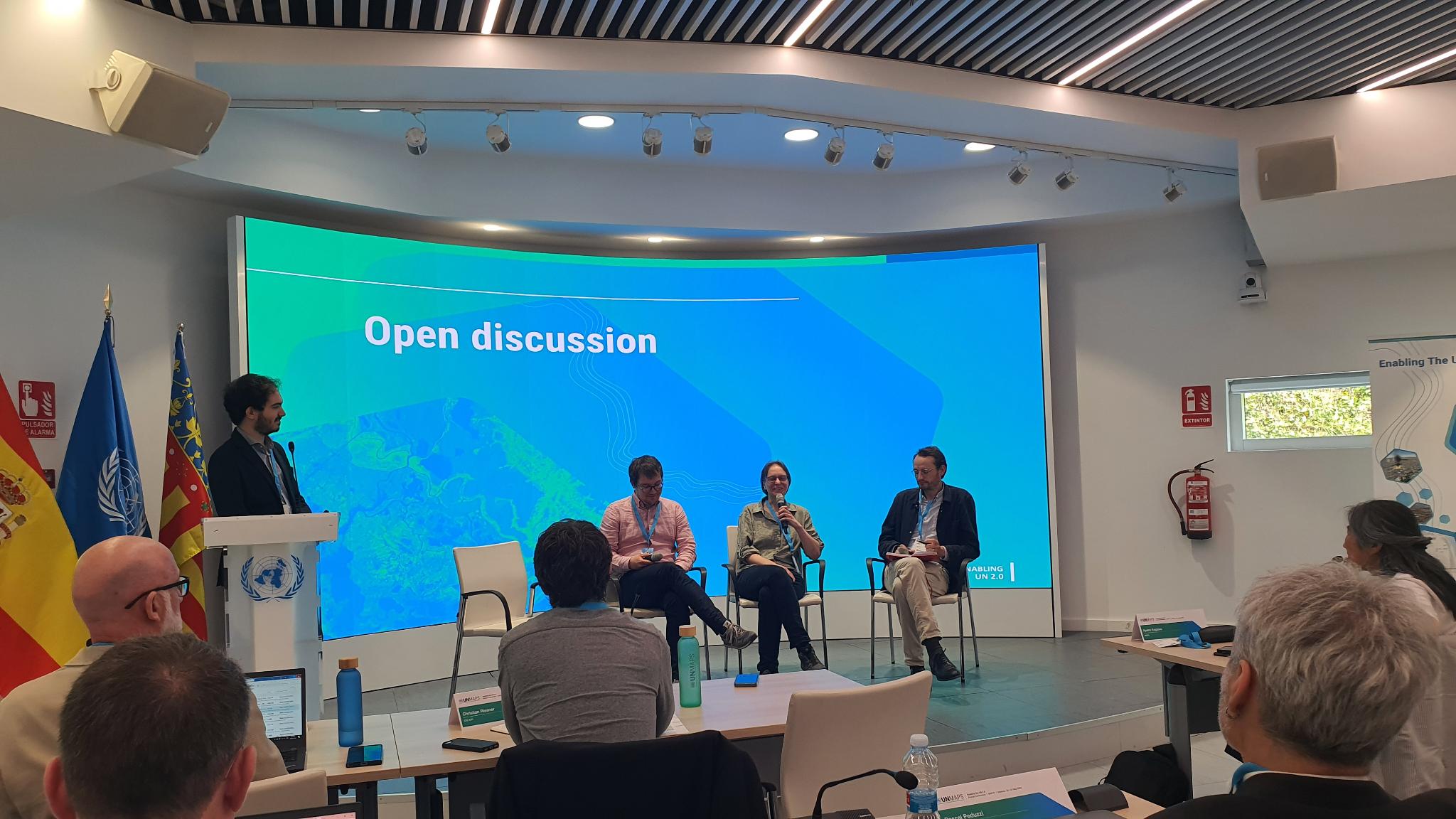
OpenStreetMap foundation board member Sarah Hoffmann recently joined the 3rd annual UNMaps conference in Valencia, Spain to present about the OpenStreetMap project and participate in a panel discussion about crowd-sourced geodata.
The UNMaps conference brings together the GIS experts from the different entities of the UN, which was about a hundred participants in 2024. There were representatives from the UN secretariat, the different UN entities, like UNICEF and the International Criminal Court (ICC), and people from the UN peacekeeping missions. They also regularly invite external partners and contributors to present their work and join the discussions. Given the vital role that OSM already plays in their work, they asked the OSMF board to join the conference and represent the OpenStreetMap community. Also invited from the wider OSM community were the researchers from HeiGIT and the humanitarian mappers from HOT.
“It wasn’t necessary to explain to anyone who we are,” noted Sarah, “OpenStreetMap is well known and used on a daily basis within the UN. The maps produced by the UNMaps division for use within the UN heavily use OSM data, mainly replacing boundaries and names to follow the official policies of the UN.”
“Crowdsourcing Geospatial Information” Panelists from left to right: (host) Michael Montani (UNMappers; (panelists) Benjamin Herfort (HeiGIT), Sarah Hoffmann (OSMF), Sam Colchester (HOT).
In many areas where the different UN entities operate, OSM is the best (and sometimes only) available source for geographic data. Thus, base maps using OpenStreetMap data were featured in almost every presentation. And it doesn’t stop there. UN users also contribute back to improve and complete the map in the areas where they use it, and the UN Mappers community supports the UN with organised mapping activities.
Sarah answered questions about OSM and OSM operations, including a lively discussion about iD editor as a response to the question: how do we deal with errors in the map data? In addition, Sarah joined a panel discussion on crowd-sourced data focussing on the questions of data quality and the importance of local knowledge in map data.
The discussions continued in the hallways, as well. Sarah noted that there were informal conversations about what kind of data is suitable for OSM and how to best connect with the community, as well as about what it’s like to be part of a world-wide community in peaceful cooperation to achieve a common goal.
“The conference was a great opportunity for getting to know each other,” said Sarah, “seeing OpenStreetMap data used so much in the daily operations of the UN is a great reminder how much our project has grown and how essential our data has become for so many different activities.”
The OpenStreetMap Foundation is a not-for-profit organisation, formed to support the OpenStreetMap Project. It is dedicated to encouraging the growth, development and distribution of free geospatial data for anyone to use and share. The OpenStreetMap Foundation owns and maintains the infrastructure of the OpenStreetMap project, is financially supported by membership fees and donations, and organises the annual, international State of the Map conference. Our volunteer Working Groups and small core staff work to support the OpenStreetMap project. Join the OpenStreetMap Foundation for just £15 a year or for free if you are an active OpenStreetMap contributor
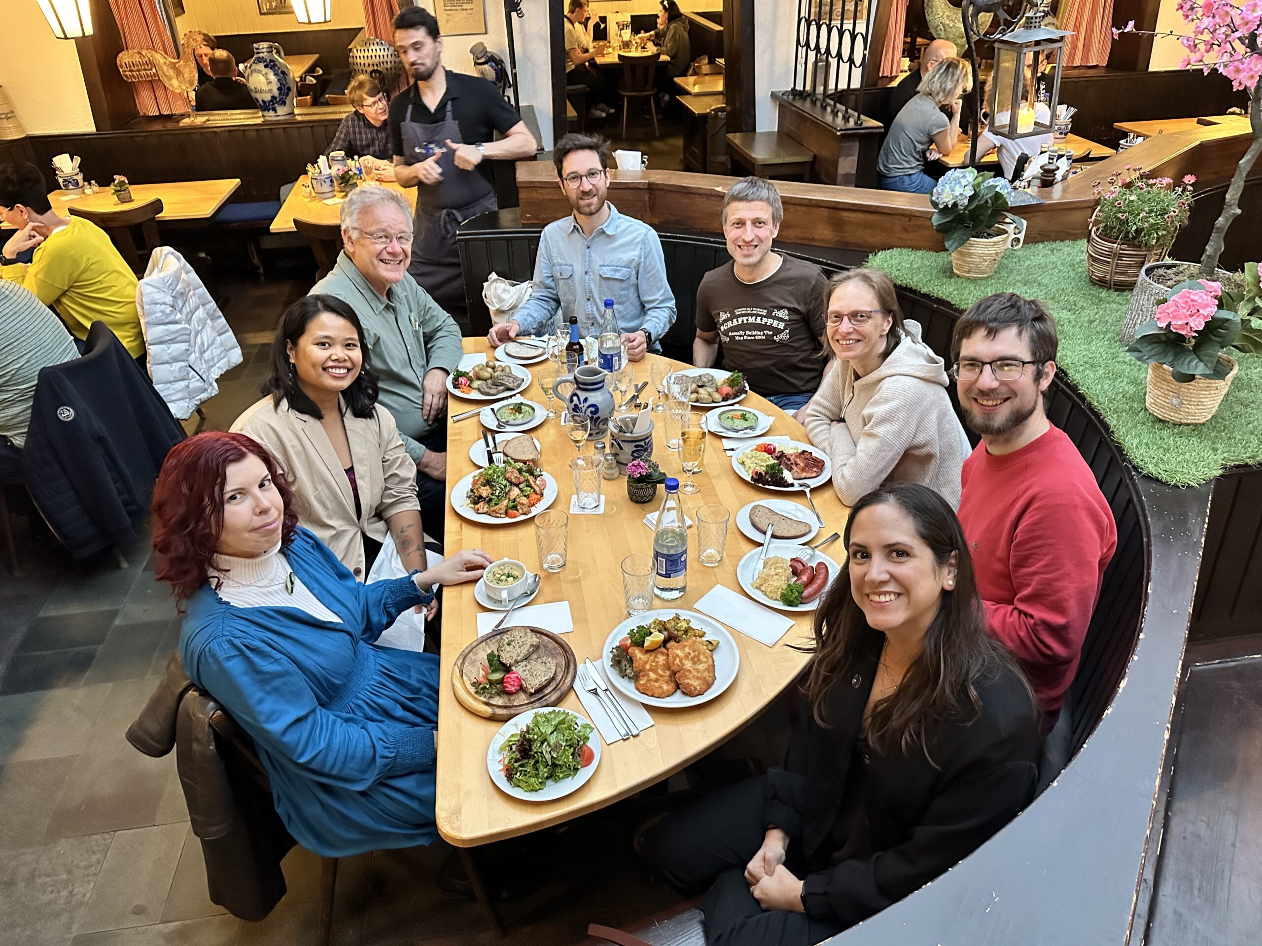
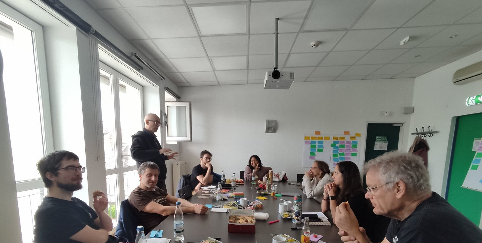
The OpenStreetMap Foundation (OSMF) Board of Directors recently convened for a Face-to-Face (F2F) strategy meeting, and we wanted to provide you all with an update!
We met on April 27th and 28th in Frankfurt in person, and for some of us, it was our first time ever meeting in person.
The meeting allowed us to discuss and refine strategies, foster deeper connections, and become more effective in serving the OSM community. By coming together in person, we were able to cultivate a deeper understanding of each other’s perspectives, refine our communication strategies, and focus on the most pressing priorities facing the OSMF.
Over the busy weekend, we were fortunate to have the guidance of our trusted facilitator, Gunner, who helped us navigate through discussions and prioritize our action items. He helped us communicate better, refocus on what really matters, and prioritize our many tasks and goals. With his guidance, we were able to make the most out of our time together and tackle important issues head-on. With his support, we not only stimulated our internal operations but also laid a solid foundation for more effective engagement with the OSM Community.
By coming together, we were able to address challenges more efficiently, brainstorm innovative solutions, and lay the groundwork for future initiatives. As we move forward, the Board is excited and motivated to share the progress of our action items with the community. While some of these initiatives will yield results in the short term, others may require more time to fully come to fruition. Nevertheless, we are committed to transparency and accountability, and we look forward to celebrating our achievements together with you all, the community.
You read more about some of our discussions and actions from the meeting on the OSMF website (here).
We’re incredibly grateful for the opportunity to meet F2F and strengthen our bonds. And we’re not stopping here! Looking ahead, we are eagerly anticipating our next in-person engagement at this year’s State of the Map in Nairobi. This event will provide another invaluable opportunity for us to connect with each other, and most importantly with members of the OSM community, exchange ideas, and continue our collaborative efforts to make OpenStreetMap the best it can be.
The OpenStreetMap Foundation is a not-for-profit organisation, formed to support the OpenStreetMap Project. It is dedicated to encouraging the growth, development and distribution of free geospatial data for anyone to use and share. The OpenStreetMap Foundation owns and maintains the infrastructure of the OpenStreetMap project, is financially supported by membership fees and donations, and organises the annual, international State of the Map conference. Our volunteer Working Groups and small core staff work to support the OpenStreetMap project. Join the OpenStreetMap Foundation for just £15 a year or for free if you are an active OpenStreetMap contributor.
1. As a a member you can self-nominate to serve as a member of the OSMF Board. This allows you to influence the strategic plan, some of OSM’s finances and other matters that directly affect the direction of OpenStreetMap’s future.
This year’s OSMF General Meeting and board elections are 19 October 2024. This means that if you want to run for the Board you must become a member of the Foundation by 22 April 2024 There are FOUR Board positions up for election next fall. Even if you’re not sure that you want to run for the Board, but you think you might be interested, you should join!
2. If you are a member of the OSM foundation at least 90 days before the Annual General Meeting, you can vote in the annual Board elections,as well as on other foundation initiatives. The details on types of membership are here. Importantly, if you are an ‘active contributor’ you can apply for a free membership.
3. To help us grow and diversify the OSM Membership worldwide.
As you can see from this blog post, we are in the midst of a worldwide campaign to increase the number of OSM foundation members from all parts of the world. Right now, representation amongst OSM members is skewed toward the US and northern Europe, whereas there are many thousands of OSM contributors all over the world. By joining as a member, you can make the voices of the communities heard.
OSMF Board member Arnalie Vicario has been posting testimonials from current members on her X (and other accounts.). Here’s a video from Daniel Akor from OpenStreetMap Nigeria:
Daniel Akor from @OSMNigeria provides a background what is #OSMF & membership types, & encourages us to tackle geographical diversity in the #OSMF membership 🌍🌏🌎
The OpenStreetMap Foundation is a not-for-profit organisation, formed to support the OpenStreetMap Project. It is dedicated to encouraging the growth, development and distribution of free geospatial data for anyone to use and share. The OpenStreetMap Foundation owns and maintains the infrastructure of the OpenStreetMap project, is financially supported by membership fees and donations, and organises the annual, international State of the Map conference. Our volunteer Working Groups and small core staff work to support the OpenStreetMap project. Join the OpenStreetMap Foundation for just £15 a year or for free if you are an active OpenStreetMap contributor
Welcome to the 2024 OpenStreetMap Foundation Membership Campaign!
Today, members of the OpenStreetmap Foundation (OSMF) Board and several of the OSMF Working Groups are launching a worldwide OSMF Membership campaign with the goal of growing and diversifying OSMF membership in regions where there are no or very few OSMF members.
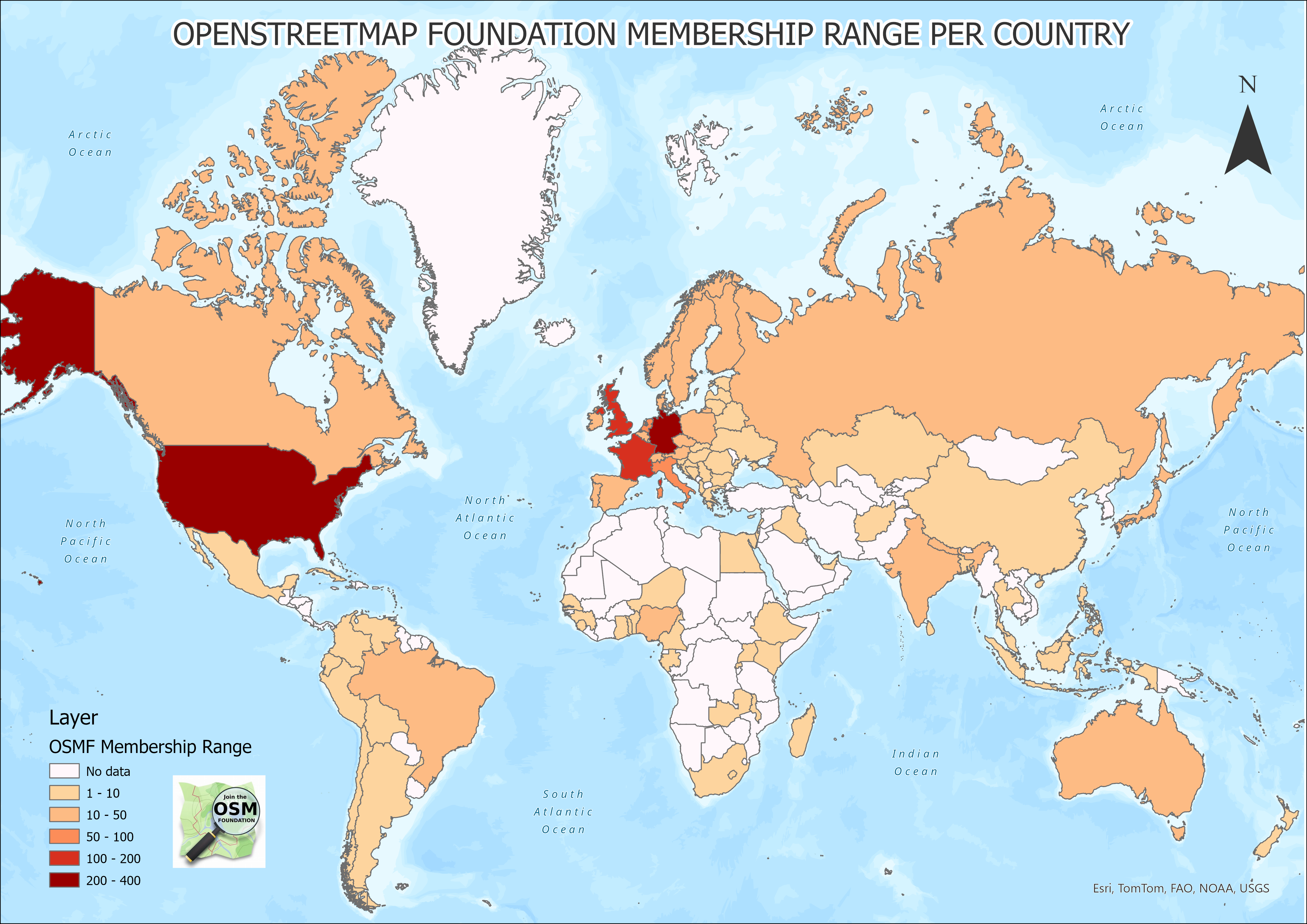
As you can see from this map, there are many such regions.
A visualization of OSMF membership by country, worldwide
OSM is known for being built by a vast, global community of mappers, GIS professionals, community builders, developers, engineers, trainers, etc. over the last twenty years of the map’s existence, all of whom contribute their local knowledge and maintain open and free geospatial data.
The OSM Foundation administers and supports the making of OSM by overseeing OSM’s technological systems and data. It also helps steer the long-term strategy and well-being of the map.
So, it’s very important to have the membership of the OSM Foundation be reflective of the vast diversity of its community.
Why Do We Need an #OSMFMembershipCampaign?
As headlined on the OSMF website, the OpenStreetMap Foundation is dedicated to encouraging the growth, development and distribution of free geospatial data and to providing geospatial data for anyone to use and share.
It’s important to note that you don’t have to be a member of the OSM Foundation to make a profile on OSM.org and begin editing OpenStreetMap. You don’t even have to be a member to volunteer for a local community or a Working Group, or go to a State of the Map event or participate in a mapping party.
However, if you want to make a difference in the overall future of OSM, becoming an OSMF member is a good idea.For example, OSMF members are entitled to vote in the affairs of the Foundation, including to select members of the Board. OSMF members can also self-nominate for the Board. As you can see from its charter, the OSM Foundation values OSM contributors, and the OSMF membership exists to give dedicated contributors a voice in how the Foundation is run.
However, of 16 January 2024, there are just 1,929 OSMF members. This is a small percentage of the overall number of active mappers in OSM. (Pascal Neishas provided many resources, including this one,which show the data about the tens of thousands of people who are mapping at any one time and the millions who have mapped over the last 20 years.)
The fact that there are only 1,929 OSMF members means that just a tiny percentage of OSM’ers are electing the board and helping shape the OSM strategic plan and finances.
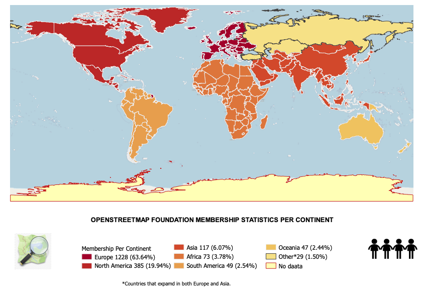
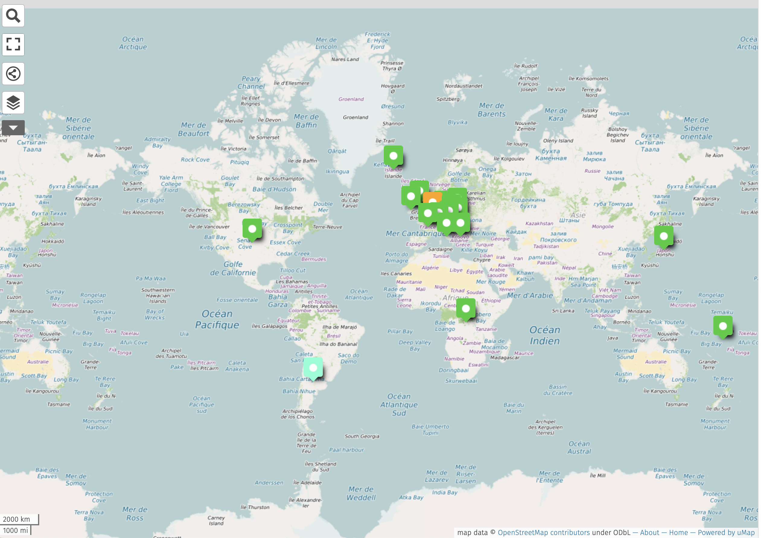
Further, here is the regional distribution of the 1,929 OSMF members.
To be successful at its goal to represent the interests of the OSM community, the OSMF must increase its membership in regions and countries where there are no or very few OSMF members.
What Are The Benefits of Being a Member of the OSMF?
You get to play a direct role in choosing the leadership of the OSM Foundation. OSMF members vote every year at the Annual General Meeting, usually held in December, to elect the people who serve as volunteers on the OSMF Board. Importantly, you have to be a member in good standing 90 days before the election, so the time to join is now.
If you’re a member during the 180 days before the General Meeting, you can self-nominate to serve as a member of the OSMF Board. This allows you to influence the strategic plan, some of OSM’s finances and other matters of governance.
You show your support for the map and the community.
If you are already an OSMF member, share why OSM mappers should be a member and encourage OSM contributors to join as an OSMF member! Use the testimonial guide and upload your testimonials in the OSM Community Forum thread or email arnalie.vicario [at] osmfoundation.org
We are specifically looking for volunteer translators who can help us translate into different languages, specifically:
French
Spanish (Juan)
Arabic
Portuguese
Swahili
We are also looking for help to explore other spaces where we can reach OSM community members, for example by organizing webinars, researching spaces e.g. podcasts where we can promote the campaign, and going live on social media (e.g. Facebook, TikTok, Instagram, etc.).
We appreciate your help and look forward to growing and diversifying OSMF membership with you!
The OSMF Membership Campaign Team
The OpenStreetMap Foundation is a not-for-profit organisation, formed to support the OpenStreetMap Project. It is dedicated to encouraging the growth, development and distribution of free geospatial data for anyone to use and share. The OpenStreetMap Foundation owns and maintains the infrastructure of the OpenStreetMap project, is financially supported by membership fees and donations, and organises the annual, international State of the Map conference. Our volunteer Working Groups and small core staff work to support the OpenStreetMap project. Join the OpenStreetMap Foundation for just £15 a year or for free if you are an active OpenStreetMap contributor.
Last year, the global OpenStreetMap community, together with OSM’s corporate members and partners, donated an astounding £373,000 to support the map.
In an extraordinary show of support for OSM’s 19th birthday, the mapping community contributed over £113,000 through small donations. This enthusiastic broad base of community support resulted in approximately 3,089 donations from all over the world averaging £36 each. The OSM fundraising committee is especially grateful for the social media shares and the kind and encouraging comments on supporting.openstreetmap.com, in addition to the gifts. The positive response to the birthday fundraising campaign was a highlight of the year. Thank you!
OSM’s corporate partners also played a pivotal role, with total corporate memberships reaching £201,074. Additional, generous gifts, above and beyond corporate membership fees, from Microsoft, NextGIS, Smoca, and Elasticsearch helped bring us to the £373,000 total. We are also grateful to the corporate Advisory Board for their advice and collaboration which has been essential to the success of our partnerships.Thank you!
A special note of thanks goes out to NextGIS, which has pledged 10% of its profits from data sales to OSM, setting an impressive standard for its commitment to the project.
In an extraordinary show of support for OSM’s 19th birthday, the mapping community contributed over £113,000 through small donations. This enthusiastic broad base of community support resulted in approximately 3,089 donations from all over the world, averaging £36 each.
OSM is fortunate to be the recipient of mission critical, “in kind” support through donations hardware and other infrastructure. We are grateful to Fastly, who provide the content delivery network for the file service, and many others, including TomTom, Bytemark, AWS and University College London, as well as AARNet, AWS,Academic Computer Club, Umeå University, Appliwave, Bytemark, Equinix Amsterdam, Equinix Dublin, Exonetric, INX-ZA, NetAlerts, OSUOSL, OVH, and Scaleway and everyone else who contributes to OpenStreetMap.
We’d also like to add a special note of thanks to Kevin Bushaw, who gave us a steep discount on our new website, supporting.openstreetmap.org.
The funds raised in 2023 will go toward enhancing infrastructure, supporting our critical support staff including our SSRE, and helping build OSM into the future.
On behalf of OSM’s local communities, the OSMF board would like to thank the companies who sponsored SotMs in 2023, both regional and local. This kind of support is very important to local communities, because the OSMF itself cannot promise companies that their funding goes towards regional events, except where the money is earmarked as part of a Sponsorship Distribution Agreement. Companies who directly support regional events are making a positive difference for the community and the quality of the map.
Lastly, we want to point out that any generosity toward OpenStreetMap is generosity to the broader open source software and data community, not just the OSM project. The impact of your gifts extends far beyond the financial; it is a commitment to a world where open data serves as a cornerstone for creativity, problem-solving, and community building.
Thank you for supporting OpenStreetMap!
The OpenStreetMap Foundation is a not-for-profit organisation, formed to support the OpenStreetMap Project. It is dedicated to encouraging the growth, development and distribution of free geospatial data for anyone to use and share. The OpenStreetMap Foundation owns and maintains the infrastructure of the OpenStreetMap project, is financially supported by membership fees and donations, and organises the annual, international State of the Map conference. Our volunteer Working Groups and small core staff work to support the OpenStreetMap project. Join the OpenStreetMap Foundation for just £15 a year or for free if you are an active OpenStreetMap contributor.
OpenStreetMap has applied for and has now been registered as a “Digital Public Good” by the Digital Public Goods Alliance (DPGA), which is a multi-stakeholder United Nations-endorsed initiative. The designation is an important step in making sure that OpenStreetMap is recognized for its positive role in global economic development.
By formally registering with the DPGA, the OSM project has now gained further legitimacy and an internationally raised profile tied to the advancement of the UN Sustainable Development Goals.
What are Public Goods?
The phrase “public goods” was invented by economists to describe things that are free, inexhaustible, and non-competitive. Sunshine is a pretty good example – it costs nothing, it never runs out, and if your neighbour uses lots of it your own supply is not diminished at all.
Like sunshine, OSM data is free, you can use it as much as you want, and even if your neighbour uses a lot of it, too, your own supply doesn’t run out. Note that it’s the data that is a public good, not the servers – our server computers are not free and are a limited resource.
Making the World a Better Place
A panel of experts was convened by the United Nations panel in 2019 to look at digital co-operation in support of global development. Their report on “The Age of Digital Interdependence” had five main recommendations. All five are great proposals, but proposal five is particularly relevant for OSM as it says that the United Nations should foster global digital co-operation. The exact text is:
“Digital public goods are essential in unlocking the full potential of digital technologies and data to attain the Sustainable Development Goals, in particular for middle and low income countries”.
This means that the United Nations is promoting the use of free open software and data as a tool for middle- and low-income counties to allow them to advance and meet the United Nation’s agreed development goals. This promotion is especially important because free data pairs well with free software and the pair can be widely used by even the poorest governments. Plus, free data and apps allow governments to advance their development without diverting scarce resources to pay license fees to companies from wealthy nations.
The UN then created the Digital Public Goods Alliance as its implementing agency for proposal five, with a mandate to advance the development and use of digital public goods for development.
The DPGA has created a register for approved open systems, open applications and open data that is accessible by all for the advancement of global development.
Why is This Important for OSM?
OSM is a large but in some ways unrecognised force in global development. It underlies many humanitarian efforts, supports academic research of many different specialisations, and is a component of much software development, especially in geographic and navigation applications. OSM data is also already widely used by the United Nations agencies, international NGOs and governments at all levels around the world.
By formally registering with the DPGA the OSM movement has now gained further legitimacy and an internationally raised profile tied to the advancement of the UN Sustainable Development Goals. More simply put, and this is something most of us knew all along – the UN thinks that OSM is a great tool to make the world a better place for all.
This registration boosts the legitimacy and profile of OSM and its partners and creates new opportunities. One important area lies in the governmental work environment. OSM’s status as a Public Good, could be used to open doors and promote an increased use of OSM by government organisations at national, regional and local levels. This could then give OSM an opportunity to gain access to government-held data, and/or to government funds to boost our mapping community and/or to a range of resources to reinforce our delivery systems, benefitting everyone.
(Note that OSM Foundation has not yet developed a strategy to encourage and facilitate the use of OSM in government spaces; this is still in the idea phase.)
The boost to the profile and legitimacy of OSM and its partners can also help us make the case for philanthropic investment in OSM.
A final wry thought at the possibilities of this opportunity is that OSM was originally created by Steve Coast as a response to controls on government mapping. It would be very satisfying indeed, if free and open mapping grows to be the basis of much government mapping.
The German chapter of OpenStreetMap, FOSSGIS e.V., has voted unanimously to a commitment providing annual financial support to the OpenStreetMap foundation. This is a first-of-its-kind decision for an OpenStreetMap local chapter, reflective of the German OSM community’s relatively large size and financial resources, as well as its strong commitment to the OSM project.
With our large OSM community and many OSM users in Germany FOSSGIS e.V. sees our responsibility to help the global OSM community where we can.
–Jörg Thomsen, chairperson of the FOSSGIS board of directors
No fixed amount has been set by the membership; instead, the FOSSGIS board will set the amount each year, depending on their capabilities and the OSMF’s needs. At its meeting on December 5th the board decided that the contribution for 2023 and 2024 will be 5,000 EUR each.
FOSSGIS e.V. is already a long term supporter of the worldwide OSM community: they run several services open to everyone, including Overpass API, a tile server, routing services (Valhalla and OSRM, which are both directly available from www.osm.org) and others. Learn more about FOSSGIS.
The FOSSGIS community supports OpenStreetMap in countless ways. Direct financial support for the work of the OSM Foundation is above and beyond, and deeply appreciated.
Mikel Maron, OSMF board member and advisory committee coordinator
As a recognized local chapter of the OSMF, FOSSGIS Germany is not obligated to support the OSMF, nor is the OSMF obligated to support FOSSGIS. Local communities are diverse in size, scope and mission, and as such, exist independently from the OSMF and are not required to make any financial contribution to the OSM project. (You can learn more about local communities by reading this blog post or reading this FAQ )
However, a shared love of mapping and free and open source software and data means that OSM local communities and the OSMF are committed to collaborating in every possible way to advance the OpenStreetMap project. The OSMF is very grateful to FOSSGIS for their commitment and contributions!
The OpenStreetMap Foundation is a not-for-profit organisation, formed to support the OpenStreetMap Project. It is dedicated to encouraging the growth, development and distribution of free geospatial data for anyone to use and share. The OpenStreetMap Foundation owns and maintains the infrastructure of the OpenStreetMap project, is financially supported by membership fees and donations, and organises the annual, international State of the Map conference. Our volunteer Working Groups and small, core staff work to support the OpenStreetMap project. Join the OpenStreetMap Foundation for just £15 a year or for free if you are an active OpenStreetMap contributor.
The OpenStreetMap Foundation Board is delighted to announce a $150k gift from Microsoft to benefit the OpenStreetMap project and community. This substantive support will go directly to the improvement of OSM operations and infrastructure, as well as to funding OSM community activities such as local, regional, and global State of the Map events.
At Microsoft, we are fully committed to supporting OpenStreetMap, not only through financial contributions but also by fully embracing and encouraging open map data and actively participating in the community via volunteering and development efforts.
—-Marko Panić, Principal Lead Product Manager at Microsoft
The funds from this gift will be allocated in the following ways:
Importantly, Microsoft supports OSM through ‘in-kind’ gifts, as well as monetary contributions. It has donated technical expertise and engineering resources; helped build awareness of the importance of OSM amongst other companies, nonprofits, and other entities; and played an important consulting role on the OSM Advisory board.
The OSM Advisory Board is a unique group within the OSM community that brings companies and local communities together. It builds positive connections between companies who use and contribute to OSM and the local communities who know the local guidelines, spearhead development projects, and bring OSM mappers together through education and events.
— Mikel Maron, OSMF Board Member
Microsoft, through its representatives, donations, and other help, has provided significant support for the maintenance of the iD editor, is working on improvements to OSM’s sign-up flow, and has introduced OSM to a wider user base through Bing’s Map builder. The OSMF board is grateful for the many contributions to the success of OpenStreetMap.
The OSMF welcomes in-kind support, as well as financial support for OSM’s technical development, operations, and community:
The OpenStreetMap Foundation is a not-for-profit organisation, formed to support the OpenStreetMap Project. It is dedicated to encouraging the growth, development and distribution of free geospatial data for anyone to use and share. The OpenStreetMap Foundation owns and maintains the infrastructure of the OpenStreetMap project, is financially supported by membership fees and donations, and organises the annual, international State of the Map conference. Our volunteer Working Groups and a very small core staff are the primary support for the OpenStreetMap project. Join the OpenStreetMap Foundation for just £15 a year or for free if you are an active OpenStreetMap contributor.
Our contributors and communities are the main drivers of the OpenStreetMap project. As a means of supporting and nurturing local communities, the OSM Foundation recognizes country-level or region-level legal entities, called “Local Chapters,” to represent mappers and OSM data when dealing with local government, business, and media.
While you don’t have to become a formally recognized Local Chapter to operate as a national or regional OSM user group, there are benefits to joining. These include a streamlined approach to the use of the OpenStreetMap trademark and a mechanism for representing your groups in any OSMF decision making process.
Note that the OSMF has recently improved the process. One major change is that the Local Chapters and Communities Working Group (LCCWG) will process and review applications before making a recommendation to the OSMF Board.
Why join as a Local Chapter?
The OSMF highly values OSM’s many diverse communities and their contributions to the map. They serve as ambassadors in their national / regional areas by promoting map generation and improvements, as well as creating and developing uses for OSM data and tools that fit their needs.
By becoming a formally recognized community, Local Chapters have the power to:
Officially use the name and trademark of OSM
Represent the OSMF in interactions with governments and companies
Have a seat in the OSMF Advisory Board (to ensure that local community ideas and opinions are heard)
The OSMF Board asks Local Chapters to share Annual Reports to make sure we are aligned in our pursuit of our shared goals. It’s also an opportunity to share each chapter’s amazing work with other OSM and mapping communities. Recent and past reports can be found here.
Below are some highlights from this year’s Annual Reports:
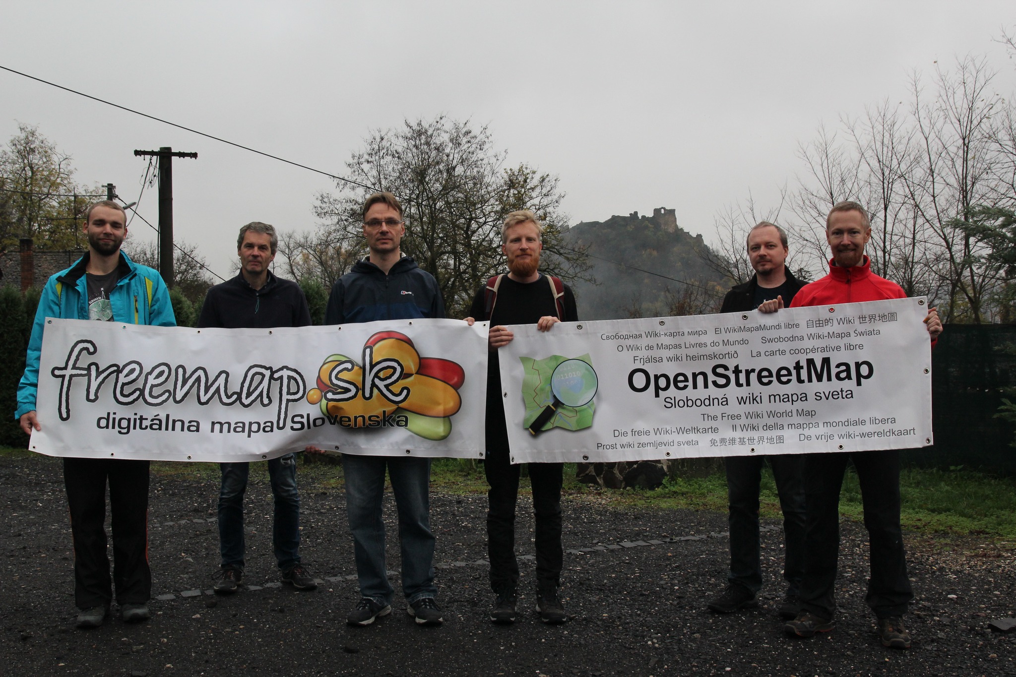
We empower users of freemap.sk to upload and view photos. Our photo gallery contains almost 300,000 photos, including more than 10,000 photos of hiking and cycling guideposts.
As a group, we continued to share the word about OpenStreetMap and UK mappers. This ranged from mapping waste and recycling centres during the CodeTheCity hack weekends, to Andy Mabbett presenting to the Data Management Association and the British Computing Society. The latter is an example of where having an official organisation provides a route for companies or groups to ask for assistance.
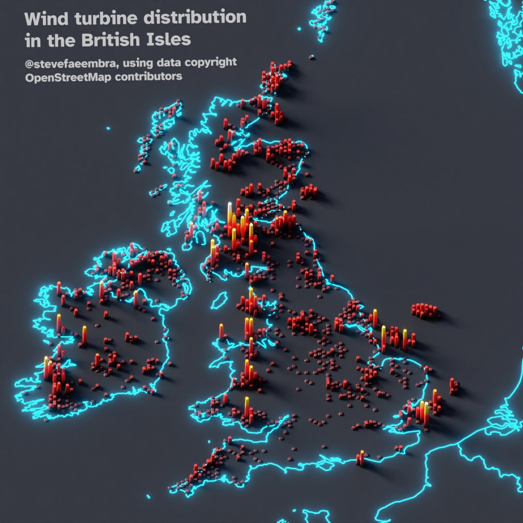
from @stevefaeembra on X (FKA Twitter): “Wind turbine density across the British Isles. Hexbinned into 10km hexes. Using data copyright OpenStreetMap contributors and #qgis. (Usual caveat for OSM, this only shows mapped turbines. Around 15,000 have been mapped)”
OSM Czech
Greeter tool – in 2021, we developed and published greeter-osm tool, that is used to send a welcome message to first time contributors in specific area. In 2021 we sent several hundred welcome messages and we have continued to do so since then. See github.com/osmcz/greeter-osm.
OSM US recently organized the 11th State of the Map US in June 2023 in Richmond, Virginia. Check out the videos in the Youtube playlist and photos in Flickr.
from https://openstreetmap.us/news/2023/01/2022-year-in-review
OSM Japan
OSM Japan hosted State of the Map Japan 2022 in Kakogawa and online with the theme: "Restart" following the COVID19 pandemic. It was organized by 12 volunteers and attended by 140 participants with 15 student scholars volunteers. Check out the videos.
The year 2021-2022 was the occasion for OSM France to be integrated into the plenary council of the CNIG (National Council for Geolocated Information). The activity of the CNIG is growing following the appointment of its new president last year. This entry of the association is excellent news. It recognises the work of the entire community in the service of the OSM project and it officially marks the importance of the project in the geographic information landscape.
OSGeo Oceania organized FOSS4G SotM Oceania 2022 with Pacific Islands GIS and Remote Sensing User Conference in Fiji in December 2022, you can view the presentation here. This year, the annual regional conference is happening in Aukland - find out more in the official conference website
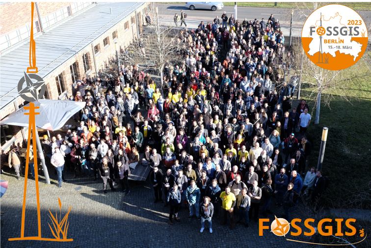
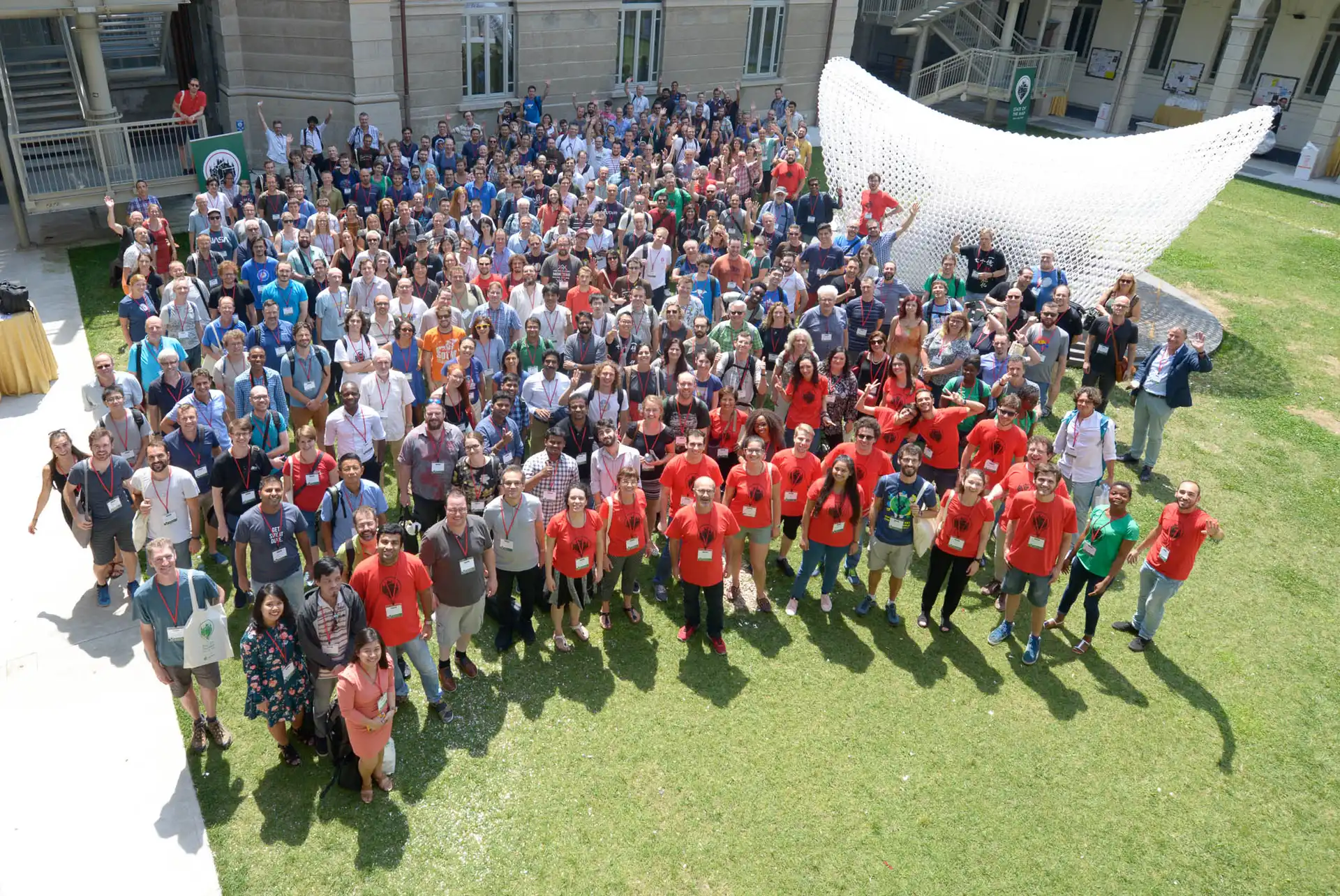
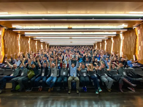
FOSSGIS Conference 2023 happened in March 2023 in Berlin. Participated by about 500 participants, FOSSGIS Konferenz addresses local users and businesses to meet, learn about new development & collaborate on local chapter activities in their own language.
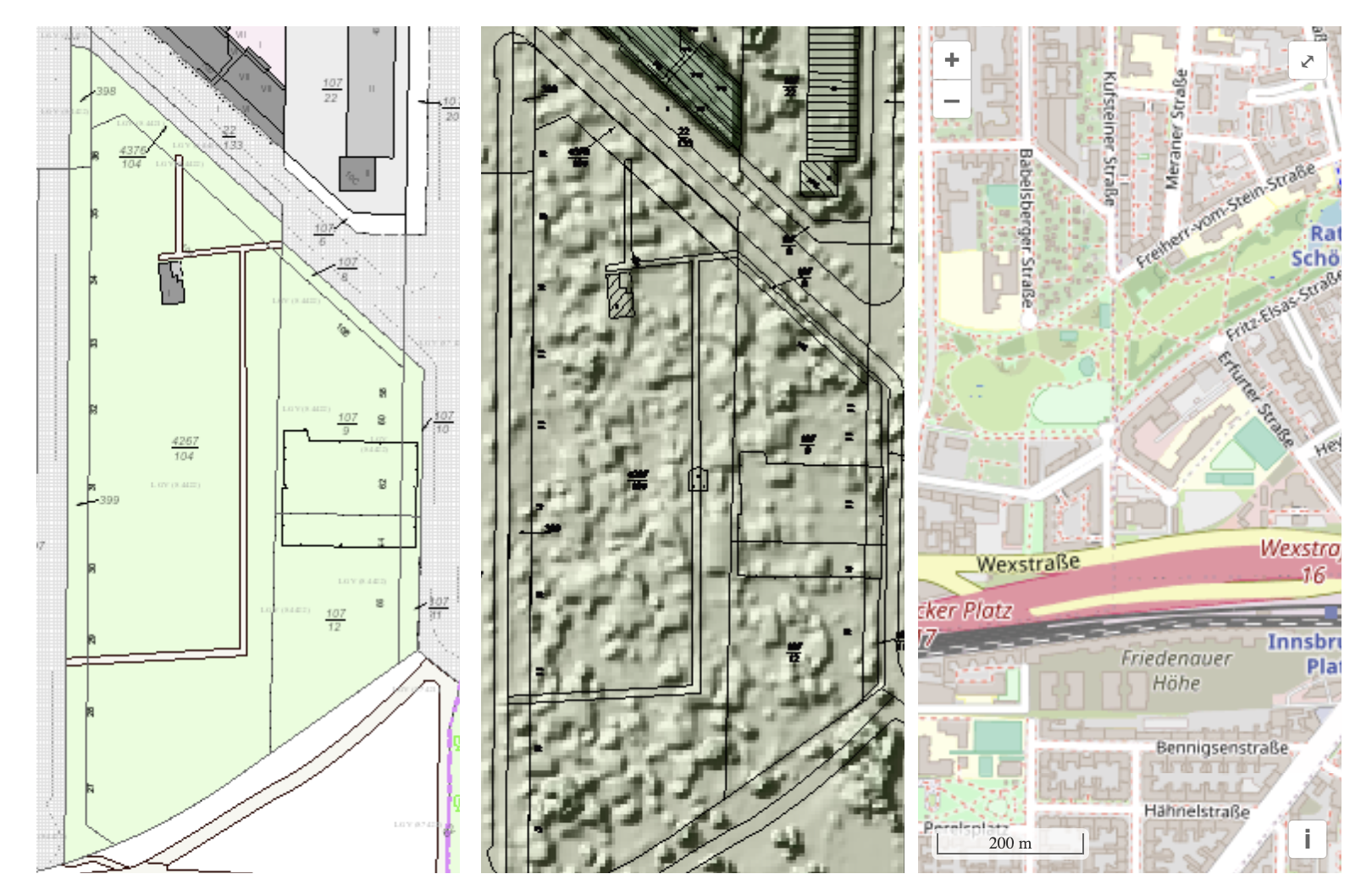
The following three map examples show part of the Berlin allotment garden colony “Am Stadtpark I” ALKIS as an example of official geodata (left), image-based digital surface model (bDOM) as an example of the information open remote sensing data (middle image), OpenStreetMap map (right). from https://www.fossgis.de/aktivit%c3%a4ten/grueneoasen/
OSM Iceland
OSM Iceland has met with the National Land Survey of Iceland who has been tasked with creating a free and open road dataset. Until now the OSM road data has been the de facto road network used in work both by governmental and non-governmental organizations. A presentation made in 2020 for the OSMF board is available at the OSMF website.
In January 2023, Geomob podcast featured an active Swiss mapper, Simon, who happens to be the the current president of the Swiss OpenStreetMap association. Tune in to hear about his motivation for the project, and his perspective on the OpenStreetMap community and its future.
Note: OSM BE is currently not a recognized local chapter, due to internal changes in the organization. However, this report is reflective of a period when they were recognized.
OSM Belgium has been busy organizing State of the Map Europe 2023 that will happen in Antwerp. It hopes to bring together the brightest and most active members of the OpenStreetMap mapping and developing community for a detailed exchange of results and ideas that support the continued success of the various initiatives by strengthening the ongoing projects and collaboration. More information is on the website.
The evolution of mapping roads in Brussels. Green: slow roads. Grey: mapped roads. Black: roads being worked on that month. From https://openstreetmap.be/en/projects/road-completion.html
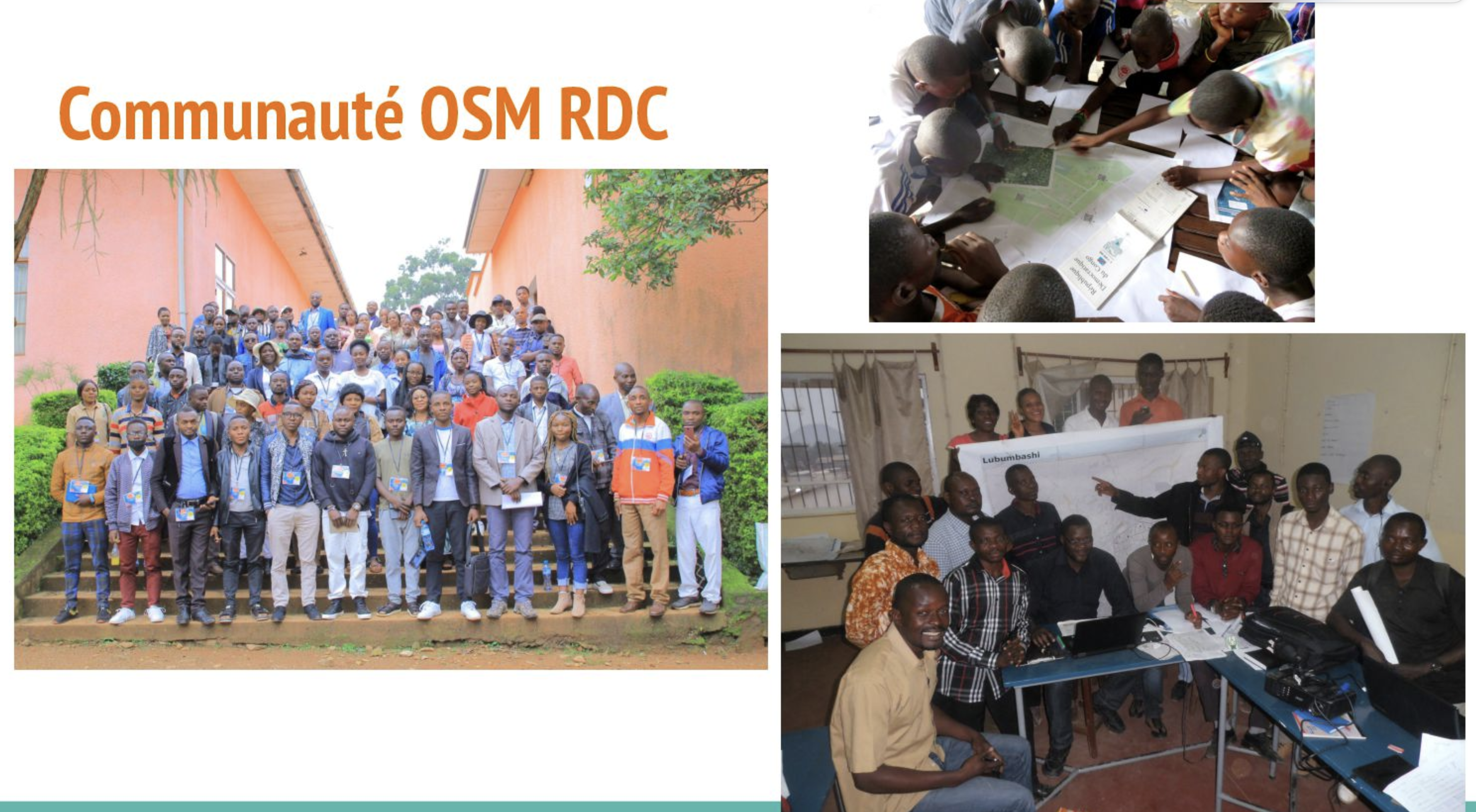
OSM Democratic Republic of Congo
At the end of 2022, OSM DRC started crowdmapping projects of main waterways using a national open data reference to identify missing ones and manually digitize them. Two provinces (Lualaba and Haut-Katanga) out of 26 are being finalized now, but we want to achieve a national coverage. See this presentation during the OSMF Community Spotlight session in July 2023.
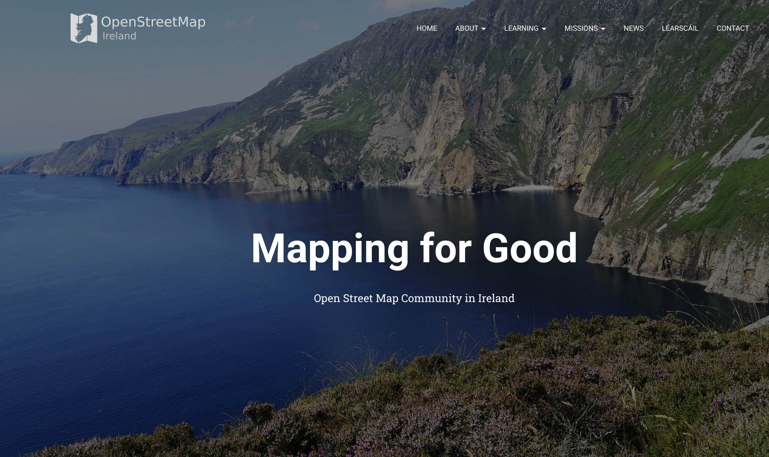
OSM Ireland Buildings Microgrant Project concluded in 2022 - with 200,000 buildings mapped with growth in the community as a result of frequent online community meetings and goodies. See the full report in the wiki.
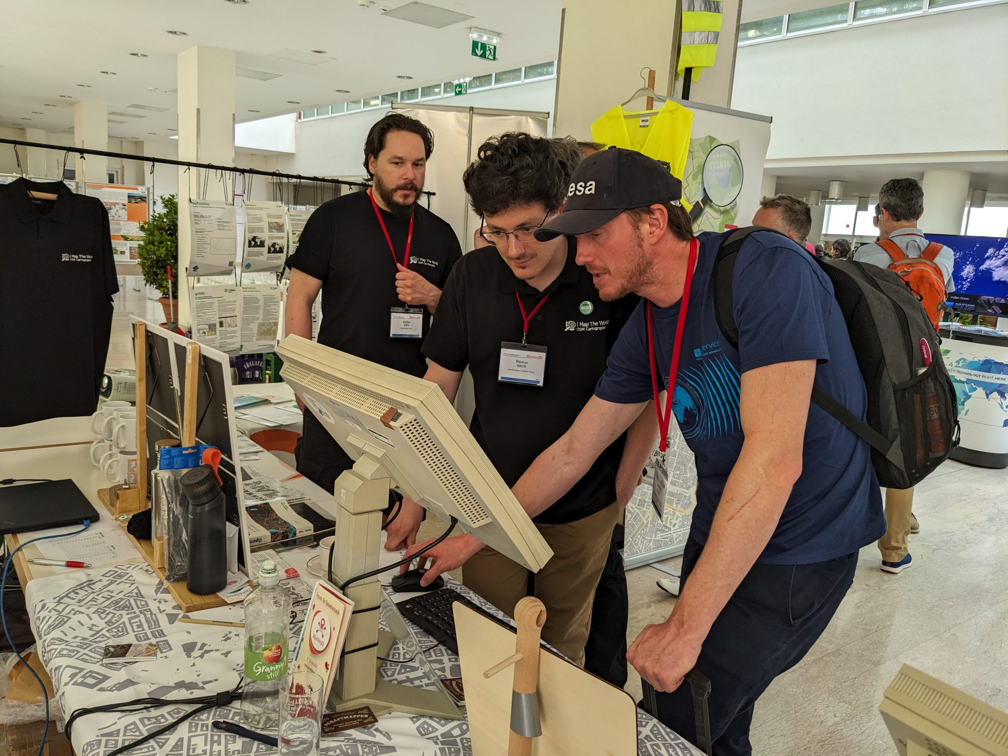
OSM Austria continues to spread the knowledge of OpenStreetMap in the country. They participated in Maker Faire Vienna 2023, the trade fair for global makers and inventors, and looking forward to participate in Maker Faire Salzburg in November this year.
from https://www.openstreetmap.at/2023/07/das-war-die-gi-salzburg-2023/
Free Libre Open Source Software Kosova
Fostering Community Engagement in Albania: OSM Kosovo played an integral role in establishing and organizing the OpenStreetMap Albania community. Their efforts were focused on fostering a vibrant mapping community, promoting the use of open-source mapping tools, and facilitating collaboration among various stakeholders.
OSM Poland has been developing the OpenAEDMap project, which has reached more than 5,600 locations of the AED devices - this is possible thanks to community activism and a campaign among local government entities.
If you and you’re community is interested in becoming a Local Chapter, please check the FAQs page or reach out to LCCWG via email local@osmfoundation.org.
The OpenStreetMap Foundation is a not-for-profit organisation, formed to support the OpenStreetMap Project. It is dedicated to encouraging the growth, development and distribution of free geospatial data for anyone to use and share. The OpenStreetMap Foundation owns and maintains the infrastructure of the OpenStreetMap project, is financially supported by membership fees and donations, and organises the annual, international State of the Map conference. Our volunteer Working Groups and small core staff work to support the OpenStreetMap project. Join the OpenStreetMap Foundation for just £15 a year or for free if you are an active OpenStreetMap contributor.
The OpenStreetMap Foundation (OSMF) has released new guidelines for companies and organizations who use OpenStreetMap (OSM) data in their products and services. The new guidelines clarify the rights and responsibilities between OSM and the entities who use and edit its data, as well as offer guidance on how they can support the map financially and in advisory capacities.
Highlights include:
Corporate members at the Bronze level and higher will now have a seat on the OSMF advisory committee
The fee for an annual membership has increased by 50% across the tiers
An OSMF-facilitated ‘consultation’ has been added as a benefit to the highest, “Platinum” tier
There is new guidance on what is the appropriate membership level.
A Tradition of Supporting OSM with Tools, Editing, Sponsorship, and Donations
Mikel Maron, a long time member of the OSMF Board, noted that opening up access to the advisory committee to corporate members at the Bronze level and higher is a direct result of the value that the committee provides to the community: “The ability to engage with organizations who use and improve OSM is a valuable source of insight in our planning and operations. We especially appreciate those who go above and beyond in their willingness to both consult and contribute financially. Many of these organizations have served as co-developers and friends to the project over the long term.” Maron also noted that changes to the guidance and pricing for OSMF corporate memberships is part of an overall commitment to improving OpenStreetMap’s financial management.
“The ability to engage with companies who use and improve OSM is a valuable source of insight in our planning and operations. We especially appreciate companies who go above and beyond in their willingness to both consult and contribute financially. Many of these organizations have served as co-developers and friends to the project for the long term.” –Mikel Maron, OSMF board member
The many companies who support OSM through a corporate membership include TomTom, who became its first Platinum member in 2023, and current Gold members Mapbox, Esri, Gojek, Grab, Graphhopper, Meta, and Microsoft. A warm welcome also goes out to the first OSMF corporate member to sign up under the new guidelines: StadiaMaps:
In the Preamble to the Plan, the board has noted that the size and scale of OSM necessitates a new approach, saying “The main focus of the OSMF must be to ensure that the infrastructure is available…[and for] OSM to remain a project that is driven by its volunteers, we need to be careful to not overstrain them. The OSMF can help through financial and operational support.
The current scale of the OSM project cannot be overstated. OSM volunteers have contributed eight billion data points to the map over the past two decades, and there are hundreds of millions of API calls each month. The use cases for OSM data include building smarter cities, reducing traffic congestion, solving supply chain issues, powering climate change research, and helping people grow food, find clean water, reach medical and other kinds of help, and build local businesses. OSM editors also help millions of people through hundreds of humanitarian use cases. Accenture has estimated that its data provides billions of euro of value to companies and governments.
The use cases for OSM data include building smarter cities, reducing traffic congestion, solving supply chain issues, powering climate change research, and helping people grow food, find clean water, reach medical and other kinds of help, and build local businesses. OSM mappers also help millions of people through hundreds of humanitarian use cases
The financial costs for a project of this global scale are comparatively small. The OSMF runs as an extremely lean nonprofit with just one full time employee, a part-time small staff, and an all-volunteer board. The need for more sys admins, project management, and resources to help local communities, as well as funds to cover infrastructure and cloud costs is significant.
The OpenStreetMap Foundation is a not-for-profit organisation, formed to support the OpenStreetMap Project. It is dedicated to encouraging the growth, development and distribution of free geospatial data for anyone to use and share. The OpenStreetMap Foundation owns and maintains the infrastructure of the OpenStreetMap project, is financially supported by membership fees and donations, and organises the annual, international State of the Map conference. Our volunteer Working Groups and small core staff work to support the OpenStreetMap project. Join the OpenStreetMap Foundation for just £15 a year or for free if you are an active OpenStreetMap contributor.