iD is the editor through which 80% of OpenStreetMap users contribute to the common edifice. The OpenStreetMap Foundation is committed to its support and seeks to staff iD development.
iD development is a funded position with the OpenStreetMap Foundation, with remuneration at market rates according to skills and commitments.
Please submit your application to board@osmfoundation.org. Include CV, cover letter, and/or examples of work as attachments. Also please indicate your preferences of full-time or part-time, work location, contractor status, and anything else we should consider.
What we are looking for
iD development involves a wide range of roles that may be held by one single polyvalent person – or by more than one, with skills and motivations that complement each other.
The overarching concern will remain addressing and balancing the needs of a diverse range of stakeholders, including:
iD mappers and OpenStreetMap community members from around the world
Corporate and non-profit players in the OpenStreetMap space
Downstream forks and instances of iD
Peer projects that rely on components of iD, or that iD relies on
Project management responsibilities will put an emphasis on communications:
Foster a welcoming, professional, online public space
Maintain and communicate a project roadmap based on input from stakeholders
Gather feedback and build consensus around major changes
Host regular online audio/video meetings to give updates, receive feedback, and hold discussion
Leverage the community to reach out and mobilize beyond the development team’s immediate circle
Of course, the basics of open source software project management shall also be fulfilled:
Provide support for existing functionality
Design solutions to enable new functionality
Review and assist with pull requests from contributors of all skill levels
Publish periodic updates with detailed release notes
Ensure that a third party can build an independent instance as completely as possible
Some domain-specific knowledge will play an important part in understanding user needs:
Some familiarity with the modern field of geospatial technology
An understanding of the OpenStreetMap data model, including tags
The culture of OpenStreetMap, and the free software and volunteered open data world in general
iD is a web application widely used in a varietiy of technological and social contexts – hence the following areas to which its design must pay careful attention:
Usability: ensure that tasks are intuitive to accomplish
Accessibility: accommodate a wide range of users’ abilities
Localization: adapt the app across language, region, and culture
Cross-platform: support all major systems and browsers
Tablet support: handle touch and stylus interactions as well as mouse and keyboard
Privacy: limit web tracking to the minimum required for operation and keep the Privacy Policy up-to-date
Performance: optimize operations for compatibility with the older hardware available to the economically disadvantaged
Development technologies:
HTML / CSS
JavaScript
Node.js
Node Package Manager (npm)
Data-Driven Documents (D3.js)
Git
GitHub
Quality control:
Code readability
Unit testing
Continuous integration
Debugging
Clear documentation, both for users and other developers
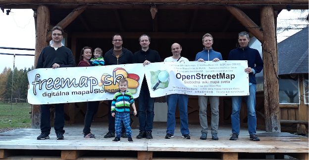
The following post was written by Freemap Slovakia, one of the OSM Foundation Local Chapters.
OpenStreetMap is represented in Slovakia by Freemap Slovakia (NGO Freemap) which was founded in 2009 and became recognized as Local OSM Chapter in 2021.
We have 13 regular and 4 registered members. Apart from the organized members, there are several hundred active mappers in Slovakia.
Over the time, we contributed to OSM in many ways and we continue to do so.
Community
General OSM discussion forum related to Slovakia
We maintain osm_sk google group, available to everyone, where all OSM contributors that deal with Slovakia in OSM are welcome to ask questions and discuss ideas.
Mapping Parties
Once, or twice a year we organize mapping parties, one of which serves as a meeting for our NGO. The parties are always held at different places in Slovakia.
In an effort that has been going for several years we continuously perform supervised bulk import of buildings and addresses from the Cadastre of Real Estate of Slovakia. For this purpose we built a JOSM plugin that allows users to visually inspect batch-imported data and upload it subsequently into the OSM database.
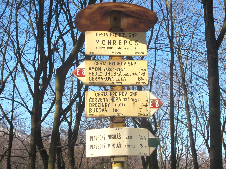
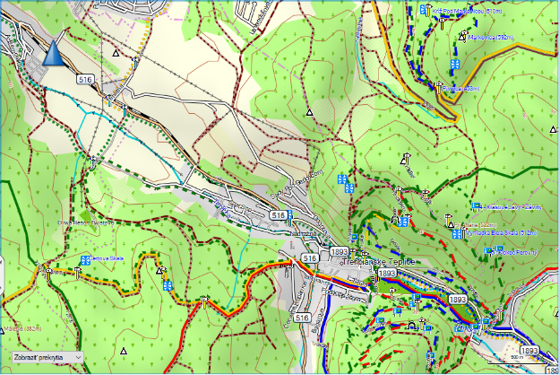
Marked Hiking Trails
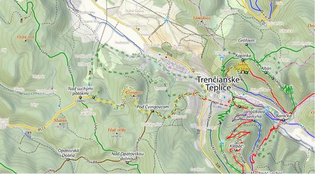
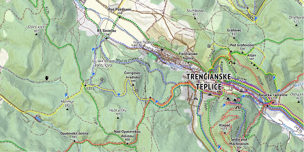
Slovakia is a mountainous country and has one of the most elaborate systems of marked hiking trails in the world with more than 100 years of history (shared with Czech Republic).
We cooperate with the Klub Slovenských Turistov (Association of Slovak Tourists) which maintains the physical trails and markings, to make sure all changes are captured in OSM as soon as possible.
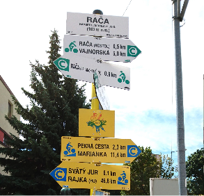
Cycling Infrastructure
Slovakia enjoys steady growth of cycling infrastructure, both in physical means (e.g. dedicated cycling paths) and in terms of trail marking. We make sure the latest changes in the “physical world of Slovak cycling” are captured in the OSM database.
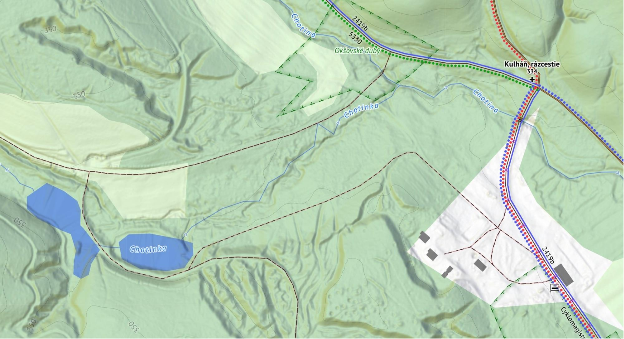
Rivers and streams
Rivers and streams are hard to be properly mapped by “survey”, therefore we imported most of the waterways from the Cadastre of Slovakia, open data sources of Slovak Cartography Office of Slovak Republic, INSPIRE dataset and recently from more precise Aerial Laser Scans of Terrain performed by the Geodesy, Cartography and Cadastre Authority of the Slovak Republic.
Software & Hardware
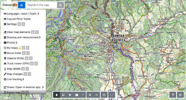
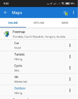
Freemap.sk Web Portal
We develop and maintain web portal freemap.sk that provides a number of features:
Source code of the portal, backend servers and many utility repositories are Open source.
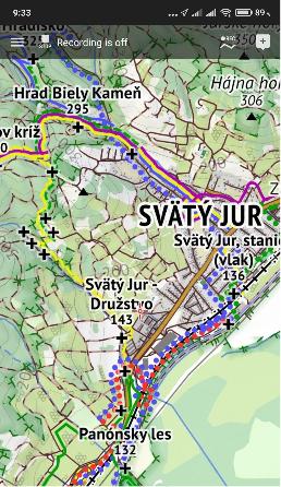
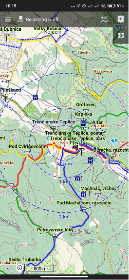
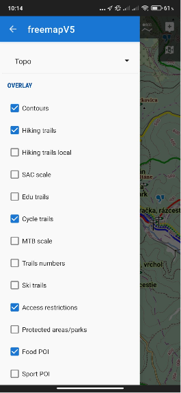
Custom Map Styles and Renderers
Due to the specific appearance of the hiking trail marking in Slovakia, we developed several custom map styles which we also render and provide publicly as tiles.
Legacy Hiking Style
This raster map style was used for many years until we developed a more recent, hi-res “outdoor style”. Some people still consider this legacy style a pinnacle in terms of balance between colours, information and general aesthetics, and therefore the style is still available in the portal.
Recent Outdoor Style
A new hi-res raster map style has been in development since 2019, with a more “busy” appearance, as it displays hiking, cycling, cross-country skiing and horse riding marked trails all at once.
We empower users of freemap.sk to upload and view photos. Our photo gallery contains almost 300 000 photos, including more than 10 000 photos of hiking and cycling guideposts.
Rendering Maps and Hosting Tiles
We render our own map styles and expose the map tiles for public use. This way, anyone can easily use our raster map tiles in their websites, or smartphone apps.
We also provide offline vector maps for the Android smartphone app Locus and other devices:
Garmin Exports
Twice a week we export the freemap-style map into a format suitable for Garmin devices.
Other
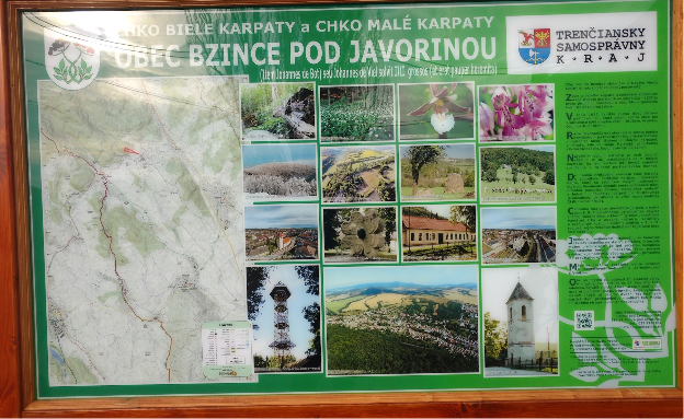
Printed maps
We create custom vector maps for large prints on information boards. Freemap.sk users can also easily export their own raster maps in print quality through the Export Map feature.
OSM License Compliance
Maps generated from the OSM data are frequently used by various NGOs in Slovakia on information boards and printed maps. When we encounter OSM-based maps missing appropriate attribution, we communicate with creators of those maps to make sure the text is included. In almost all cases such the situation is caused by lack of knowledge and not by malicious intent and the problem is usually resolved by adding a sticker to the board containing the attribution text.
Awards
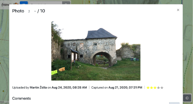
The Openstreetmap Foundation Greatness in mapping award was granted to our member Martin Ždila in 2016.
Funding
Our largest expenses are for hosting the freemap.sk portal and the map rendering servers. These costs are covered with income from annual fees paid by our members, by donations, and via the Slovak government-run 2% income tax donation schema.
Vision for Upcoming Years
In the near future we will be busy with the following:
we believe that as a community, we succeeded in creating the best outdoor map of Central Europe, with an unmatched level of detail, precision, and frequency of updates. We plan to continue in this effort
grow the OSM community in Slovakia and make the existing tools more accessible for non-English speaking mappers.
as mostly technology-centric group of people, we realize the need for recruiting new members, who could help us put a more human face on our effort through social media, or by organizing mapping-propagating events for lay people
continue importing data into the OSM database from datasets published by various Slovak government agencies. This also includes cleanup of data that was previously imported from less precise datasets.
work on further development of the freemap.sk web portal, the outdoor map style and a custom routing service, most likely based on GrapHopper
try to raise more funds, which would allow us to grow the area covered by our map even further
oma.sk – partner portal build on top of OSM data and Freemap.sk maps
nabezky.sk – partner portal for cross-contry skiing using Freemap.sk maps
If you would like to contact us
Write us via osm_sk google group, or through Facebook page, or send us an email to freemap@freemap.sk
Do you want to translate this and other blog posts in another language..? Please send an email to communication@osmfoundation.org with subject: Helping with translations in [language]
The OpenStreetMap Foundation is a not-for-profit organisation, formed to support the OpenStreetMap Project. It is dedicated to encouraging the growth, development and distribution of free geospatial data for anyone to use and share. The OpenStreetMap Foundation owns and maintains the infrastructure of the OpenStreetMap project, is financially supported by membership fees and donations, and organises the annual, international State of the Map conference. It has no full-time employees and it is supporting the OpenStreetMap project through the work of our volunteer Working Groups.
After two and a half years developing iD, Quincy wishes to pass the torch on, for personal reasons. Together with the OpenStreetMap Foundation, he will hand over iD to good hands; the Foundation is now starting the process of finding a replacement by consulting the OSM community about a planned paid position serving iD users.
To ensure continuity, Quincy will be part of an OpenStreetMap Foundation working group – a privileged environment to pass his knowledge as his successor ramps up in mastery of iD.
The OpenStreetMap Foundation remains fully committed to robust support of the editor through which 80% of OpenStreetMap users contribute to the common edifice.
The Foundation thanks Quincy for his great work on iD.
Volunteers from across the OpenStreetMap community are coming together to improve how we communicate in our central spaces, and we want your help! The Local Chapters and Communities Working Group Moderation Subcommittee invites your participation in the process.
The subcommittee has created a Scope of Work to help you understand what work is being undertaken and an Implementation Plan that outlines a step by step approach, including how you can get involved and the different types of contribution that community members can sign up for.
Please take a minute to share your ideas and any interest in participating in the process via this form. And help spread the word! Please share this form with anyone who might be interested. Form closes April 10, 2021. Thank you!
On March 10 & 11, Allan Mustard, Chair of the OpenStreetMap Foundation, will present a series of three Big Blue Button video conferences, open to the OSM community and 8 hours apart, to brief on and answer questions about the results of the 2021 OSMF community survey. The briefings will take place at 12:00 UTC and 20:00 UTC on March 10, and 04:00 on March 11 UTC (click the links to convert for your timezone). He will present some summaries of the data in graphic form, then take questions. He will use his Big Blue Button home room at https://osmvideo.cloud68.co/user/all-3t3-ekg.
Allan also plans to open an instance of Microsoft Translator and to speak into it in English, and will share the access code for the instance at the start of the presentation, so that anybody with Microsoft Translator’s app (on desktop, notebook, tablet, or smart phone) can follow his oral narrative in the language of their choosing. He will also use the Power Point 365 facility for rendering speech to text so that anyone who can read English can read subtitles as he speaks. Anyone planning to view the video conference who wishes to use the translation facility should download the Microsoft Translator app in advance and become familiar with it first.
If you would like to access the anonymized, raw results of the 2021 OSMF community survey, visit this page on the OSMF wiki.
Geocoding is the process of converting between addresses or placenames and geographic coordinates (longitude and latitude). Geocoding is a core geospatial functionality; an underlying building block that is critical to developing location based services.
OpenStreetMap Foundation corporate member OpenCage operates a highly-available, enterprise level geocoding API based on OpenStreetMap. We’re pleased to announce that OpenCage recently increased their commitment to the OpenStreetMap Foundation by upgrading to silver level corporate membership.
“For years our service has built on OpenStreetMap. We’re delighted to increase our ongoing support of the worldwide OSM community by increasing our level of commitment to the OpenStreetMap Foundation.” said Ed Freyfogle, OpenCage co-founder.
“It’s a nice milestone that the business has grown to the point that we could upgrade from Bronze to Silver. But beyond financial support the main work we do is opening the eyes of our customers – most of whom arrive knowing simply that they need geocoding, and without a detailed understanding of open data – to open data’s many benefits. Our customers around the world are proof that OpenStreetMap is commercially usable not in some distant theoretical future, but today” continued Freyfogle.
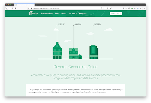
An example of that type of educational work is OpenCage’s recently published Reverse Geocoding Guide, which details the technical challenges of ongoing operation of a reverse geocoding service, while also documenting the advantages of using open data as the underlying data foundation for such a service.
In addition to being corporate members of the OSMF, OpenCage are proud members of the UK (the business was started in the UK) and German (the business is currently based in Germany) local chapters, co-sponsor and contribute to the open source development of Nominatim (the primary OpenStreetMap geocoding software), and regularly sponsor OpenStreetMap events.
OpenCage also encourages geoinnovation by running Geomob, a regular series of in-person and online events with the goal of promoting geoinnovation in any and all forms – whether for “fun or profit”, as the event tagline says. Now in its thirteenth year, Geomob has become an established feature of the European geo event landscape, and regularly features projects using OpenStreetMap.
Early in 2020 the Geomob podcast was launched. The weekly conversations provide a chance to reflect on geo industry trends, discuss interesting new geo technology, and interview Geomob speakers. Podcast guests have included many members of the OpenStreetMap community, including Allan Mustard (chairperson of the OSMF Board), Tyler Radford (executive director of the Humanitarian OpenStreetMap team), Sarah Hoffmann (maintainer of the geocoding tool Nominatim, which powers search on osm.org), several founders of businesses building on top of OpenStreetMap, and many more.
What is OpenStreetMap?
OpenStreetMap was founded in 2004 and is a international project to create a free map of the world. To do so, we, thousands of volunteers, collect data about roads, railways, rivers, forests, buildings and a lot more worldwide. Our map data can be downloaded for free by everyone and used for any purpose – including commercial usage. It is possible to produce your own maps which highlight certain features, to calculate routes etc. OpenStreetMap is increasingly used when one needs maps which can be very quickly, or easily, updated.
What is the OpenStreetMapFoundation?
The OpenStreetMap Foundation is a not-for-profit organisation, formed to support the OpenStreetMap Project. It is dedicated to encouraging the growth, development and distribution of free geospatial data for anyone to use and share. The OpenStreetMap Foundation owns and maintains the infrastructure of the OpenStreetMap project, is financially supported by membership fees and donations, and organises the annual, international State of the Map conference. The OSMF supports the OpenStreetMap project through the work of our volunteer Working Groups. Please consider becoming a member of the Foundation.
Would you like to provide feedback on decisions that the OSM Foundation board made in 2020 and on current topics? The board has prepared a survey and is asking for your input in order to set priorities.
You can see a copy of the questions in English here.
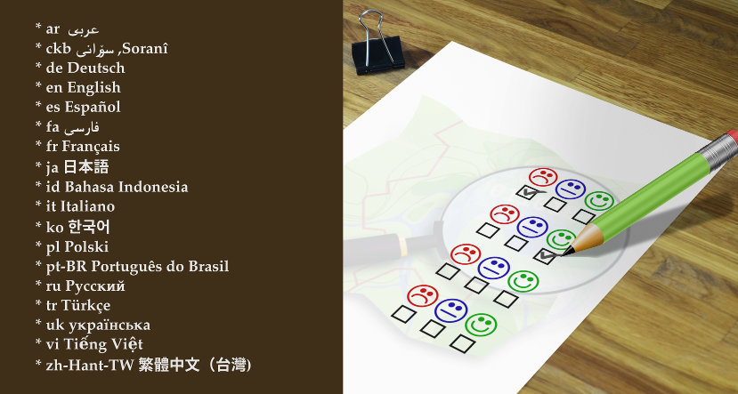
The survey is available in18 languages so far. Image by D. Kazazi, CC-BY-SA 3.0. Official OSM logo by Ken Vermette, CC-BY-SA 3.0 & trademarks apply.
Languages
Thanks to volunteer translators, the survey is available in eighteen languages so far:
If you would like to provide a translation to a language not on the list, or to suggest a correction in one of the translations, please email allan@mustard.net
If you would like to help with translations of non-English answers to English, future surveys or blogposts, please send an email to communication@osmfoundation.org with subject: Helping with translations in [language].
Practical
You need to provide an email address (to receive a token) and solve an equation in order to access the survey.
There are 18 questions, most are multiple-choice and mandatory.
There is an optional section with demographic questions.
There are several sections. You cannot go back to the previous section but you can resume later.
Please note that pages with background information linked from the survey are in English.
If the pages are on the OSM wiki, you are welcome to translate them.
If they are on the OSMF website and you would like to provide translations, please email the Communication Working Group at communication@osmfoundation.org with subject: Translating OSMF pages in [language].
Feedback
There is discussion about the survey on the “talk” mailing list, where you are welcome to provide feedback. You can register to the talk mailing list here. All past messages of the list are available here.
The answers can be accessed by current board members and the administrative assistant and will be processed by the board.
The email addresses and names (if provided) of participants won’t be published after the survey ends.
Results
The general results will be published after the survey ends. Past surveys are listed here.
Deadline for participation: 14 February 2021.
Even if you don’t participate, it would be appreciated if you spread the word about the survey.
Thank you in advance 🙂
The OpenStreetMap Foundation is a not-for-profit organisation, formed to support the OpenStreetMap Project. It is dedicated to encouraging the growth, development and distribution of free geospatial data for anyone to use and share. The OpenStreetMap Foundation owns and maintains the infrastructure of the OpenStreetMap project, is financially supported by membership fees and donations, and organises the annual, international State of the Map conference. It has no full-time employees and it is supporting the OpenStreetMap project through the work of our volunteer Working Groups. Please consider becoming a member of the Foundation.
I convey the following information on behalf of the Board of Directors of the OpenStreetMap Foundation.
An outcome of the current controversy on the osmf-talk mailing list over misogynistic language is a decision by the Board as follows:
The Board will find partners to help instate a moderator team for the OSMF-talk and talk mailing lists. These moderators need to have the trust of the community subject to the moderation (consent of the governed) by some kind of approval mechanism.
This moderator team will start to work on enforcing the current Etiquette guidelines as soon as possible. We will also start work on updating/replacing our Etiquette rules, which must focus on balancing all participants’ interests.
We have asked the Local Chapters and Communities Working Group (LCCWG) to take the lead on this and to work with signatories of the open letter to the Board as well as members of the Diversity and Inclusion Special Committee to produce proposals for the Board to consider at its January meeting. The LCCWG has accepted this task. This issue will be on the agenda of the January meeting of the Board of Directors, exact time and date yet to be determined, though as is customary it will be posted to the Foundation’s website well in advance.
Members of the OSM community are, as always, welcome to share their opinions and any relevant information on this matter, either publicly via osmf-talk, or privately in direct communications to the LCCWG. I feel compelled to remind all members of the community that a Code of Etiquette has existed since June 2011 and shall be observed by all community members.
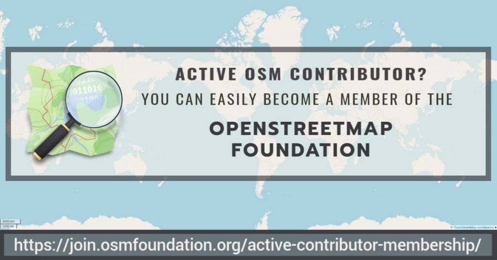
If you contribute significantly to the OpenStreetMap project you should have a voice in the OpenStreetMap Foundation, which is supporting the project, and be able to vote for the board members of your choice. There is now an easier and costless way to become an OpenStreetMap Foundation member:
The volunteers of the OSMF Membership Working Group have just implemented the active contributor membership program, where you can easily apply to become an Associate member of the Foundation and there is no need to pay the membership fee.
What can I do as an OSMF Associate member?
You can vote for the board candidates of your choice at the board elections.
You can vote on some issues during General Meetings (but not all).
You have the option to receive a single daily digest, containing all the emails of the day.
Feel free to email in your language 🙂
You can proudly say that you are an OSMF member 🙂
How does it work?
We will automatically grant associate memberships to mappers who request it and who have contributed at least 42 calendar days in the last year (365 days).
Not everyone contributes by mapping, and some of the most familiar names in our members list barely map. Some are very involved, for example, in organizing conferences. Those other forms of contribution should be recognised as well. If you do not map at all or less than the 42 days, then we expect you to write a paragraph or two about what you do for OpenStreetMap. The Board will then vote on your application.
How can I find out how many mapping days I have?
You can get an estimate from tools like Pascal Neis How did you contribute, which should be accurate enough for most purposes.
If you are technically versed and wish to verify your mapping days yourself, use the changesets API of OSM to query your changesets. Then you can collect all unique dates in the created_at attributes of the changesets, and count how many unique days you have in the last 365 days.
I would like to become a member via the active contributor program!
● If you qualify based on mapping activity (at least 42 mapping days in the last 365 days) please fill out this form to get your active contributor membership
Your email address (where ballots for voting will be sent and will be the email address associated with participation in the OSMF members mailing list, if you choose to subscribe)
How long is this membership valid?
Just like paid membership, membership under the membership fee waiver programme must be renewed annually. You will get a reminder, and you then can request the renewal, similar to the initial application. The check for mapping at least 42 calendar days in the last year will be carried out at the time you request the renewal, or alternatively you submit again a paragraph or two about what you do for OpenStreetMap.
What else do I need to know?
By law, every member of the OSMF can inspect the membership register (we ask for the purpose before handing it out and generally distribution by the recipient is not allowed). Who joined under which program is not revealed. The name, country, email and one of the OSM account names will be shown.
Why does this active contributor membership program exist?
By inviting more active community members to join the OSMF, we become more resilient against take-over attempts through massive signups. We believe that even mappers for whom £15 is not a lot of money would be more willing to join, if they are invited to a free membership due to their good work. Also, active contribution to the project is easier to assess than financial hardship and does not require the applicant to disclose personal information. The potential loss of individual membership fee income is not a threat to our financial stability. In fact, there are quite a few members who like to donate more than just £15. Those donations need not be tied to any membership.
Why 42 mapping days?
Mapping days is not perfect, but we need a benchmark that is objective, easy to verify, and simple for us to measure and implement. Why 42 days? If we measure contributions in mapping days by OSMF members who map (83%), roughly half of them map more than 42 days per year. We would expect a “slightly exceptional” contribution in terms of mapping days.
How are my changes divided into days for measuring 42 mapping days
For measuring the mapping days, the created at time stamp of each changeset is used. Typically, all changes in a change set have the same time stamp. A day is defined in UTC from midnight to midnight.
Does paid mapping count?
The “active contributor program” is there to measure your engagement towards the project. In the first place, we think this is shown by volunteer activities for the project. If you do organizing or mapping for OSM as a part of your paid job, that is not necessarily a show of engagement with the project. By default, we would not include these activities as qualifying for this type of membership. But feel free to explain your contributions, and the Board will have a vote.
Can’t this be cheated?
We also discussed abuse. When we receive an application, we contact the mentioned OpenStreetMap account(s) through the OSM messaging system to confirm they are owned by the applicant. You could of course make tiny contributions like wiggling a single node on 60 days, and maybe go undetected and get your membership. But that would be fraud, and the membership could be revoked if the OSMF Membership Working Group finds out that the contributions are not meaningful.
What happens to the old fee waiver program?
The Active contributor membership program is replacing the old “fee waiver” program (active from 2018 January onward) where the membership fee was waived in cases of financial hardship or lack of suitable money transfer ability. The change was made possible by a vote during the 2019 Annual General Meeting. The “financial hardship” and “Lack of suitable money transfer” rule will be dropped entirely because even today, we expect someone joining under those rules to demonstrate some sort of contribution, so they would likely be eligible under the new rule as well.
Do you want to translate this and other blogposts in another language..? Please send an email to communication@osmfoundation.org with subject: Helping with translations in [language]
The OpenStreetMap Foundation is a not-for-profit organisation, formed to support the OpenStreetMap Project. It is dedicated to encouraging the growth, development and distribution of free geospatial data for anyone to use and share. The OpenStreetMap Foundation owns and maintains the infrastructure of the OpenStreetMap project, is financially supported by membership fees and donations, and organises the annual, international State of the Map conference. It has no full-time employees and it is supporting the OpenStreetMap project through the work of our volunteer Working Groups.
After many weeks of examining the 48 submitted proposals for the OSMF Microgrants Program, the committee is pleased to announce the 12 projects which have been selected for funding. While the entire range of submissions included thoughtful proposals with potential for impact, a shortlist was formed to keep under the proposed budget of up to €5,000 per project, up to €50,000 total. The selected proposals represent the top tier of ideas that will help shape and impact the OpenStreetMap community in the coming year with microgrant funding.
The accepted proposals are:
Leaflets to Promote OSM A series of leaflets promoting OpenStreetMap aligned to our Local Chapter aims. Costs will cover the printing and distribution of the leaflets. Design work is expected to be covered by volunteer time.
Tactile Maps for Blind or Visually Impaired Children Inspire others and promote OpenStreetMap by making map that will be used by blind children. Maps will be donated to school for blind children and used during lesson teaching how to move through a city.
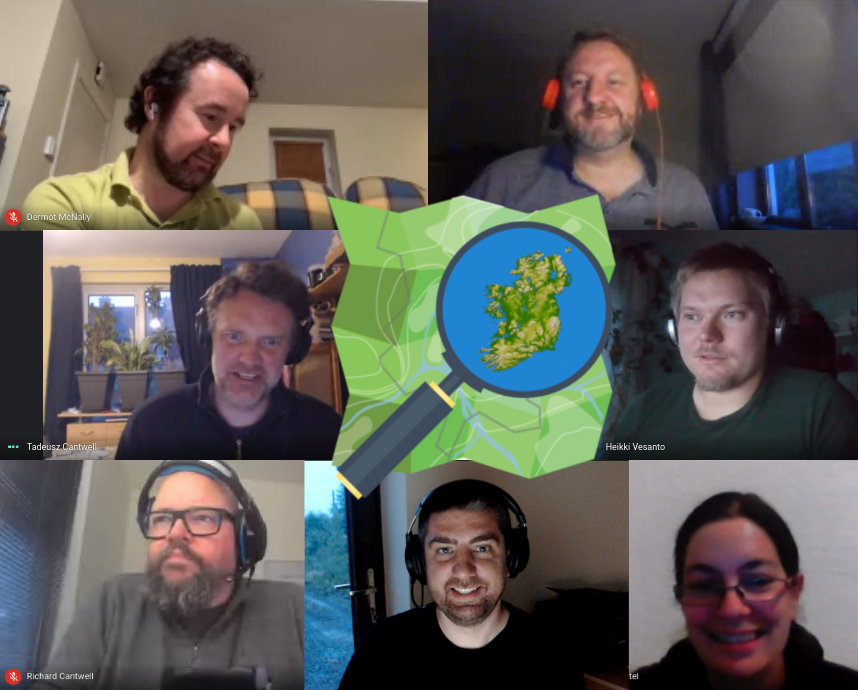
OSM Ireland Buildings We have a project to map all of the buildings in Ireland on OpenStreetMap.
OpenStreetMap Ireland board members during recent online meeting.
Map Maintenance with StreetComplete Extend StreetComplete with functionality that makes its users actively and continuously keep contributed map data up-to-date.
Tobias Zwick, developerof StreetComplete
Teaching and learning OSM in Albania through LibreTech School Organising teaching classes for local OpenStretMap contributors with less or without experience in editing and using OSM. Volunteer’teachers’ will organize online classes with under-represented groups in Albania using amongst others explanatory videos about getting started with OSM and the OSM community.
Mapping Villages and Settlements in Kosovo Twelve mapathons are planned to be organized with high school students to map their settlements. This will be done in cooperation with ASSET (an afterschool activity project that aims to develop employability and entrepreneurial skills in youth and a positive attitude to their future ASSET).
HIV facilities mapping in the Philippines on OpenStreetMap HIV has been very rampant in the country and PLHIV are at most vulnerable specially in times of disaster and outbreak. This project aims to map out and validate all HIV facilities’ location and contact details all over the Philippines on OSM.
Road Completion project Process automatically the road networks official datasets and display the comparison in a way that will help the mappers to add or fix the road network in OpenStreetMap.
OpenStreetMap Calendar OpenStreetMap Calendar simplifies event organisation and staying up-to-date on nearby events.
All projects must conclude within 12 months from their start, and should show promising results as they commence in the near future. Next steps will include final funding agreements for accountability, disbursement of funds, and kicking off the accepted projects.
A total of €42,368 is authorized by the board for this round of microgrants, although some of this will be reduced due to savings on shared video chat infrastructure and other minimal adjustments. No projects were allowed to have their nature or content modified in order to facilitate selection, but were judged on the merit of their originally submitted format. Community endorsements were considered in the selection process, and input of the OSMF Board was provided in regards to the shortlisted projects.
The Microgrants Committee includes Christopher Beddow, Janet Chapman, Geoffrey Kateregga, Clifford Snow, and Hanna Krüger. The committee wishes to profusely thank Joost Schouppe for his advising and refereeing during the process, as well as Craig Allan and Michael Collinson who served as neutral observers in the latter half of the committee proceedings. Finally, a profound thanks goes out to all who put in the effort to build a project proposal focused on improving OpenStreetMap, a dedication which does not always come with reward, but demonstrates the spirit of volunteerism and innovation that helps the OpenStreetMap project thrive.
About photos in this post: The twelve applicants were asked for photos. The post includes those received up to the time of publication.
Do you want to translate this and other blogposts in another language..? Please send an email to communication@osmfoundation.org with subject: Helping with translations in [language]
The OpenStreetMap Foundation is a not-for-profit organisation, formed to support the OpenStreetMap Project. It is dedicated to encouraging the growth, development and distribution of free geospatial data for anyone to use and share. The OpenStreetMap Foundation owns and maintains the infrastructure of the OpenStreetMap project, is financially supported by membership fees and donations, and organises the annual, international State of the Map conference. It has no full-time employees and it is supporting the OpenStreetMap project through the work of our volunteer Working Groups. Please consider becoming a member of the Foundation.
OpenStreetMap was founded in 2004 and is a international project to create a free map of the world. To do so, we, thousands of volunteers, collect data about roads, railways, rivers, forests, buildings and a lot more worldwide. Our map data can be downloaded for free by everyone and used for any purpose – including commercial usage. It is possible to produce your own maps which highlight certain features, to calculate routes etc. OpenStreetMap is increasingly used when one needs maps which can be very quickly, or easily, updated.

