We all know and love the OpenStreetMap data model with its nodes, ways, and relations and the open tagging that has allowed OpenStreetMap to be so innovative. But the data model also shows its years and some improvements might be possible. There is a lot we don’t want to change. Especially the open tagging model has proven itself. We might think of some small improvements, but the core idea of allowing any number of key-value (string) tags has worked amazingly well.
But there are some pain points due to the way we organize our data. The biggest problem is that geographic location is only available to nodes and not higher-level geographic objects like ways and relations. This means that accessing the location of, say, a way always means we have to follow the references to the member nodes of that way. This makes processing OSM data extremely cumbersome and resource-intensive. The other major pain point often talked about is the missing “area” datatype. We use work-arounds like closed ways and multipolygon relations, but that has always been problematic, because we can’t be sure that those objects are actually valid polygons.
The OSMF Engineering Working Group (EWG) has commissioned me (Jochen Topf) to write a study over the next months outlining the problems with our current data model, possible improvements and their impact on our systems. Any changes to our data model will, of course, have a large impact on our mappers, the data users, our software and on the whole OSM ecosystem. So the study will also suggest ways to move forward implementing those changes step by step.
You are welcome to contact me via email at jochen@topf.org if you want to discuss any of this. After my talk at the State of the Map in Milano in 2018 in which I already outlined some of the issues with the data model, I created the osm-data-model repository. Feel free to comment there. After my preliminary study I will expect there will be a more formal discussion process where we can decide as a community which (if any) changes we want and how we are going to implement them.
The OpenStreetMap Foundation is a not-for-profit organisation, formed to support the OpenStreetMap Project. It is dedicated to encouraging the growth, development and distribution of free geospatial data for anyone to use and share. The OpenStreetMap Foundation owns and maintains the infrastructure of the OpenStreetMap project, is financially supported by membership fees and donations, and organises the annual, international State of the Map conference. Our volunteer Working Groups and small core staff work to support the OpenStreetMap project. Join the OpenStreetMap Foundation for just £15 a year or for free if you are an active OpenStreetMap contributor.
Last March saw the launch of the Pin je punt project (“Pin your point”). The aim of this tourism-focused mapping campaign is to augment OpenStreetMap with points of interest for hikers and cyclists, specifically in the Belgian region of Flanders. Pin je punt is a collaboration between Toerisme Vlaanderen/Visit Flanders (the region’s official tourism administration), the provincial tourism organisations and OpenStreetMap Belgium.
A partnership like this has a lot of potential to increase awareness about OpenStreetMap, and convince organisations and individuals to hop on the OSM train. So of course we wanted to know more. How did this collaboration come about? What has been achieved? And what can OSM as a community learn from a project like this?
To get an answer to these questions, we sat down with Pieter Vander Vennet (OSM Belgium) and Jos Pyck (project manager for Pin je Punt at Visit Flanders). This post is a reflection of those conversations.
Pieter Vander Vennet
Jos Pyck
What is the goal?
The Flemish tourism agencies want to enrich OpenStreetMap with as many points of interests as possible in the following categories:
Charging stations for e-bikes
(Public) toilets
Benches and picnic tables
Observation towers
Bicycle repair stations
Bicycle rentals
Playgrounds
The data should be complete enough so it can be used to improve route planning applications for hikers and cyclists, possibly even printed maps.
How did it start?
Back in the winter of 2020-2021, Visit Flanders was contacted by route planning developers looking for datasets to improve their services for cyclists and hikers. Triggered in large by the COVID pandemic, this target audience had grown into a large community with varying needs: hikers in search of public toilets now that restaurants and bars were closed, young families looking for playgrounds, e-bikers in need of charging stations, …
Unfortunately, no Flemish dataset was available to meet these requirements. The Flemish tourism organisations did have open datasets, but they were incomplete and spread across the five provinces. The solution? Using OpenStreetMap to unify, improve and maintain these different datasets.
Through the local cyclist organisation Fietsambassade Gent, Visit Flanders came into contact with Pieter Vander Vennet, who had developed the MapComplete editor and had already worked with a couple of government agencies. They formed a core working group with other OSM Belgium users Joost Schouppe and Seppe Santens (also ICT manager at the West-Flemish tourism organisation Westtoer, the only provincial agency with previous OSM experience). And just like that, Pin je punt was born.
How is the data added to OSM?
The existing datasets of the provincial tourism organisations were loaded and the objects converted into notes, which can be validated by users one by one. Of course new data points can be added as well. Validation and editing occurs in a custom theme in Pieter’s MapComplete tool, enabling users to edit specific POI categories in OSM in a user-friendly way. This makes it the perfect fit for the Pin je punt campaign, which is also aimed at users without OSM experience. Visit Flanders invited all Flemish province and municipality employees to start editing, and even launched a media campaign to reach the general public. (The promo video featuring a former Flemish radio presenter (in Dutch only) is, as far as Pieter knows, the first professional commercial encouraging contributions to OpenStreetMap!)
Of course, as new users are attracted, it is important to keep an eye on the quality of their work. For that reason, volunteers of the Belgian OSM community monitor the edits made in Pin je punt.
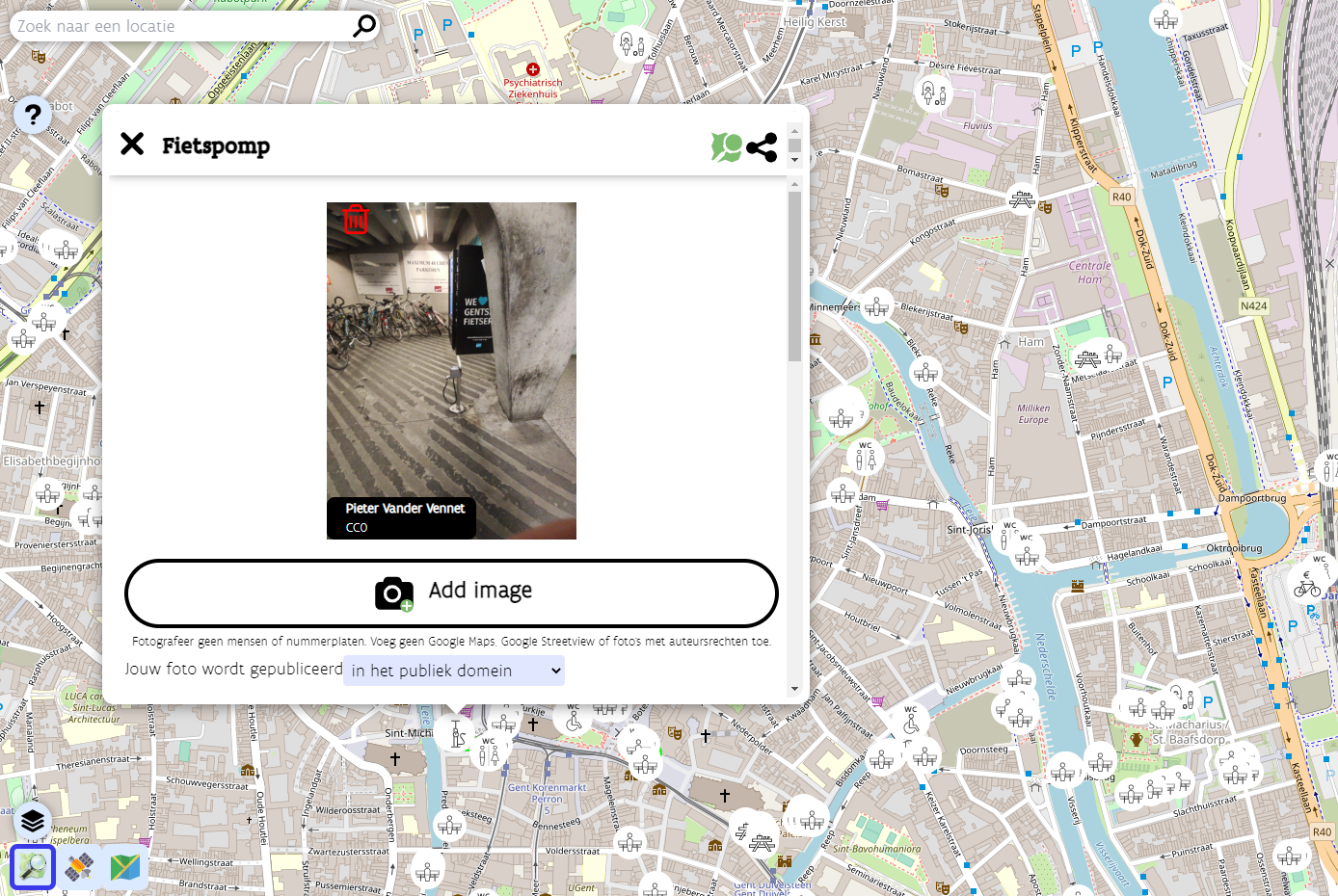
A bicycle pump in the Pin je punt MapComplete theme
What are the results and takeaways?
The Pin je punt campaign officially concluded at the end of April 2022. During the 1,5-month-long project run, the imports of the provincial datasets and the edits made by many tourism organisation employees and other users resulted in about 1,500 new points being created in OpenStreetMap. Since the Pin je punt MapComplete theme remains available, these users can continue to improve the data in their municipalities.
But the potential effects of Pin je punt extend far beyond an increased number of POIs for hikers and cyclists. The campaign also has the capability to increase awareness about OpenStreetMap and its possibilities outside of the OSM community, and to encourage more organisations to start using OSM.
Pin je punt has convinced one person in particular of OpenStreetMap’s strengths: project manager Jos Pyck of Visit Flanders. He used to be sceptical about using OSM, as he–despite his GIS background–deemed it far too technically complex. But this campaign has turned him into a true OSM believer. He’s impressed by the sheer size of the database and the fact that anything can be captured in it. And his pleasant experience with the helpful community even resulted in Visit Flanders becoming a corporate member of OSM Belgium.
Jos is very interested in expanding the Pin je punt theme with more tourism-related layers in the future, for instance bars, restaurants, drinking fountains, … He has even made it his mission to encourage other government agencies and municipalities to invest (more) in OSM, instead of setting up and maintaining their own limited, siloed databases. The five provincial tourism organisations involved in Pin je punt are already on board. Four of them had no previous experience with OpenStreetMap, and this project convinced them that the OSM community can produce a dataset superior to theirs. The experience really lowered the barrier for them to use OSM again in the future. Hopefully the results of Pin je punt can win over other public organisations as well.
Collaborations like these can also be a learning experience for the OpenStreetMap community. As a former outsider, Jos Pyck had some interesting insights to share. Though he is now an avid fan of OSM, he still believes it is difficult for newcomers to start using the map, as they are intimidated by how technical it looks. This outsider perspective had a positive impact on the look and feel of the MapComplete theme created for Pin je punt. While Jos’s team members were trying out the first versions of the theme, they formulated some comments about the user-friendliness of the tool. Pieter Vander Vennet took their feedback to make the tool as simple, easy to use and promotable as possible. Note that it can be reused outside of Flanders–the project team already saw some edits popping up in the rest of Belgium, the Netherlands, France, the UK, …
One particular observation Jos made while venturing into the world of OpenStreetMap, is the small number of women in the community. He points out that his colleagues who tested the MapComplete theme were all female and therefore had a different perspective on usability, which helped tweak the tool substantially. According to Jos, OSM would very much profit from getting more women on board.
Want to find out more?
This blog post points to many interesting links providing more information about the Pin je punt project and the people involved. If you have any additional questions, feel free to reach out to Jos Pyck, Pieter Vander Vennet and Joost Schouppe at pinjepunt@toerismevlaanderen.be.
Want to contribute?
Though the Pin je punt project officially concluded at the end of April, all contributions to help cyclists and hikers in Flanders are still very much welcome. So don’t hesitate to head to the Pin je punt MapComplete theme (in Dutch only) and start mapping!
Do you want to translate this and other blog posts in another language? Please send an email to communication@osmfoundation.org with the subject: Helping with translations in [language]
Thanks to the support of corporate donors, the OpenStreetMap Foundation has been able to hire its first employee, who is starting on 1 May 2022. Grant Slater and Guillaume Rischard, the Foundation’s chairman, sat down for a virtual chat.
Hi! Tell us about you?
Hi! I’m Grant Slater, and I’m the new Senior Site Reliability Engineer (SRE) working for the OpenStreetMap Foundation. I’m originally from South Africa, and now live in London (UK) with my wife Ingrida and our son Richard.
What do you do in OSM? Where do you like to map?
I’ve been mapping since 2006, mostly in the Southern Africa and in the United Kingdom. I have a strong interest in mapping the rail network of South Africa; holidays “back home” often involve booking railway trips across the country, with a GPS in hand.
My latest toy is an RTK GPS base station and rover. I’ll soon be mapping my neighbourhood with centimetre-level accuracy.
For the last 15 years, I’ve been part of the volunteer OpenStreetMap Operations Team who install and maintain the servers and infrastructure which runs the OpenStreetMap.org website and many other related services.
What are your plans for the new SRE job?
My main objective will be helping improve the reliability and security of the project’s technology and infrastructure.
One of my goals will be to improve the project’s long-term stability as we grow. OWG can’t work without volunteers, and I will be improving the Operation Team’s bus factor by also improving our processes, documentation, and by smoothing the path to onboarding new team members.
I will be helping to drive forward modernising the project’s infrastructure by reducing complexity, paying-down technical debt, and reducing our need to maintain undifferentiated heavy lifting, by tactically using Cloud and SaaS services, where suitable.
Is there anything else you’d like to say?
With time, I would like to see OpenStreetMap introduce new tools and services to improve our mappers’ access to opted-in passively collected data to improve the mappers’ ability to map and detect change.
Gamification! OpenStreetMap should always remain a fun and gratifying experience for all. We’re building an invaluable and unique dataset with far-reaching consequences for which we should be incredibly proud. Happy Mapping!
The OpenStreetMap Foundation board welcomes Martin Raifer, whom we contracted to work on the maintenance and development of iD, the default editor at openstreetmap.org. Below you will find his self-introduction. Martin willcontinue working for 20% of his time for HeiGIT (Heidelberg Institute for Geoinformation Technology) and he will have regular meetings with the OpenStreetMap community regarding iD. We would like to remind that any iD-related disputes will be dealt by the OSMF Software dispute resolution panel.
Hello, my name is Martin Raifer, on OSM I use the username tyr_asd. I’m happy to announce that starting with November 2021, I will take over the maintenance and continue the development of the iD editor (OSM’s default mapping web-application) as a freelancer and will be paid for that by the OSMF. I’m feeling humbled that the OSMF entrusted me with this important task!
my goals for iD
To put it simply: I want iD to be the best possible mapping tool! It should optimally fulfill its prominent, important and also delicate role of being the OSM’s default map editor.
iD should remain an intuitive tool which everyone can use, from beginners performing their first edits to the most experienced of mappers. Since many users will continue to have their first point of contact with mapping using the iD editor, there is the need for a strong focus on good usability and user experience design. At the same time, I find it also important to not neglect the needs of more advanced users who like to work efficiently and sometimes need more specialized ways to manipulate OSM data.
In many ways, iD already does a quite good job of affording people to edit the map. Of course there are always things to improve, stuff to optimize and features to change.
my background
I’m an active OSM mapper since 2009, and have been contributing to the OSM software ecosystem in various ways. Some of you might know overpass-turbo – the web front end I created for the Overpass API – or some of my other OSM-related projects. Professionally, I have worked with OSM data first at an urban bike mobility startup, then as a freelancer for a project of the Humanitarian OpenStreetMap Team, and became a research associate at Heidelberg University/HeiGIT (more about that below) where I helped organizing the State of the Map conference in Heidelberg in 2019.
In the past, I already contributed occasionally to the development of several OSM’s core software: for example the osm website, the editor-layer-index and the iD editor. For iD I helped with beta-testing in the early days, added presets, submitted bug fixes and implemented a few small features like the support for WMS backgroundlayers.
my affiliation with HeiGIT
I will continue to work for the HeiGIT (Heidelberg Institute for Geoinformation Technology at Heidelberg University) alongside my work on the iD editor to a small extent of one day per week. At HeiGIT, I will continue to collaborate on mostly OSM-related research activities, with a strong focus on data quality. In addition, I will also support some teaching activities such as lectures at Heidelberg University.
The main chunk of my time will of course go into the development of the iD editor! I will do my best to cleanly separate my activities at HeiGIT from my work for the OSMF. Should at any point in time a conflict of interest occur, I will directly report it to the OSMF and HeiGIT to resolve.
my next steps
Initially, I will prioritize fixing of bugs, publishing of updates and documenting of the status quo such that decisions about future changes can be made in an informed way. Working through the accumulated reported issues on GitHub will probably take a while.
I am open to feedback from the whole OSM community, so get in touch on iD’s issue tracker on github or through some of the many OSM communication channels (I will try to follow as many of them as possible). Of course code contributions from you are also very welcome!
Do you want to translate this and other blog posts in another language..? Please send an email to communication@osmfoundation.org with subject: Helping with translations in [language]
The OpenStreetMap Foundation is a not-for-profit organisation, formed to support the OpenStreetMap Project. It is dedicated to encouraging the growth, development and distribution of free geospatial data for anyone to use and share. The OpenStreetMap Foundation owns and maintains the infrastructure of the OpenStreetMap project, is financially supported by membership fees and donations, and organises the annual, international State of the Map conference. It has no full-time employees and it is supporting the OpenStreetMap project through the work of our volunteer Working Groups.Join the OpenStreetMap Foundation for just £15 a year or for free if you are an active OpenStreetMap contributor.
The LCCWG is excited to invite OpenStreetMap local chapters and community organisers and leaders to the 2021 Local Chapters and Communities Congress!
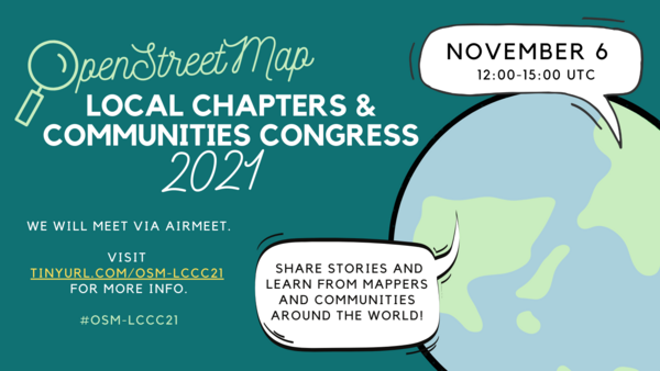
Local Chapters & Communities Congress poster– please share widely!
The LCCC 2021 is a virtual event where leaders and members of various OSM communities, whether they are officially recognized Local Chapters of the OSM Foundation or just a regular user group of OSM mappers, come together to share stories and learn from each other.
Last year, 35 community leaders came together from more than 20 different countries and the LCCWG is asking you to spread the word far and wide so that even more communities come to exchange knowledge and build networks this year!
In 2020 the OpenStreetMap Foundation (OSMF) board funded 12 OpenStreetMap projects proposed by community members, groups and organisations. All the project proposals (funded or not) are visible on the OSM wiki and some of the 12 selected proposals were presented on the OSM blog. The program was overseen by the microgrants committee, whose composition was determined by the OSMF board. Initially, the program was set to fund 10 projects with a budget of up to 5000 Euros per project and for a maximum of 50.000 Euros. The policy framework can be read here.
Report by the OSMF Microgrants Committee
The trial run of the OSMF microgrants program has now ended. You can
read the detailed final report(.odt, 29 KB) by the Microgrants Committee, submitted in September 2021 to the board, and
Almost all projects have sent their final reports and you can read them on the OSM wiki. The respective project proposal is linked towards the top of each page.
The final report by the Microgrants Committee was sent recently, so at the time of writing there is no evaluation published by the board or a decision taken on whether there will be a second microgrants round.
Do you want to translate this and other blog posts in another language..? Please send an email to communication@osmfoundation.org with subject: Helping with translations in [language]
The OpenStreetMap Foundation is a not-for-profit organisation, formed to support the OpenStreetMap Project. It is dedicated to encouraging the growth, development and distribution of free geospatial data for anyone to use and share. The OpenStreetMap Foundation owns and maintains the infrastructure of the OpenStreetMap project, is financially supported by membership fees and donations, and organises the annual, international State of the Map conference. It has no full-time employees and it is supporting the OpenStreetMap project through the work of our volunteer Working Groups.Join the OpenStreetMap Foundation for just £15 a year or for free if you are an active OpenStreetMap contributor.
In December, the OpenStreetMap Foundation (OSMF) Board asked for help to instate a moderator team for the OSMF-talk and talk mailing lists. This task was passed to the Local Chapters and Communities Working Group (LCCWG) who subsequently set up a moderation subcommittee to lead this work.
Over the last 9 months, the subcommittee has led efforts to revise the Etiquette Guidelines and Process for Moderation but it will be the role of the Moderation team to put this guidance into practice and continue to define moderation practices in OSM spaces.
Volunteers are needed from all corners of the global OpenStreetMap community to participate in this Moderation Team to lead efforts to keep the lists safe, welcoming, and inclusive. The moderators will help to steer conversations on topic and encourage effective and respectful communication on the OSMF-talk and talk mailing lists.
Interested? Please complete this form and a member of the subcommittee will be in touch. The goal is to have a team in place by the OSMF election season (aiming for the end of October), so don’t delay!
Any natural person may be elected to become a board member, provided that:
they have been a normal OSM Foundation member [1] (notan associate member [2]) during the full 180 days before the General Meeting (start date of normal membership before 14 June 2021), and
are willing to act as a board member, and
are permitted by law to do so.
[1] Normal members provide their full residential address and can vote on all issues. Their residential address may be disclosed to other members.
[2] Associate members provide just their country of residence - which may also be disclosed to other members - and can vote - but not on all issues. Additionally, they cannot be board candidates.
If you want to find out the type of your OpenStreetMap Foundation membership (normal or associate), please check the most recent approval/renewal membership email or email the volunteers of the Membership Working Group at membership@osmfoundation.org
Available seats in this election
The 2021 board election will have at least 4 board seats available: of M. Maron, A. R. McCann, A. Mustard and G. Rischard. The terms of T. Knerr, JM Liotier and E. A. Villar will continue.
Currently there are seven seats on the foundation board. Board members are volunteers.
What the board is/is not, rules and responsibilities and why run
A lot of the foundation’s work is done by the volunteers of our working groups, and if you want to help the foundation, you can also look at joining those.
How to nominate yourself
Update: The self-nomination window has now closed. Thank you to everyone who put their name forward!
You can create an account on the OSM wiki here and you will be able to add your name to the table that will be added on that date by editing the page here (please wait until 16 October 2021 to do so).
Resources about the 2021 board election and Annual General Meeting
The main two pages that will have the information about the 2021 board election and Annual General Meeting are:
A few of the current and past board members have mentioned that the thought of being a candidate did not cross their mind until it was suggested to them. So, you might want to think if you’d like to run for the board or to suggest being a candidate to others.
Do you want to translate this and other blog posts in another language..? Please send an email to communication@osmfoundation.org with subject: Helping with translations in [language]
The OpenStreetMap Foundation is a not-for-profit organisation, formed to support the OpenStreetMap Project. It is dedicated to encouraging the growth, development and distribution of free geospatial data for anyone to use and share. The OpenStreetMap Foundation owns and maintains the infrastructure of the OpenStreetMap project, is financially supported by membership fees and donations, and organises the annual, international State of the Map conference. It has no full-time employees and it is supporting the OpenStreetMap project through the work of our volunteer Working Groups.
To support the development of open source software around OpenStreetMap, the OSM Foundation has recently launched the Engineering Working Group (EWG). The group intends to support open source software projects with direct funding, mentorship programs, and by offering a platform for coordination.
Why this working group?
OpenStreetMap relies on a vast ecosystem of open source software. This includes the tools used by mappers to understand and contribute data, the software powering our database servers and website, the libraries and frameworks used by developers to build consumer-facing applications around OSM data, and many of these applications themselves.
The development teams creating these software products are generally independent entities, separate from the OpenStreetMap Foundation (OSMF). This is by design: The OSM community values do-ocracy and decentralization, so the OSMF does not manage software projects. However, that does not mean there is no room for the OSMF to support this vital ecosystem!
What we do
The Engineering Working Group (EWG) is charged with
Handling software development paid for by the OSMF, including the distribution of grants. This will involve putting out calls for proposals on tasks of interest, and accepting proposals on other tasks.
Offering a platform for coordination of software development efforts across the OSM ecosystem. We want to encourage standardization and shared efforts between projects by bringing together developers with similar interests. This work also includes responding to emails and directing people at other people or appropriate resources.
Managing OSM’s participation in software mentorship programs such as Google Summer of Code, which help grow the OSM developer community.
For handling paid development, “tasks” include development of new features, maintenance of code, documentation, and other tasks that improve the developer experience. When we are ready to start providing grants, we will encourage applications from skilled individuals who aren’t professional developers, professional contractors or companies, as well as those who are.
The OSMF has previously supported software projects through microgrants as well as separately with funding for Nominatim, osm2pgsql, Potlatch 2 and iD. With EWG, this kind of support will be placed on a more solid foundation.
In our first round we will look for projects that don’t need much management and focus the bulk of our efforts on core software. Like with all work paid for by the OSMF, the principles of the Hiring Framework will apply.
Whom we seek
As a group that is just getting started, we’re eagerly looking for additional working group members.
We would particularly welcome people knowledgeable about technology used in key OSM systems, such as the rails port, Ruby on Rails in general, and the cgimap implementation of the main OSM API, as well as those who can help with knowledge domains, such as user interface design, which are not well covered by the existing members.
However, you do not need to know any particular technology to participate! So if you have experience with the OSM software ecosystem, developing software, or managing software development, consider joining us!
Do you want to translate this and other blog posts in another language..? Please send an email to communication@osmfoundation.org with subject: Helping with translations in [language]
The OpenStreetMap Foundation is a not-for-profit organisation, formed to support the OpenStreetMap Project. It is dedicated to encouraging the growth, development and distribution of free geospatial data for anyone to use and share. The OpenStreetMap Foundation owns and maintains the infrastructure of the OpenStreetMap project, is financially supported by membership fees and donations, and organises the annual, international State of the Map conference. It has no full-time employees and it is supporting the OpenStreetMap project through the work of our volunteer Working Groups.
The following post was put together by several members of Czech OSM community, and the main contributor was Mikoláš Štrajt. OpenStreetMap Česká republika z.s. is one of the OSM Foundation Local Chapters.
OpenStreetMap Česká republika z.s. association was founded in 2018 with a primary aim to have a stable entity for ownership of already existing website of the local community on domains openstreetmap.cz and osmap.cz. Since 2020 the association acts as a local chapter of OpenStreetMap Foundation in the Czech Republic.
automatically, address points (operated by poloha.net project),
semi-automatically, buildings (from the RÚIAN database) and fields and meadows (from the LPIS database) using the JOSM plugin called Tracer,
we are updating post boxes according to open data by Česká pošta (Czech Post) and we report any discrepancy found,
as needed, we sometimes do collective edits. Recently, we have been for example improving the tags about recycling containers or controlling if we do not have telephone booths, which were cancelled the other day, hanging in the map.
organise the State of the Map CZ+SK conference (as part of wider OpenAlt conference or standalone action), and we are publishing video recordings of the speeches,
quarterly, call for a personal meeting of mappers – so-called “quarterly beer”,
organise mapathons,
clean up after vandals operating in the area of the Czech Republic, communicate with the newbies, state offices, and commercial subjects.
Members of our community operate their own projects, e.g.:
– MTB map – a map for mountain bike riders, – tourist maps for Garmin, other Garmin maps, – maps of the Czech Republic for applications based on the mapsforge library, – POI importer used to easily import various datasets into OSM, – Osmose backend for CZ,PL,DE,FI,DK,AT, – Taginfo for the Czech Republic, – OsmHiCheck – QA applications for hiking routes, – Archive of extracts of OSM data for the Czech Republic with very old versions, – Monthly generated map tiles for the Czech Republic starting 04.2006.
Do you want to translate this and other blog posts in another language..? Please send an email to communication@osmfoundation.org with subject: Helping with translations in [language]
The OpenStreetMap Foundation is a not-for-profit organisation, formed to support the OpenStreetMap Project. It is dedicated to encouraging the growth, development and distribution of free geospatial data for anyone to use and share. The OpenStreetMap Foundation owns and maintains the infrastructure of the OpenStreetMap project, is financially supported by membership fees and donations, and organises the annual, international State of the Map conference. It has no full-time employees and it is supporting the OpenStreetMap project through the work of our volunteer Working Groups.