In 2023, OpenStreetMap will participate once more as a mentoring organization in Google Summer of Code, a program to bring new contributors into Open Source software development. Originally targeted at students, the program now also accepts people new to Open Source in general.
We particularly welcome potential participants who are already involved with OpenStreetMap. You ideally have done some mapping and had an opportunity to get to know the community. You have used some of the software around OpenStreetMap and would now like to get involved in its development.
With the support of an experienced mentor, you will, over the course of a few months, add features to one of the Open Source tools which power the OSM ecosystem. Your work will improve software used daily by the OSM community, and Google will provide you with an attractive stipend for the summer. You will find more information about the program in general on the Google Summer of Code 2023 website.
Because of OSM’s diverse software ecosystem, you can choose from projects involving a variety of tools, technologies and programming languages. OSM tools planning to participate this year include editing software such as iD or JOSM, routing software such as OSRM or Valhalla, and the Nominatim search engine.
Applications are open March 20 to April 4 – but please get in contact with your mentors early so you can use the chance to improve your application. Visit our GSoC 2023 wiki page to learn what we’re looking for and browse our project ideas.
The OpenStreetMap Foundation is a not-for-profit organisation, formed to support the OpenStreetMap Project. It is dedicated to encouraging the growth, development and distribution of free geospatial data for anyone to use and share. The OpenStreetMap Foundation owns and maintains the infrastructure of the OpenStreetMap project, is financially supported by membership fees and donations, and organises the annual, international State of the Map conference. Our volunteer Working Groups and small core staff work to support the OpenStreetMap project. Join the OpenStreetMap Foundation for just £15 a year or for free if you are an active OpenStreetMap contributor.
Here’s an opportunity to get involved in the OpenStreetMap Foundation, the nonprofit that supports the OSM project!
The OpenStreetMap Foundation Board elections are coming up in December, and there are three seats that will be open. If you’re interested in running, the deadline to nominate yourself is coming up, October 22, 2022 at 23:59 UTC.
About the OpenStreetMap Foundation Board of Directors
The seven-person Board of Directors works on OSM Foundation matters on a volunteer (unpaid) basis and is elected by the OSM Foundation membership.
The board meets regularly to work on administrative, policy, and fundraising issues, to vote on resolutions and to support the OSMF Working Groups, which are also composed of volunteers. The Working Groups are always looking for help too!
For the December election, the terms of Board members Eugene Alvin Villar, Jean-Marc Liotier and Tobias Knerr are expiring, so their seats will be available. (They also may choose to run again.)
If you’re interested in running yourself, or know someone who might be, there is more information about nominations and the elections here. You can nominate yourself!
Board members serve two year terms and may be reelected a few times, with a term limit of three terms in the last eight elections. (You can get more information about board term limits in sections 33 and 34 of the OSMF Articles of Association. The Articles of Association are the rules and guidelines of the OSM Foundation.)
The Board elections start December 3rd and close December 10th. You can see more key dates here.
Monthly board meetings are open to OSMF members to observe or ask questions. You can find minutes of past meetings here.
Why you should run for the Board
We always need board candidates! Consider it yourself or ask someone else who you think might be good for the next OSMF board election, which will take place on the 10th of December, 2022!
Why run for the board? Below you can read the personal views of current and past board members:
(Please note that in order to run, you need to be a Normal OSMF member 28 days before the election, not an Associate one, and you must have been a member during the full 180 days before the election.)
If you’re not already a member of the Foundation, it’s a great way to support the OpenStreetMap project, voice your opinions and also become eligible to vote in Board elections. You can learn how to join the OSMF here, which can be free if you are an active contributor to OSM.
Note: translations for this post are to come.
About OpenStreetMap
The OpenStreetMap Foundation is a not-for-profit organisation, formed to support the OpenStreetMap Project. It is dedicated to encouraging the growth, development and distribution of free geospatial data for anyone to use and share. The OpenStreetMap Foundation owns and maintains the infrastructure of the OpenStreetMap project, is financially supported by membership fees and donations, and organises the annual, international State of the Map conference. Our volunteer Working Groups and small core staff work to support the OpenStreetMap project. Join the OpenStreetMap Foundation for just £15 a year or for free if you are an active OpenStreetMap contributor.
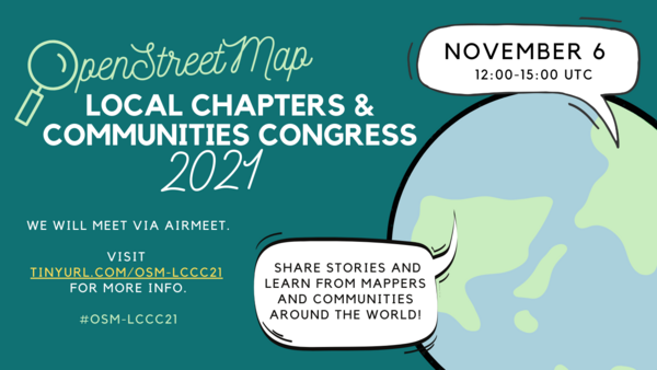
The LCCWG is excited to invite OpenStreetMap local chapters and community organisers and leaders to the 2021 Local Chapters and Communities Congress!
Local Chapters & Communities Congress poster– please share widely!
The LCCC 2021 is a virtual event where leaders and members of various OSM communities, whether they are officially recognized Local Chapters of the OSM Foundation or just a regular user group of OSM mappers, come together to share stories and learn from each other.
Last year, 35 community leaders came together from more than 20 different countries and the LCCWG is asking you to spread the word far and wide so that even more communities come to exchange knowledge and build networks this year!
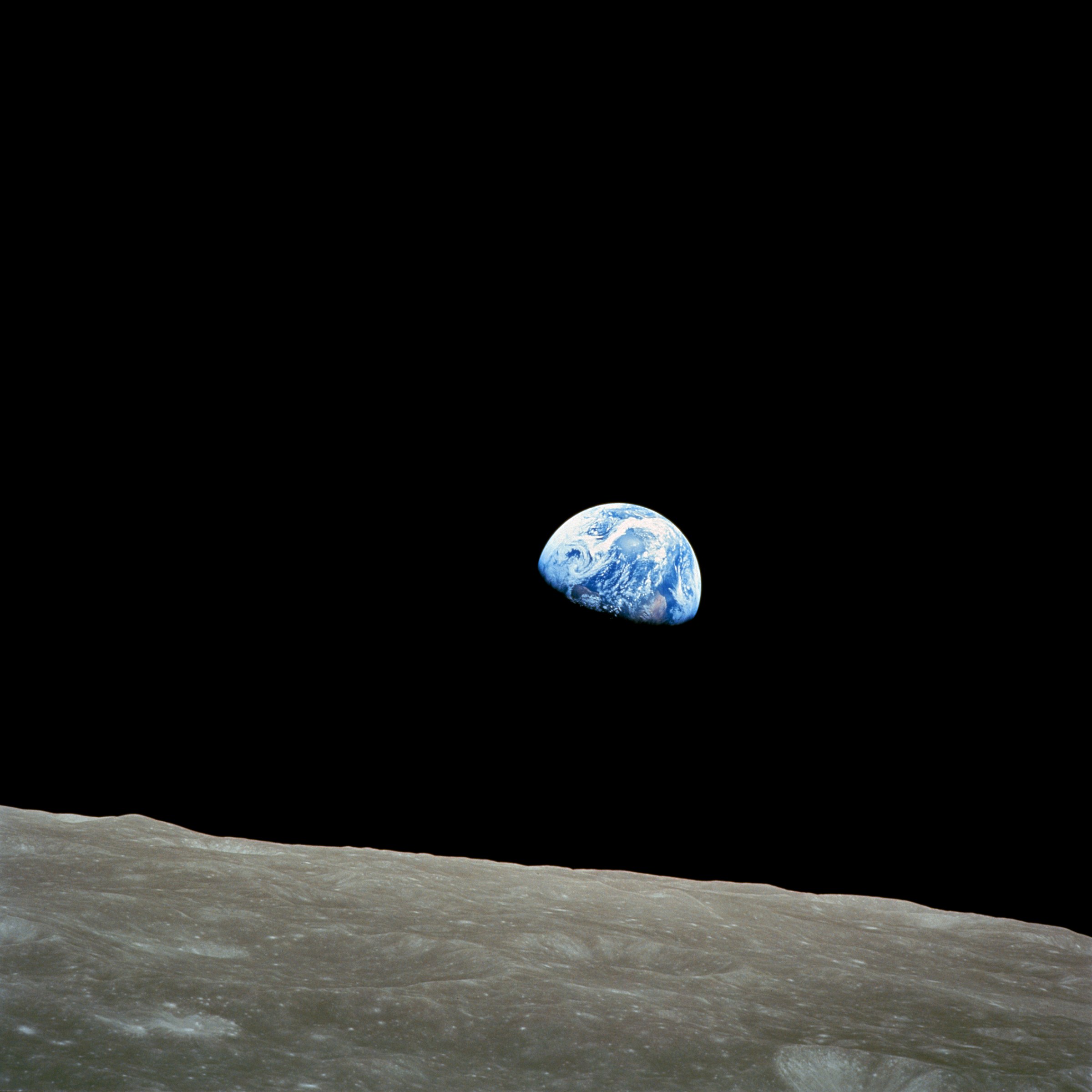
April brings two international commemorative days that offer fun ideas for mapping. Earth Day on April 22 demonstrates support for environmental protection, and the less well-known International Day of Human Space Flight on April 12, which was created by the United Nations fifty years after Yuri Gagarin’s first human space flight.
These celebrations are intricately intertwined in the famous “Earthrise” image, which helped spark global environmental consciousness and led to the first Earth Day in 1970. The increasing availability of earth observation imagery since then has directly helped OpenStreetMap for the entire globe.
There are plenty of opportunities for mapping related to Earth Day. You could map natural areas, reserves and parks, recycling facilities, and many other kinds of features mentioned in the Environmental OSM project.
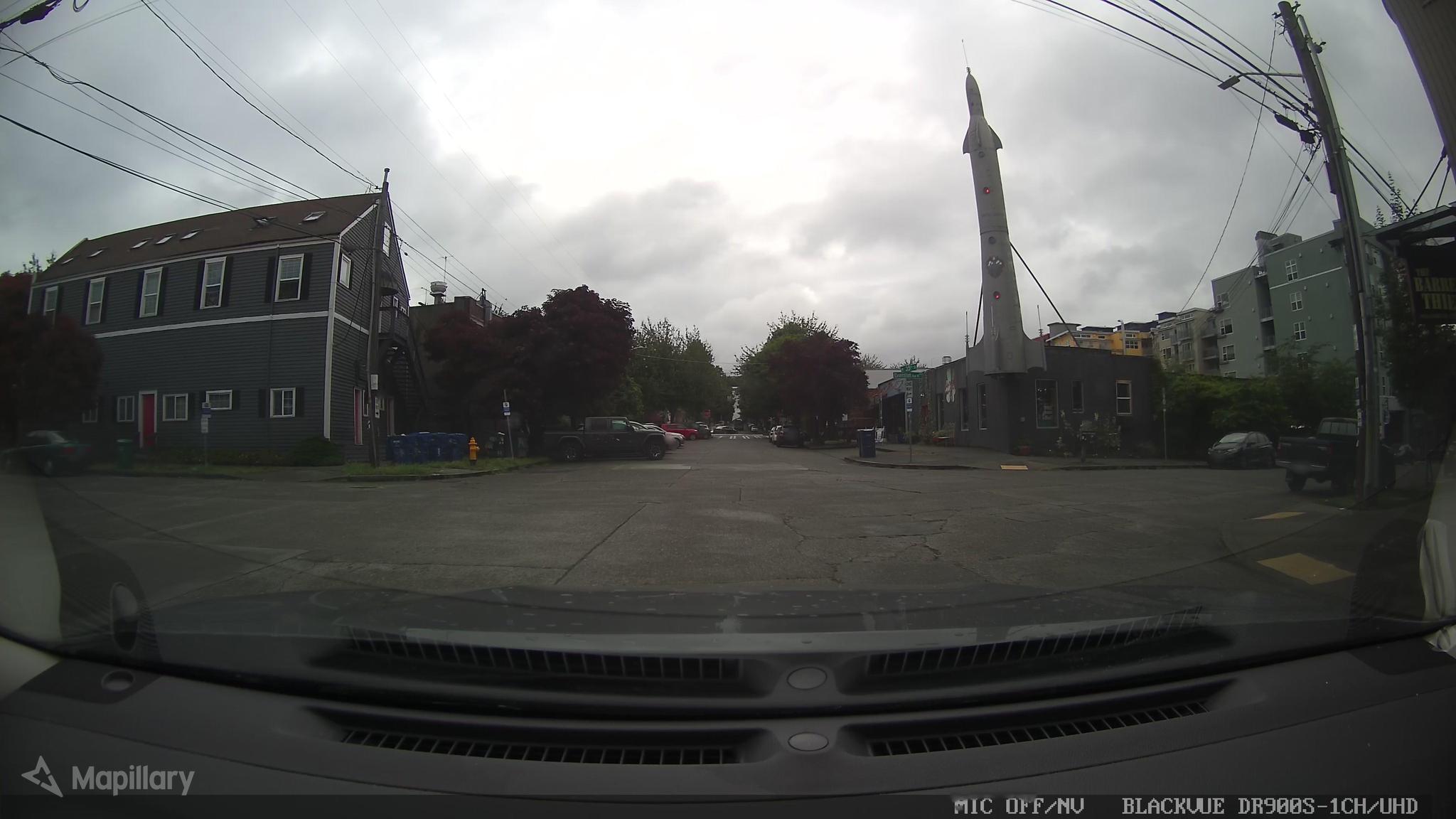
And for the International Day of Human Space Flight, while OSM doesn’t map in outer space (yet), you can map terrestrial features related to space flight, like launch sites, space-related facilities, historic sites and museums, or even just things named for outer space.
Mapping Earth
The Environmental OSM project has a lot of great ideas, from the local to the global.
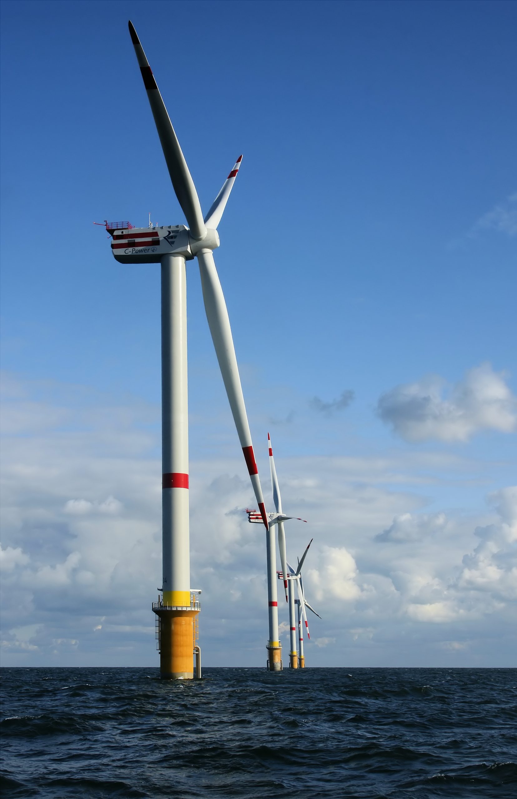
You could help map your favorite green space or natural area, whether it’s wilderness, a park, or something else. National parks and nature reserves are among many included in boundary=protected_area, or you could try mapping land use, wetlands, or mangrove forests. There are also clean energy facilities like wind power — are there any near you that aren’t mapped? Other ideas include cycling and hiking trails, or you could look to see if any polluting industries near you need to be mapped.
Or you can take a look at places related to the environment: the United Nations Environment Programme is headquartered in Nairobi, Greta Thunberg’s first School Climate Strike took place at the Swedish Riksdag, and there’s even an Earth Day monument in Orlando, Florida.
Mapping Space Flight
There are many Earth-bound options for mapping space flight! OSM has tags for spaceports and launchpads and Wikipedia has a list of rocket launch sites including latitude and longitude coordinates. There are spaceports around the world too (via Overpass). You could take a look at some near you and make sure everything is mapped and tagged properly around them — or see if any are missing around the world. (Make sure to follow local tagging guidelines, though.)
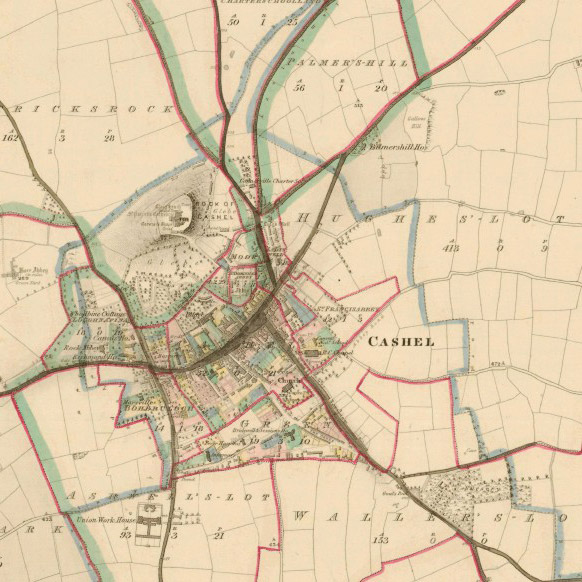
The Blewitt clan of Ireland is proud that one of their kin, Joe Biden, was elected the next President of the United States. His Irish roots are well known on both sides of the Atlantic. Before Biden’s great-great-great-grandfather Edward Blewitt moved his family to America to escape the Irish Famine, Edward and his brother James were surveyors whose work shaped Irish maps and municipalities, supported livelihoods, and has even been used in OpenStreetMap today.
Edward and James worked on two foundational Irish mapping projects in the 1830s–40s, the Ordnance Survey and the Griffith’s Valuation. In 1838, James corrected an error in the Ordnance survey’s calculation system that had been missed by many of the brightest mathematical minds of the day in Ireland and Britain. In the late 1840s, Edward managed public works programs that built roads, improved farming through drainage, and gave work to people suffering through the Potato Famine.
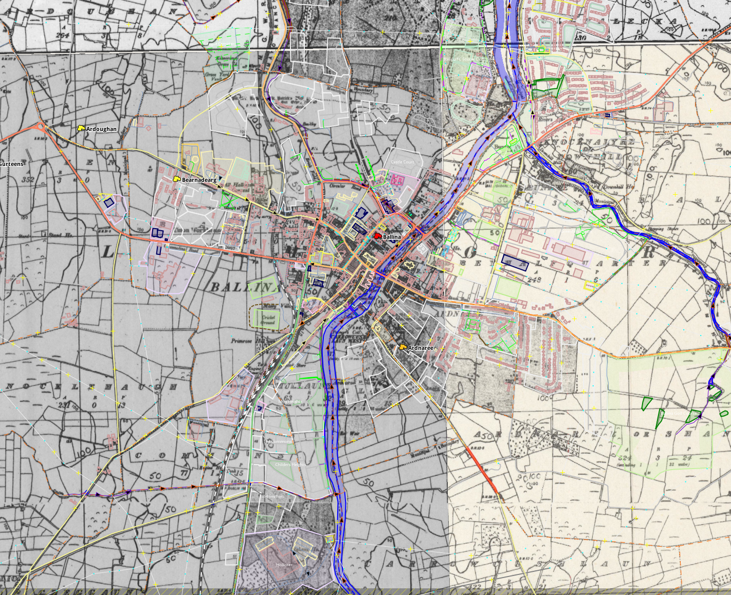
Historic imagery used for editing modern day OpenStreetMap data
OpenStreetMap’s freeform tagging scheme allows people to map what’s important to them. And people are mapping the historical and heritage features they care about. You can explore OpenStreetMap’s coverage of historical features on interactive maps on the HistOSM and Historical Objects websites. If you want to use OpenStreetMap data like this, it’s all available to everyone. If you see something missing, please open up your favourite OpenStreetMap editor and fix the map!
OpenStreetMap is becoming the de facto source of map data for many services and organisations, so we can help preserve our shared human heritage for years to come. Who knows, in 150 years, maybe OpenStreetMap data you enter today will be useful to someone?
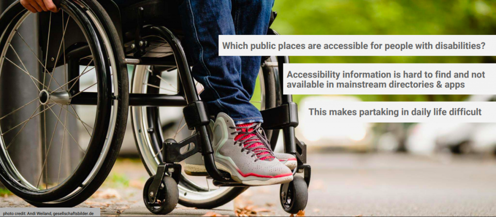
The International Day of Persons with Disabilities is observed every December 3rd, and OpenStreetMap marks this day by saying “Our aim is to be the best world map for accessibility”. OpenStreetMap has long been a resource to map and share open data on features related to disabilities.
We asked community members gathered on the accessibility mailing list about why and how OpenStreetMap is so useful.
Jean-Marie Favreau of the Université Clermont Auvergne explained…
The strength of OpenStreetMap is that it allows anyone to contribute accessibility data, whether they are local authorities, user associations, or individual contributors. Being a global project, it facilitates the sharing of observations and learnings of how the equipment, habits and practices of accessibility vary in different coutnries. Finally, the data is in a commons and managed by a community, so it more accurately reflects the reality of the territories it maps.
Nick Bolton of the University of Washington adds…
When people with disabilities seek out map information, they find that accessibility information is missing or doesn’t account for their personal preferences; neither companies nor government agencies are consistently creating connected pedestrian map data flexible enough to meet the diversity of pedestrian concerns expressed by people with disabilities. OpenStreetMap is well-suited to fill this informational gap as it has a flexible and democratically extensible data model, can be mapped out by locals without waiting for an agency or company to dedicate resources or take on liabilities, and all data is immediately published and examined by the public.
We are so glad OpenStreetMap fulfills this need. Read on to learn about applications for persons with disabilities, and ways to contribute to the map.
Apps for accessibility
There are many applications and research projects for persons with disabilities that use OpenStreetMap for collecting and sharing accessibility data, and for communicating that data in appropriate ways.
Data on sidewalks is critical to accessible navigation. OpenSidewalks focuses on developing tagging schemes and tools for collecting accessibility data of sidewalks, and its sister project AccessMap creates individualized accessible routing plans for people with mobility impairments. Both are projects of the Taskar Center at the University of Washington. This approach has been picked up by the Italian OpenStreetMap community in Padova and Milan, with people with disabilities, high school students, and other new mappers contributing.
And then there is navigating indoors. AccessbileMaps is a project of the Technische Universität Dresden in cooperation with the Karlsruher Institut für Technologie and focuses on indoor accessibility. They develop tools for mapping buildings with the Simple Indoor Tagging scheme, especially accessibility information, and produce applications using indoor data from OSM for blind, visually impaired and mobility impaired people to plan trips.
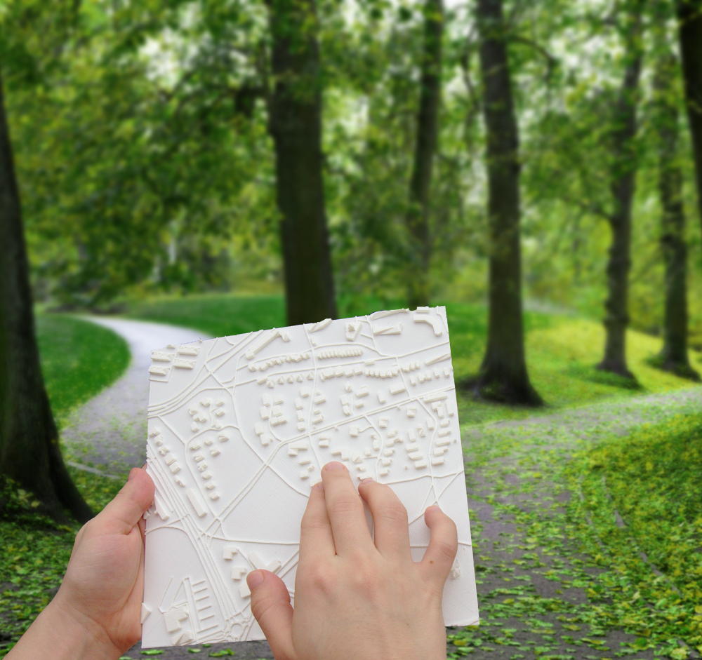
Touch Mapper 3d printed tactile map in use
Then this data needs to be used in appropriate ways, and the creativity and innovation is inspiring.
Tactile maps help people who are blind or partially sighted navigate their surroundings. Touch Mapper uses 3D printing to create tactile maps from OSM data.
Soundscape from Microsoft Research helps users with visual disabilities to create better mental maps of their surroundings for navigation. Using audio to describe places, they can naturally and intuitively explore more and feel more comfortable and connected in new environments. The app is built on OpenStreetMap data.
Compas research project at the University Clermont Auvergne develop ACTIVmap in partnership with other academic and private sector researchers to build multimodal maps leveraging tactile, sound and haptic feedback to represent and interact with geographic information.
How can you help?
a screenshot of editing accessibility information in a StreetComplete quest
You can of course also add disability-related tags with regular OpenStreetMap editors like JOSM and iD, and mobile apps like Vespucci, StreetComplete, OsmAND, and Go Map!!
Traffic signals with sound (traffic_signals:sound=yes/no)
Accessibility information for steps, such as the presence of handrails (handrail:left/right/center=yes/no), the number of steps (step_count=*) as well as whether there is a ramp (ramp=yes/no) and which kind
Wheelchair accessibility at shops and other amenities (wheelchair=yes/limited/no) as well as bathrooms (toilets:wheelchair=yes/no)
There are many other ways to help, documented on the wiki as well. For example, promote OpenStreetMap with friends who have a disability, and ask them how else OSM can help. You could organize a mapping party focused on mapping these kinds of features. Translate our wiki pages on disabilities to other languages. Or build new routing and rendering applications for people with disabilities.
OSM’s freeform tagging system is always evolving, if there’s something you think should be mapped in OSM, but isn’t, you can help guide that process to wider adoption.