Have a bold, brilliant idea that could improve the OpenStreetMap (OSM) ecosystem? Got a vision for the future of OSM? Then we’ve got good news for you: the OpenStreetMap Foundation is thrilled to launch the 2025 edition of our Engineering Microgrants program!
This program is designed to support community members working on software projects that strengthen the OSM platform and ecosystem. We’re setting aside a total of £30,000, which may be distributed across several innovative and impactful projects. The per-project limit is £6,000, but if your idea goes beyond that, don’t hold back! The Engineering Working Group (EWG) may explore other funding avenues through the Foundation to help bring ambitious proposals to life. As such, we’d still encourage you to apply.
What’s the Process?
It’s simple and fair:
Submit your project idea via our GitHub template. This ensures transparency and reduces the chance of any conflicts of interest.
Our independent jury will review, score, and help select winning proposals through a multi-round process. Each idea will be reviewed not only for its score, but also for feasibility and implementation potential.
Pro tip: Before you hit submit, we strongly encourage all applicants to reach out to software maintainers if your idea touches existing tools, projects, or platforms. This helps align efforts, avoid duplications, and possibly even uncover opportunities for collaboration. If you need help identifying any software maintainers, you can contact the Engineering Working Group or the OSM Foundation Board, or ask directly on the announcement thread, so you can be put in contact with the correct parties.
Got questions? You can reply to the announcement thread, reach out to the jurors, or message the EWG directly. Jurors might also contact applicants during the review process if clarification is needed,so keep your inbox open.
We’re excited to see what you all come up with and submit! Whether it’s a tool to improve mapping workflows, enhancements to core OSM infrastructure, or entirely new ideas that fill a gap—we want to hear from you.
Submit your idea today and help shape the future of OpenStreetMap!
The OpenStreetMap Foundation is a not-for-profit organisation, formed to support the OpenStreetMap Project. It is dedicated to encouraging the growth, development and distribution of free geospatial data for anyone to use and share. The OpenStreetMap Foundation owns and maintains the infrastructure of the OpenStreetMap project, is financially supported by membership fees and donations, and organises the annual, international State of the Map conference. Our volunteer Working Groups and small core staff work to support the OpenStreetMap project. Join the OpenStreetMap Foundation for just £15 a year or for free if you are an active OpenStreetMap contributor
Official OSM logo by Ken Vermette, CC-BY-SA 3.0 & trademarks apply.
OpenStreetMap Foundation members will vote to elect a new board in September. There are seven seats on the foundation board and board members are volunteers. Board members typically serve for two years until their seat is up for re-election.
There will be at least three board seats available in this election: of Dani Waltersdorfer, Guillaume Rischard and Roland Olbricht, whose board terms are ending. The terms of Craig Allan, Héctor Ochoa Ortiz, Laura Mugeha and Maurizio Napolitano will continue.
The two main pages that have the information about the board election and the 2025 Annual General Meeting, which will take place on 2025-09-13, are:
A lot of the foundation’s work is done by the volunteers of our Working Groups, and if you want to help the foundation, you can also look at joining one of them.
Eligibility criteria
Any natural person may be elected to become a board member, provided that:
they have been a normal OSM Foundation member [1] or an associate member[2] during the full 180 days before the General Meeting, which will take place on 13 September 2025, and
have been a normal member for the full 28 days prior to the General Meeting, and
are willing to act as a board member, and
are permitted by law to do so.
[1] Normal members provide their full residential address and can vote on all issues. Their residential address may be disclosed to other members. [2] Associate members provide just their country of residence - which may also be disclosed to other members - and can vote - but not on all issues. Additionally, they cannot be board candidates.
If you want to find out the type of your OpenStreetMap Foundation membership (normal or associate), please check the most recent approval/renewal membership email or email the volunteers of the Membership Working Group at membership@osmfoundation.org from the email account associated with your OSM Foundation membership.
Submission of community questions to board candidates is now open
OSM Foundation members can submit questions to the board candidates on the OSM wiki until July 12 (“by end of day”, in UTC). An official set of questions, based on the community questions and questions from previous years, will be published on the page above by the facilitator, Brian Sperlongano, on July 26.
Resolutions proposed by OSM Foundation members
OSM Foundation members can submit resolutions and ask the membership to vote on them. The resolutions need to be supported by at least 5% of members eligible to vote, in order to be added to the ballots. Please read: Companies Act 2006: Members’ power to require circulation of written resolution. The deadline for providing the supported resolutions is the end of July 12 (in UTC).
How you can help
A few of the current and past board members have mentioned that the thought of being a candidate did not cross their mind until it was suggested to them. So, you might want to consider running for the board or suggesting it to others.
The OpenStreetMap Foundation is a not-for-profit organisation, formed to support the OpenStreetMap Project. It is dedicated to encouraging the growth, development and distribution of free geospatial data for anyone to use and share. The OpenStreetMap Foundation owns and maintains the infrastructure of the OpenStreetMap project, is financially supported by membership fees and donations, and organises the annual, international State of the Map conference. Our volunteer Working Groups and small core staff work to support the OpenStreetMap project. Join the OpenStreetMap Foundation for just £15 a year or for free if you are an active OpenStreetMap contributor
Tickets are now available for State of the Map 2025 in Manila! Get ready for an incredible experience to connect, learn, and celebrate OpenStreetMap!
The moment you’ve been waiting for has arrived – tickets for State of the Map 2025 in Manila are officially on sale!
Act Fast! Early Bird Tickets Available Now! To make it easier for you to join us, we’re offering Early Bird tickets at a special discounted rate. This is a limited opportunity to secure your place for less!
We have two types of Early Bird tickets available:
Community Early Bird Specifically for individuals who contribute to OpenStreetMap as a hobbyist.
Regular Early Bird: Our standard discounted rate.
Early Bird Pricing:
Community: GBP 150.00 GBP 70.00
Regular: GBP 300.00 GBP 220.00
These Early Bird tickets are limited in number (currently 200 of each type available) and are only offered for a limited time, so grab yours before they’re gone!
SotM is the premier global conference for the entire OpenStreetMap community. It’s where mappers, developers, researchers, users, companies, and everyone passionate about the world’s free and open map comes together. This is your chance to share your amazing work, learn groundbreaking new things, discover exciting projects, and make real-world connections with fellow enthusiasts from every corner of the globe.
Why attend SotM 2025 in Manila?
Experience a vibrant global community gathering in Southeast Asia!
Attend inspiring talks and practical workshops.
Meet the people behind the map and expand your network.
Be part of discussions shaping the future of OpenStreetMap.
Enjoy the atmosphere and connect with friends, old and new!
And of course, soak in the unique culture, hospitality, and buzz of Manila! Ready to join us in Manila? Head over to the official SotM 2025 website to get your tickets today at 2025.stateofthemap.org/tickets
Don’t wait too long – grab your ticket, secure your place at the heart of the OpenStreetMap community, and start planning your trip to Manila!
We absolutely can’t wait to see you there!
The State of the Map Working Group
The State of the Map conference is the annual, international conference of OpenStreetMap, organised by the OpenStreetMap Foundation. The OpenStreetMap Foundation is a not-for-profit organisation, formed to support the OpenStreetMap Project. It is dedicated to encouraging the growth, development and distribution of free geospatial data for anyone to use and share. The OpenStreetMap Foundation owns and maintains the infrastructure of the OpenStreetMap project, is financially supported by membership fees and donations, and organises the annual, international State of the Map conference. Our volunteer Working Groups and small core staff work to support the OpenStreetMap project. Join the OpenStreetMap Foundation for just £15 a year or for free if you are an active OpenStreetMap contributor.
OpenStreetMap was founded in 2004 and is an international project to create a free map of the world. To do so, we, thousands of volunteers, collect data about roads, railways, rivers, forests, buildings and a lot more worldwide. Our map data can be downloaded for free by everyone and used for any purpose – including commercial usage. It is possible to produce your own maps which highlight certain features, to calculate routes etc. OpenStreetMap is increasingly used when one needs maps which can be very quickly, or easily, updated.
We are excited to announce the call for nominees for the OpenStreetMap Awards 2025! The awards ceremony will take place this October at the State of the Map 2025 conference in Manila!
These community awards are nominated and chosen by the community. The OpenStreetMap Awards is a global recognition event that celebrates contributors from all corners of the OSM project – including mappers, developers, community organizers, writers, and everyone who makes OSM great. We need your help to identify the best and brightest of OpenStreetMap globally!
The awards are back with the following categories to recognize a wide range of contributions:
Core Systems Award
Innovation Award
Influential Writing Award
Greatness in Mapping Award
Expanding the Community Award
Team Achievement Award
Ulf Möller Memorial Award
You can find more details about what each award represents on the wiki: OSM Awards
We are primarily looking for recent impactful contributions. Therefore, projects, works, and activities should have occurred or been announced between January 1st, 2024, and April 1st, 2025 to be eligible for most categories. The Ulf Möller Memorial Award is an exception; anyone is eligible regardless of when they were active in the project.
Think about the individuals, teams, or groups whose efforts have impressed you during this time. Have you seen fantastic mapping, innovative tools, inspiring community work, or influential writing? This is your chance to make their contributions visible to the entire world! You can even nominate yourself or your team if you believe your work deserves recognition.
Ready to nominate? It’s quick and easy!
Visit the official OSM Awards website to add your nominees: SotM Nominations
The call for nominees will close on Wednesday, July 23rd, 2025.
Please make sure to add your nominations before the deadline. The more nominees we receive, the better we can represent the breadth and depth of amazing work happening in OpenStreetMap, and the more exciting the final voting and ceremony will be.
Keep the OpenStreetMap Awards in mind and nominate those who deserve recognition today!
The State of the Map Working Group
The State of the Map conference is the annual, international conference of OpenStreetMap, organised by the OpenStreetMap Foundation. The OpenStreetMap Foundation is a not-for-profit organisation, formed to support the OpenStreetMap Project. It is dedicated to encouraging the growth, development and distribution of free geospatial data for anyone to use and share. The OpenStreetMap Foundation owns and maintains the infrastructure of the OpenStreetMap project, is financially supported by membership fees and donations, and organises the annual, international State of the Map conference. Our volunteer Working Groups and small core staff work to support the OpenStreetMap project. Join the OpenStreetMap Foundation for just £15 a year or for free if you are an active OpenStreetMap contributor.
OpenStreetMap was founded in 2004 and is an international project to create a free map of the world. To do so, we, thousands of volunteers, collect data about roads, railways, rivers, forests, buildings and a lot more worldwide. Our map data can be downloaded for free by everyone and used for any purpose – including commercial usage. It is possible to produce your own maps which highlight certain features, to calculate routes etc. OpenStreetMap is increasingly used when one needs maps which can be very quickly, or easily, updated.
The OpenStreetMap Foundation Board has selected Minh Nguyễn as the Core Software Development Facilitator. Here’s Minh to introduce himself, some of his ideas and directions, and opportunities to connect. Welcome, Minh!
Hi, I’m Minh Nguyễn, an OSM contributor and community organizer from California. The OSMF has entrusted me with one of the positions funded through the recently announced Sovereign Tech Fund (STF) investment to facilitate the further long-term development of OSM’s software infrastructure. I’m grateful for the opportunity to serve the OSM community in this way.
For those who don’t know me, I started volunteering for OSM way back in 2008, cleaning up errors in my hometown, Loveland, to cure a bout of homesickness. Then I got extremely carried away, adding little details here and there all over the Midwestern U.S., nurturing a little community of mappers in Silicon Valley, translating OSM into Vietnamese, and serving on the board of OpenStreetMap U.S. In parallel, I became a professional Mac software engineer, then helped build Mapbox’s open source, OSM-based map and navigation software for several years. But I never stopped being a mapper. I’ve also spent the last few years serving on the SDRP and OpenHistoricalMap’s advisory board and will continue in these roles.
When introducing OSM to my local community, I describe the project as infrastructure for the world’s maps. Naturally, this infrastructure has its own underlying infrastructure. Many of us rely heavily on the website frontend, API backend, and related tools while mapping, debugging our map data, and generally marveling at what we’re building together. There’s a lot that goes on behind the scenes to make the site run smoothly and supply data consumers with the artifacts they depend on. For example, did you know we have not one but two overlapping API implementations running simultaneously to eke out extra performance? These aspects of OSM are less glamorous than map styles or editors but no less important.
Our software architecture is very specific to OSM, so we’ve historically relied on a relatively small number of volunteers and their domain expertise. As an open source project, we want to expand this group and keep it open to newcomers. In conjunction with longtime contributors, I’ll be prioritizing better documentation, wrangling the issue backlog, articulating a clear vision and roadmap for the core software projects, and identifying opportunities for new developers to get started and gain a foothold. This will be essential as we later onboard another role tasked more directly with daily development tasks through the same STF investment. We’ll have more to share about that in the coming months.
Lately, anyone watching the core software projects closely will have noticed the pace of development picking up dramatically, but much of it still goes unannounced and unnoticed by the rest of the community. You’re going to hear from me pretty regularly as I relate the projects’ news and current affairs for a broader audience. It’s my hope that more of you in the community will be familiar with these projects, similar to your favorite renderer or editor, and hopefully for good reasons.
As I’m making the rounds introducing myself to those involved with the core software projects, it strikes me how many ideas there are about how to move them forward and how much these ideas overlap. Over the next few weeks, I’ll also be seeking feedback from the community about where we should be headed; watch the forum for more details. While I can’t promise anything concrete at this early stage, I’m hopeful we can weave a common future for these projects that allows OSM to thrive.
The State of the Map Organizing Committee provides a Travel Grant Programme (TGP) to facilitate accessibility and diversity at the global SotM 2025 Conference, which will happen in Manila, Philippines, October 3-5. Taking into consideration the success of last year, the programme will also dedicate a portion of the budget available to support remote attendance (e.g. by providing access to a reliable internet connection) for those who cannot travel to Manila because of imposed restrictions, travel costs, or other reasons.
The call for applications to the Travel Grant Programme will be open until May 16,12:00 UTC.
It is fundamental to read all the information on this page before submitting an application.
For applicants
This section sets out the benefits of a Travel Grant to attend SotM 2025 and the process and criteria by which applicants will be selected. The TGP is administered by the State of the Map Organizing Committee.
Travel Grants
The Travel Grant will include a full conference ticket and a lump-sum contribution towards travel, accommodation and other expenses.
There will be five (5) different sizes of travel grants available:
Category
Grant Size
Likely Used For
Expected number of winners
A
£ 20
Applicants from the Manila metro area
5
B
£ 215
Applicants from Philippines and Southeast Asia (Cambodia, Laos, Vietnam, Myanmar, Thailand, Malaysia, Brunei, East Timor, Indonesia or Singapore)
The size and number of grants may be adjusted at the discretion of the Organizing Committee, depending upon the level of funding raised and the number of applications received. Applicants will only be able to apply for one size of travel grant, and they should apply for the grant depending on their country of residence. The World Bank rating is available online
Anyone applying for more than one grant will be excluded from the application process.
For categories C, D and E, a maximum of 2 winners will be chosen for each country of origin.
Online Attendance Support Grant
For those interested in attending the conference remotely but with limited internet connectivity, smaller grants will be made available to subsidise the cost of purchasing mobile data passes. The size of each grant will vary depending on the country and mobile data packages available, but it’s expected not to exceed £ 30.
With an estimated 1GB per hour of streaming videos in HD quality (720p), it’s expected that a maximum of 40GB will be sufficient to cover the entire conference. Arrangements will be made with grant recipients to purchase the data packages directly or to transfer the amount needed via mobile money.
Criteria
In order to guarantee a transparent and fair allocation of funds, the travel grant programme uses a points system for ranking applications. Points are awarded if applicants match specific criteria. After the application phase is over, all applicants are ranked by points, and the applicants with the most points will receive funding.
Please note that the travel grant programme aims to enhance diversity at the conference. We might reserve a few programme spots for people with unique and outstanding applications. However, most programme spots will solely be determined by the point ranking.
To ensure the participation of OSM contributors who have not attended any in-person SOTM conference, the in-person Travel Grant winners of the previous two SOTM (SOTM 2024 Nairobi and SOTM 2022 Firenze) will not be eligible for this Travel Grant.
Furthermore, once the ranking has been drawn up and the scholarships assigned based on it. The next two people for each grant size will be informed of their position. If one of the first winners communicates by the 22nd of August that he will not be able to participate, the scholarship will be provided to the people who are in this second ranking. However, those people will receive a free online ticket to attend the conference virtually. Moreover, if they will be able to attend the conference in person, they could receive a free ticket if they provide support volunteering.
Applicants receive points for the following criteria:
Applicants who are currently living in Low-income economies receive 1.5 points.
Applicants who are currently living in Lower-middle-income economies receive 1 point.
Applicants who are currently living in Upper-middle-income economies receive 0.5 points.
Applicants who are currently living in High-income economies receive 0 points.
Gender and Minorities
In order to create a more diverse community, women and applicants from other underrepresented groups will receive 2 points. The minority criteria will be considered with respect to the other candidates of the same category.
Students
Students, including PhD students, receive 1 point. You may be asked to provide evidence of enrollment.
First State of the Map
Applicants who attend SotM for the first time receive 1 point.
Amount required The expected cost amount requested is to indicate in pounds sterling (£). Applications without an explicit request of the amount required will not be considered. The minimum between the expected cost and the grant size based on the residence country will be assigned.
OpenStreetMap and Community Details of their past contributions to OpenStreetMap projects or community activities: up to a total of 4 points. Up to 2 points for mapping activities based on your OpenStreetMap username and up to 2 points for other contributions to the project as you will describe.
You & OpenStreetMap
Present the most valuable experience, mapping activities, or community moment that describes the travel grant experience in the OpenStreetMap world. This is not the call for participation; the call will be open, and there will be the possibility to submit talks and workshops. So, this is not an instrument to present talks; you are invited to participate in the call for talks and workshops if you would like to present your activities. Please provide a short abstract about what you would like to present, with a maximum length of 100 words. No points; the abstract will be used as a discriminant for the final decision.
Volunteering
The travel grant winners will be asked to volunteer for a time proportional to 1/3 or less of the conference length, depending on the number of other volunteers. Indicate the roles that you are confident to do: Live Video Cutting, Remote/Pre-Recorded Talk Assistant, Session Assistant and Venueless Assistant (only for remote grants). For more detailed info on the roles, see the wiki pages of volunteers for SotM 2024. No points.
Payment
You must be able to fund the direct costs of your travel to SotM and be in possession of a valid passport and entry visa and other documents (for example, vaccinations). Successful applicants will receive a conference pass and become eligible for reimbursement of expenses up to the limit of the travel grant when they check in at the conference registration desk. Reimbursement of expenses will be by electronic means (details to be advised). Reimbursement may take up to two months after the conference date, provided that the travel grantee has submitted all the necessary information before the conference commences.
Only in the case of demonstrated needs and exceptional cases will the travel grant amount be provided in advance or used to cover specific travel costs directly.
How to Apply
If you wish to be considered for a SotM travel grant, please fill out the application form.
All data will be held confidential and only used for assessing TGP applications. Please ensure that the email address that you provide is regularly monitored, as the selection committee may wish to seek clarification of responses. If no replies have been provided to requests via mail for the Travel Grant Committee within 5 days, the Travel Grant will be removed from you and assigned to the next applicants in the ranking.
Applications must be received by the May 16 at 12:00 UTC.
The selection committee will aim to notify recipients of grants by the May 31.
Supporting the Travel Grant Programme
The travel grant programme is funded through the State of the Map Sponsors.
The State of the Map Working Group
The State of the Map conference is the annual, international conference of OpenStreetMap, organised by the OpenStreetMap Foundation. The OpenStreetMap Foundation is a not-for-profit organisation, formed to support the OpenStreetMap Project. It is dedicated to encouraging the growth, development and distribution of free geospatial data for anyone to use and share. The OpenStreetMap Foundation owns and maintains the infrastructure of the OpenStreetMap project, is financially supported by membership fees and donations, and organises the annual, international State of the Map conference. Our volunteer Working Groups and small core staff work to support the OpenStreetMap project. Join the OpenStreetMap Foundation for just £15 a year or for free if you are an active OpenStreetMap contributor.
OpenStreetMap was founded in 2004 and is an international project to create a free map of the world. To do so, we, thousands of volunteers, collect data about roads, railways, rivers, forests, buildings and a lot more worldwide. Our map data can be downloaded for free by everyone and used for any purpose – including commercial usage. It is possible to produce your own maps which highlight certain features, to calculate routes etc. OpenStreetMap is increasingly used when one needs maps which can be very quickly, or easily, updated.
Official OpenStreetMap logo by Ken Vermette, CC-BY-SA 3.0 & trademarks apply.
We want to notify OpenStreetMap Foundation members about an important recent change in the renewal process for memberships set to be automatically renewed via PayPal, and how it may affect you.
If you had enabled the automatic renewal of your membership via PayPal, you must have received an email from PayPal stating: “We stop all recurring payments of all members to prevent inadvertent double payment”. We confirm that, for the time being, OSM Foundation members will need to renew their membership manually.
Reason for the change
The Membership Working Group has decided to stop automatic email renewals via PayPal for all members for now. This decision was made because many payments do not register automatically, leading to incorrect reminder emails that confuse and annoy members and can result in double payments. Over the past two years, we have been unable to resolve this issue, and managing problems with automatic renewals requires significant volunteer time, which we currently lack.
While automatic renewals offer convenience and ensure that your membership remains active without any interruption, given the current challenges, we have had to disable this feature.
Manual renewal process
Until we find a proper solution, all membership renewals will need to be done manually. We understand that this may cause some inconvenience, and we appreciate your understanding. We have set up an automatic reminder system and you will likely receive automatic email reminders before your membership is due to end.
The automatic reminder emails sent four and two weeks before your membership ends, will contain a link which you can use to renew. You will also get additional reminders if you let your membership lapse, spaced out over several months.
Fill the email address associated with your OSM Foundation membership, if you have multiple email addresses.
Have the OpenStreetMap user name ready that shall fulfill the baseline activity requirement . If you have an Active Contributor Membership with your membership fee waived via mapping contributions (so you are not affected by this issue with auto-renewals), you still need to have at least 42 mapping days in the past 365 days at the time of your membership renewal.
To ensure that your membership remains active, we strongly advise you to:
Add a reminder about your need to renew the membership to your personal calendar, and
Check that you receive a confirmation email after manually renewing.
Questions about your membership?
If you have questions about your membership, please email us at membership@osmfoundation.org, from the email address associated with the membership. Please note that we are just a few volunteers, dedicating our free personal time to Foundation issues, so there might be some delay in the replies.
We need your help
Additionally, we are looking for volunteers to help with various tasks, including managing issues with membership renewals. You can read more information about what we do here. If you are interested in volunteering your time, please let us know at mwg@osmfoundation.org with subject “Helping the Membership Working Group”. Your support would be greatly appreciated.
Thank you for your continued support to OpenStreetMap and for your membership.
Do you want to translate this and other blogposts in your language…? Please email communication@osmfoundation.org with subject: Helping with translations in [your language]
The OpenStreetMap Foundation is a not-for-profit organisation, formed to support the OpenStreetMap Project. It is dedicated to encouraging the growth, development and distribution of free geospatial data for anyone to use and share. The OpenStreetMap Foundation owns and maintains the infrastructure of the OpenStreetMap project, is financially supported by membership fees and donations, and organises the annual, international State of the Map conference. Our volunteer Working Groups and a very small core staff are the primary support for the OpenStreetMap project. Join the OpenStreetMap Foundation for just £15 a year or for free if you are an active OpenStreetMap contributor.
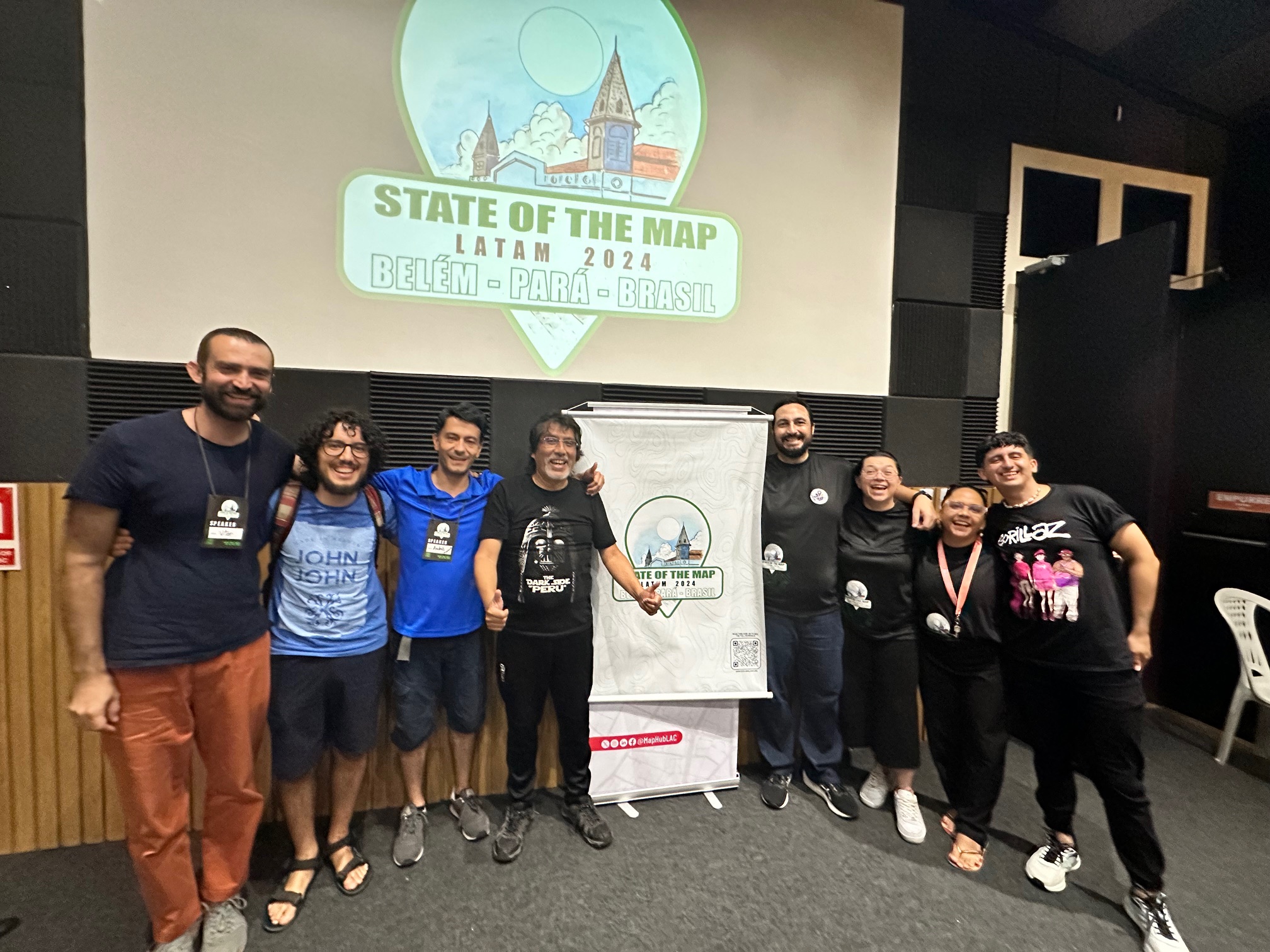
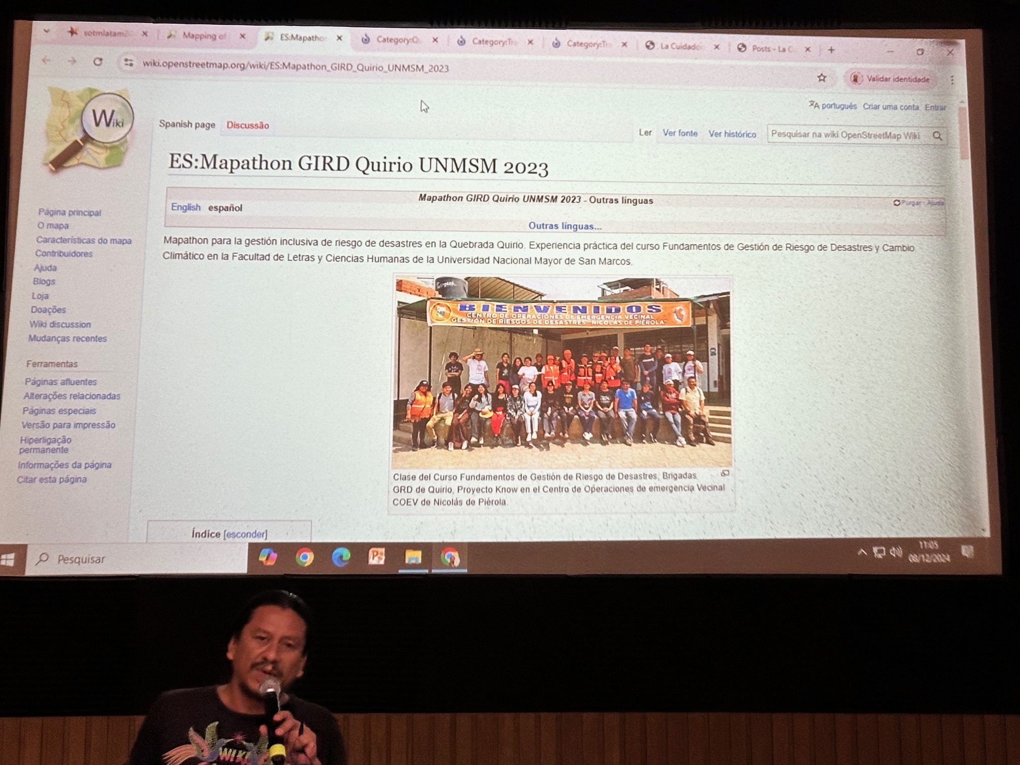
Last December, I had the privilege of attending State of the Map Latin America (SOTM LATAM) in Belém, Brazil. I want to first share my gratitude to the entire community. I may be biased because I am latina myself, but latinos sure know how to make one feel loved and welcomed.
This was my first time at SOTM LATAM, and I was deeply inspired by the energy, passion, and dedication of the OpenStreetMap (OSM) community in this region. The event showcased an impressive array of presentations and workshops, from mapping remote areas of the Amazon to using innovative tools and techniques for open mapping. I am so grateful to everyone who shared their work and insights, broadening my understanding of the challenges and opportunities in Latin America.
As a Director of the OpenStreetMap Foundation (OSMF), I had the opportunity to present about the role of the OSMF, the purpose of the Board of Directors, and how we strive to support the global OSM community. Engaging directly with attendees highlighted how essential it is for the OSMF to maintain stronger connections with regional communities. I was surprised to learn that this was the first time an OSMF Board member had attended a SOTM LATAM. Representation matters, and I am committed to ensuring this is not the last time. Strengthening our communication channels with the LATAM community is vital, and I am eager to build more meaningful and consistent engagement.
Open Conversations with the Community
A key part of this experience was the opportunity to hear directly from participants. During the event, an open online collaborative document page was shared, allowing attendees to express their thoughts, feedback, and even grievances with the Board. Some of the valuable insights included:
Regional Representation on the Board: There were discussions around creating dedicated Board seats for representatives from different regions to ensure equitable representation, particularly for communities that may struggle to gain sufficient global votes.
Lack of Awareness of Working Groups: Many attendees expressed that they were unaware of the existence and functions of OSMF Working Groups. Promoting these groups and encouraging participation from Latin American communities could strengthen regional representation and collaboration.
First Formal Board Presence: For many, this was the first time they had the opportunity to hear directly from a Board member. The engagement was positively received, and it was clear that there is a desire for more consistent interaction between the OSMF and Latin American communities.
Recognizing Regional Entities: Some established and active communities in the region are not formally recognized as official OSM chapters. This can create challenges in accessing grants and participating in global events. Greater support from the OSMF could bridge this gap.
Building Strategic Partnerships: Participants highlighted the potential for OSMF to collaborate with independent media organizations in Latin America, especially within data journalism, indigenous journalism, and environmental reporting. Strengthening these connections could increase OSM visibility and promote responsible use of open geospatial data.
Funding for Training and Capacity Building: Accessing financial resources for training journalists and other community members on OSM tools was identified as a critical need. Expanding funding opportunities for local projects could accelerate mapping efforts and amplify the impact of OSM data.
Moving Forward
The feedback shared during SOTM LATAM was invaluable. Meaningful participation and representation of all regions are essential for the growth and success of OpenStreetMap. We need to be more engaged with this and all communities. If you have any suggestions our communication channels (1;2;3;4 ) are always open.
To everyone I had the pleasure of meeting, thank you for your warm welcome and for sharing your perspectives. If you have further questions, comments, or feedback about the event or the OSMF, please feel free to reach out. ¡Obrigada, SOTM LATAM!
SOTM LATAM 2025 I’d like to also share with you all that SOTM LATAM 2025 will be in Medellin, Colombia from September 4th-6th. This is a great opportunity for all to get to know this amazing OSM Community and learn about the inspiring work they are doing.
Whether you’re passionate about maps, data, or shaping the future of OpenStreetMap (OSM), the community is always looking for your inspiring ideas! Why not sharing them during State of the Map 2025
The call for participation of SotM 2025, taking place in Manila, Philippines, on October 3 – 5, is now open! The programme committee is ready and waiting, eager to unwrap your submissions for talks, workshops, and panels. These sessions aren’t just part of the conference; they’re its beating heart, driving conversations and sparking ideas that resonate worldwide. Presenting your work, projects and ideas at SotM is also a great way to get in touch with the wider OSM community.
Tracks
Sessions can be submitted for the following tracks:
OSM Basics – Information dedicated to newcomers
Community and Foundation – Bringing people together, working group experiences, strategies & vision
Mapping – All about making the mapping easier and better
Cartography – Your ideas on how to create good-looking presentations of the OSM dataset
Software Development – Software for processing and editing data
Data Analysis & Data Model – Reflections about the OSM data, its model and analysis of quality and completeness
User Experiences – Stories of using OSM and its data as a user
Education – How you use OSM in an educational context
If your submission doesn’t seem to fit into one of these tracks, don’t worry – as long as it is clearly related to OpenStreetMap, you’re perfectly fine if you simply choose the track that feels to fit best.
Academic Track at SotM 2025
In addition to this general call for participation, there will again be a proper academic track with a separate CfP, which will be announced later. So, if you’re knee-deep in the captivating world of OpenStreetMap, stay tuned for the official call: The working group is eagerly awaiting the most riveting insights and groundbreaking results from your studies. Get your research hats on, gather your data, and prepare to submit the best of your studies.
Stay tuned for more news about the State of the Map 2025! See you later this year in Manila, Philippines, and online!
The State of the Map Working Group
Do you want to translate this and other blogposts in your language…? Please email communication@osmfoundation.org with subject: Helping with translations in [your language]
The State of the Map conference is the annual, international conference of OpenStreetMap, organised by the OpenStreetMap Foundation. The OpenStreetMap Foundation is a not-for-profit organisation, formed to support the OpenStreetMap Project. It is dedicated to encouraging the growth, development and distribution of free geospatial data for anyone to use and share. The OpenStreetMap Foundation owns and maintains the infrastructure of the OpenStreetMap project, is financially supported by membership fees and donations, and organises the annual, international State of the Map conference. Our volunteer Working Groups and small core staff work to support the OpenStreetMap project. Join the OpenStreetMap Foundation for just £15 a year or for free if you are an active OpenStreetMap contributor.
OpenStreetMap was founded in 2004 and is an international project to create a free map of the world. To do so, we, thousands of volunteers, collect data about roads, railways, rivers, forests, buildings and a lot more worldwide. Our map data can be downloaded for free by everyone and used for any purpose – including commercial usage. It is possible to produce your own maps which highlight certain features, to calculate routes etc. OpenStreetMap is increasingly used when one needs maps which can be very quickly, or easily, updated.
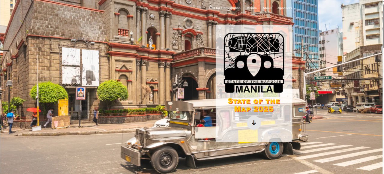
The Philippines is made up of more than 7,000 islands, and there are more than 7,000 reasons to love it! We are delighted to share that the State of the Map global conference will be coming to Manila, Philippines, from 3 to 5 October 2025. This is a historic moment for Southeast Asia as this will be the first global SotM in the region.
The OSM Philippines community warmly invites passionate OSM contributors—mappers, data enthusiasts, developers, and community organizers and members from all around the world—to celebrate the spirit of collaboration and open mapping, look back to where we came from, look closely at where we are now, and look forward to where we would like to be next.
Following the positive feedback for the past two conferences post-pandemic, the upcoming State of the Map 2025 will once again be held in a hybrid format. We are committed to making SotM even more inclusive and accessible, bringing in new voices and new faces, to participate in this open mapping festivity.
Save the date! Stay tuned via our website, 2025.stateofthemap.org, for more updates on speakers, agenda, ticketing, and how to get involved as the event draws closer. Let’s gather our ideas, pack our maps, and gear up for a one-of-a-kind mappy experience at State of the Map 2025 in Manila!
Interested in sponsoring SotM 2025?
We invite you to become a valued partner in the mapping revolution by supporting the State of the Map 2025 conference! By collaborating with us, you will be contributing to the advancement of open data, community engagement, and mapping innovation. Your support will play a crucial role in shaping the future of OpenStreetMap and will provide your organization with unparalleled exposure within the global mapping community.
For further information or to discuss customized sponsorship packages, please contact our sponsorship team at sponsor-sotm [at] openstreetmap [dot] org.
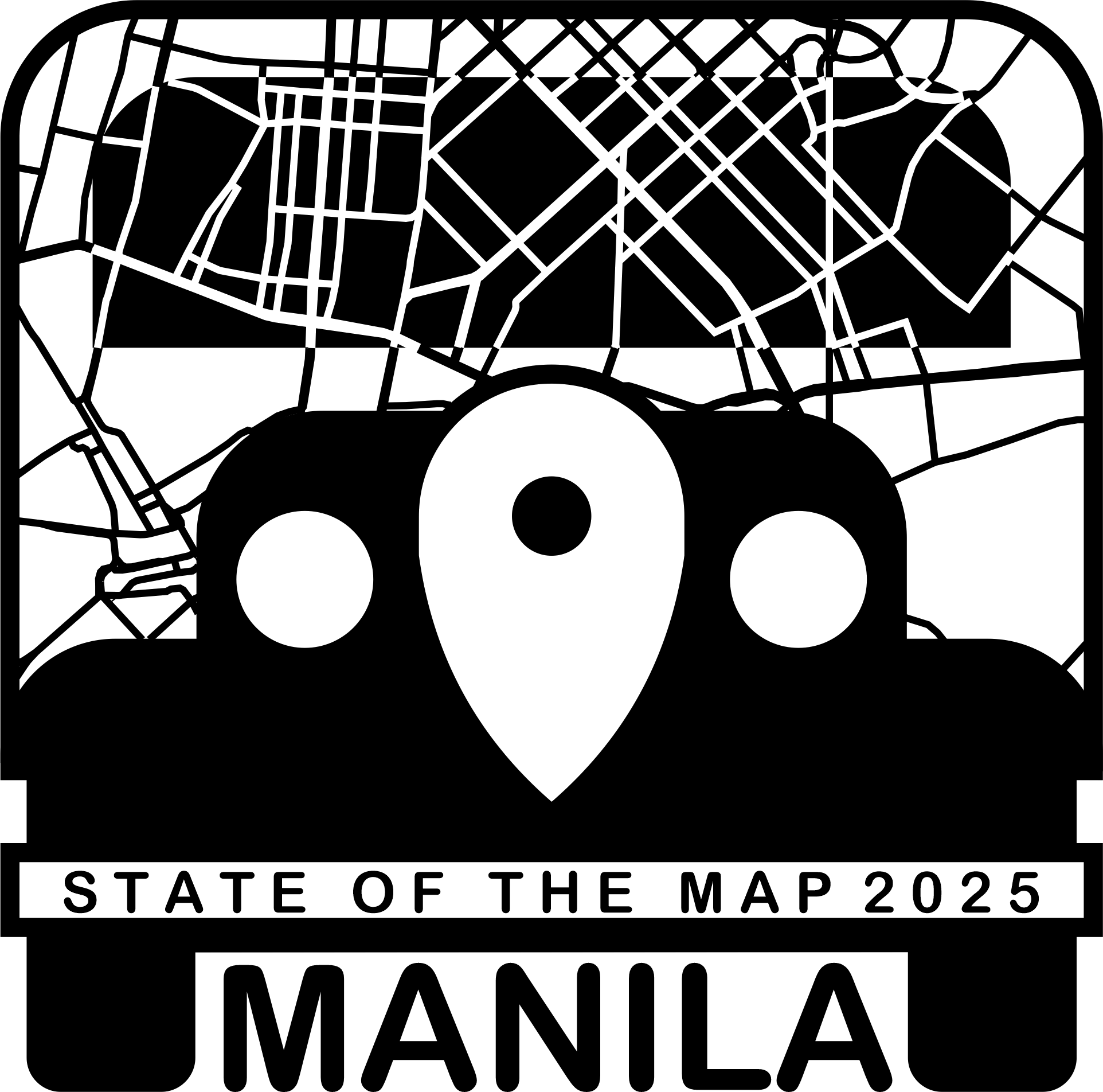
Announcing our SotM 2025 Logo
We would like to thank everyone who took part in the SotM 2025 Call for Logo! We received more than 15 proposals from creative contributors from all over the world!
…however, only one design will be the new face of this year’s conference!
Congratulations to Andi Muhlis for submitting the winning logo inspired by the iconic jeepney of Manila, which embodies the vibrant spirit and creativity of the Philippines.
The logo features a stylized jeepney, paying homage to local cultural heritage. A detailed segment of the Manila map is also prominently displayed, symbolizing our commitment to the global mapping community. The design seamlessly integrates traditional and modern elements, reflecting Manila’s unique character.
OpenStreetMap Philippines Local Organizing Team for SotM 2025 and the SotM Working Group