April brings two international commemorative days that offer fun ideas for mapping. Earth Day on April 22 demonstrates support for environmental protection, and the less well-known International Day of Human Space Flight on April 12, which was created by the United Nations fifty years after Yuri Gagarin’s first human space flight.
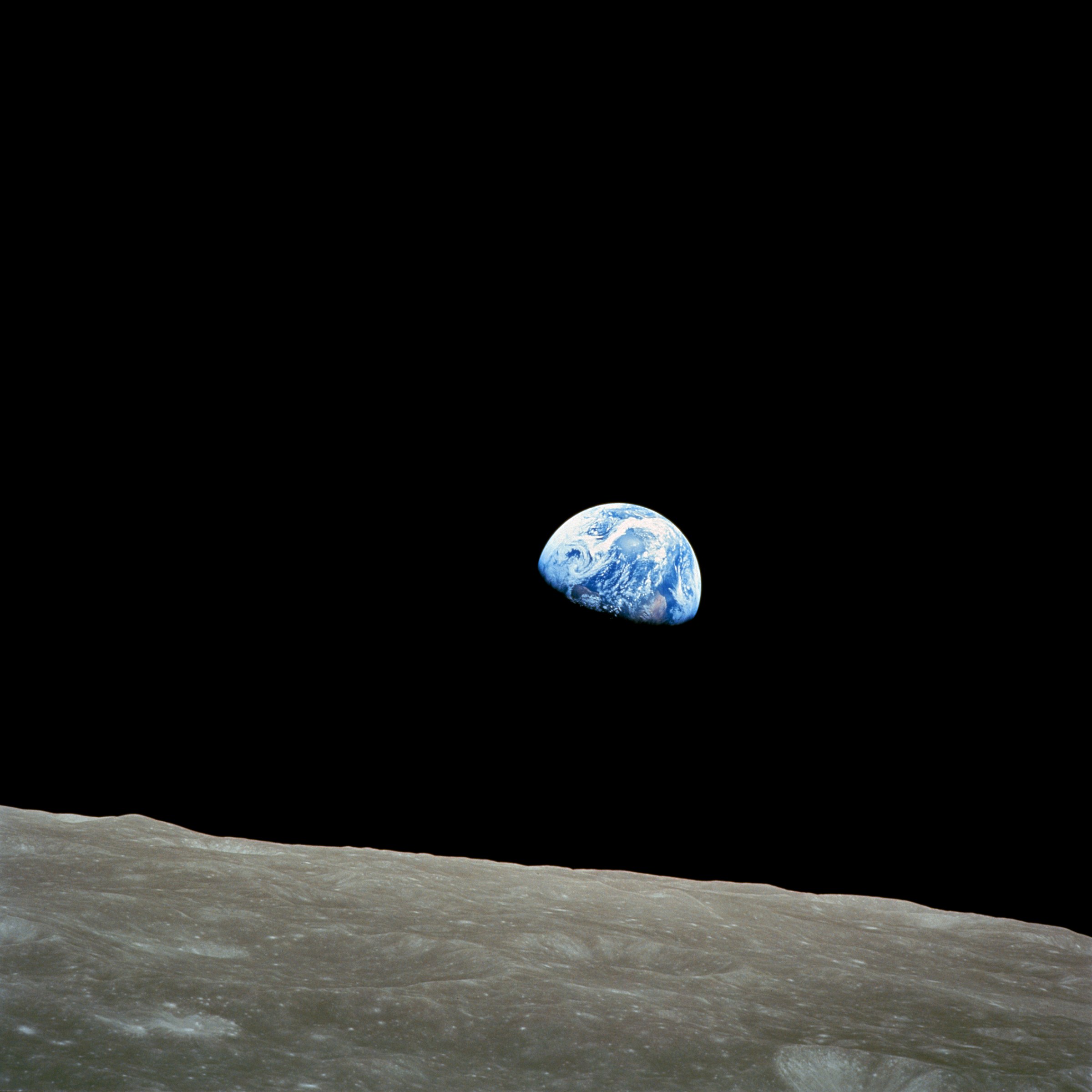
These celebrations are intricately intertwined in the famous “Earthrise” image, which helped spark global environmental consciousness and led to the first Earth Day in 1970. The increasing availability of earth observation imagery since then has directly helped OpenStreetMap for the entire globe.
There are plenty of opportunities for mapping related to Earth Day. You could map natural areas, reserves and parks, recycling facilities, and many other kinds of features mentioned in the Environmental OSM project.
And for the International Day of Human Space Flight, while OSM doesn’t map in outer space (yet), you can map terrestrial features related to space flight, like launch sites, space-related facilities, historic sites and museums, or even just things named for outer space.
Mapping Earth
The Environmental OSM project has a lot of great ideas, from the local to the global.
You could take a look at recycling-related tags and features, such as public recycling bins or recycling centres, and see if any are missing around you.
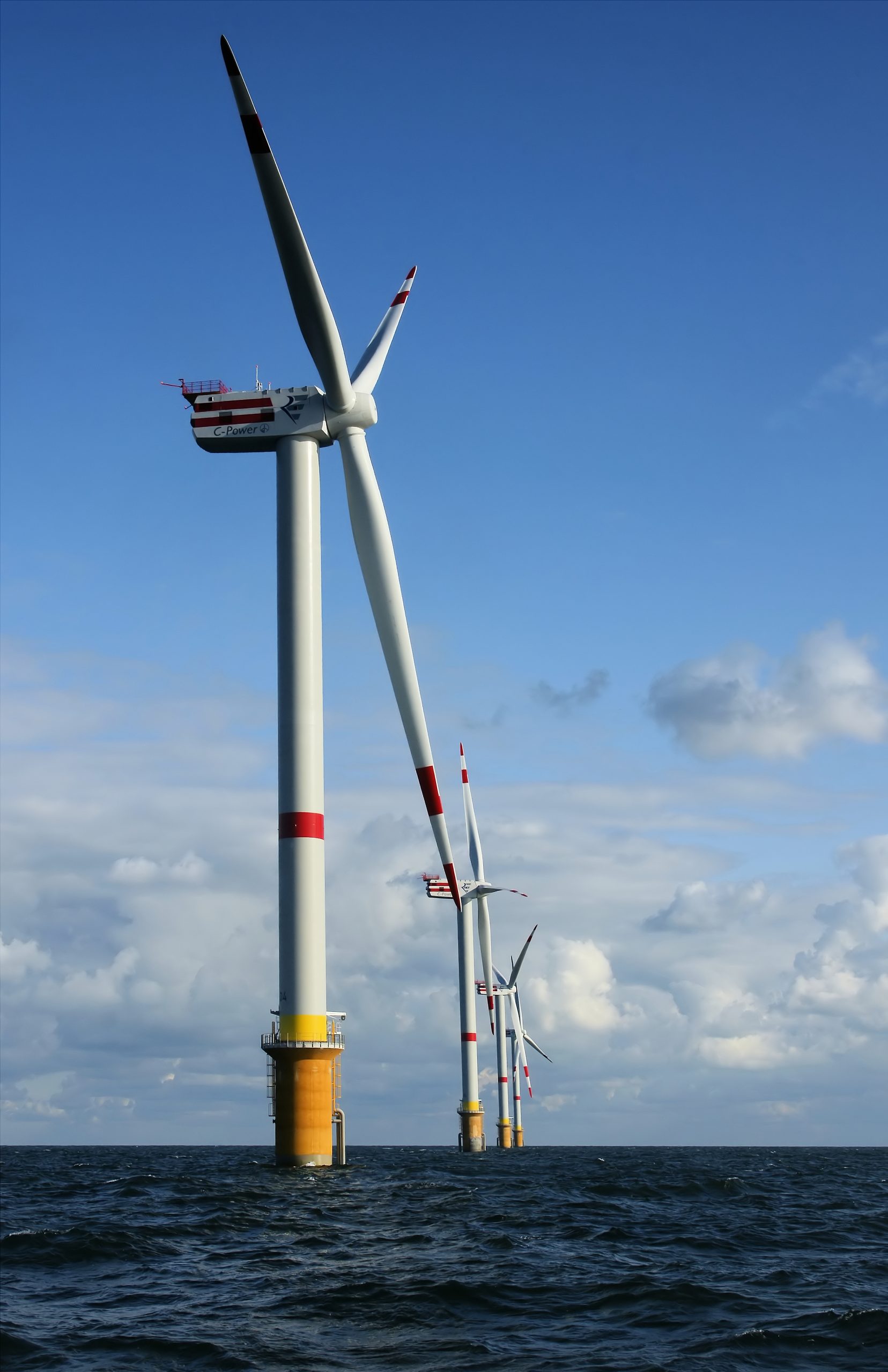
You could help map your favorite green space or natural area, whether it’s wilderness, a park, or something else. National parks and nature reserves are among many included in boundary=protected_area, or you could try mapping land use, wetlands, or mangrove forests. There are also clean energy facilities like wind power — are there any near you that aren’t mapped? Other ideas include cycling and hiking trails, or you could look to see if any polluting industries near you need to be mapped.
The Tasking Manager also has projects from various nonprofits related to environmental issues, such as mapping places with climate change-related risk.
Or you can take a look at places related to the environment: the United Nations Environment Programme is headquartered in Nairobi, Greta Thunberg’s first School Climate Strike took place at the Swedish Riksdag, and there’s even an Earth Day monument in Orlando, Florida.
Mapping Space Flight
There are many Earth-bound options for mapping space flight! OSM has tags for spaceports and launchpads and Wikipedia has a list of rocket launch sites including latitude and longitude coordinates. There are spaceports around the world too (via Overpass). You could take a look at some near you and make sure everything is mapped and tagged properly around them — or see if any are missing around the world. (Make sure to follow local tagging guidelines, though.)

You also could make sure planetariums or space museums near you are mapped.
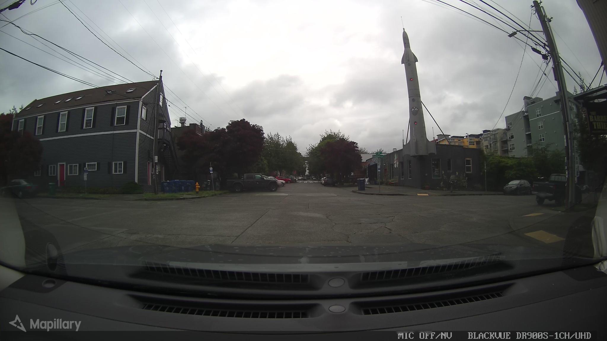
And there are some more amusing spaceflight-related places: for example, the Fremont Rocket sculpture in Seattle, USA and pubs like the Rocket in London and in Jena, Germany.
And of course, there are planty things related to non-human space flight, such as the UFO incident in Roswell, New Mexico, USA where there’s the International UFO Museum & Research Center, the Rendelsham Forest UFO landing sites in the UK and the flying saucer-shaped water tower Nave do ET (ET’s Ship) in Varginha, Brazil.
Let us know what you map — and tell us about any upcoming days you think would be interesting for an OSM blog post.
Photo credits:
Earthrise: William Anders/NASA, public domain
Windmill: © Hans Hillewaert / CC BY-SA 4.0
Space Shuttle: NASA, public domain
Fremont Rocket: damnitgetmybeer/Mapillary, CC BY-SA 4.0


