Category Archives: OSMF

Posts about organisation of the OpenStreetMap Foundation. Working groups, the board, and other entities, and how we structure our organisation

OSMF and OpenCage – Joint press release

OpenCage is a silver level corporate member of the OpenStreetMap Foundation, entitling them to this joint press release. If your organisation would like to support the OSMF more, please consider joining the OSMF as a corporate member, or read about other ways to give back.

Geocoding is the process of converting between addresses or placenames and geographic coordinates (longitude and latitude). Geocoding is a core geospatial functionality; an underlying building block that is critical to developing location based services.

OpenStreetMap Foundation corporate member OpenCage operates a highly-available, enterprise level geocoding API based on OpenStreetMap. We’re pleased to announce that OpenCage recently increased their commitment to the OpenStreetMap Foundation by upgrading to silver level corporate membership.

“For years our service has built on OpenStreetMap. We’re delighted to increase our ongoing support of the worldwide OSM community by increasing our level of commitment to the OpenStreetMap Foundation.” said Ed Freyfogle, OpenCage co-founder.

“It’s a nice milestone that the business has grown to the point that we could upgrade from Bronze to Silver. But beyond financial support the main work we do is opening the eyes of our customers – most of whom arrive knowing simply that they need geocoding, and without a detailed understanding of open data – to open data’s many benefits. Our customers around the world are proof that OpenStreetMap is commercially usable not in some distant theoretical future, but today” continued Freyfogle.

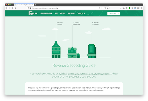
An example of that type of educational work is OpenCage’s recently published Reverse Geocoding Guide, which details the technical challenges of ongoing operation of a reverse geocoding service, while also documenting the advantages of using open data as the underlying data foundation for such a service.

OpenCage offers open source SDKs for accessing their geocoding API for over 30 different programming languages.

In addition to being corporate members of the OSMF, OpenCage are proud members of the UK (the business was started in the UK) and German (the business is currently based in Germany) local chapters, co-sponsor and contribute to the open source development of Nominatim (the primary OpenStreetMap geocoding software), and regularly sponsor OpenStreetMap events.

GEOMOB logo

OpenCage also encourages geoinnovation by running Geomob, a regular series of in-person and online events with the goal of promoting geoinnovation in any and all forms – whether for “fun or profit”, as the event tagline says. Now in its thirteenth year, Geomob has become an established feature of the European geo event landscape, and regularly features projects using OpenStreetMap.

Early in 2020 the Geomob podcast was launched. The weekly conversations provide a chance to reflect on geo industry trends, discuss interesting new geo technology, and interview Geomob speakers. Podcast guests have included many members of the OpenStreetMap community, including Allan Mustard (chairperson of the OSMF Board), Tyler Radford (executive director of the Humanitarian OpenStreetMap team), Sarah Hoffmann (maintainer of the geocoding tool Nominatim, which powers search on osm.org), several founders of businesses building on top of OpenStreetMap, and many more.


What is OpenStreetMap?

OpenStreetMap was founded in 2004 and is a international project to create a free map of the world. To do so, we, thousands of volunteers, collect data about roads, railways, rivers, forests, buildings and a lot more worldwide. Our map data can be downloaded for free by everyone and used for any purpose – including commercial usage. It is possible to produce your own maps which highlight certain features, to calculate routes etc. OpenStreetMap is increasingly used when one needs maps which can be very quickly, or easily, updated.

What is the OpenStreetMapFoundation?

The OpenStreetMap Foundation is a not-for-profit organisation, formed to support the OpenStreetMap Project. It is dedicated to encouraging the growth, development and distribution of free geospatial data for anyone to use and share. The OpenStreetMap Foundation owns and maintains the infrastructure of the OpenStreetMap project, is financially supported by membership fees and donations, and organises the annual, international State of the Map conference. The OSMF supports the OpenStreetMap project through the work of our volunteer Working Groups. Please consider becoming a member of the Foundation.

Community survey on 2020 OSM Foundation board decisions and current topics

Would you like to provide feedback on decisions that the OSM Foundation board made in 2020 and on current topics? The board has prepared a survey and is asking for your input in order to set priorities.

You can see a copy of the questions in English here.

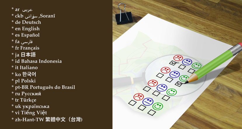
The survey is available in 18 languages so far. Image by D. Kazazi, CC-BY-SA 3.0. Official OSM logo by Ken Vermette, CC-BY-SA 3.0 & trademarks apply.

Languages

Thanks to volunteer translators, the survey is available in eighteen languages so far:

Helping with translations

If you would like to provide a translation to a language not on the list, or to suggest a correction in one of the translations, please email allan@mustard.net

If you would like to help with translations of non-English answers to English, future surveys or blogposts, please send an email to communication@osmfoundation.org with subject: Helping with translations in [language].

Practical

  • You need to provide an email address (to receive a token) and solve an equation in order to access the survey.
  • There are 18 questions, most are multiple-choice and mandatory.
  • There is an optional section with demographic questions.
  • There are several sections. You cannot go back to the previous section but you can resume later.
  • Please note that pages with background information linked from the survey are in English.
    • If the pages are on the OSM wiki, you are welcome to translate them.
    • If they are on the OSMF website and you would like to provide translations, please email the Communication Working Group at communication@osmfoundation.org with subject: Translating OSMF pages in [language].

Feedback

There is discussion about the survey on the “talk” mailing list, where you are welcome to provide feedback. You can register to the talk mailing list here. All past messages of the list are available here.

Privacy

  • Read the LimeSurvey privacy policy.
  • The answers can be accessed by current board members and the administrative assistant and will be processed by the board.
  • The email addresses and names (if provided) of participants won’t be published after the survey ends.

Results

The general results will be published after the survey ends. Past surveys are listed here.

Deadline for participation: 14 February 2021.

Even if you don’t participate, it would be appreciated if you spread the word about the survey.

Thank you in advance 🙂

The OpenStreetMap Foundation is a not-for-profit organisation, formed to support the OpenStreetMap Project. It is dedicated to encouraging the growth, development and distribution of free geospatial data for anyone to use and share. The OpenStreetMap Foundation owns and maintains the infrastructure of the OpenStreetMap project, is financially supported by membership fees and donations, and organises the annual, international State of the Map conference. It has no full-time employees and it is supporting the OpenStreetMap project through the work of our volunteer Working Groups. Please consider becoming a member of the Foundation.

Message from OSMF Board Chair on mailing list behavior

To the OpenStreetMap and OSMF communities:

I convey the following information on behalf of the Board of Directors of the OpenStreetMap Foundation.

An outcome of the current controversy on the osmf-talk mailing list over misogynistic language is a decision by the Board as follows:

The Board will find partners to help instate a moderator team for the OSMF-talk and talk mailing lists.  These moderators need to have the trust of the community subject to the moderation (consent of the governed) by some kind of approval mechanism. 

This moderator team will start to work on enforcing the current Etiquette guidelines as soon as possible. We will also start work on updating/replacing our Etiquette rules, which must focus on balancing all participants’ interests.

We have asked the Local Chapters and Communities Working Group (LCCWG) to take the lead on this and to work with signatories of the open letter to the Board as well as members of the Diversity and Inclusion Special Committee to produce proposals for the Board to consider at its January meeting.  The LCCWG has accepted this task.  This issue will be on the agenda of the January meeting of the Board of Directors, exact time and date yet to be determined, though as is customary it will be posted to the Foundation’s website well in advance.

Members of the OSM community are, as always, welcome to share their opinions and any relevant information on this matter, either publicly via osmf-talk, or privately in direct communications to the LCCWG.  I feel compelled to remind all members of the community that a Code of Etiquette has existed since June 2011 and shall be observed by all community members.

Very best regards to all,

Allan Mustard

Active OSM contributor? You can now easily join the OpenStreetMap Foundation

Deutsch Français Galego Polski Nederlands Русский

Map data by OpenStreetMap Contributors. Official OSM logo by Ken Vermette, CC-BY-SA 3.0 & trademarks apply. Image by D.Kazazi CC BY-SA 2.0

If you contribute significantly to the OpenStreetMap project you should have a voice in the OpenStreetMap Foundation, which is supporting the project, and be able to vote for the board members of your choice. There is now an easier and costless way to become an OpenStreetMap Foundation member:

The volunteers of the OSMF Membership Working Group have just implemented the active contributor membership program, where you can easily apply to become an Associate member of the Foundation and there is no need to pay the membership fee.

What can I do as an OSMF Associate member?

  • You can vote for the board candidates of your choice at the board elections.
  • You can vote on some issues during General Meetings (but not all).
  • You can participate in the discussions between members on the OSMF members mailing list (if you are already an OSMF member register here – see the archive available to all).
    • Subscription to the mailing list is optional.
    • You have the option to receive a single daily digest, containing all the emails of the day.
    • Feel free to email in your language 🙂
  • You can proudly say that you are an OSMF member 🙂

How does it work?

We will automatically grant associate memberships to mappers who request it and who have contributed at least 42 calendar days in the last year (365 days).

Not everyone contributes by mapping, and some of the most familiar names in our members list barely map. Some are very involved, for example, in organizing conferences. Those other forms of contribution should be recognised as well. If you do not map at all or less than the 42 days, then we expect you to write a paragraph or two about what you do for OpenStreetMap. The Board will then vote on your application.

How can I find out how many mapping days I have?

  • You can get an estimate from tools like Pascal Neis How did you contribute, which should be accurate enough for most purposes.
  • If you are technically versed and wish to verify your mapping days yourself, use the changesets API of OSM to query your changesets. Then you can collect all unique dates in the created_at attributes of the changesets, and count how many unique days you have in the last 365 days.

I would like to become a member via the active contributor program!

● If you qualify based on mapping activity (at least 42 mapping days in the last 365 days) please fill out this form to get your active contributor membership

● If you qualify for other contributions to OpenStreetMap please fill out this form and describe your activities to get your active contributor membership.
General link:
https://join.osmfoundation.org/active-contributor-membership/

Frequently asked questions

What do I need to supply?

  • Your name.
  • Your OSM username.
  • Your country of residence.
  • Your email address (where ballots for voting will be sent and will be the email address associated with participation in the OSMF members mailing list, if you choose to subscribe)

How long is this membership valid?

Just like paid membership, membership under the membership fee waiver programme must be renewed annually. You will get a reminder, and you then can request the renewal, similar to the initial application. The check for mapping at least 42 calendar days in the last year will be carried out at the time you request the renewal, or alternatively you submit again a paragraph or two about what you do for OpenStreetMap.

What else do I need to know?

By law, every member of the OSMF can inspect the membership register (we ask for the purpose before handing it out and generally distribution by the recipient is not allowed). Who joined under which program is not revealed. The name, country, email and one of the OSM account names will be shown.

Why does this active contributor membership program exist?

By inviting more active community members to join the OSMF, we become more resilient against take-over attempts through massive signups. We believe that even mappers for whom £15 is not a lot of money would be more willing to join, if they are invited to a free membership due to their good work. Also, active contribution to the project is easier to assess than financial hardship and does not require the applicant to disclose personal information. The potential loss of individual membership fee income is not a threat to our financial stability. In fact, there are quite a few members who like to donate more than just £15. Those donations need not be tied to any membership.

Why 42 mapping days?

Mapping days is not perfect, but we need a benchmark that is objective, easy to verify, and simple for us to measure and implement.
Why 42 days? If we measure contributions in mapping days by OSMF members who map (83%), roughly half of them map more than 42 days per year. We would expect a “slightly exceptional” contribution in terms of mapping days.

42

How are my changes divided into days for measuring 42 mapping days

For measuring the mapping days, the created at time stamp of each changeset is used. Typically, all changes in a change set have the same time stamp. A day is defined in UTC from midnight to midnight.

Does paid mapping count?

The “active contributor program” is there to measure your engagement towards the project. In the first place, we think this is shown by volunteer activities for the project. If you do organizing or mapping for OSM as a part of your paid job, that is not necessarily a show of engagement with the project. By default, we would not include these activities as qualifying for this type of membership. But feel free to explain your contributions, and the Board will have a vote.

Can’t this be cheated?

We also discussed abuse. When we receive an application, we contact the mentioned OpenStreetMap account(s) through the OSM messaging system to confirm they are owned by the applicant. You could of course make tiny contributions like wiggling a single node on 60 days, and maybe go undetected and get your membership. But that would be fraud, and the membership could be revoked if the OSMF Membership Working Group finds out that the contributions are not meaningful.


What happens to the old fee waiver program?

The Active contributor membership program is replacing the old “fee waiver” program (active from 2018 January onward) where the membership fee was waived in cases of financial hardship or lack of suitable money transfer ability. The change was made possible by a vote during the 2019 Annual General Meeting. The “financial hardship” and “Lack of suitable money transfer” rule will be dropped entirely because even today, we expect someone joining under those rules to demonstrate some sort of contribution, so they would likely be eligible under the new rule as well. 

What other options do I have to become a member?

As previously, you can still become a Normal member or Associate member of the Foundation by paying the annual £15 membership fee.

The main differences between Normal and Associate members are that:

  • Normal members have to supply their full residential address.
  • Normal members can vote on all issues during the General Meetings, while Associate members only on some issues.
  • Normal members can be board candidates and hence become board members.

You can switch your membership type. Please contact the Membership Working Group (email below) for more information.

OpenStreetMap logo with magnifying glass, showing stick figures.
Membership Working Group logo based on the official OSM logo by Ken Vermette, CC-BY-SA 3.0 & trademarks apply. Figures by Pascal Neis, reproduced with permission.

I would like to help the volunteers of the OSMF Membership Working Group!

Thank you 🙂 We need your help and you can make a difference by joining the Working Group. Send us an email at membership@osmfoundation.org

As a MWG member you can help us to:

  • Administer the membership register.
  • Answer routine questions like what kind of membership does someone have (normal or associate) or when will they need to renew.
  • Help with the manual work for matching bank transfers with memberships for new sign ups and renewals.
  • Sort out other problems regarding sign up or renewal.If you join, you can be as involved as you like.

I have another question!

Feel free to contact us at membership@osmfoundation.org

Cute half-blobs with eyes, holding sticks with maps.
Image by Tintao CC BY-SA 2.0, modified.

Get notified about new blogposts: Subscribe to the RSS feed!

Do you want to translate this and other blogposts in another language..? Please send an email to communication@osmfoundation.org with subject: Helping with translations in [language]

The OpenStreetMap Foundation is a not-for-profit organisation, formed to support the OpenStreetMap Project. It is dedicated to encouraging the growth, development and distribution of free geospatial data for anyone to use and share. The OpenStreetMap Foundation owns and maintains the infrastructure of the OpenStreetMap project, is financially supported by membership fees and donations, and organises the annual, international State of the Map conference. It has no full-time employees and it is supporting the OpenStreetMap project through the work of our volunteer Working Groups.

Continue reading

OSMF Microgrants Program: Congratulations to Selected Projects

After many weeks of examining the 48 submitted proposals for the OSMF Microgrants Program, the committee is pleased to announce the 12 projects which have been selected for funding. While the entire range of submissions included thoughtful proposals with potential for impact, a shortlist was formed to keep under the proposed budget of up to €5,000 per project, up to €50,000 total. The selected proposals represent the top tier of ideas that will help shape and impact the OpenStreetMap community in the coming year with microgrant funding.

The accepted proposals are:

  • Leaflets to Promote OSM
    A series of leaflets promoting OpenStreetMap aligned to our Local Chapter aims. Costs will cover the printing and distribution of the leaflets. Design work is expected to be covered by volunteer time.
OpenStreetMap Ireland board members during recent online meeting.
Tobias Zwick, developer of StreetComplete
  • Teaching and learning OSM in Albania through LibreTech School
    Organising teaching classes for local OpenStretMap contributors with less or without experience in editing and using OSM. Volunteer’teachers’ will organize online classes with under-represented groups in Albania using amongst others explanatory videos about getting started with OSM and the OSM community.
  • Mapping Villages and Settlements in Kosovo
    Twelve mapathons are planned to be organized with high school students to map their settlements. This will be done in cooperation with ASSET (an afterschool activity project that aims to develop employability and entrepreneurial skills in youth and a positive attitude to their future ASSET).
  • HIV facilities mapping in the Philippines on OpenStreetMap
    HIV has been very rampant in the country and PLHIV are at most vulnerable specially in times of disaster and outbreak. This project aims to map out and validate all HIV facilities’ location and contact details all over the Philippines on OSM.
MapUganda – some of the team members.
  • Road Completion project
    Process automatically the road networks official datasets and display the comparison in a way that will help the mappers to add or fix the road network in OpenStreetMap.
  • OpenStreetMap Calendar
    OpenStreetMap Calendar simplifies event organisation and staying up-to-date on nearby events.

All projects must conclude within 12 months from their start, and should show promising results as they commence in the near future. Next steps will include final funding agreements for accountability, disbursement of funds, and kicking off the accepted projects.

A total of €42,368 is authorized by the board for this round of microgrants, although some of this will be reduced due to savings on shared video chat infrastructure and other minimal adjustments. No projects were allowed to have their nature or content modified in order to facilitate selection, but were judged on the merit of their originally submitted format. Community endorsements were considered in the selection process, and input of the OSMF Board was provided in regards to the shortlisted projects. 

The Microgrants Committee includes Christopher Beddow, Janet Chapman, Geoffrey Kateregga, Clifford Snow, and Hanna Krüger. The committee wishes to profusely thank Joost Schouppe for his advising and refereeing during the process, as well as Craig Allan and Michael Collinson who served as neutral observers in the latter half of the committee proceedings. Finally, a profound thanks goes out to all who put in the effort to build a project proposal focused on improving OpenStreetMap, a dedication which does not always come with reward, but demonstrates the spirit of volunteerism and innovation that helps the OpenStreetMap project thrive. 

The OSMF Microgrants Committee

About the OSMF Microgrants: framework, committee minutes and timeline

About photos in this post: The twelve applicants were asked for photos. The post includes those received up to the time of publication.


Do you want to translate this and other blogposts in another language..? Please send an email to communication@osmfoundation.org with subject: Helping with translations in [language]

The OpenStreetMap Foundation is a not-for-profit organisation, formed to support the OpenStreetMap Project. It is dedicated to encouraging the growth, development and distribution of free geospatial data for anyone to use and share. The OpenStreetMap Foundation owns and maintains the infrastructure of the OpenStreetMap project, is financially supported by membership fees and donations, and organises the annual, international State of the Map conference. It has no full-time employees and it is supporting the OpenStreetMap project through the work of our volunteer Working Groups. Please consider becoming a member of the Foundation.

OpenStreetMap was founded in 2004 and is a international project to create a free map of the world. To do so, we, thousands of volunteers, collect data about roads, railways, rivers, forests, buildings and a lot more worldwide. Our map data can be downloaded for free by everyone and used for any purpose – including commercial usage. It is possible to produce your own maps which highlight certain features, to calculate routes etc. OpenStreetMap is increasingly used when one needs maps which can be very quickly, or easily, updated.

Toward resolution of controversies related to iD

The OpenStreetMap Foundation Board of Directors seeks to resolve controversies that have periodically arisen around updates of and enhancements to the iD editor. This request for comment is expected to lead to adoption of community structures that will not answer to the Board or be influenced by the Board, in keeping with the OSM philosophy that the Board supports OSM but does not tell anybody what to map or how to map. We ask that comments be made on the OSM-talk mailing list (register to OSM-talk) or -if you are an OSMF member- to the OSMF-talk mailing list discussion (register to OSMF-talk).

OSMF offers and recommendations for iD governance

iD is the simple, friendly, default web editor for OpenStreetMap, centrally important software for the project. There’s a lot of passion about its development, and that appears sometimes to become a problem.

The OSMF Board recently convened a small gathering to discuss how to improve the development environment for iD. While there have certainly been times when major and minor decisions in iD have triggered conflict, the vast majority of development discussions are non-polarizing and productive. The convening focused on the key areas where problems emerge (most often, though not only, tagging), and ways to allow for constructive disagreement and resolution, without their deteriorating into disputes that hurt the project.

Essentially, the maintainers of iD need a productive space to carry out their work; contributors, users and other interested parties need to be heard; the decision-making process needs to be understood and respected; and disputes need a way to escalate and resolve.

There’s no technical solution to this kind of situation. What’s required is process and organization. To that end, below are several offers and recommendations from the OSMF Board that the iD project may consider supporting and adopting. We hope that the iD project finds these suggestions helpful and looks forward to discussing what sounds workable and what does not.

OSMF will establish an appeal process

OSMF is seriously considering creating or identifying a body to adjudicate various kinds of technology disputes, capable of drawing on expertise ad hoc to determine the best path forward for the community. Software projects could opt-in into using this appeal process; it would not be required. This appeal process may simply involve arbitrating the disagreement between different parties or projects and helping to find agreement between them; or might involve making or overruling decisions. This mechanism is under early discussion, yet to be defined.

If disputed decisions cannot be resolved directly within the iD project by its maintainers and stakeholders, then the issue can be escalated to this appeal process.

The role of this group would certainly not be to force developers to add certain features. However, if issues are escalated to the group, it could verify that newly added features (e.g., presets, validation rules, or inclusion of external services) are in line with a consensus view.

If this sounds potentially helpful at this stage, OSMF asks iD to share input and expectations to make the process most effective.

OSMF will support development of better systems for tagging decisions; iD documents status quo and separation of concerns

The only way to assess the “correct” tags is a baroque evaluation of the various sources of OSM documentation – the wiki, tagging mailing list, taginfo. This leaves editing and consumption tools in the position to “decide” on what tags are appropriate or not for OpenStreetMap. When this turns contentious, at best this is an unwelcome distraction; and at worst, development can be blocked. To this end, the OSMF welcomes the development of better documentation, decision-making and a curation process for tags. Where needed, the OSMF is prepared to aid such efforts with infrastructure and other support. This would provide a greater degree of clarity for tool developers. If an action taken on presets in iD is contested, the issue could be escalated to the appeal process described above.

For iD’s part, while work on tagging systems is ongoing, we recommend now adding detail on the status quo approach iD takes to tagging decisions in CONTRIBUTING.md. It’s clear that iD aspires to refrain from making decisions on what tags are appropriate for OpenStreetMap; rather, iD aims to represent the consensus view on tags in presets. “Consensus” is currently subjective, and the iD project strongly (we believe, please say so if otherwise) supports efforts in OSM to bring more clarity to how tags are developed.

Presets can be requested in issues, and in PRs, as well as discussion in the issue/PR. The maintainer of iD reserves the right to include or exclude certain tags/presets on technical or usability grounds, though the goal is to avoid curating tags and making decisions on the merits of tags in general. If there seems to be consensus, based on evaluation of source documentation, and it meets a need for other users, presets will be accepted. If there is not clear consensus, the preset (or validation rule, etc.) won’t be accepted.

Institute quarterly planning meetings, and publish bi-weekly sync time and notes

OSMF recommends iD hold a quarterly (or so) video meeting with iD stakeholders. This meeting is a chance to step out of the everyday work of iD and make sure work is on the right path. The agenda would assess development over last quarter, discuss requirements and priority needs, and make plans for the next quarter and beyond. Additionally if any decisions or topics have proven difficult or disputed over the past quarter, this is a time for direct discussion. Notes will be taken and distributed.

Additionally, iD holds a bi-weekly sync, but it is not well known. iD could raise awareness of the bi-weekly sync by announcing it on additional channels, including https://ideditor.blog/; and make sure notes from the sync are visible and accessible.

iD can improve clarity on decision making and communication

We recommend that in CONTRIBUTING.md iD maintainers add a new section which explains how decisions are made in iD. Some points made here are contingent on adopting other recommendations. The new section would explain the following.

  • There are many places to discuss and input on iD development – GitHub issues and PRs, the monthly syncs, quarterly planning meeting, and in response to announcements on https://ideditor.blog/.
  • The developers of iD are committed to being responsive and transparent. By default, iDs maintainers determine the sequence and timing of fixes, changes and enhancements in order to optimize technical work.
  • Invite stakeholders to join an “acceptance testing” process, where feedback on releases is sought and handled for a time delimited period of time.
  • Ultimate decision on accepting PRs is with iD’s maintainer, Quincy Morgan.
  • If there is a dispute on a decision, that will be escalated to the quarterly planning meeting and/or an appeal process managed within the OSM Foundation.

Additionally, we recommend that iD publish a roadmap and regularly update status on major iD releases. iD3 plans were last shared at SotM US. The approach has changed, with more focus on updated UI, and more iterative efforts on componentization. It would be good to get a clear idea of where things are, and where things are going (as much as is clear now), and especially where help is needed in order to build momentum on this important effort.

Document how Code of Conduct is handled

iD has a Code of Conduct but it lacks details on how to report a harmful incident within the iD development environment, and how those reports are adjudicated. Previously Code of Conduct complaints were addressed openly by opening an issue on GitHub, but maintainers later directed people towards the private OSMUS committee. Clarity on process is just as important, if not more, in order for a CoC to be helpful to the project. If that process is not well defined, then thought is needed, perhaps within the quarterly planning meeting. Our recommendation is to add a section on CoC process.

Allan Mustard
Chairperson, OSMF Board of Directors

The OpenStreetMap Foundation is a not-for-profit organisation, formed to support the OpenStreetMap Project. It is dedicated to encouraging the growth, development and distribution of free geospatial data for anyone to use and share. The OpenStreetMap Foundation owns and maintains the infrastructure of the OpenStreetMap project, is financially supported by membership fees and donations, and organises the annual, international State of the Map conference. It has no full-time employees and it is supporting the OpenStreetMap project through the work of our volunteer Working Groups. Please consider becoming a member of the Foundation.

OpenStreetMap was founded in 2004 and is a international project to create a free map of the world. To do so, we, thousands of volunteers, collect data about roads, railways, rivers, forests, buildings and a lot more worldwide. Our map data can be downloaded for free by everyone and used for any purpose – including commercial usage. It is possible to produce your own maps which highlight certain features, to calculate routes etc. OpenStreetMap is increasingly used when one needs maps which can be very quickly, or easily, updated.

Announcing the OSM Foundation’s Call for Microgrant Applications

2020 will be the first year that the OSM Foundation operates the new microgrants project. In the coming weeks, we hope to hear from you about a bold, community-driven, and impactive OpenStreetMap project idea that will benefit from a microgrant of up to 5000 euros. We welcome a broad range of projects, with the minimum requirement being a clear connection to OpenStreetMap.

What is a microgrant? In our case, it is a modest amount of funds awarded to applicants in order to fund direct expenses of a project. For an idea of successful projects, you can take a look at the Humanitarian OpenStreetMap Team’s 2019 microgrant awardees. Keep in mind that the OSM Foundation (OSMF) has a wider focus than the humanitarian sector, spanning our global community, and welcomes applications with any focus that relates to OpenStreetMap. We particularly encourage applicants to consider the core values from the OSMF’s mission statement and how any microgrant work can incorporate them.

The OSMF Microgrant Program focuses on simple grant proposals, and we will swiftly decide on what to fund. Our goal is to avoid a complicated and long application and decision process. You should submit a brief and concise proposal, and we plan to quickly announce the awardees.

We encourage submissions from individuals, groups, and organizations who have a clear idea they want to pursue. Each project should be completed within 12 months of the microgrant being awarded this spring. Microgrants are open to all OSMF members, and can be submitted in any language. If you are not yet a member of OSMF then you can apply to join up until the time you submit a microgrant application, and be eligible for an award. Please note there is an active contributor program that may allow you to join the OSMF at no cost. 

In light of the ongoing health crisis regarding COVID19, we will not be awarding microgrants for projects which require offline group gatherings and in person meetings, although these ideas are certainly valuable for future rounds.

Funding can be used for a variety of purposes. You may need tools and supplies for mapping activity, funds for training materials, technology expenses for a series of virtual mapathons, prizes for an online coding, mapping, or writing contest, and many more examples. Please embrace your own creativity and not feel limited by the range of examples.

We encourage you to consult with your local OpenStreetMap community when planning a microgrant application, and make sure you adhere to community guidelines in the scope of the project. If accepted for a microgrant, you will be responsible for reporting progress, signing a grant agreement, and making sure to follow the detailed microgrant rules. It is strongly suggested that your project uses the funding to enable volunteer work to have a wider and stronger impact than it would without funding.

The call for microgrants will open on April 19th, 2020 and we will continue to accept applications through May 10th, 2020. In order to submit,  visit the OSM Wiki page and click on “Start your application” to enter the template. When this is complete, send a message to microgrants at osmfoundation.org. We also encourage sharing your application on osmf-talk when it is submitted. If you need help with the submission process, please feel free to contact the Microgrants Committee for help. If you don’t have enough time to prepare your plan and application, please consider submitting it in a possible future round of microgrants.

Once the submission period closes on May 10th, we invite the community to review the complete list of submissions and provide feedback on the wiki page. We also will accept feedback by email to microgrants at osmfoundation.org and via osmf-talk

Complete timeline:

  • April 19: call for microgrant applications opens
  • May 10: final date for submission (23:59 Pacific Time Zone, USA). 
  • May 10-TBD: community feedback period
  • Late May: announcement of awards

For more details, see the complete rules and guidelines on the OSM wiki and contact us at microgrants at osmfoundation.org with any questions. This is the first time the OSMF is sponsoring such an activity, and we look forward to learning together about how this benefits our community and how to build a transparent, effective, and inclusive microgrants program for everyone involved. We are grateful for the opportunity to make funds available to the community and hope to hear your ideas in the coming weeks.

Chris Beddow, OSMF Microgrants Committee Chair

Do you want to translate this and other blogposts in your language..? Please send an email to communication@osmfoundation.org with subject: Helping with translations in [your language]

The OpenStreetMap Foundation is a not-for-profit organisation, formed to support the OpenStreetMap Project. It is dedicated to encouraging the growth, development and distribution of free geospatial data for anyone to use and share. The OpenStreetMap Foundation owns and maintains the infrastructure of the OpenStreetMap project, is financially supported by membership fees and donations, and organises the annual, international State of the Map conference. It has no full-time employees and it is supporting the OpenStreetMap project through the work of our volunteer Working Groups. Please consider becoming a member of the Foundation.

OpenStreetMap was founded in 2004 and is a international project to create a free map of the world. To do so, we, thousands of volunteers, collect data about roads, railways, rivers, forests, buildings and a lot more worldwide. Our map data can be downloaded for free by everyone and used for any purpose – including commercial usage. It is possible to produce your own maps which highlight certain features, to calculate routes etc. OpenStreetMap is increasingly used when one needs maps which can be very quickly, or easily, updated.

Request for feedback on proposal for OSMF membership based on sizeable contribution to the project

MWG logo based on the official OSM logo by Ken Vermette, CC-BY-SA 3.0 & trademarks apply. Figures by Pascal Neis, reproduced with permission.

Last December at the Annual General Meeting of the OpenStreetMap Foundation a proposal for membership in the foundation based solely on sizeable contribution was accepted with a very good result (91%):

The membership fee for associate membership, which normally is tied to the regular membership fee, may be waived if the person applying for membership can demonstrate that they have consistently made sizeable contributions to OpenStreetMap, for example by mapping.

The OSMF Membership Working Group will, together with the Board of Directors, define what counts as “sizeable contributions”.

Just like paid membership, membership under the membership fee waiver programme must be renewed annually.

Please read the rationale here.

In January, the Membership Working Group (MWG) discussed the implementation. Sorry for the long silence since; the MWG would now like to open the discussion and ask for your feedback and comments on the implementation of the new active contributor membership.

As described in the rationale for the vote, this is no charity. We want active contributors to be members of the OSMF and be able to vote for the benefit of the project. The membership fee should not be a barrier.

Our proposal is to automatically grant memberships to mappers who request it and who have contributed at least 42 calendar days in the last year (365 days).

Mapping days is not perfect, but we need a benchmark that is objective, easy to verify, and simple for us to measure and implement.

Why 42 days? If we measure contributions in mapping days by OSMF members who map (83%), roughly half of them map more than 42 days per year. We would expect a “slightly exceptional” contribution in terms of mapping days.

We also discussed abuse. You could of course make tiny contributions like wiggling a single node on 60 days, and maybe go undetected and get your membership. But that would be fraud, and the membership could be revoked if MWG finds out that the contributions are not meaningful.

On non-mapping contributions to the project

Not everyone contributes by mapping, and some of the most familiar names in our members list barely map. Some are very involved, for example, in organizing conferences. Those other forms of contribution should be recognised as well, and the board would take circular decisions on these applications.

Please share your thoughts

We would like to hear your thoughts on the proposal. You can:

Comments can be in any language you are comfortable with. We will make the best effort to have them translated.

Please share your thoughts before the 30th of April 2020.

Thank you.

Michael Spreng
Membership Working Group

Do you want to translate this and other blogposts in your language..? Please send us an email to communication@osmfoundation.org with subject: Helping with translations in [your language]

The OpenStreetMap Foundation is a not-for-profit organisation, formed to support the OpenStreetMap Project. It is dedicated to encouraging the growth, development and distribution of free geospatial data for anyone to use and share. The OpenStreetMap Foundation owns and maintains the infrastructure of the OpenStreetMap project, is financially supported by membership fees and donations, and organises the annual, international State of the Map conference. It has no full-time employees and it is supporting the OpenStreetMap project through the work of our volunteer Working Groups. Please consider becoming a member of the Foundation.

OpenStreetMap was founded in 2004 and is a international project to create a free map of the world. To do so, we, thousands of volunteers, collect data about roads, railways, rivers, forests, buildings and a lot more worldwide. Our map data can be downloaded for free by everyone and used for any purpose – including commercial usage. It is possible to produce your own maps which highlight certain features, to calculate routes etc. OpenStreetMap is increasingly used when one needs maps which can be very quickly, or easily, updated.

Call for Microgrants Committee

Drawing: “Balloon-Prospect”, featured in Thomas Baldwin’s Airopaidia (1786). Public domain. Image by the Communication Working Group.

Microgrants: enabling volunteers to do more by overcoming financial barriers.

The Microgrants project is ready for launch! When the OpenStreetMap Foundation received the Pineapple fund donation, the money was quickly earmarked as to be given back to the community. Now that’s finally happening, after a recent Board decision (plenty of background behind that link!). Any volunteer who thinks they can make an impact with a small grant will soon be able to apply.

But first we need the help of a few volunteers to manage the project. What do we expect of you?

  1. Running the call for projects.
  2. Making a selection of about ten projects.
  3. Following up with the selected projects.

Anyone can apply to be on the selection committee, and the Board will then make a selection. We are looking for people who know how the OSM community works, who have experience with making an impact for OSM – but also people with practical experience running these kinds of projects.

The policy document offers a guideline to what the Board wants to see happen with this project, but it leaves a lot of leeway for the committee to implement as they see fit. For example, the committee is expected to work out their own rules of order. During the entire process, you will be able to rely on Dorothea for administrative assistance.

The most impactful job of the Microgrants Committee will be the selection itself. The decision is expected to be based on deep community consultation. The Board did keep a veto right over the selected applications.

The committee is also expected to guide the projects to fruition. However, it is encouraged for the committee to extend the group with more volunteers, so as to lighten the workload and diversify points of view. For example, it would be really helpful to have volunteers who speak the language or are culturally close to the selected projects.

When the projects are finished and have reported on their experience, the Committee is almost done. A final task will be to make recommendations to the Board for the next phase of the Microgrants project – we’ve only just begun!

Send your application to join the Microgrants Committee
to microgrants at osmfoundation.org
by March 8th, 2020.

All relevant information will be accessible through the OSMF website at
https://wiki.osmfoundation.org/wiki/Microgrants

All the best,

Joost Schouppe
for the OSMF Board

Do you want to translate this and other blogposts in your language..? Please send an email to communication@osmfoundation.org with subject: Helping with translations in [your language]

The OpenStreetMap Foundation is a not-for-profit organisation, formed to support the OpenStreetMap Project. It is dedicated to encouraging the growth, development and distribution of free geospatial data for anyone to use and share. The OpenStreetMap Foundation owns and maintains the infrastructure of the OpenStreetMap project, is financially supported by membership fees and donations, and organises the annual, international State of the Map conference. It has no full-time employees and it is supporting the OpenStreetMap project through the work of our volunteer Working Groups. Please consider becoming a member of the Foundation.

OpenStreetMap was founded in 2004 and is a international project to create a free map of the world. To do so, we, thousands of volunteers, collect data about roads, railways, rivers, forests, buildings and a lot more worldwide. Our map data can be downloaded for free by everyone and used for any purpose – including commercial usage. It is possible to produce your own maps which highlight certain features, to calculate routes etc. OpenStreetMap is increasingly used when one needs maps which can be very quickly, or easily, updated.

OpenStreetMap Welcomes Diversity

In January, the OpenStreetMap Foundation adopted this Diversity Statement:

The OpenStreetMap Foundation and the global OpenStreetMap community welcome and encourage participation by everyone. Our community is based on mutual respect, tolerance, and encouragement, and we are working to help each other live up to these principles. We want our community to be more diverse: whoever you are, and whatever your background, we welcome you.

The Board then appointed the Diversity and Inclusion Special Committee to compile research and undertake new research on our diversity, identify root causes that contribute to any shortfalls, and make recommendations to help resolve issues and improve.

If you’re interested to take part, join one of the two upcoming starting meetings of the committee;

We’ll discuss the scope of work laid out by the Board, sketch initial work plans, and figure out logistics and timing and structure of future meetings.

You might also be interested to join the OpenStreetMap diversity mailing list.

Do you want to translate this and other blogposts in your language..? Please send an email to communication@osmfoundation.org with subject: Helping with translations in [your language]

The OpenStreetMap Foundation is a not-for-profit organisation, formed in the UK to support the OpenStreetMap Project. It is dedicated to encouraging the growth, development and distribution of free geospatial data for anyone to use and share. The OpenStreetMap Foundation owns and maintains the infrastructure of the OpenStreetMap project, is financially supported by membership fees and donations, and organises the annual, international State of the Map conference. It has no full-time employees and it is supporting the OpenStreetMap project through the work of our volunteer Working Groups. Please consider becoming a member of the Foundation.

OpenStreetMap was founded in 2004 and is a international project to create a free map of the world. To do so, we, thousands of volunteers, collect data about roads, railways, rivers, forests, buildings and a lot more worldwide. Our map data can be downloaded for free by everyone and used for any purpose – including commercial usage. It is possible to produce your own maps which highlight certain features, to calculate routes etc. OpenStreetMap is increasingly used when one needs maps which can be very quickly, or easily, updated.