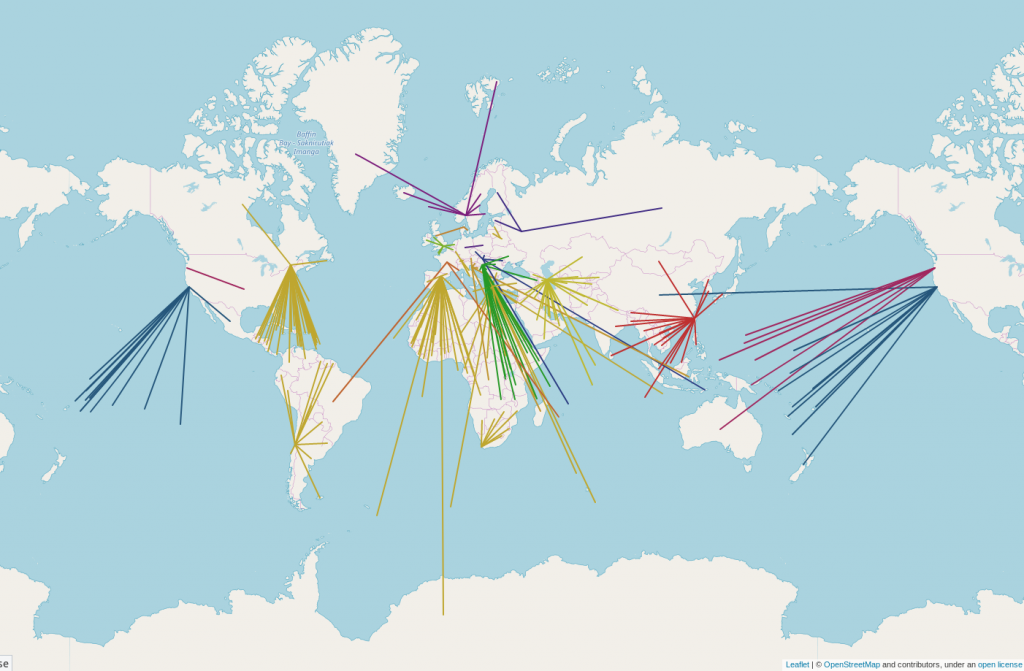
A big use of the OpenStreetMap data is the web map on OpenStreetMap.org. Along with our hard working team of volunteer sysadmins who keep it going, we are helped by many donated tile cache servers around the world, which speed up the map in various regions.
We are always open to more servers, but the Operations Working Group is currently looking for servers in Brazil, and Australia/New Zealand. If you or your organisation would like to donate a cache server and hosting, we’re ideally looking for a physical server or powerful VM with 8GB+ RAM and at least 146GB of storage. Read more details.
Please email operations@osmfoundation.org if you are interested.
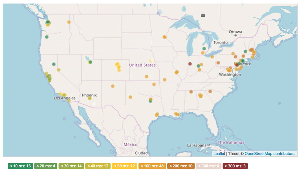
Our peak Brazil traffic is currently around 65 Mbps. Our peak Australian and New Zealand traffic is currently around 20 Mbps. See the full country breakdown in bits per second.
Some more information:
- Brazil has the 10th highest traffic and is the largest country without a cache in it or nearby.
- Worldwide peak traffic is 2300 Mbps.
- Antarctica and Australia are the two continents we do not have caches on.
We fully manage the software and operating system. All config is managed via our chef recipes. We also run a local firewall on each server. If physical hardware, we monitor using it SMART, hp-health, etc and report any hardware issues back to the hosting organisation.
Will you help us and join the people and organisations that support OpenStreetMap? Thank you!
The OpenStreetMap Foundation is a not-for-profit organisation, formed in the UK to support the OpenStreetMap Project. It is dedicated to encouraging the growth, development and distribution of free geospatial data for anyone to use and share. The OpenStreetMap Foundation owns and maintains the infrastructure of the OpenStreetMap project. Volunteers, like the indefatigable team of server administrators, keep all of this hardware working.
OpenStreetMap tiles are free for everyone to use, but should be used with moderation. If you are a high traffic site you should look at switch2osm.org to find out how to use the data and keep the tiles available for everyone.
If you can’t donate server hosting, you can always make a financial donation to the OSMF.