This week’s round-up

The debate surrounding the use and licensing of OSM’s data that was reported in last week’s round-up has continued in earnest this week, resulting in an explosion of traffic on the OSM legal mailing list:

There are several components to the problem. First, there is the issue of copyright. Currently each individual contributor retains the copyright to their contributions. This situation is unlikely to change, as in many countries, such as Germany, it is simply not possible to transfer copyright held by an individual to another body. Next is the issue of the OSM license. All the data held by OSM is licensed under the Creative Commons Attribution-Sharealike 2.0 license (CC-by-SA). CC-by-SA means that anyone can use OSM data for anything they like, provided they give attribution to the creator(s) of the data (the guys with the GPS units and bicycles) and providing that they apply the same license to any derivative works that they make and distribute. I think I speak for the whole OSM community when I say that we all want the best free map of the world we can get; how we define freedom and how we get there is another matter. Richard Fairhurst gives his opinion on some of the problems with the current OSM license:

No webmapping company or cartographer will contribute any data back to OSM except through the goodness of their own heart. That’s because CC-SA doesn’t require you to publish the source code, just the final product.

So if a cartographer produces a beautifully illustrated map using OSM data and then redistributes the map, they are required to redistribute it under the CC-by-SA license. This would make selling the derived work very difficult and Richard and others have suggested that this factor will stop cartographers from using OSM’s data in the future. Instead, they will go to organisations from whom they can buy data under licenses that allow them to create works that they can use commercially, effectively bolstering the position of organisations who sell proprietary data. Frederick Ramm and Robert “Jamie” Munro also point out that this scenario contradicts OSM’s stated aim, to produce maps that are free of the “legal and technical restricions” that most geo-data is subject to.

Take another scenario, one in which a big provider of geo-data gets hold of OSM’s data-set, cleans it, augments it and then uses it to produce map tiles. The current CC-by-SA license does not require this organisation to release the augmented data back into theOSM data set , they would only release their finished product. Those who see this as a problem have suggested making a distinction between the source data (a planet dump for example) and a “rendered” work. It is suggested that the source data could be licensed so that any improvements have to be given back to OSM, whilst derived works would not need to be licensed under such a license, allowing more widespread use of OSM data.

This is a very brief round-up of a pretty complex problem that many people have strong opinions about. Whatever the final outcome of the debate is, it is going to play an important part in shaping the future of OSM. We’ll be meeting with some Creative Commons people in the next couple of weeks, so if you have any ideas about licensing, send a mail to the legal list, or take a look at this wiki page, and make sure your opinion is counted.

Almien published a list of interesting tags, based on the most recent Planet dump. One of my personal favourites is “wrong=oh yes!”, with “description=Official home of the President of The Philippines”, coming a close second. After seeing “blackadder:service=cobler” I know where I will be going to get my shoes fixed in the future, after which I can visit “blackadder:cuisine=fish” for a nice bit of seafood.

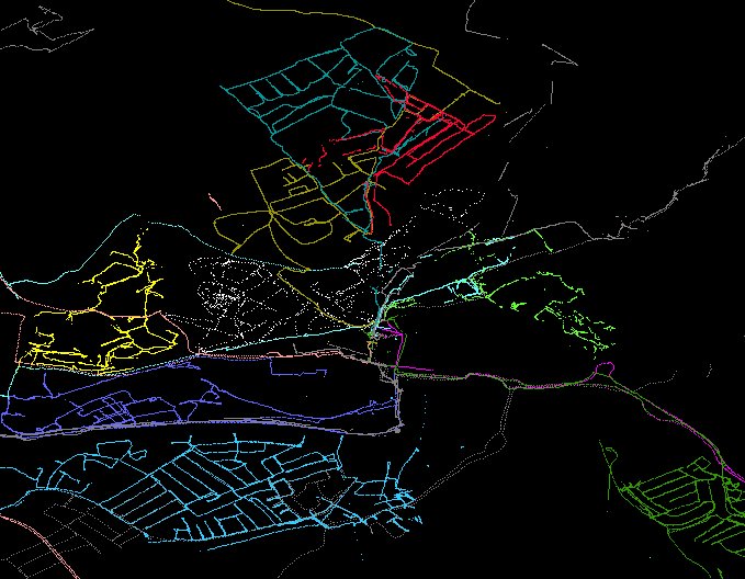
OSM@home is a project that uses distributed computing power to render SVG images of places from OSM data. You can browse through the different places here. Through the work of Barry Crabtree, J.D. “Dutch” Schmidt and others, the latest OSM@home client post-processes Osmarender data to produce images with beizer curves, like these:

There’s more information about the curve smoothing algorithm here and you can download the OSM@home client from here.

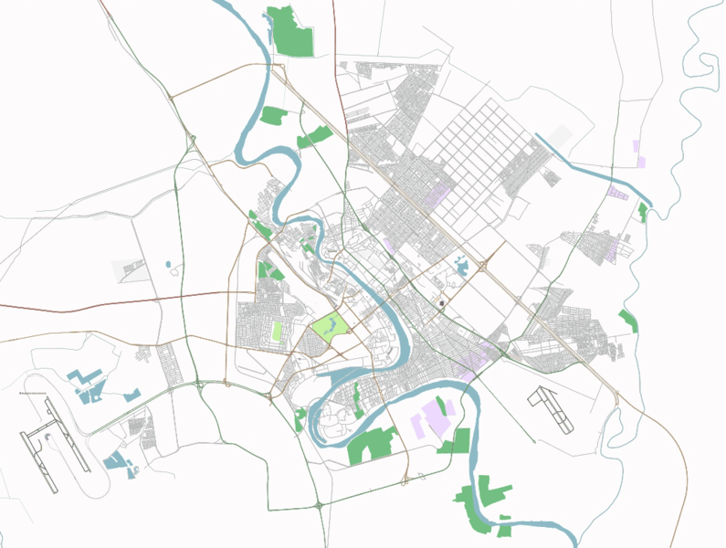
Free-Map – the countryside oriented open mapping project – now have a similar client that allows people to render Free-Map tiles (with really nice looking SRTM contours) at home. If you want to help out, you can get it from here.

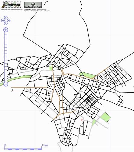
The OSM Cartography meet-up on Saturday saw Artem, SteveC, Steve Chilton and Richard Fairhurst spend a few hours going through the Mapnik config file with the aim of improving the cartography produced by Mapnik. About 10 people met up in Oxford afterwards and there was some interesting discussion about cartography in OSM. Steve Chilton and Richard Fairhurst made the point that a lot of the discussions about rendering OSM data focus on getting as much data as possible onto the maps. They pointed out that the secret of cartography is to represent the information that is needed for a particular use case, and had some convincing examples of traditional cartographic products, like maps oriented towards cyclists, that don’t include many features at all, but succeed in conveying the information needed by the cyclist by choosing the most useful features. This is definitely something for OSM’s renderers to think about. As the database gets larger and more diverse, and the demand for cartographic outputs of OSM data gets greater its going to be increasingly important to carefully select the features that are represented on our maps.

Saturday’s “You know you got OCOSMD (Obsessive Compulsive Open Street Mapping Disorder) when….” thread, started by J.D. “Dutch” Schmidt has thrown up some funny suggestions, along the lines of “…when you read other peoples gpx files as blogs” or “… You forget to pick the girlfriend up from work, but remember the GPS”. It would be so much funnier if it wasnt so painfully true. There’s definitely a fair amount of obsessiveness in the OSM community. I’ve always found that you appreciate things a lot more when you start trying to do or make them for yourself – thats certainly the way its been for me with mapping. Thomas Walraet reported on a French project that’s taking the do-it-yourself ethos to the extreme, making their own GPS circuit boards:

The boards retail for around €100, with the board’s manurfacturers making no profit. More information is available in French, here.

Thats all for this week, keep tuned to OpenGeoData for all latest news from the world of Open Mapping.

Bristol restrospective

The Bristol mapping party was a week ago now, and we collected some great data:

We were at the Watershed and had about 40 people turn up in all. We almost ran out of GPS units despite the rain, and some good social events happened on Friday, Saturday and Sunday. Laurence and I did an interview you can here here with the local radio station. All in all a good weekend!

Thanks very much to all who helped.

A week on Open Street Map Mailing lists.

Mailing lists are great. Don’t you just love it when an innocently titled OSM layer into Adobe Illustrator post breaks out into a storm? Phil Barnett, who wanted to use OpenStreetMap data along with imagery from Google Earth in an ITN news cast asked, “…and I presume there’s no problem with broadcasting this composite…”. There followed plenty of IANAL (I Am Not A Lawyer) prefixed comments, but the crux of the problem is this (from Mike Collinson) – OSM needs to make it crystal clear what constitutes a derivative work from OSM data, otherwise all this fantastic content is not going to be used to anywhere near its full potential. The debate continues on the Legal Mailing list.

If you are thinking of getting involved and wondering what type of gps unit to get (Tom-tom? Garmin? ….) take a look at the disucssion promped by David Stevenson on which sat-navs log, which specifically discusses Tom-toms, or look at the advice on the freshly updated wiki. That should give you a good round up of the pros and cons of the different devices that are around and set you off in the right direction (groan!).

The open tagging system that OpenStreetMap adopts always causes a lot of debate. This week, David Earl tried to finalise a new set of tags that the community have almost agreed on, which soon became a village-green discussion and a plea from Ben Robbins to be less flame-war-ish – its about critical discussion – don’t take it personally. It turns out that, village greens are not commons. OK, true enough but do you really care? Get off the fence and join the great OSM tagging debte. How exactly do you tag a fence?

A great subway-station vs. subway entrance discussion kicked of – do you put a node where the subway is, or mark each of the entrances? The weight of opinion was that you mark all the entrances, with the view that the routing/rendering engines will do the right thing and produce a detailed map. This does the discussion so much injustice – as with most of these kind of things, the devil is in the detail. Check here for the details.

There was a good talk about presenting the splippy map starting from other locations than Europe – country/IP based mapping was discussed, as was a view of the whole world (you know, sometimes the simplest solutions are the best 🙂 ).

Don’t you just hate it when…. opened up a vein by Nick Whitelegg to vent all those frustrating things that can happen once you start that addictive thing called mapping. If you do nothing else today just read the thread. Did you really spend a few hours mapping and forget to check that your gps was logging? Wasn’t it really frustrating when your train took a detour down all these new unmapped tracks and the coating on the windows interfered with GPS reception. I was on the floor by the time I read Ivan Sanchez’s comment! You need to go there… I’m waiting for an OSM-dev version to appear….

Osmarender4 has been up and running for a week or so now – (beautiful bridges) and should be running on all tiles@home clients now. There are a whole new set of icons as well. Looks like there will be some occasional confusion with the tiles on the slippy map util they are all osmrender4’d.

Looks like an Amsterdam Mapping Weekend is on the cards for the 17th/18th March. Who’d want to go to Amsterdam eh? 🙂 The things we’ll do for our art!

Oh, and we made it to the UK East Anglia Evening News, or David Earl did with an article on his and other OSM contributor’s great efforts to cycle and map the whole of Cambridge. There’s a brief item here.

By Barry Crabtree

OpenStreetMap Baghdad

OpenStreetMap Baghdad is happenning. This is incredible and exciting. And we need your help. Please read on.

OpenStreetMap is an free and open collaborative map of the entire world. We gather GPS tracks and draw maps over them, in an editable wiki style database. And recently we added aerial imagery to our toolbox, thanks to Yahoo!, so dense urban areas and remote locations can be mapped just by tracing streets in the web browser.

This means that OpenStreetMap has the most comprehensive map of Baghdad among any of the web mapping services.

Yahoo has great coverage over Baghdad, and we’ve been tracing. But since we’re physically just about everywhere else in the world but Baghdad, we don’t know the names of the streets or the neighborhoods, and especially what’s changed and still changing during these years of conflict.

So we’re reaching out to find people who could help .. people in Iraq now or have been in Iraq. Data sources, like any old maps or geographic names databases that are permissible to use would be very useful. Or crucially at this point, people who might know people who might know these people and sources. Maybe that’s you.

Our core belief is that open and accessible geodata helps people. The BBC reported on Iraqis using Google Earth to safely travel and avoid violence.

We are well aware of the huge challenges here, culturally and technically. There’s been discussion on how to handle the multiple names of streets .. the old names under Saddam, new names under different factions, and the government. OpenStreetMap can handle all endonyms .. names should exist by use not prescription. And that’s just scratching the surface of the issues. But right now is the right time for proving the open collaborative model for geodata, in the places that need it the most, and OpenStreetMap is ready to take it on.

So any help is welcome .. forward an email, blog post, CNN .. anywhere closer to people that can make OpenStreetMap Baghdad take off. And any comments or discussions, positive or negative, are welcome too.

The State of the Map

Thanks to a lot of hard work from all involved, we have a conference web site up over here. Please spread the word! This will serve as a base for info for the upcoming event:

  • The State of the Map – First openstreetmap international conference
  • Manchester, England
  • 14-15 July 2007

There’s a Call for proposals up. Got something to speak about? We’re interested in a broad range of topics:

  1. Freeing Up Access to Geodata – The political, commercial and opensource implications of open Geodata
  2. Redrawing the Map the OSM Way – GPS, surveying, data editing methods and additional sources of base data.
  3. New Uses For A New Style of Geodata – A look at new and existing uses for OSM data.
  4. Cartography 2017 – where are we headed?
  5. Building Blocks for Collaborative Mapping – Data storage, processing, scalability and delivery in a wiki-like environment.

It doesn’t have to be exclusively about openstreetmap – feel free to suggest mini-talks, talks, BOF sessions, posters and more. Oh, and it wouldn’t be an openstreetmap conference without mapping all of the city either, would it?

Party on

Some upcoming mapping parties and events to mention!