OpenStreetMap Gets Noticed by Microsoft, AOL

By SCOTT MORRISON

OpenStreetMap, a sort of Wikipedia of online maps assembled with contributions from thousands of globe-trotting volunteers, has gotten the attention of two big Internet players: Microsoft Corp. and AOL Inc.

The companies recently invested money and contributed aerial imagery to help OpenStreetMap forge new ground. They see the project as a potential alternative or complement to expensive digital maps built by commercial vendors like Nokia Corp.’s Navteq and TomTom International BV’s Tele Atlas, which license data to Microsoft, AOL, Yahoo Inc. and Google Inc. for all or parts of their online maps.

For Microsoft and AOL’s MapQuest unit, OpenStreetMap presents an opportunity to build new local services or develop new business models while skirting the costs and terms associated with licensed data from the commercial providers. The two companies are estimated to pay Navteq tens of millions of dollars a year for its map data.

“As location becomes an important element in online services, it’s really critical that companies have the flexibility to build the services that consumers want without the constraints of licensing agreements,” said MapQuest general manager Christian Dwyer.

Google last year began moving away from commercial vendors by rolling out a U.S. based map built with government data, satellite and aerial imagery, and data collected by its Street View vehicles. A company spokesperson says Google’s having control of its own maps enables it to do frequent updates and make them available whenever and wherever users need them—online, on mobile devices, or in the car.

“Google has tremendous business flexibility in how they use their map,” says digital mapping consultant Marc Prioleau. “The others have to work with a third-party vendor to make changes to the maps or try new business models.”

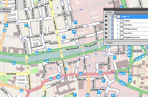
OpenStreetMap, meanwhile, is a free map of the world that is being built with government data and supplemented by an army of 300,000 volunteers who use GPS technology to trace and upload their routes to OpenStreetMap’s website.

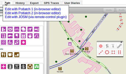
These community mappers can also use programming tools on the website to fill in features like bicycle paths, traffic restrictions, restaurants and shops, historic sites and sporting venues.

Volunteers so far seem to have mixed reactions to the idea of their contributions being used for commercial purposes. Samat Jain, an IT consultant in New Mexico who contributes to OpenStreetMap, says many members of the open-source community are concerned that Microsoft and AOL might steer the project in the wrong direction as they seek to commercialize the maps, but he personally supports their involvement because they will help push his contributions out to a broader audience.

OpenStreetMap founder Steve Coast, a computer developer and physics dropout, founded his nonprofit project in 2004 after recognizing that unlike open-source software and community encyclopedias, there was no free mapping data available to computer programmers. “Mapping is one of the few things that gets you, as a hacker, out into the streets doing physical things,” says Mr. Coast, who recently joined Microsoft as a map architect.

Mr. Coast acknowledges that the OpenStreetMap project has a long way to go, but he argues that maps of some regions, like the U.K and Germany, are comparable, if not more detailed, to those provided by Navteq and Tele Atlas.

The project’s U.S. map, by contrast, still lags. OpenStreetMap used freely available government data to lay out a basic map grid for the entire country and is now relying on community mappers to fill in the details. So far, those mappers have focused on major urban areas like New York City, Houston and San Francisco.

Tiffany Treacy, a senior vice president at Navteq, wouldn’t comment directly on OpenStreetMap, but claims her company can provide the consistency and level of accuracy that consumers demand in their maps.

Patrick McDevitt, vice president of community mapping for Tom Tom, says that while community maps work for some applications, “those that require consistent high quality, accuracy and extensive coverage will need quality-assured and tested products.”

OpenStreetMap received a major boost this year when MapQuest began rolling out maps of several European countries, including the Netherlands and Switzerland, based on the project’s mapping data. AOL also invested $1 million to help developers build tools that make it easier for mappers to contribute to these maps.

MaqQuest’s Mr. Dwyer says the goal is to eventually switch to OpenStreetMap for the entire world, but he estimates it will take three to five years to make that vision a reality.

Microsoft followed MapQuest’s lead last month when it hired Mr. Coast and announced it would provide high resolution aerial imagery to OpenStreetMap, a step that will help volunteers fill in gaps in the map by tracing streets and other features from the images.

Blaise Aguera y Arcas, architect of Bing Maps at Microsoft, says he sees OpenStreetMap as a source of mapping data that is complementary to the sets provided by Navteq, which powers Bing Maps.

Mr. Agueras y Arcas also notes that commercial mapping providers are focused on the U.S. and European markets, while OSM volunteers have in some cases built highly detailed maps in South America and Asia.

“We have no plans to drop our relationship with Navteq,” he says. But “it would be silly not to provide easy ways for users to use OpenStreetMap in areas in which OpenStreetMap has a lot to offer.”

Write to Scott Morrison at scott.morrison@dowjones.com

Woo

Weekly OSM Summary #4

11/29/2010 – 12/05/2010

Every week a lot of things are happening in the OpenStreetMap (OSM) world. It can be hard to keep track of all the different communication channels and don’t miss any important news. That’s why we’ve created a short summary of all the news here. Enjoy!

  • Potlatch2 is now available at http://www.openstreetmap.org, woha!
  • Since last Tuesday you can find the details on how to use the Bing-imagery here. More information about Bing and about their imagery-coverage.
  • Aerial imagery can be shifted from its origin position. If you forget to correct this in your editor, it can cause problems when editing OSM data. To solve this problem there is a plan to create a central system for automatic correction of this offset.
  • At the OpenStreetMap-Foundation blog, Richard Weait wrote a post about the activities of some OSM working groups.
  • “A Night at the Office” – Frederik Ramm describes in a blog post how the OSM extracts for their Geofabrik download server are made, using OSM tools.
  • Adena Schutzberg wrote some interesting thoughts: “My Take on Coast Going to Microsoft” here.
  • Eric Rodenbeck from Stamen Design took a look at the different categories of scans that get uploaded at Walking Papers. Some of them look like small artwork.
  • Oliver Kühn has interviewed Randy Meech from MapQuest about their motivation and commitment to OpenStreetMap.
  • Martijn van Exel has created a map that shows the acquisition date of the Bing-imagery for a certain area. Learn more about it here.
  • New version of the OpenLinkMap is online!
  • A new hiking-map for the Netherlands is available here.
  • Skobbler has announced a “new” bug-tool (called MapDust). It’s created out of their feedback-channel in the Skobbler app. You can find some more information in the OSM Wiki.
  • MapQuest has now open.MapQuest-websites for Switzerland and the Netherlands too, read their blog announcement here.
  • For the people who want to have maps everywhere: Get OSM maps printed on blankets.

For more news, especially regarding new tags and wiki pages, you can check-out the community-updates over here.

Authors: PascalJonas & Dennis.
We missed something? You want to help us collecting the news for next week’s issue? 
You can contact us via mail or Twitter.


Image of the Week: Animation of aerial imagery tracing

Media_httpimgurcom887_lcabf

OSM contributor Findvej sends this animation of an editing session in Denmark.

Just two hours of work in JOSM with the new Bing layer in a location
(Hjerting, Esbjerg, Denmark) with low coverage. All street names have
been added as well, from the updated KMS dataset.

Screenshots were taken about every five minutes and compiled to animated gif.

View the image full size to see the animation.

This is a Featured image, which means that it has been identified as
one of the best examples of OpenStreetMap mapping, or that it provides
a useful illustration of the OpenStreetMap project.

If you know another image of similar quality, you can nominate it at

http://wiki.openstreetmap.org/wiki/Featured_image_proposals

Project of the Week: Railway station

They are a point in a daily commute of countless people. Utilitarian,
they must provide for efficient movement of people in crowds.
Seemingly vacant at one minute and then teeming the next, with the
hustle and bustle of those determined to get from here to there. The
ordinary and repetitious trip of a commuter can lead to blank faces,
seeming drones programmed to catch the 7:15 without interaction with
others, without emotion.

Yet they have also been the scene of emotional hellos and goodbyes. A
backdrop to tears and embraces, an important goal in a departure or a
return.

The Project of the Week is to map your local train station, bus depot,
or other public transit center. Learn more about this Project of the
Week on the OpenStreetMap wiki:

http://wiki.openstreetmap.org/wiki/Project_of_the_week/2010/Dec_01

This is your Project of the Week. Make suggestions. Inspire other
mappers. What is it about contributing to OpenStreetMap that
interests you? Postboxes? Bowing alleys? Share your OpenStreetMap
interests by contributing a Project of the Month.

http://wiki.openstreetmap.org/wiki/Project_of_the_week/Proposals
Goodbye train photo by Till Krech http://www.flickr.com/photos/extranoise/
is licensed CC-By http://creativecommons.org/licenses/by/2.0/deed.en

Microsoft Imagery details

“Microsoft is pleased to announce the royalty-free use of the Bing Maps Imagery Editor API, allowing the Open Street Map community to use Bing Maps imagery via the API as a backdrop to your OSM map editors.

Bing Maps imagery must be used in accordance with the API Terms and Conditions [see PDF below] – although this is not legal binding advice, and you are encouraged to read the TOU itself, in sum the TOU says: you are only granted rights to use the aerial imagery, you must use the imagery as presented in the API, you cannot modify or edit the imagery, including the copyright and credit notices; you cannot create permanent, offline copies of the imagery, all of your updates to OSM arising out of the application must be shared with OSM, and the OSM map editor must be free to end users.”


If you have a question, I’m at steve@asklater.com or you can chat to people live at http://irc.openstreetmap.org/ Richard Fairhurst and others have already been working on the code to use this stuff with potlatch etc. You should see it go live soon!

OpenStreetMap editor Potlatch 2 launched

Media_httpwikiopenstr_fwaej

You may have noticed something new in your OpenStreetMap editing
today. Potlatch 2 has now gone live on OpenStreetMap.org. Potlatch 2
is a complete rewrite in ActionScript 3 using the free Flex 3
compiler. Potlatch 2 rendering uses MapCSS and RichardF’s halcyon
rendering library. It’s new. It’s Open Source. And it’s on
OpenStreetMap.org

But, why didn’t I notice it?

That’s a fair question. You might not have noticed Potlatch 2 on the
main OpenStreetMap.org web site because it is now an editor option.
That’s right. If you hover over the Edit tab, you can select from
Potlatch or Potlatch 2. JOSM is also an option if you have JOSM open
with the remote control plugin active. You can set a default editor
in your API user preferences. [Support for the Merkaartor remote
control plugin is coming soon.]

Media_httpimgurcomerc_fxzgk

Potlatch 2 may not be the right editor for everybody. There will be
bugs discovered, and removed as development continues. Consider
adding Potlatch 2 to your editing arsenal, and be sure to report any
bugs you find.

The amazing team behind Potlatch 2 and this update to the web site
includes some of the same people who keep OSM running and have been
making OpenStreetMap great for years.

Richard Fairhurst http://wiki.openstreetmap.org/wiki/User:Richard
Andy Allan http://wiki.openstreetmap.org/wiki/User:Gravitystorm
Tom Hughes http://wiki.openstreetmap.org/wiki/User:TomH
Dave Stubbs http://wiki.openstreetmap.org/wiki/User:Randomjunk
Matt Amos http://wiki.openstreetmap.org/wiki/User:Matt

And thanks extend to many others including all of those who keep OSM
running day to day, all of the Potlatch 2 testers, documenters, and
MapQuest for sponsoring Andy’s development time over the past few
months.

You can see a graphical representation of the development of the
Potlatch 2 code here:

Media_httpwikiopenstr_abcen

Congratulations to the entire Potlatch 2 team and thanks for this new editor!

Developers wishing to contribute to Potlatch 2 will find the code in
svn and can hack on it with the Open Source Flex compiler.

http://svn.openstreetmap.org/applications/editors/potlatch2/README.txt

Open an editing session in Potlatch 2

http://www.openstreetmap.org/edit?editor=potlatch2

Image of the Week: OpenStreetMap data in svg layers

Media_httpimgurcompjc_aimjg

A screenshot of Illustrator showing a SVG file produced by Maperitive.
This new functionality is available in the newest release of
Maperitive.

This is a Featured image, which means that it has been identified as
one of the best examples of OpenStreetMap mapping, or that it provides
a useful illustration of the OpenStreetMap project.

If you know another image of similar quality, you can nominate it at

http://wiki.openstreetmap.org/wiki/Featured_image_proposals

Weekly OSM Summary #3

11/21/2010 – 11/28/2010

Every week a lot of things are happening in the OpenStreetMap (OSM) world. It can be hard to keep track of all the different communication channels and don’t miss any important news. That’s why we’ve created a short summary of all the news here. Enjoy!

For more news, especially regarding new tags and wiki pages, you can check-out the community-updates over here.

Authors: PascalJonas, Matthias & Brice.
We missed something? You want to help us collecting the news for next week’s issue? 
You can contact us via mail or Twitter.