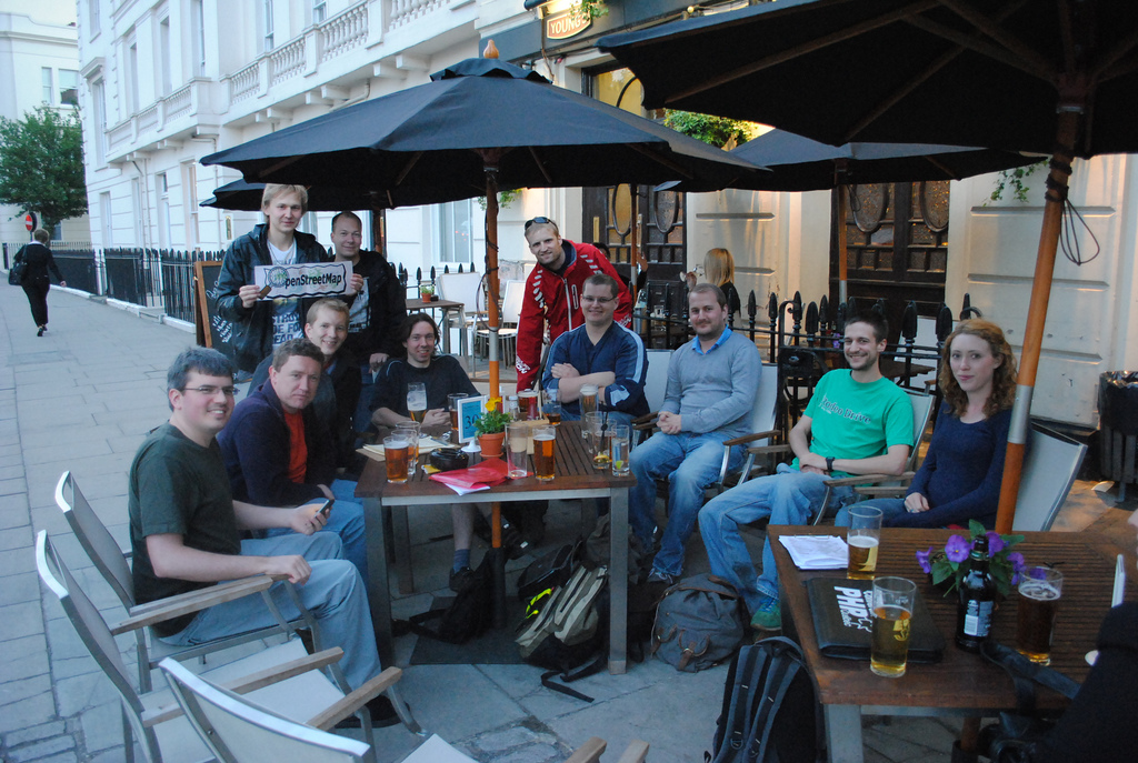
OpenStreetMap contributor Lübeck tests JOSM on a tablet touchscreen.
SotM-EU early bird pricing this week
Early bird booking for State of the Map Europe 2011 conference ends
15th May. Hurry up to catch a EUR 60,-*) ticket this week! Pricing
will be EUR 90,-*) afterwards.
* additional charge for paypal payment is applied
Emilie Laffray resignation
Emilie Laffray has resigned from her position as board member and treasurer of the OpenStreetMap Foundation. The board has accepted her resignation with regret and thanks Emilie for all of her work as member of the board.
The board appointed Oliver Kühn to the position of treasurer previously held by Emilie Laffray.
The OpenStreetMap Foundation board will continue with six members until the next board election.
Tile server upgrade
The OpenStreetMap server team has upgraded the tile server to render changes faster. Demand for OpenStreetMap tiles has increased steadily as the project grows. Recent increases in demand for tiles has lead to long waiting times for mappers who want to see the results of their improvements to the map.
Thanks go to Grant Slater, Jon Burgess, the Mapnik.org team, and many others who keep improving OpenStreetMap every day in ways large and small.
Read the announcement and hardware details on talk@.
Speedometer photo by Nathan E Photography is licensed CC-By
Directions (and correcting erroneous routing behavior) with OpenStreetMap
Many people are wondering how they can get directions with OpenStreetMap. Currently, there is no ‘directions feature’ on the website, OSM.org. However, there are methods to get directions based on OpenStreetMap data. Probably the most sophisticated web solution is open.mapquest.com.
You can enter a starting point and a destination, either as an address or POI. Alternatively, you can right-click on the map and select a location as a starting point, and a destination respectively. Directions can be optimised for cars, bicycles or pedestrians.
If you want to report a problem with the directions you can do this in MapDust.com or directly in open.mapquest.com. Also, if you want to work on routing problems, MapDust shows you all the reported problems and gives you the opportunity to adjust a route around a problem to see how the map redirects the engine functions around the problem in real-time. More information can be found in the wiki resource.
Update:
There are other tools that might be wortg trying e.g. http://maps.cloudmade.com/ or http://www.openrouteservice.org/
New Changeset display
The OpenStreetMap web site was updated today. When you view the history
tab, you’ll now see a map with bounding boxes shown for recent changesets in the area. Hovering over the changeset will highlight the bounding box, and vice-versa.
This improvement was coded by Mikel and refined by Mikel and TomH.
Project of the Week: Gyms and Dojos
May is sport and activity month. We’ll be adding various sport and
activity locations to the map. The Project of the Month: Sport fields continues through May. Each Project of
the Week during May will focus on another type of sport or activity
facility.
Gyms and Dojos
Gyms and dojos are similar in structure and purpose. Both tend to
include an open activity area for classes and exercise stations with
exercise equipment and free weights for strength and flexibility
training. While the activities and locations are very similar, a dojo
may distinguish itself with a focus on a particular martial art, or
group of martial arts.
The Project of the Week is to add local gyms and dojos to the map.
This is your Project of the Month. Make suggestions. Inspire other
mappers. What is it about contributing to OpenStreetMap that
interests you? Postboxes? Bowing alleys? Share your OpenStreetMap
interests by suggesting a Project of the Week or Project of the Month.
Gym photo by Neeta Lind is licensed CC-By
Weekly OSM Summary #16
April 17th, 2011 – May 3th, 2011
A summary of all the things happening in the OpenStreetMap world.
- The OSMF Strategy Working Group requested for collaboration for a review of the “Articles of Association“. And they tries to improve the OSM main site, every single one of you can help here! The first improvement was the rails port and an updated OSM logo.
- Several projects were accepted for the Google Summer of Code 2011. For OSM: khtml.maplib, OSRM, OSM Tile Server and for Marble: osm render for Marble, Marble goes Mobile and for Mapnik: Mapnik stylesheet, TextSymbolizers, Mapnik Windows build system.
- Frederik announced a new OSM Quick History Service. It shows all contributors of an OSM object.
- The iPhoneTracker used OSM-maps to display GPS-traces and thereby it caused some traffic at the OSM-Tile-Server.
- Pierre Béland developed a Tsunami JOSM Editor Menu/Presets and Map Paint Style
- WorldMap ALPHA is a new Open Source software for viewing and interpreting maps. You can read more in Henri’s blog.
- SimpleGeo announced that they will use open licensing for their places data.
- The UN Office for the Coordination of Humanitarian Affairs (UN-OCHA) seeking OSM volunteers for Libya
- The UN-Spider Program will host an expert meeting about the crisis-mapping at July 5th and 6th in Vienna.
- A new version of LinkedGeoData is online, read here the full announcement.
- “Various OSM Maps” can combine several OpenStreetMap Maps as overlays. Try it out here.
- A new map with SpeedCameras based on OSM is available.
Did we miss something? You can contact us via mail.
Early bird registration for State of the Map and FOSS4G closing soon
This is it folks! Only six weeks remain to grab early bird pricing on registration for State of the Map 2011.
Be sure to grab your price savvy tickets now before normal prices kick in.
And while you’re getting your State of the Map ticket, be sure to check out the FOSS4G (Free & Open Source Software for Geospatial) coming up the week following SotM. Plus stay for Denver’s Oktoberfest, sure to please the beer lover in all of us.
Flight and hotel discounts are still available with more information about Denver at the State of the Map website.
Count down to State of the Map: T – 18 weeks!
OpenStreetMap tile layer guidelines
The image above was inspired, in part, by Firefishy’s April Fools Day joke, OpenWhateverMap. While such a map is unlikely to be used for an ordinary application, it does serve to show the wide variety of renderings of OpenStreetMap data that are created by the OpenStreetMap community and displayed on the OpenStreetMap web site. It also serves as an illustration of one of the frequently asked questions about the OpenStreetMap.org web site.
How are maps added to the OpenStreetMap web site?
Until December 2005, the OpenStreetMap web site did not have a map shown at all.
Starting in December 2005, maps have appeared on the OpenStreetMap web site. Today, the slippy map
is the most prominent feature of the OpenStreetMap web page. Currently there are four rendering layers that can selected on the front page as well as one overlay layer.
The OpenStreetMap Foundation now has published guidelines for tile layers to be considered for inclusion on the OpenStreetMap web page. If you know of an interesting rendering of OSM data, and you think it should be considered as a Featured Layer, add your suggestion to the featured tiles score card and start the discussion.
The proposed layers will be evaluated for suitability by the Technical Working Group, periodically, and the tile layer that you recommend could be featured on the OpenStreetMap web site.