Free Web Mapping APIs and Mapstraction

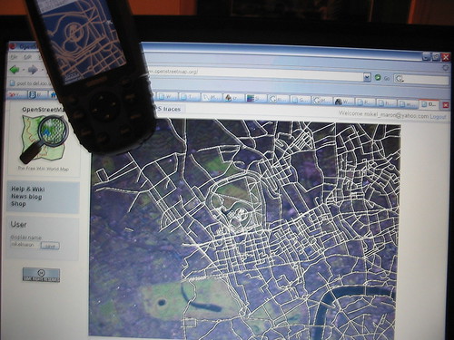
When I first got involved with OpenStreetMap, my aspiration was to make free maps to enable something like Wayfaring or Platial to be built. Even though those sites and many others are storming ahead without us and creating great services on top of Google’s Maps API, I still think it’s important for them to be able to access and build upon free geodata and avoid lock-in with commercial vendors. This is especially important for sites like Placeopedia that use Google Maps to geo-code things, because as Mikel Maron and Richard Fairhurst have pointed out (see the comments) it’s entirely possible that the map owners could claim ownership of the geodata they are creating.

With all that in mind, I took a look at what could be done to make it as easy as possible to switch mapping providers. In the short term, this would mean making it easy to flip between Google Maps, Yahoo Maps and Microsoft Virtual Earth in response to changes to T&Cs, introduction of ads, addition of better data etc. In the long term, a common javascript mapping API would mean that free offerings such as OpenStreetMap or Worldkit could quickly be adapted as drop-in replacements for commercial providers. I’ve been collecting my thoughts on this at Mapstraction.com/wiki based on discussions with Steve and Mikel, and there’s an illustration of how it might work here.

I’m not the only one thinking along these lines, of course. The Open Source Geospatial Foundation has a cross-project mailing list for people interested in similar issues, and numerous hacks and comparisons abound as people work out how similar but different the various mapping platforms are. Hackers everywhere have been murmuring about their dependence on Google for some time, and maps aren’t the first area where Google’s initial offering invites obvious commoditisation.

Looking at the common features of the mapping APIs, it’s clear that the bar is currently set quite low: it’s scrolling tile-based maps with map markers, folks. With tongue in cheek, Schuyler Erle refers to this as “red dot fever” (more context here, though I don’t know if that’s Schuyler’s writing or a like-minded collaborator). Numerous open source equivalents have emerged, but none has taken hold to my knowledge. This cements the general feeling among the responses to Tim O’Reilly’s open question about Google’s Mapping API dominance: Google Maps is actually very good, it was first to market, its maps look nicest, its terms and conditions are reasonable and as a developer it’s pretty easy to work with. It’s clear to us that OpenStreetMap has a lot of catching up to do, but it’s also become clear to me that Yahoo and Microsoft do too. I’m watching this space.

Tom Carden

Our first spam

Openstreetmap had its first spam yesterday from someone uploading a html file (a web page) as a GPX file (a GPS trace file). Being XML (similar format), it got parsed and uploaded with spam-like tags linking to the individuals business. The point being that google etc would crawl the pages and increase his page rank. It exposes the soft underbelly of openstreetmap’s policy of crossing bridges when we get to them – we’ve only had good bridges so far!

Podcast: Ed Parsons

One of the cool things about wordpress 2.0 is that you can drop an mp3 in to it and it magically becomes a podcast, including the RSS feed bits (so yes, you can subscribe to this feed in iTunes). I thought it would be useful to talk to people within openstreetmap and slightly further afield in the geo community as openstreetmap grows beyond everyone knowing each other. If you have a story to tell please get in touch, it’s likely I might ask to talk to you anyway 🙂 You can discuss this cast, and maybe help transcribe it if that’s useful here. The first cast is me speaking to Ed Parsons who is CTO of the OS and says some pretty interesting things, but has detractors. You can find the 21Mb mp3 here. Enjoy.

Now with pictures

An idea discussed by a few bright people like tom, mikel and ben is that of getting people to map as fallout from some other process like sharing their GPS traces. Or manipulating those traces, getting statistics or commenting/organising them. As tom calls it ‘the flickr of maps’, rather than ‘the wikipedia of maps’ which would be, from one angle, mapping for mappings sake. To this end I’ve been hacking away at nice sharing features for your GPX / GPS traces. You can have a look. RSS feeds, tags, descriptions and little pictures of your trace are now available. There’s some work left yet to be sure. It’s not super polished, but it is getting better and better.

OpenStreetMap SVG Output

80n's Weybridge Map

OpenStreetMap contributor Etienne Cherdlu (aka 80n) has been working on converting the OpenStreetMap API output into SVG using XSL tranforms. So far so good!

The projection on this example is only really suitable for Etienne’s area of interest, but this gives a good example of where we’ll be headed for the Isle of Wight workshop, and shows what is possible right now using OpenStreetMap tools and a little bit of hard work. Thanks Etienne!

freeourdata gets wings

The Guardian campaign has hit liftoff rather quickly with a site and blog. I wrote a response which turned in to a bit of commentary to the OSM mailing list:

FAQ entry:

‘Wouldn’t it be better to create an open-source database of geographic and other data?

Much though we admire the stoicism of the people at XXX, when you compare it to the Post Office’s thousands of postcodes – which it has to verify – and the Ordnance Survey’s billion-odd bits of data, which would cost perhaps £200m in taxes to keep updated to their present quality – that is, about £4 per taxpayer per year – you have to say that it makes more sense to free the existing data than to reinvent the wheel. It’s a very large wheel.’

This misses the point of what’s useful. We don’t have to have millions of postcodes to be useful. We don’t need to know where trees are to the milimeter to create a map that’s 99% useful. Even Ed was saying this, I think, when he was saying that what OSM is doing is not the same as what the OS is. To the best of my knowledge the OS leaves streetmap work to mastermap derivation by third parties. They do mastermap.

It also misses that OSM and FTP are collaborative efforts with social and innovative technological angles.

If the campaign is about money then as a friend said the other day, let an economist decide IP law. There is no ‘right way’ to do government IP policy. The US has public domain, we have crown copyright, others have others. public domain is not magically better, it’s worse in lots of ways than, say, viral licenses like CC. I’ll leave the BSD vs. GPL argument.

But again, some economists should decide the IP law. Not the rightsholders (the OS) or us as consumers because we’re equally biased. What’s the overall benefit to the UK economy? That’s the question.

Personally, having been involved in campaigns, I think it’s going to take *ages* to have any effect. This will stir up a hornets nest. The OS may be big and evil, but as people said on Ed’s blog (I think): the treasury isn’t going to pay for this. They’ll privatise the OS if anything. Then what? Then we’re all suddenly competing with someone who has all the data, most of the expertise, and no need to play nice. Because I think at the moment they _do_ play nice with some people, compared to their options should they be privatised.

This is not an argument that the debate is pointless or that the ‘campaign’ should not be supported, but that we should be careful what we wish for. Oh, and that we shouldn’t dismiss the people at XXX.

So personally, I’d avoid polarising this issue about public domain vs. crown copyright. My personal judgment is that I will have more effect on the availability of free mapping data by working on and promoting OSM than lobbying europarl or within Westminster.

OpenStreetMap is way bigger than me though. I could spend time lobbying. What does everyone think? Are these seperate parallel inititives or more closely intertwined?