Ed Parsons (Geospatial Technologist EMEA, Google) to keynote at SOTM07

The OpenStreetMap Foundation are pleased to announce that Ed Parsons will be delivering the Keynote presentation at the State of the Map 2007, on Sunday 15th July 2007. Ed is a well known and respected figure in the geospatial community, whose long-term interest in OpenStreetMap is know to many. In his new position as Google’s Geospatial Technologist for Europe, Middle East and Africa, Ed is in a unique position to talk about OpenGeoData. His talk is titled “The Cathedral and the GPS – a personal view” and promises to be a highlight of the action packed SOTM07 weekend.

If you still haven’t registered, visit this page.

Holland is 5% done

The Dutch Statistics department calculated that there is 141,251 km of road in the Netherlands. In the OSM database 6,833 km are accounted for. That is almost 5%!

From the big cities, the following is done:
1. The Hague: 545 km
2. Amsterdam: 403 km
3. Utrecht: 313 km

Rotterdam is almost white space. It needs another 2,100 km! You can help this weekend!

The top 10:

1. Nuenen, Gerwen en Nederwetten 46.8%
2. Heiloo 45.8%
3. ‘s-Gravenhage 43.5%
4. Leidschendam-Voorburg 38.8%
5. Schermer 32.9%
6. Delft 29.2%
7. Utrecht 27.0%
8. Boxtel 26.8%
9. Waterland 24.4%
10. Bussum 23.9%

We are almost done in Bennebroek: only 21 km to do! (of a total of 21 km).

OSM Weekly Review – Mooses on Rails

The talk of the town this week has been the long awaited Ruby on Rails port. A developer’s meeting in Oxford on Saturday gave the opportunity to finish off some loose ends in the existing Rails code, integrate Potlatch, as well as experimenting with PostGIS. Version 0.1 of OpenStreetMap was written in Java, then re-written in Ruby and over the last 6 months all the server code has been ported to Ruby on Rails. The good news is that the new site has been deployed and is running. There have been some teething problems, so if the site is unavailable when you take a look (if you get a 500 error), come back in half an hour or so. Because the way that the API works in 0.4 is slightly different from 0.3, applications that use OSM will have to be updated. To use OSM 0.4 with JOSM, you’ll have to download a new version from the JOSM homepage. Other apps like Tiles@Home and the Applet are being updated and users should check their wiki pages for updates. There’s going to be an OpenGeoData post dedicated to the Rails Port later on this week – so stay tuned.

Anyone who reads OSM-Dev or OSM-Talk will have experience the "we should use PostGIS" scenario. The familiar story has taken a new twist with Robert Monro, Schuyler Earle and others working on bringing the benefits of PostGIS to the OSM Rails port. PostGIS is a spatial database – a sort of swiss-army knife for all things geospatial. It can suck in numerous formats of spatial data, and speeds up spatial queries like "what is next to here?" or "what is inside this box?". A major problem with using PostGIS has been its lack of support of Topology. Topology is about connectedness – what connects to what and what, what side of A is B on – and OSM’s database is topologically constructed, which has limited the usefulness of tools like PostGIS. By writing customised functions for PostGIS, SDE and Robert Monro hope to get around the problems with PostGIS whilst maintaining OSM’s data model. There is more information here and source code here.

Devout countryside man, Nick Whitelegg, brought this post to the attention of the mailing list. It seems that a lot of walkers don’t see the value of OSM and have a "if its not complete I don’t want to know" attitude – something that rings true of a lot of people that OSM users encounter. Mikel makes a good point that the continued mapping of the countryside by the OS is currently far from guaranteed. If walkers want up-to-date maps they are either going to have to pay a lot more for them, or get them from other sources. If you are a walker or countryside user, take a look at Free-Map, which provides editable maps optimised for countryside users, based on OpenStreetMap data.

A rainy bank-holiday weekend in the UK isn’t great news for most people. For OSM users it meant one cool new tool and one interesting use of a wiki page. The cool new app is David Earl’s name search, which runs off OSM data. The search algorithm is impressive, to say the least. Try searching for your local pub – actually that’s a bit easy – try putting the tool to the test. Prizes for the most bizarre, correctly returned search posted to the comments of this post.

Are you the Moose? Take the OSM Purity Test and find out.

By Nick Black

Week 16 on OSM – From Essen to Blue Seas and Bicycles

Its been a little while… Holidays and all that, but at least a tiny bit of Portugal is now mapped, and I’ve found out conclusively that my kids don’t find it amusing anymore to drive twice round a roundabout!

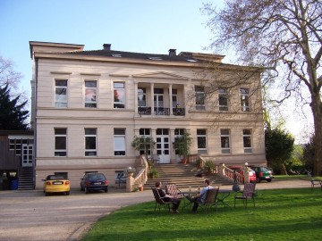
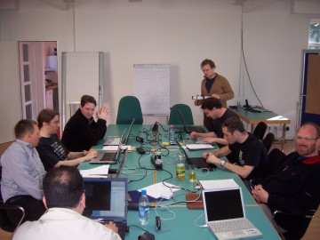
The Essen developers Workshop has been and gone (it has been a while!). A great weekend by the sound of it – pick up the results here – and if you wondered what happened to the code in subversion, a big restructuring (for the better!) happened. The code’s still there, but more logically laid out. It will be interesting to see what will come out of the UK workshop in Oxford next weekend.

Its been a good week for the osmarender layer on coastlines, again brought up at the Essen workshop. The threads Blue sea tiles, speckled oceans, & too much blue give an indication. So, thanks to Frederick’s work on a pre-processor to handle colouring of coastline tiles the coast is looking rather spiffing. Its great that (I guess) everyone who lives near the coast or had an interest in a bit of coastline made sure the coastline ways were fixed for their area (I know I did!). In fact its been such a good week for osmarender that there was a suggestion to create a separate osmarender-dev mailing list for it!

With a nod to Shakespeare, the thread titled: Users, contributors and developers, (… I come to bury columns; not to praise them) is worth a read in that it covers some of the ethos of OSM and how the simple approach to mapping is working very well. It then goes on to discuss the idea of a ‘third column’ to give namespaces to attributes that was brought up at the Essen workshop.

Watch out for The Rails Port of the server/API coming to a machine near you real soon! Announced by Nick Black on dev. This is going to have a big impact on OSM pretty quickly as its going to make it much easier for the devvers to tinker quickly in a safe environment.


Everyone loves animations!?! Dave has been making snapshots of progress on London over the last 6 months. You’ll have to follow the link to go to the animation.

Placenames disappearing! Its been discussed for a while, but David Earl noticed as you zoom in the slippy map that different names appear and disappear. Its a general problem with what to render at different levels, but it is an interesting discussion on what should be rendered at what level, and what should be considered important for rendering.

Languages for streetnames… The thread on Bilingual street names is a useful discussion on how to tag streets where there are two languages spoken, particularly where in some regions one of the languages is rarely used (we are talking parts of Wales here). Surprised there were no comments about Canada….

If you are one of the out-on-the road mapping types its frustrating to have to stop/start to make notes of a road, the streetname or whatever, so if you have a PDA running windows mobile, you might want to look at the thread on Audio mapping with a PDA and the wiki page that came out of it here.

Maplint I guess is the first really specialised map, but dare I say it, rather geeky! But – hey – that’s what its all about – very specific maps for specific purposes. Now with better cycle-specific tagging being discussed at Cycle route planning using OSM we will soon be getting really personal maps for cyclists. This is what OSM is all about, really personal maps.

And finally, if you want to spread the word on OSM look no further than Andrew’s question on presentation materials – its all there, including a lovely map by Steve Chilton. So there are no excuses now – go forth and promote!

by Barry Crabtree.

Essen

Lots of developers at the linuxhotel in Essen, Germany for the developer weekend.


Right now it’s Saturday morning and we’re making a quick mind map of people and interests.

More as the weekend continues… I didn’t get round to updating this what with lack of connectivity these past few days so have a look at the results page

OpenStreetMap – Weekly Review

Lint is a tool that checks for errors in C code, taking its name from fuzzy fluff that accumulates around us, getting in our way and making us sneeze. Map’s have lint too; misplled tgs, orphan segments and untagged ways all cause problems when people want to use OSM’s data. Maplint does for OSM data what Lint does for C code, it looks at an OSM XML file and generates an error report, which can then be rendered by OSMarender, giving visual clues to the location of rogue data:


The Maplint Layer In InformationFreeway.org

With the extension of the Tiles@Home server to support multiple layers, Maplint reports can now be viewed at InformationFreeway.org. There’s also a plugin for JOSM – JosmLint – that will highlight potential errors whilst you are editing a map, which can be downloaded from here.

Wii have an interesting approach to mapping underground networks developing on the dev mailing list. GPS units are pretty lame underground, and there haven’t been many volunteers to survey the Blackwall Tunnel on foot. A solution being discussed at the moment is to use accelerometers to detect motion and produce a map, specifically the motion sensors that are integrated into the handset of the Nintendo Wii console. The handsets also have integrated Bluetooth, meaning that they could communicate with another device that is connected to a GPS, and through the use of a process like Kalman Filtering, could produce usable results. This is very much a theoretical discussion at the moment – but highlights the inventiveness and resourcefulness of the OSM community. Read more here.

Nick Whitelegg has produced a browser-based editor for OSM data using the new vector support features of OpenLayers. The modest developer begins his mailing list post, “Not that the world needs yet another OpenStreetMap editor…”, if this is what you are thiking, think again. This is the first time that we have had a browser-based tool that can edit OSM-data without requiring the installation of additional plugins, like Java or Flash. OpenLayers is built entirely upon open source Javascript libraries, with the vector editor making use of SVG to render the data. Having another opensource editor on the OSM horizon is bound to accelerate the pace of development of the other editors. OpenLayers developer, Chris Schmidt says that he had planned to start working on an OSM editor in the next few weeks. Its going to be great to see what further collaboration between OpenLayers and OSM can bring.

If you want to get hold of raw OSM data to play with, you probably want to get hold of a Plant dump – a weekly snapshot of the OSM database. As the data in OSM grows in size, planet.osm also grows. The last planet.osm was 3.5GB when decompressed – thats a whole load of XML that has to be shipped around the place each week. Jon Burgess has produced a set of tools that produce a diff – a file that contains information about changes to the dataset, so all you have to do is apply the diff to your existing OSM data to have the latest version. Very nice work.

And finally, just when you think you have the whole tagging thing nailed down, something like this happens:

Read more about tagging streets like this one here

By Nick Black