Today, the 100 millionth changeset was uploaded to OpenStreetMap. This milestone represents the collective contribution of nearly 1 billion features globally in the past 16+ years, by a diverse community of over 1.5 million mappers.
The result is the largest free and open map dataset in the world, providing critical infrastructure for understanding our planet and running our society.
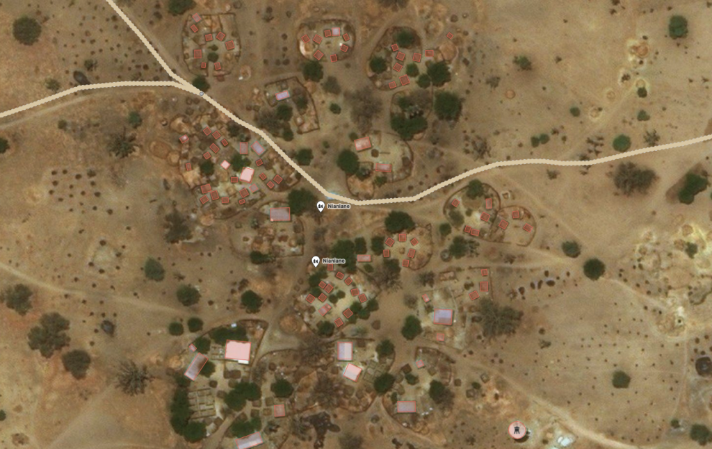
Changeset number 100,000,000 was uploaded by userLamine Ndiaye. They added buildings in Nianiane, Sénégal. Look out for an interview with this mapper in an upcoming edition of WeeklyOSM.
100 million times a mapper has chosen to share their knowledge of the world with everyone. 100 million thanks of appreciation. And our mapping is growing and accelerating. Changeset 90 million was only about 6 months ago.
Will you join us as we make the next 100 million contributions? Get started now!
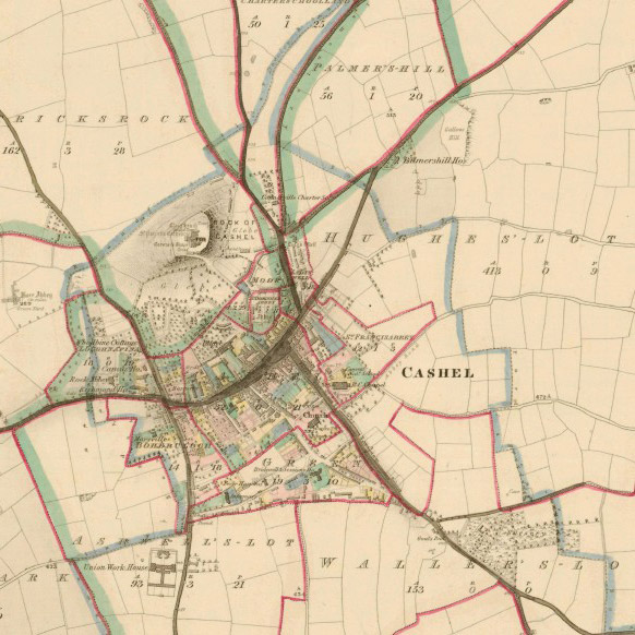
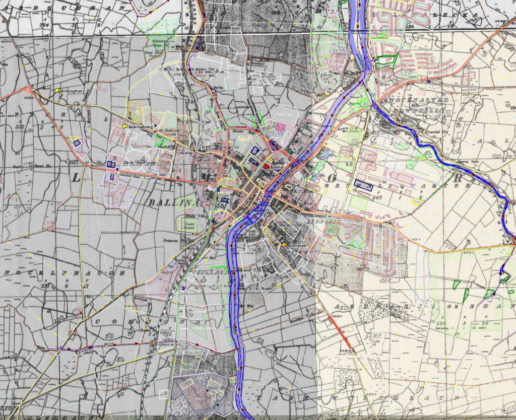
The Blewitt clan of Ireland is proud that one of their kin, Joe Biden, was elected the next President of the United States. His Irish roots are well known on both sides of the Atlantic. Before Biden’s great-great-great-grandfather Edward Blewitt moved his family to America to escape the Irish Famine, Edward and his brother James were surveyors whose work shaped Irish maps and municipalities, supported livelihoods, and has even been used in OpenStreetMap today.
Edward and James worked on two foundational Irish mapping projects in the 1830s–40s, the Ordnance Survey and the Griffith’s Valuation. In 1838, James corrected an error in the Ordnance survey’s calculation system that had been missed by many of the brightest mathematical minds of the day in Ireland and Britain. In the late 1840s, Edward managed public works programs that built roads, improved farming through drainage, and gave work to people suffering through the Potato Famine.
OpenStreetMap’s freeform tagging scheme allows people to map what’s important to them. And people are mapping the historical and heritage features they care about. You can explore OpenStreetMap’s coverage of historical features on interactive maps on the HistOSM and Historical Objects websites. If you want to use OpenStreetMap data like this, it’s all available to everyone. If you see something missing, please open up your favourite OpenStreetMap editor and fix the map!
OpenStreetMap is becoming the de facto source of map data for many services and organisations, so we can help preserve our shared human heritage for years to come. Who knows, in 150 years, maybe OpenStreetMap data you enter today will be useful to someone?
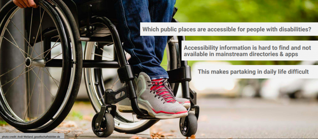
The International Day of Persons with Disabilities is observed every December 3rd, and OpenStreetMap marks this day by saying “Our aim is to be the best world map for accessibility”. OpenStreetMap has long been a resource to map and share open data on features related to disabilities.
We asked community members gathered on the accessibility mailing list about why and how OpenStreetMap is so useful.
Jean-Marie Favreau of the Université Clermont Auvergne explained…
The strength of OpenStreetMap is that it allows anyone to contribute accessibility data, whether they are local authorities, user associations, or individual contributors. Being a global project, it facilitates the sharing of observations and learnings of how the equipment, habits and practices of accessibility vary in different coutnries. Finally, the data is in a commons and managed by a community, so it more accurately reflects the reality of the territories it maps.
Nick Bolton of the University of Washington adds…
When people with disabilities seek out map information, they find that accessibility information is missing or doesn’t account for their personal preferences; neither companies nor government agencies are consistently creating connected pedestrian map data flexible enough to meet the diversity of pedestrian concerns expressed by people with disabilities. OpenStreetMap is well-suited to fill this informational gap as it has a flexible and democratically extensible data model, can be mapped out by locals without waiting for an agency or company to dedicate resources or take on liabilities, and all data is immediately published and examined by the public.
We are so glad OpenStreetMap fulfills this need. Read on to learn about applications for persons with disabilities, and ways to contribute to the map.
Apps for accessibility
There are many applications and research projects for persons with disabilities that use OpenStreetMap for collecting and sharing accessibility data, and for communicating that data in appropriate ways.
Data on sidewalks is critical to accessible navigation. OpenSidewalks focuses on developing tagging schemes and tools for collecting accessibility data of sidewalks, and its sister project AccessMap creates individualized accessible routing plans for people with mobility impairments. Both are projects of the Taskar Center at the University of Washington. This approach has been picked up by the Italian OpenStreetMap community in Padova and Milan, with people with disabilities, high school students, and other new mappers contributing.
And then there is navigating indoors. AccessbileMaps is a project of the Technische Universität Dresden in cooperation with the Karlsruher Institut für Technologie and focuses on indoor accessibility. They develop tools for mapping buildings with the Simple Indoor Tagging scheme, especially accessibility information, and produce applications using indoor data from OSM for blind, visually impaired and mobility impaired people to plan trips.
Then this data needs to be used in appropriate ways, and the creativity and innovation is inspiring.
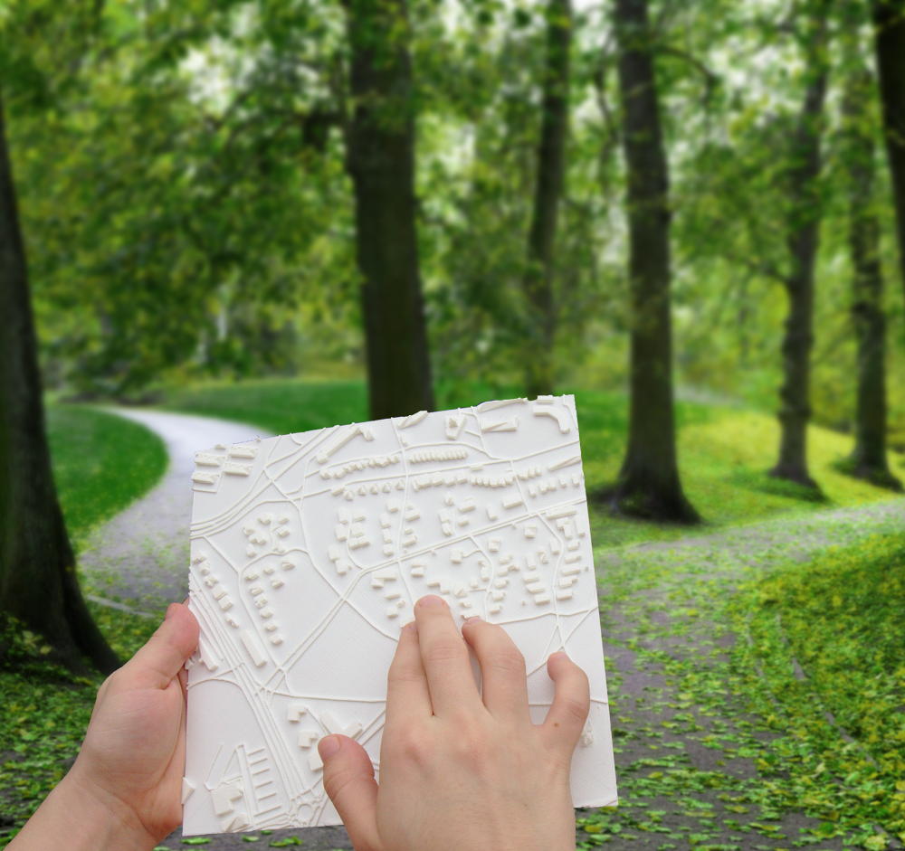
Tactile maps help people who are blind or partially sighted navigate their surroundings. Touch Mapper uses 3D printing to create tactile maps from OSM data.
Soundscape from Microsoft Research helps users with visual disabilities to create better mental maps of their surroundings for navigation. Using audio to describe places, they can naturally and intuitively explore more and feel more comfortable and connected in new environments. The app is built on OpenStreetMap data.
Compas research project at the University Clermont Auvergne develop ACTIVmap in partnership with other academic and private sector researchers to build multimodal maps leveraging tactile, sound and haptic feedback to represent and interact with geographic information.
How can you help?
You can of course also add disability-related tags with regular OpenStreetMap editors like JOSM and iD, and mobile apps like Vespucci, StreetComplete, OsmAND, and Go Map!!
Traffic signals with sound (traffic_signals:sound=yes/no)
Accessibility information for steps, such as the presence of handrails (handrail:left/right/center=yes/no), the number of steps (step_count=*) as well as whether there is a ramp (ramp=yes/no) and which kind
Wheelchair accessibility at shops and other amenities (wheelchair=yes/limited/no) as well as bathrooms (toilets:wheelchair=yes/no)
There are many other ways to help, documented on the wiki as well. For example, promote OpenStreetMap with friends who have a disability, and ask them how else OSM can help. You could organize a mapping party focused on mapping these kinds of features. Translate our wiki pages on disabilities to other languages. Or build new routing and rendering applications for people with disabilities.
OSM’s freeform tagging system is always evolving, if there’s something you think should be mapped in OSM, but isn’t, you can help guide that process to wider adoption.
When we get together for State of the Map, there is so much to do… in-person.
On Friday, Saturday and Sunday of State of the Map, we will have several spaces for Birds of a Feather (BoFs). BOFs are informal meetings, planned ahead or thought up spontaneously. These can be gathering points for discussions, mapping, code and documentation sprints, and hacking sessions. They can even be organized rest and napping sessions! These meeting are whatever you want and whatever you need to make a successful State of the Map.
The Birds of Feather sessions will take place in the Foyer and “Building D” classrooms, adjacent to the main conference hall. We will have a sign up board prominently in the main area to schedule sessions and add ideas.
And all day Sunday, we have Free and Open Space in Nelson Mandela Hall! Collaborate together on coding, mapping, or documentation sprints. Plan the next big thing. Unlike a Birds of a Feather session this is a non-bookable room; let’s make it a hive of activity open to all.
As if your 8am to 6pm State of the Map schedule was not social enough, we are packing your Saturday night with an officially sponsored State of the Map social event. And it will definitely be an event worth remembering as we convene both in silo and in style at the Brussels Event Brewery. Named after the huge tanks (‘silos’) of the former brewery, this multi functional industrial area will be home base for Belgian beers (aka drink), Belgian food (aka frites) and maybe a Belgian waffle or two.
Come join us after the social presentations close on Saturday, September 24th for the official State of the Map 2016 social event! The details for your fast recall:
Today we’re sharing the programme of upcoming talks at State of the Map 2016 with you!
Over the last few weeks the State of the Map team have been hard at work reviewing your session proposals. We’ve translated, we’ve read, we’ve scored, we’ve filtered, we’ve talked, we’ve listened, we’ve tweaked and we’ve debated! But most of all we’ve thoroughly enjoyed learning about your exciting OpenStreetMap projects. And we’d especially like to thank you for your input via the community survey, important input to the process.
It’s been a big challenge getting to this step. We’ve picked out the best talks but with a limit of just 44, this meant some difficult decisions had to be made. We hope you enjoy the programme of talks – to join us in Brussels don’t forget to purchase your ticket and book your accommodation.
And will soon be adding the Sunday workshops, and lightning talks. There will definitely be space for you to set up informal discussion groups (“birds of a feather” session) during the event.
Community voting for State of the Map 2016 is now OPEN! Inspired by the community that makes OSM a reality we want you (!!) to inform the conference program.
Community voting means you now have a say in the talks that mark this historic conference. To participate in the vote, please head over to the survey site.
After you click the link, we will ask you to prove you’re not a robot. You can provide us with your OSM username to help us with spam detection. You’ll then get a huge page of talks to rate, sorted at random. Feel free to rate as many as you like. Just don’t leave the page open for too long, as your session might time out. When you’re tired of it, just scroll down, hit Next until you can Submit your answers.
This is a breakdown of what it all means:
Voting will be open until June 10. We want to hear from the community but also know your privacy is paramount. Your vote can be anonymous if you wish, and will always be confidential.
You matter in the creation of OpenStreetMap and we want your voice to be heard in the creation of its conference. So vote!
The open source survey tool is kindly hosted by Made4it (http://www.made4it.be/), a Belgian data analysis and market research company.
Some secondary services like the wiki may be affected by maintenance this weekend. Following this weekend, OpenStreetMap users may experience some slow uploads due to continued tuning after our recent database move.
On Monday May 9, our Operation Team smoothly moved the master OSM database server to Bytemark hosting, from Imperial College. Setting up multiple data center redundancy avoided further downtime due to planned power testing and maintenance at the Imperial data centre.
Over the weekend, we are switching some additional services to Bytemark, due to that power maintenance at Imperial. Primary OSM services will be operational, but the Wiki will be in read-only mode during this time. The slow uploads are a known issue, and are being addressed following the maintenance this weekend. More details on the talk mailing list.