Last weekend in Seattle, the OSM Foundation Board met “face-to-face”. We get together because no matter how much you try otherwise, there’s way more done in person in a couple intensive days. It cost about 4 or 5k USD this time, and it’s worth the cost. But, I think we’ve always done a terrible job explaining what happens at the Board meetings, and a middling job following up, and those two things are totally related.
I want this meeting to be different. It must be different. This is my fifth year on the Board and final year on the Board (I was elected again this year, but will stand down at the next AGM), and to me, and the entire Board, this is a crucial year for OSM. The face-to-face was the most productive yet, and the most difficult yet. I’m very satisfied. In year’s past, the minutes get published, and various announcements go out through working groups, and that will happen. But it’s insufficient, maybe distilling too far the atmosphere and the messiness of these get togethers.
The Stage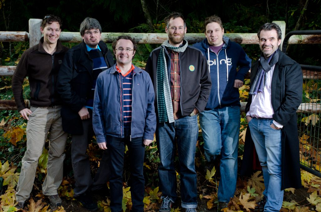
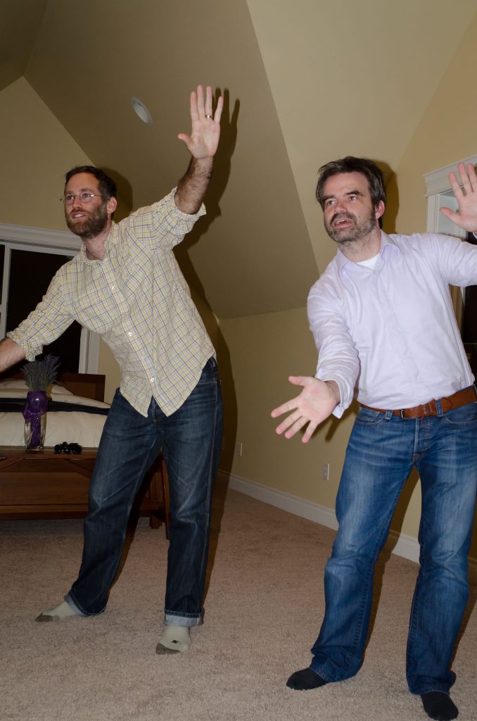
Steve is based in Redmond, and expecting a child any day, so he offered to host and avoid travel. I wasn’t far, relatively, in Chicago. The rest of the Board (excepting RichardF who couldn’t make it) flew in from Europe. I found a cabin near a lake on airbnb, quiet, cosy, and cheap. Henk hired a car, and drove everyone around. We had a meetup Friday night, made some burritos and played Kinect at Steve and Hurricane’s place (and tried to forget we watched Crank 2), and enjoyed the Seattle sunshine (no joke). Sunday Hurricane gave us horse riding lessons!
A regular vacation! Except for the part where we spent 18 hours of our weekend discussing/arguing about OSM in windowless meeting rooms at Microsoft (which we very much appreciate btw!). And the rest of the weekend continuing to talk about it, or even dream about it. Being on the Board is a sacrifice of time, because we all feel deeply responsible to the project and our position.
Presentations
The Board meeting proper started with presentations by Steve and Oliver. Steve hit many of the same themes from his SOTM and SOTM-EU talks, except he left out all the stuff about how awesome OSM is doing. We looked and discussed several graphs of recent statistics. OSM’s growth to date has been beyond imagination, but there’s no shortage of projects that changed the world and then met reality, hard. Looking at some of these, the factors in decline included insular community, lack of direction, and no innovation. That’s what we have to avoid.
Oliver made the point that “We are the Board! Shape the project!”. The Board, and the Foundation, needs to be a functional team, with clear goals and activities, all within the limited volunteer time we have to contribute. Fact at this point is, the Foundation doesn’t have clear objectives, beyond the mission to support but not control the OSM project. To meet goals, we can take action, we can guide and steer, we can spend money. At the end of workshop, there should be a target that guides all our activities towards achievement. Some of the slides were beyond funny management clip art (a guy looking forlorn into the mirror, facing reality) but the point was important. “We are the Board! Shape the project!”
At this point, I thought it would be useful to look at some of the management lessons and differences from HOT. While we are by no means perfect, I do feel there’s good alignment between the organizational side of HOT and the community, largely the same community as OSM. Contrast to OSMF, HOT is very focused in what it does, with clear guidance and priorities and steering. We aren’t afraid of spending money when it’s necessary. We value marketing by the organization (though could be better). There are clear technical needs, and we pay for it. There’s a key attention to the consumption side of map data collection, seeking strategic partnerships with other organizations. We’ve been selective and directive with responsibility, and when necessary, have taken it away. We try to be as transparent as possible, publishing very detailed board minutes.
Goals
We took Oliver’s point and started strategic planning.
OSMF Board meeting traditionally use a simple technique to come to consensus on a topic, whether it’s the agenda of the meeting, or in the case of Seattle, the objectives and activities of the OSMF this year. We brainstorm all our choices on the subject, write them on the whiteboard. Each person gets some number of votes, say 5, and distributes them among the topics. If topics can be grouped together, their count is added together. There’s discussion about the meaning of terms, sometimes a lot of discussion. Iteration to insure that we all have a common understanding. At the end, there’s a list of priorities. I always squirm in this process, because somehow I don’t believe it can work, but inevitably does a pretty good job, and if we need to override, we’re not strict about the methodology.
In less than an hour, we had these goals for 2012.
The World’s Most Used Map OSM is clearly the world’s most used open map, and most open map, and the best map. We want as many people of possible contributing and using OSM, and to do that, the experience of using OSM needs to improve, and where you use OSM can improve.
More Than Just Streets Do you know everything OSM is capable of mapping? Does your neighbor? Does your mayor? OSM is relatively well known in some circles, but it’s full potentially is still opaque to many. We want everyone to know what OSM is about.
Cultivating Leadership of Mappers. Shared Goals Between the Community & OSMF Mapping is driven by mappers, with a clear goal (make the map!), and there’s every reason that with clear goals and empowered members, the OSMF can act strongly. We now have clear goals, and clear expectations of what the management team and working groups can do and achieve, without much prescription on how things happen. This all frees the Board to provide the direction, and the management team and working groups to make the operational decisions.
Easier Contribution for Non-Geeks We debated how this differed from the Most Used Map, and decided it was important enough focus to stand on its own. Usability is certainly related, but more broadly, there’s much to do to improve all kinds of involvement in OSM.
And Again
The bulk of our time was spent translating these goals into actions, and this really was the most difficult part. Some things were quick to decide, like the final switch over to ODbL, but others became very drawn out and very detailed, like the process for site redesign. We touched on every standing issue, and aligned clearly to the goals. PR, list moderation, license change, the management team, working group budgets, SOTM, PR, site redesign, the articles of association.
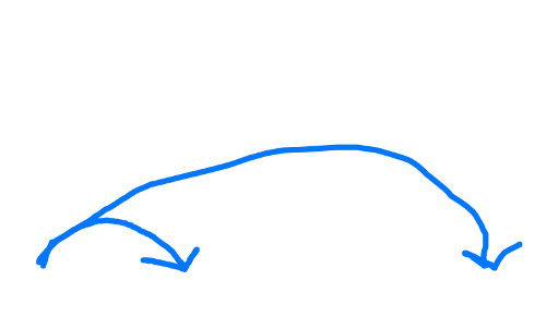
We all agreed that short term action was needed on almost everything, with mind to how things should play out in the longer term. This meant drawing the above diagram, a lot, to remind ourselves of the urgency. We set big, audacious goals for all parts of the Foundation, with clear deadlines.
With so much on the table, we decided to stay in the room until we had decided on everything, which ended up meaning staying hours late, til there was little sunshine outside (or metaphorically sunshine inside the room) and tension rising. At one point, I was so fed up, I almost walked out, really seeing that if we didn’t resolve the issue at the Board, it wouldn’t resolve in the Foundation and the project, the goals wouldn’t be met, and decline was inevitable. And for me personally, that would mean a slow turning away from a project ingrained in almost everything I do in the world. We had to push through.
And we did. Despite looking over the brink, we had resolve. I felt tense, but knew I’d be happy with what we accomplished.
And after it was all done, we had some beers. The next day we rode horses. Group hug.
Thanks to the 2012 Board. This is going to be the year.
And thanks for Oliver for the photos!
cross-posted from Brain Off