Redactions progressing well

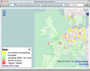
In the past week the redaction bot has progressed well. After the intial Ireland test, it has proccessed the UK and is now finishing off the ‘Western Europe’ area. Spain, and Italy are fully proccessed, France is very nearly complete, and the bot is (at time of writing) getting to work on some densely mapped regions such Germany and the Netherlands. You can see its progress on the redaction bot progress map

As you’ll see, the internal checks of the bot and the API occasionally throw up errors which cause a region (1 degree square) not to be fully processed. The developers working on the bot managed to track some of these failures down to specific bugs, meanwhile others are caused by temporary glitches in the API. The bot has been re-run in several areas for this reason.

You’ll also notice many yellow “current” regions being processed. These are parallel instances of the bot processing code. Although we’re not really in a hurry, we have a big dataset to get through. Running in parallel like this is proving to be a little faster.

There is still time to perform remapping ahead of the bot reaching your part of the world, though you may wish to refrain from editing in a region where the bot is actually runnning, to avoid any unnecessary complications. If you’re in a green area there is now a new kind of remapping to do. This is easier and clearer in many ways. Head out and remap those patches where the bot has redacted data.

Remember the license has not changed yet. Even in areas where processing is complete and redactions have been made, the license remains the same until we declare otherwise.

Follow the rebuild mailing list for more details and discussion.
Building a friendly editor for OpenStreetMap in JavaScript

It’s been an amazing year for OpenStreetMap and it continues to get better. New users from Foursquare to Apple to Wikipedia to Esri, TV and press coverage around the world, innovative releases from MapBox, MySociety, Skobbler, Stamen, and a thousand others. More people are using OSM data than ever before.

More people are adding to it, too. Our data has grown by 43% in just one year. Most of this is added with two tools: JOSM, the offline editor (Java), and Potlatch, the online one (Flash). Launched in 2006 and 2007 respectively, they’re mature, stable, and enjoyed by thousands of users – the tools that have built the best map of the world.

But how do we harness the knowledge of millions of casual users who are now seeing a ‘Data by OpenStreetMap’ credit for the first time? How do we get people editing on the move, using phones and tablets that can’t run Flash or Java? Can we build something that doesn’t have the power of JOSM or Potlatch, yet is easier for the first-time user to grasp?

Hell yes!

Id_prototype

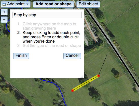
iD is a new project to build a simple, friendly editor for OpenStreetMap – an editor designed entirely for the first-timer to quickly add their street or their local cafe. It’s not a new Potlatch or a new JOSM: it’s ‘an editor for the rest of us’, a stepping stone into OSM.

It’s written in JavaScript: things that required a plugin just a few years ago, modern browsers can do natively, and fast. And with powerful frameworks that even out the differences between browsers, JavaScript can be a joy to program in.

Development is at its really early stages. It doesn’t do much yet: no tagging, no save. It’s not very pretty. That’s where you come in. OSM needs the best, most intuitive map editor there is, and you can help. Coder? Designer? UX specialist? Get involved.

You can read the project introduction, fork the code on github, and read the live docs. Check out the code, play to your heart’s content – tear it up and make it drastically different if you want – and let’s build something to take the OSM editing experience up another notch.

New OpenStreetMap maps website with state-of-the art features by skobbler

Iegidhgg

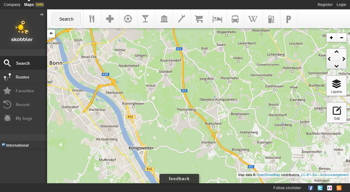
OpenStreetMap is the best map when it comes to attention to detail. However, the experience of the map sometimes lags behind when compared to commercial implementation of the web-based maps. skobbler made an attempt at a new web-based map powered by OpenStreetMap: http://maps.skobbler.com.

There are some innovative features that were always missing with other solutions:

  • Auto-positioning via HTML5 browser positioning in Firefox and Chrome (if the user allows it)
  • Internationalised style in Germany and the US (coming to many more countries)
  • Drag & Drop Route calculation (just move the pins where routes should be calculated)
  • Multi-line address search
  • POI layers

Performance is very effective due to use of:

  • Modern and Fast map JavaScript Engine based on Leaflet
  • High-performance map tile loading due to worldwide big chunks of pre-rendered tiles (not only in the US)

Furthermore, there is a new map style with a good compromise of details and clarity. The address search for route calculations is temporarily based on a 3rd party geocoder (in default mode), but allows a single line address entry and very effective address coverage. 

Give it a try: http://maps.skobbler.com

Licence redaction ready to begin

Hello all,

I’m pleased to announce that the licence change bot is ready to get underway.

Starting this week, we will be ‘redacting’ the contributions (less than 1%) from the live database that are not compatible with the new Contributor Terms and Open Database Licence (ODbL) – in other words, they will no longer be accessible. We are expecting to begin on Wednesday (11th July) assuming a couple of final setup details are completed by then.

The bot will run in the following order:

  1. Ireland
  2. UK
  3. Western Europe
  4. North America
  5. Australia
  6. rest of the world

Once it is complete, we will be ready to distribute data under the ODbL and we’ll advise of that with a separate announcement. The final pre-redaction dataset available under CC-BY-SA has now been generated at http://planet.openstreetmap.org/planet-120704.osm.bz2 . Where data has been redacted, any attempt to access it from the API or the site’s ‘browse’ pages will return a response to that effect.

Test runs have shown that the bot is functioning as we want it to, but we will of course be monitoring its progress. We are currently expecting it to take in the order of one month to complete; given the many variables I’m afraid we can’t give a more precise steer yet, but we’ll aim to keep everyone updated as it runs (via the announce@ and talk@ lists).

There will be no API outage and no other interruption to editing. When the bot is running in your area, please do save your edits frequently to minimise the likelihood of conflict.

(Separate messages are going to talk-ie@ and talk-gb@ as the first two areas to be affected. Please do forward and translate this for your local mailing lists.)

As you know we were expecting this to start just after 1st April and the complexity of the task incurred the delay. Thank you all very much for your patience in waiting for it to get underway. Thank you especially to those who have contributed to the code, whether by patches, suggestions or just helping to firm up the workings.

Posted to the mailing list by Richard for the OSMF board

Weekly OSM Summary #46

June 18th, 2012 – July 2nd, 2012

A summary of all the things happening in the OpenStreetMap (OSM) world.

  • 165 terabyte of new aerial imagery has been released by Microsoft/Bing. You can read their announcement here. You can also find some more general information in our wiki.
  • Flickr increased their implementation of OSM map tiles for a few cites. Read the full blog post here. Their map styles are available at github.
  • The “Pirate Map” is a new special mapstyle provided by MapBox and created by AJ Ashton.
  • The “Swiss OSM Association” was founded during the GEOsummits 2012 in Bern.
  • The OSM Mapping project „Via Alpina 2012” has been traveling for 18 days now. They created a blog and a hiking map to keep everyone posted.
  • The Android App “KeypadMapper”, which can be used to recording addresses, has been updated. Check out the wiki page.
  • The new version 2.12 of Openlayers has been announced. Please be sure to check your current map-pages, since the new version might cause some problems.

Did we miss something? You can contact us via weekly.osm@googlemail.com

Authors: Pascal & Dennis – (thx @ “Wochennotiz”)

Weekly OSM Summary #45

June 4st, 2012 – June 18th, 2012

A summary of all the things happening in the OpenStreetMap (OSM) world.

Did we miss something? You can contact us via weekly.osm@googlemail.com

Authors: Pascal & Dennis – (thx @ “Wochennotiz”)

Weekly OSM Summary #44

May 21st, 2012 – June 4st, 2012

A summary of all the things happening in the OpenStreetMap (OSM) world.

Did we miss something? You can contact us via weekly.osm@googlemail.com

Authors: Pascal & Dennis – (thx @ “Wochennotiz”)

Weekly OSM Summary #43

May 7th, 2012 May 21st, 2012

A summary of all the things happening in the OpenStreetMap (OSM) world.

  • The latest news about the rebuild progress at the “Rebuild” can be found here and here.
  • The OSM Foundation introduces the Ulf Möller Memorial Fund und Award.
  • A Kickstarter project by Kate Chapman for the „First Free Haitian Creole OpenStreetMap Book“ can be found here.
  • The International Committee of the Red Cross (IRRC) is asking for help to trace aerial imagery of Tierralta, Colombia. Read more here.
  • The HOT have some new aerial imagery for Mali, Niger, Bangladesh, Colombia and South Sudan which can be used for mapping.
  • Tom MacWright explained in a blog post how the new State of the Map US website works.
  • Will White writes about the technology which Mapbox uses to create maps.
  • Taking the Hackerbus to the mapping party.
  • A Step-by-Step introduction to QGIS, PostGIS, and TileMill for Windows.

Did we miss something? You can contact us via weekly.osm@googlemail.com

Authors: Pascal & Dennis – (thx @ “Wochennotiz”)

Weekly OSM Summary #42

April 23th, 2012 – May 7th, 2012

A summary of all the things happening in the OpenStreetMap (OSM) world.

  • The latest news about the license change and the data rebuild-process.
  • The OSM project has more than 600 000 registered members now. Pascal created a new webpage which shows the latest active members. You will find the blog post here.
  • Apple’s new iPhoto attributes the OSM project as a source now.
  • The State of the Map US will take place in Portland on October 13th and 14th, 2012.
  • Six OSM projects have been accepted for this year’s Google Summer of Code.
  • The next Wherecamp Berlin will take place on June 22nd and 23rd. You can already register here.
  • What we can learn from Wikipedia“ a new blog post by Frederik Ramm.
  • Dan Stowell wrote a blog post about how he made a nice map handout from OSM.
  • An online cycle map of Oxford was developed based on OSM data and created with Maperitive.
  • The “Worst Of OSM” webpage shows some failed OSM mapping or import efforts.
  • The new HOT Technical Working Group will start their first IRC Chat on Thursday May 10th at 3pm GMT. Read more here.
  • The “Waymarked Trails: Hiking” webpage is available in seven new languages now.
  • The new Maperitive version can create its own Walking papers now. You will find a description here.
  • A new version of the Overpass API is available. You can find all changes and new features here. For all new readers: The Overpass API is a read-only API that serves up raw XML encoded OSM map data.
  • A new plugin for the Leaflet open source library enables a feature to display GPX or KML overlays or a Google layer. You can find the code on github.

Did we miss something? You can contact us via weekly.osm@googlemail.com

Authors: Pascal & Dennis – (thx @ “Wochennotiz”)

Memorial Fund and Award

In January, 2012, our friend Ulf Möller died unexpectedly. Ulf was a mapper known for his smile and his helpful demeanor. He was also an OpenStreetMap Foundation board member, elected in 2009 and served on the License Working Group. His friends in the OpenStreetMap community have struggled with this; How can we recognize Ulf’s contributions to the community? How can we cope with our feelings of loss?

Ulf’s family, who are surely feeling the loss of their son, brother, nephew, provided consolation and guidance for us. Today, on what would have been Ulf’s fortieth birthday, we announce:

The Ulf Möller Memorial Fund

The Möller family have asked us to accept donations to the OpenStreetMap Foundation in Ulf’s name, to continue his contributions to the project. The Ulf Möller Memorial Fund will serve to advance the cause of OpenStreetMap as Ulf did. You may honour your memories of Ulf by donating in his name.

Donations to the Memorial Fund can be made by credit card, paypal or bank transfer.

We are also announcing:

The Ulf Möller Memorial Award

The Ulf Möller Memorial Award will recognize an individual each year who improves OpenStreetMap through good mapping, benefit to the community and other improvements to the OpenStreetMap project.

You may nominate a person who makes a difference to the OpenStreetMap project for a Memorial Award by email. Include the name of the nominee and their noteworthy actions. The first Memorial Award will be recognized in May 2013.

We’ll be able to celebrate the memory of our friend and the continuing good works of mappers, each May.

Ulf Möller, 1972 - 2012

Photo courtesy the Möller family.