Interesting article from mikel: San Jose, largest city in Silicon Valley, is a rapidly sprawling suburban metropolis. This unsustainable mode of development is generally considered detrimental to open space, consumed by low density housing, energy resources, squandered on car dominated transportation, and community, split apart by satellite dishes and 6 lane roads. But what is bad for the environment is still brilliant for OpenStreetMap!
Pubmap the first app to be mapstraction powered
Mapstraction, the API which abstracts away the mapping API’s has seen quite a bit of work today, to the point that it now runs the google and yahoo versions of the site. Switching between API’s is now trivial! Well, for pubmap anyway. There is still a ways to go.
Nick’s Progress
Nick Black is keeping a blog of his OSM activities which include his Masters thesis…
Where 2.0 podcasts
With Where 2.0 coming up it might be good to listen to last years where 2.0 talks on the excellent IT Conversations network. There are some good talks, you just hear them 9-12 months after the event it seems. O’Reilly are missing a trick, I think people would pay to hear them… or maybe they already do?
Podcast: reboot 8
Here is an un-edited, powerbook-recorded mp3 of my talk at reboot 8 in Copenhagen. Here is a PDF of the slides so you can follow along. If someone wants to edit out the ‘ums’ and ‘ers’ or link the slides in to a proper podcast with garageband for video ipods please do! 🙂 here is a mind map someone made and here is the reboot wiki page relating to the talk.
Travel Time Maps
MySociety have done some funded temporal travel maps which sort of follow on from Toms tube temporal maps. They interestingly put a veiled critique of the data access they had at the bottom:
‘Although the journey planning services and software we used were publicly accessibly, almost none of the other data is available unless you pay for it, or your work falls under an existing licencing agreement. So while we set out to demonstrate how easily we could make travel-time maps from public data, very little of this work could be cheaply reproduced or extended without assistance from a government department.
That’s unfortunate, because it means that innovative work by outsiders in this area can only go ahead if it’s explicitly sponsored by government. If all the data we’ve used had been available for free, somebody else might well have done what we’ve done years ago, with no cost to the taxpayer. We’d love it if others extend the work that we’ve done, but realistically there aren’t very many people in a position to do this cheaply.’
I guess they can’t bite the hand that feeds them too hard! 🙂
Foundation
This post to the OSM mailing list kicks off the voting / nominating for the OSM Foundation initial board, with wiki activity too. This follows a past IRC discussion.
Mappedchester

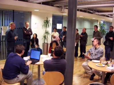
Yes, mapchester is over. We met at the MDDA and through various bits of insane publicity attracted 40-odd people over the weekend who came to help map manchester. The end result will be used at futuresonic.
It was a somewhat different event to the Isle of Wight, not attracting so many people versed in licenses and GPS signal properties. In fact, most had never used a GPS unit before. Speaking of GPS units, eTrex devices didn’t fare too well in Manchester’s urban areas thanks to the urban canyon effect. We all need 60CSX units but they’re expensive. Much like we all need houses in the Caribbean.
Podcast: David Groom

This podcast has a slightly abrupt start and end as David and I were rudely interrupted by, er, a TV crew. But hey. It was recorded on Friday 5th May on the sunny Isle of Wight (as it was then, the next few days were wet) whilst waiting for people to arrive on the Isle.
Great Quote
Etienne Cherdlu makes an interesting couple of perhaps tounge-in-cheek points against what the OS recently told The Guardian.
>From Thursday’s Guardian article:
“We make an average of 5,000 changes to our large-scale data every day,” said an OS spokesperson. “It’s not about mapping the Isle of Wight once – it’s about continuing to map it … It is expensive to collect detailed, accurate information on the ever-changing world to the level of detail our customers require.”
>From an OSM spokesperson:
“This month we made an average of 6,567 (Note 1) changes to our large scale-data every work day” said an OSM spokesperson. “It’s not about mapping the Isle of Wight once – it’s about continuing to map it … and using enthusiastic and passionate volunteer surveyors we are collecting more information every day with 1,864 registered volunteers than the Ordnance Survey manages to do with a paid full time workforce of 1,490.”
