Note: The OpenStreetMap Foundation and GraphHopper publish this joint press release due to the Gold Corporate Membership of GraphHopper GmbH. If you want to be an OSMF Corporate Member too, you can join at https://join.osmfoundation.org/corporate-membership/
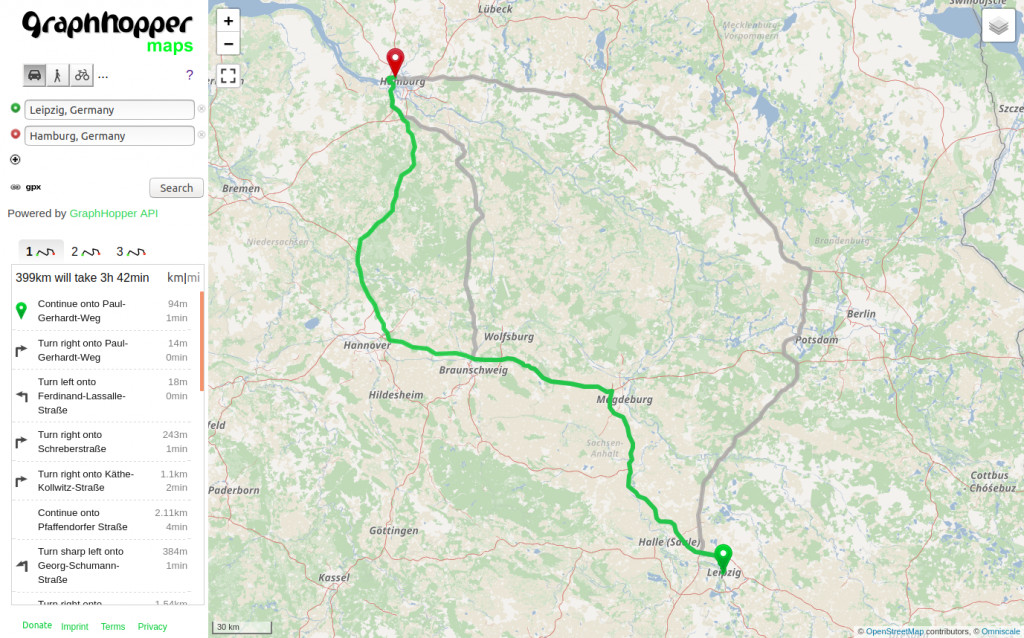
On 25th May the release of version 1.0 for the open source GraphHopper routing engine was announced. The first version 0.1 of the routing engine was released in 2013 and since then it has grown into a mature solution that is integrated on openstreetmap.org since late 2014 and is now used by thousands of companies around the world.
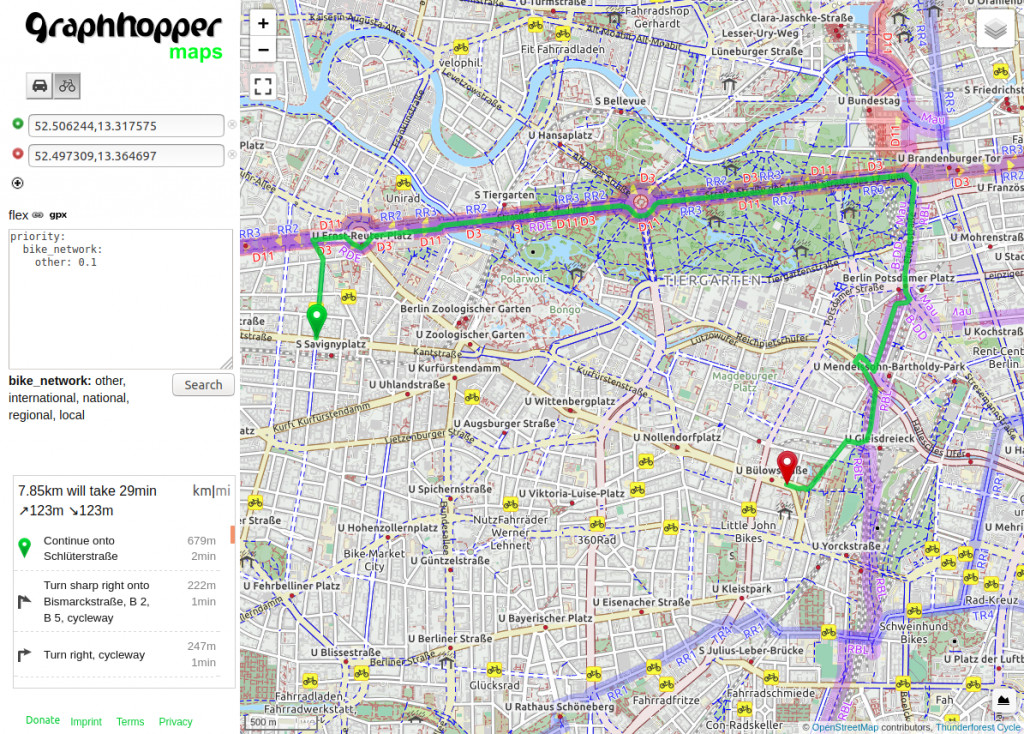
The new release contains a fast alternative routes feature, as well as a new customizable routing that allows people to modify the routing behaviour even without programming knowledge.
New feature of GraphHopper Routing Engine: Fast Alternative RoutesCustomizable routing: Here the bike mode is forced to prefer official bike routes even though this means a big detour. Another use case would be a cargo bike where additional properties like road width are taken into account.
One key player in the GraphHopper community is the GraphHopper GmbH. The mission of the GraphHopper GmbH is to build the routing software stack of the future, with as many open source software as possible and also utilizing open data, like OpenStreetMap. The GraphHopper GmbH supports the OpenStreetMap project with sponsoring the routing service for openstreetmap.org, with using and improving the data as well as spreading the word. Since 2018 the GraphHopper GmbH is also a Gold Corporate Member of the OSMF.
What is GraphHopper The GraphHopper Routing Engine is an open source software project started in 2012. The GraphHopper GmbH is a company founded in 2016 in Germany to support the development for its open source projects like the GraphHopper Routing Engine and jsprit.
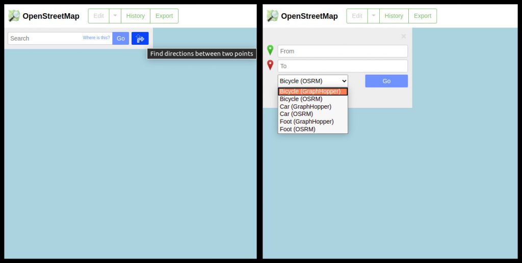
GraphHopper routing is integrated on www.openstreetmap.org, together with OSRM routing.
What is OpenStreetMap OpenStreetMap was founded in 2004 and is a international project to create a free map of the world. To do so, we, thousands of volunteers, collect data about roads, railways, rivers, forests, buildings and a lot more worldwide. Our map data can be downloaded for free by everyone and used for any purpose – including commercial usage. It is possible to produce your own maps which highlight certain features, to calculate routes etc. OpenStreetMap is increasingly used when one needs maps which can be very quickly, or easily, updated.
What is the OpenStreetMapFoundation The OpenStreetMap Foundation is a not-for-profit organisation, formed to support the OpenStreetMap Project. It is dedicated to encouraging the growth, development and distribution of free geospatial data for anyone to use and share. The OpenStreetMap Foundation owns and maintains the infrastructure of the OpenStreetMap project, is financially supported by membership fees and donations, and organises the annual, international State of the Map conference. It has no full-time employees and it is supporting the OpenStreetMap project through the work of our volunteer Working Groups. Please consider becoming a member of the Foundation.
Today we celebrate International Women’s Day, and while it would be nice to have no need for this day, we would like to take the opportunity to acknowledge the contributions of women OSMers.
Thank you for any contribution to the project – be it map data, code, organising mapathons, advocacy or other.
We do not know exactly how many women globally contribute to the OpenStreetMap project via mapping or other ways, however, it is known that the percentage of women in the OSM community – as in many tech adjacent communities – is low. The reason we do not know is because we do not ask for personal information such as name, gender or age when signing for an account on OpenStreetMap.org. Mappers can freely choose, and change, their username, and it is not mandatory that they respond to surveys, or map in a certain way.
All this doesn’t make the collection of demographic data easy, and figures mentioning percentages should be taken with a big grain of salt. Collecting data on why people aren’t joining us is even more difficult as absent people can’t answer questions. While it has been impossible, so far, to get a clear picture on why some people contribute more or less than others, hypotheses have been formulated throughout the years – the lower percentage might reflect aspects of societies such as that many women have less free time than men. We should also note that the percentage of women OSM contributors varies geographically. The majority of attendees at Albanian community events, for example are women. We also seem to see more women participating when there is a clear goal – for example in humanitarian mapping campaigns we often have an almost equal gender balance.
The under-representation of women has been often highlighted on community channels, as well as by initiatives like Geochicas. They raise an important message, and we are also thankful for the work of local groups that are raising awareness.
We -do- know that the reasons that bring people of any gender, origin or age to our project seem to be similar among contributors: it’s fun to make the map data a bit better and it’s rewarding when someone finds your work useful.
Renaming Belgium’s biggest tunnel Initiatives of individuals have effect, both in the representation of women as well as on OpenStreetMap. So, we would like to take this opportunity to share some news from the Belgian community: the longest tunnel in the country, which currently carries the name of Leopold II, will be renamed after a woman, who has not been chosen yet. What does that have to do with OSM you may ask (other that the change will be reflected on our map data as soon as one of eager and active contributors can update it). The name change came about after officials became aware of equalstreetnames – a project by the Belgian OSM community and the Feminist Collective Names Maybe Maybe, which colours streets differently on an OSM-based map, depending on whether the streets are named after a man or a woman. You can read more about the tunnel renaming here.
OSMF board’s answer to recent press enquiry The OSM Foundation board and the OSM Communication Working Group have recently been contacted by a Reuters reporter, enquiring about why the number of women in OSM is low and what is OSM doing to address the gender imbalance and encourage more women to contribute. You can read the full answer here. Excerpts follow:
“We would like to highlight that anyone can contribute to OpenStreetMap, irrespective of their gender/nationality/religion and other factors (which we do not ask). Having said that, yes – there are actions both from the OpenStreetMap Foundation, as well as from community members, to increase the participation of women, and all underrepresented groups. Note that the OpenStreetMap Foundation has a relatively minor role in the OpenStreetMap project. Core infrastructure is run by volunteers, but even our map style and our website are built by independent volunteers. Most things that happen in the OpenStreetMap environment are run by the community.”
“The OpenStreetMap Foundation is interested in increasing the diversity in general and to attract marginalized groups of people and people outside the gender binary, not just women.”
OpenStreetMap Foundation and community efforts Efforts by the OpenStreetMap Foundation and the OSM community mentioned in the press answer include:
Increasing diversity
The OSM Foundation has recently adopted a Diversity Statement which affirms support for expanding our diversity (in all its forms) in OSM.
The OpenStreetMap Foundation has also recently initiated a Diversity and Inclusion Special Committee. Its first task is to assist the Foundation (and hopefully the wider OpenStreetMap project & community) to identify imbalances in the community. To do so, it will gather and assess existing research, and collect any additional necessary data. It will then look at the causes, both internal and external, of imbalances, recommend actions to address them, and in due time evaluate their impact.
Mapping in support of women and girls
The community has created and maintains a page dedicated to mapping in support of women and girls. You can find it at https://wiki.openstreetmap.org/wiki/Tagging_in_Support_of_Women_and_Girls and it lists some points of interest that are related to women’s health, safety or life that can be mapped. Lit roads, gynaecologists, toilets for females and vending machines that dispense feminine hygiene products are a few examples of things that can be mapped.
We would like to emphasize that OpenStreetMap is based on mapping freedom and anyone can map almost any object with geographical qualities that is verifiable. So, if someone is interested in a feature that has not been mapped yet, they are free to create their own tags and add it to the database (it might be a good idea to discuss the created tags on the tagging mailing list to get feedback for potentially better tag options).
Specific communication channels
OSM is large, and made up of many smaller (sub-)communities. Many groups have been formed for people interested in this topic, which helps encourage members of that marginalized group participate in OSM. Geochicas is one example of this. Other examples are the communities formed around the Telegram channels RainbOSM and Geoladies(there is some overlap of participants).
Ensuring safe and welcome participation at OSM events
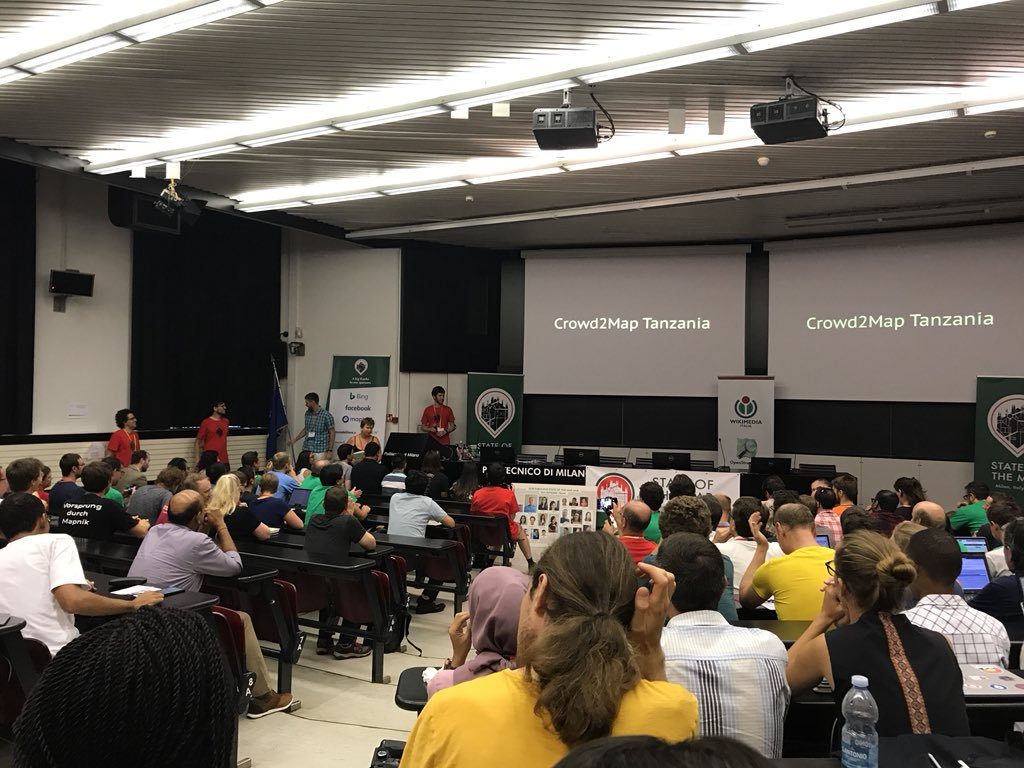
The OSM Foundation organises the annual, international State of the Map (SotM) conference, which has rules ensuring that a wide range of participants feels safe and welcome.
There are local OpenStreetMap events run by community members with rules having the same aim.
Granting scholarships to the annual conference
The OSM Foundation has a scholarship program providing support to community members who cannot afford to travel to the international State of the Map conference. Gender is a core consideration in the selection process.
Electing women to the OSM Foundation board
Before December 2019, both the chairperson and the secretary of our Foundation were women. Board members are voted by the OSM Foundation membership.
Please note that OSM Foundation members constitute a small part of the community – you don’t need to be an OSMF member in order to participate in the OpenStreetMap project, you just need to create an account at www.openstreetmap.org. Having said that, we would like to see the OSMF membership becoming more diverse so please consider joining the Foundation. We are also trying to make it easier to join.
Raising awareness
Participation of women in OSM, and diversity in general, is a subject frequently discussed in community channels, has been highlighted in talks by community members in State of the Map conferences and has led to actions by the OSM Foundation.
Reach out and support
Various local groups reach out to women and engage them in introductory OSM workshop, offering support afterwards.
Recognising the contribution of specific women OSMers
For the past several years, the OSM community has nominated and selected individuals, groups and projects which have helped the project. One of the OpenStreetMap Awards is for “Expanding the Community”, which recognises growing and diversifying the OSM community.
Please note that the list above is incomplete, as there are many efforts by local communities. We invite you to share the contributions of your local group in the comments.
New article about female participation in OSM You can read Reuters’ article, which focuses on female participation in OSM and is based on conversations with OSMers such as Geochicas and the OSM Foundation Board at “Visible women’: Feminist mappers bridge data gap in urban design”.
We would like again to thank anyone who identifies as a woman for their contributions and would like to highlight that mappers don’t require permission, moderation, approval or votes by the existing majority in order to add new things, or to start mapping new features. Even small minorities can map what’s important to them. This openness, and flexibility, allows OSM to be welcoming to new, and unforeseen, types of contributions.
Are you an OSMer who identifies as a woman? Share with us in the comments what you are passionate about. If you would like to answer anonymously, feel free to send your answer to communication@osmfoundation.org and we will post it without your (user)name.
International Men’s day is on 19th of November. International Nonbinary Day is on 14th of July.
Do you want to translate this and other blogposts in your language..? Please send us an email to communication@osmfoundation.org with subject: Helping with translations in [your language]
The OpenStreetMap Foundation is a not-for-profit organisation, formed to support the OpenStreetMap Project. It is dedicated to encouraging the growth, development and distribution of free geospatial data for anyone to use and share. The OpenStreetMap Foundation owns and maintains the infrastructure of the OpenStreetMap project, is financially supported by membership fees and donations, and organises the annual, international State of the Map conference. It has no full-time employees and it is supporting the OpenStreetMap project through the work of our volunteer Working Groups. Please consider becoming a member of the Foundation.
OpenStreetMap was founded in 2004 and is a international project to create a free map of the world. To do so, we, thousands of volunteers, collect data about roads, railways, rivers, forests, buildings and a lot more worldwide. Our map data can be downloaded for free by everyone and used for any purpose – including commercial usage. It is possible to produce your own maps which highlight certain features, to calculate routes etc. OpenStreetMap is increasingly used when one needs maps which can be very quickly, or easily, updated.
Allan Mustard, the new OSMF board chairperson, is asking the OSM community members to share their perspectives on OSM’s Strengths, Weaknesses and Opportunities and Threats (SWOT) that OSM faces. Strengths and Weaknesses refer to internal facets of OSM over which we, the community, have control. Opportunities and Threats are external influences with which we may and in some cases must deal.
Allan writes: “One usual practice in SWOT analysis is “brainstorming”. There are two rules of brainstorming. First, no idea is bad. All ideas are good and may be added to the list. We are in that phase, so no matter how crazy or unusual your idea may be, if you believe it is a genuine SWOT, put it down. We will sort out the good from the less good later. Second, no ad hominem (i.e., personal) attacks. If somebody puts something on this page that you don’t like, express your opinion politely later on.“
You are welcome to also translate the initial page in other languages and add them to the OSM wiki. If you don’t know how, please send us an email to communication@osmfoundation.org
Reference materials about this type of analysis are on the wiki page. Discussion about the analysis can take place at the OSM wiki and the OSM diaries.
Thanks for participating 🙂
OSMCommunication Working Group
Do you want to translate this and other blogposts in your language..? Please send us an email to communication@osmfoundation.org with subject: Helping with translations in [your language]
The OpenStreetMap Foundation is a not-for-profit organisation, formed in the UK to support the OpenStreetMap Project. It is dedicated to encouraging the growth, development and distribution of free geospatial data for anyone to use and share. The OpenStreetMap Foundation owns and maintains the infrastructure of the OpenStreetMap project, is financially supported by membership fees and donations, and organises the annual, international State of the Map conference. It has no full-time employees and it is supporting the OpenStreetMap project through the work of our volunteer Working Groups. Please consider becoming a memberof the OSM Foundation.
OpenStreetMap was founded in 2004 and is a international project to create a free map of the world. To do so, we, thousands of volunteers, collect data about roads, railways, rivers, forests, buildings and a lot more worldwide. Our map data can be downloaded for free by everyone and used for any purpose – including commercial usage. It is possible to produce your own maps which highlight certain features, to calculate routes etc. OpenStreetMap is increasingly used when one needs maps which can be very quickly, or easily, updated.
It’s difficult to detect patterns in the huge variety of experiences and perspectives in the responses to the OSM community survey. What is clear from the responses of over 300 people (thank you all!) is that community is valued, important and desired; as well as complicated, and energy and time consuming. One common thread is the need for more support for community building efforts. The specific ideas for that support vary so much, as well as who and how to marshal the effort.
Communities vary from isolated mappers who only see others editing on the map but don’t connect online or offline in person, to places with a full formal organized presence. But an organization doesn’t guarantee a growing, connected and vibrant community. Most places are in between, from a few friends coordinating together closely, to a core group with ‘fly by tourist mappers’, to places with regular meetups and local conferences. The scope of what people consider their community varies from an individual city or region, to an entire country, to being a part of several places. Many feel disconnected or unconcerned with the “global community”, though some feel the global community is their community, with unique issues and dynamics of its own. The communication channels people prefer are probably only going to grow from the large list we have already.
Yes, you can say that anyone who bothers to answer this survey would be a biased self selected sample, and of course would care about community. Someone happily mapping without talking to anyone wouldn’t care about a survey, and certainly there are some people who are happy to edit OSM without talking to others. But, these community connections — online and offline in person — are widely agreed as the key to what makes OSM work. A bunch of disconnected people editing a database without talking to each other would fail. We can do more together than apart. The means to connect and support all these communities is the major challenge.
Below we present some of the numbers from the quantitative questions, and some individual reflections from the Board. We don’t anticipate this is the only post from this survey; there’s a lot to work through here, so likely more to come.
You are welcome to read and draw your own conclusions from the anonymous answers to the set of narrative questions on community; find those shared at the bottom of this post.
Stats
This survey was filled in by people who saw the link and decided to fill it out. So it is obviously not a random sample of the OSM community. That was always the plan, but it means we should tread with care to generalize. For example, if we see that many Latin Americans in our sample are using Telegram, that might just mean that by chance the link has only been visibly shared on that network.
Although we had 310 useful responses, not everyone filled out the interesting free text questions. For example, the first block of open questions was answered (at least partially) by 204 people.
Volunteers translated the survey itself, as well as the answers. This was a huge job, as there were 139 people who filled in the survey in Spanish, German, French, Italian, Hungarian, Portuguese, Farsi, Chinese and Lithuanian.
Background
People could mark any of the below to describe their involvement in OSM. People who didn’t mark anything aren’t included in the graph below.
Communications channels
The graph below shows the communication channels sorted by number of readers. Thematic and local mailing lists together are the most widely read, as well as contributed-to channels.
We look forward to dig further into the data. One thing we already did, was have a look at how the communication channels differ by region. The below graph shows the percentage of people by region who follow a certain channel. This brings up some interesting data points. For example, mailing lists seem most popular in Asia and least in Africa. The Weekly and the blog are underrepresented in Latin America. Telegram is popular there (and to a lesser extent in Asia), Slack in North-America and Facebook in Asia and Africa. The forum stands out by being so consistent. There were only 3 responses from Oceania, so can not draw any pattern from those.
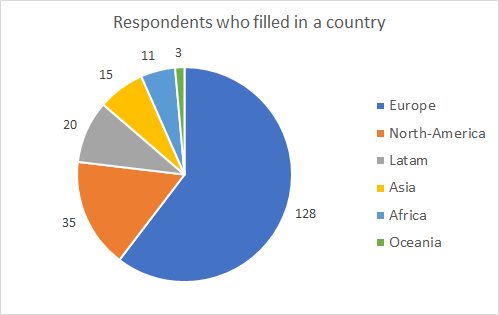
Countries
People from 45 different countries filled in the survey.
Germany – 35 US – 33 Italy – 17 France – 16 UK – 15 Spain – 11 Argentina – 7 Hungary – 7 Switzerland – 7
5 or less respondents Brazil Guinea Philippines Australia Belgium India Portugal Canada Colombia Denmark Japan Lithuania Nigeria Paraguay Poland Sweden Belarus Bolivia Europe Indonesia Iran Ivory Coast Kazakhstan Luxembourg Malaysia Mexico Panama Peru Romania Russia South Africa Taiwan Thailand Togo Uganda Ukraine
Reflections from board members
from Joost
Is there a community? Do you meet other mappers? Some of you seemed surprised by the very question. And in other places, there is more going on than you can follow. But national activity is not enough. Even if there’s for example an Italian community, people organize in their own more local area. Some of these groups are really inspiring – and though the OSM weekly does a great job highlighting what’s happening everywhere, we still picked up things we hadn’t heard of. A suggestion was a yearly report on what is happening locally. We were pleasantly surprised to hear about what is happening in for example Bretagne or Piedmonte. But then in a place like New York City, even if a lot of things happened in the past, current heavy mappers might feel rather alone. A different kind of struggle happens in low population places, where mappers are just too far apart.
from Mikel
In the early years of OpenStreetMap, it was easy to just do it. If you had an idea and energy, there was nothing but space to try things out. After 15 years, OSM has grown enormously, accreted data, communication channels, cultural practices and history, and its harder to see ideas through to actualization. There’s still no shortage of inspiration, as the ideas in the survey show. How can we cultivate the space to make it easy to just try things out again?
To name a few ideas that stuck out for me: annual reports, grants, “twinning” chapters, individuals who “bridge” communities, community building training, informal planned live chats between communities.
Exciting and exhausting. It’s takes energy for all these things. Take one example: microgrants. The jury is out on whether this will help build community or not, but that’s certainly the intention. The OSMF Board have wanted to do this for years. We’re actually fairly close to launching this finally, but it’s taken so long.
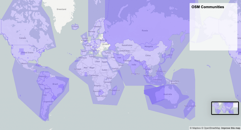
In the middle of reviewing the responses, I had to do something, so I built an interactive map from of the OSM Community Index. Yet another map solves nothing, but satisfying to see our presence across the globe, and think about better ways to share what’s happening between us.
Excited to talk about this all in Heidelberg! Especially think the Local Chapter Congress can be a place to pick up some of these topics.
from Heather
OSMF should consider a community engagement plan to further delve into the needs of the ‘community of communities.’ There is a large potential to, with a data-enabled process, make some ‘light-touch’ adjustments to improve the health of the network. This should be done in consultation with the various groups across OSM. We need to buid on activities, events, and surveys to a more inclusive, distributed plan.
from Frederik
Browsing through the answers we got here, I see a serious need for arbitration in the future. The issues people want prioritized are often contrary – one person wants more of something, the other wants to ban the same thing altogether. There are many issues on which the OSMF hasn’t defined for themselves a clear standpoint, and for good reason – because even without a survey it was clear that opinions differ greatly. Many people seem to expect things from the OSMF that would far exceed its current, established mandate. Does that mean the OSMF should expand its influence – or have those who want the OSMF to stand back and shut up simply not participated?
from Tobias
The survey responses seem to demonstrate a considerable appetite for a more unified OSM community communication platform. At the same time, they also make it clear that we often look for very different things in communication channels, and that preferences regarding the existing ones also vary wildly between contributors, making this a challenging situation for our project. I believe it’s important to continue improving OSM’s own communication platforms, which might mean technological updates as well as working on our social dynamics. Our goal should be spaces that people enjoy visiting and productively contributing to. If we succeed in this effort, we might even win over some contributors who currently choose to use third-party tools.
Several participants shared their insights about local events and meetups: The benefits for motivation and community building, but also their struggles in getting regular meetings off the ground or keeping existing groups alive. While these initiatives must ultimately be run by local community members, the OSMF should explore possibilities to offer support. Suggestions from the survey included making existing groups more visible on the OSM website, providing tools for finding other local contributors interested in such events, and improving the osm.org messaging tools.
Although not strictly about communication and communities, the more open-ended questions saw many of the pressing issues from our previous survey brought up again – which should remind us that the OSMF, and the board in particular, must make faster and more visible progress on addressing them.
Finally, kudos to WeeklyOSM! While reading through the responses, it stood out to me how often this channel was mentioned in a positive light, especially given the controversial opinions on many other platforms. Providing an overview of the vast OSM landscape with its fractured platforms and sub-communities is an invaluable service.
Partial Dataset released
Many community members have allowed us to share their answers publicly, aggregated and anonymously. We are now sharing the answers to the first set of questions:
What is happening in your local community?
What about your local community should be more widely known? What can other communities learn from yours?
Do you meet other mappers in person? Is there a local community beyond mapping?
Are you engaged in the “global community”. If you aren’t, why not?
What do you think could improve the interaction between global and local communities? How can you help?
Do you know who organises the global State of the Map conference? If you’re going to SotM, why? If you’re not going to SotM, why not?
There were 158 individuals that have answered at least one of those questions and gave us permission to share their answers. You can find that partial dataset at the OSMF website.
If you prefer an online spreadsheet, we have also put them at framacalc, but please note that the OSMF spreadsheet is the definite reference.
The OpenStreetMap Foundation is a not-for-profit organisation, formed in the UK to support the OpenStreetMap Project. It is dedicated to encouraging the growth, development and distribution of free geospatial data for anyone to use and share. The OpenStreetMap Foundation owns and maintains the infrastructure of the OpenStreetMap project, is financially supported by membership fees and donations, and organises the annual, international State of the Map conference. It has no full-time employees and it is supporting the OpenStreetMap project through the work of our volunteer Working Groups. Please consider becoming a member and read about our fee-waiver program.
The community voting for the OpenStreetMap Awards 2019 is open! We had a call for nominees, during which you have submitted the names of almost a hundred mappers, bloggers, developers and teams. Then OSMF working groups, the Board and past winners helped to prepare a shorter list. And now it is again your turn: choose who gets an award during the ceremony at the State of the Map in Heidelberg.
We have 28 nominees to choose from: six categories of notable mappers, developers, writers and community builders, and a new category for teams: commercial companies and groups of people working together to make OpenStreetMap better. Every one of these worked hard, and deserves every bit of our love.
You don’t have to choose only one nominee per category: that would be an impossible choice, given we have so many great people on the list. Click as many checkboxes as you like, even all of them. What matters is not winning, but knowing that hundreds of people support you and your project. The main point of a community is to support its members, and this is your chance to do that. Don’t forget to press the “Vote” button afterwards.
The voting ends soon, on 18th of September, so please do not postpone visiting the website — spend a minute right now. Please vote now and show your appreciation!
Image by Harry Wood. Background by Michael Belew (public domain). OSM logo by Ken Vermette (cc-by-sa & trademarks apply)
In advance of State of the Map 2019, with this survey we are reaching out to communities across the globe, especially to voices we might not otherwise hear. This will not be a quantitative poll. Since we are circulating this through all our networks, it can’t even give a representative sample of the OSM community.
The next big thing is State of the Map (SotM), and we want to feed the discussions there. SotM is the place where people from all over the world meet and mingle, and in this survey we would like to focus on communication and what is happening around the world. What are people doing in Bali, Belarus and Brazil? Is there a local community? What can we learn from each other? How do we all get involved in the global community?
We would like to see how the local communities are connected to the global OpenStreetMap community. What actions should the OpenStreetMap Foundation undertake? What concerns and ideas does they community have? Please note that this is in no way a vote, but rather a means of gathering information to take better informed decisions.
We encourage people to get together and discuss and even provide group answers. You can choose to provide answers only to the Board, or indicate they be shared publicly but anonymously.
Note: Please have javascript enabled and make sure your ad-blocker does not interfere. You might want to save any free-text answers on a text document and then paste them on the survey. If you encounter any problems, please email dorothea@osmfoundation.org
On privacy
We will collect all answers. Answers might contain personal information that you provided, such as country, OSM username, email address, years of mapping, whether you identify as a mapper/OSMF member/etc.
You don’t have to answer any question, except the first one, about consent.
Please email privacy@osmfoundation.org for privacy matters regarding the questionnaire.
On translations
Community members have volunteered and translated the survey in their languages. Thanks!
Helping with translations If you want to help translating answers from the above languages, please sign this non-disclosure agreement and send it to communication@osmfoundation.org with subject “Helping with translations in [language]”. Thank you.
The OpenStreetMap Foundation is a not-for-profit organisation, formed in the UK to support the OpenStreetMap Project. It is dedicated to encouraging the growth, development and distribution of free geospatial data for anyone to use and share. The OpenStreetMap Foundation owns and maintains the infrastructure of the OpenStreetMap project, is financially supported by membership fees and donations, and organises the annual, international State of the Map conference. It has no full-time employees and it is supporting the OpenStreetMap project through the work of our volunteer Working Groups. Please consider becoming a member and read about our fee-waiver program.
Would you like to translate posts on blog.openstreetmap.org? Or see surveys from the OpenStreetMap Foundation in your language..? This is a call to community members who have helped with translations in the past or want to help now.
You can translate as many old or new blog posts as you like – expressing an interest does not mean you have to translate every new post.
We would like to encourage people to collaborate! If more than one person can do a translation, we would be thrilled if you work together.
Blog post translations
We’d like to make the official blog at blog.openstreetmap.org available in more languages, and for some of the existing languages we’d need to catch up on translations of recent blog posts. These are straightforward and we will provide initial guidance.
Extra help needed for translations of surveys
For surveys we need help both in translating the questions, as well as the answers. For that reason we would be thrilled if local communities decided to form small groups that will volunteer to help us. Please note that as anyone who helps with surveys will have access to information that people might want to keep private, you will have to sign a non-disclosure agreement.
The OpenStreetMap Foundation will start doing surveys 2-3 times per year. The next one is planned just before the State of the Map 2019 conference and translation of questions will start this week.
Next step
Want to help? Please send us an email to communication@osmfoundation.org with subject: Helping with translations in [your language] and indicate whether you want to help with translations of blog posts, surveys or both.
The OpenStreetMap Foundation is a not-for-profit organisation, formed in the UK to support the OpenStreetMap Project. It is dedicated to encouraging the growth, development and distribution of free geospatial data for anyone to use and share. The OpenStreetMap Foundation owns and maintains the infrastructure of the OpenStreetMap project, is financially supported by membership fees and donations, and organises the annual, international State of the Map conference. It has no full-time employees and it is supporting the OpenStreetMap project through the work of our volunteer Working Groups. Please consider becoming a member and read about our fee-waiver program.
The June solstice is upon us, which means the seasons are changing — and with that, lots of opportunities to map, no matter which hemisphere you’re in!
If you’re in the northern hemisphere, why not take a look at your local outdoor fun: maybe it’s swimming pools, beaches, hiking and biking trails, and the like. The parks and playgrounds might be busy, as well as sports pitches, places to camp, national parks, wildlife parks and more. Midsummer is also a holiday in many countries, why not map the local traditions like permanent maypoles? Or mapping your local ice cream parlours might be fun.
And if you’re in the southern hemisphere, it’s winter! It may be a bit colder, and good weather for winter sports like skiing, or maybe just staying indoors at your local pub, restaurant, indoor pool and so on. Are your local favorites on the map already? There are also winter festivals all over the hemisphere, have you mapped them? And in warmer climates, it may be nice weather for exploring outside, going surfing, taking road trips and more.
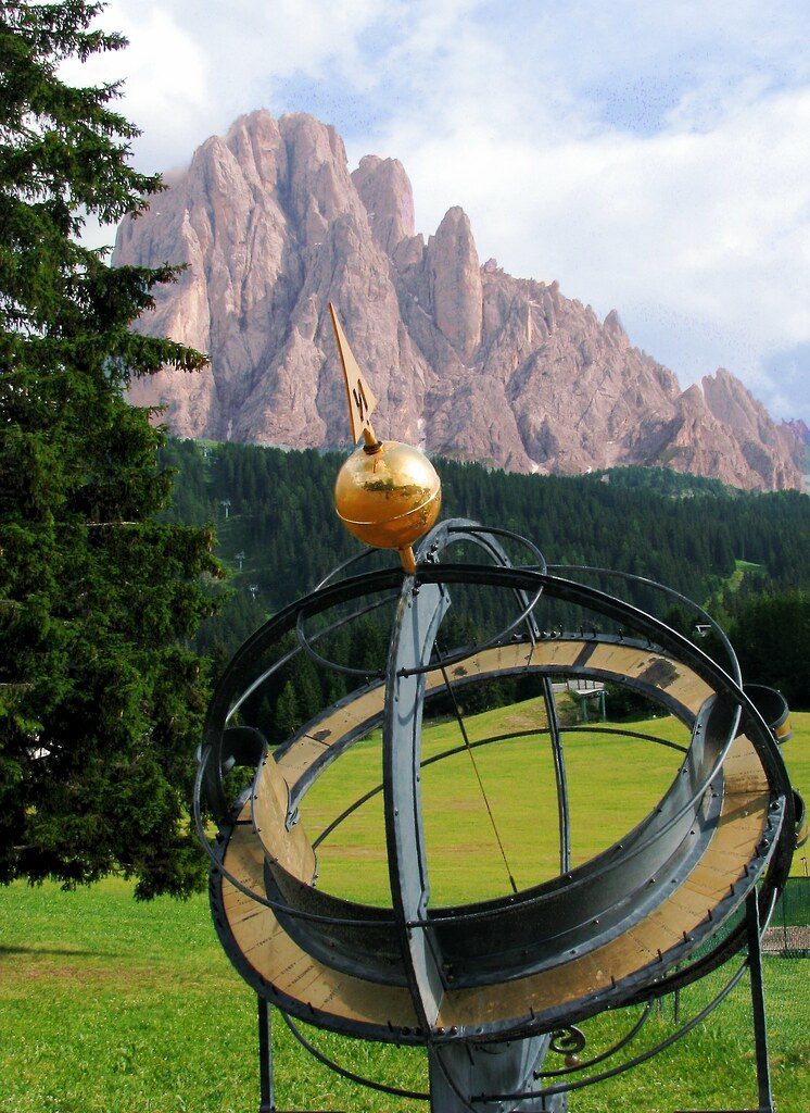
Speaking of the solstice, are the observatories and other astronomical facilities in your area mapped? Is the sundial of the cover photograph mapped?
We are announcing the call for nominees for the OpenStreetMap Awards 2019, which will be presented this September at the State of the Map 2019 conference in Heidelberg!
These are community awards, as nominees and winners are chosen by the community. The Awards strive to be a worldwide event for all OpenStreetMap members, including developers, mappers, community leaders, blog writers and everyone else. We need your help to find the best of OpenStreetMap globally.
For the fourth awards, we have made some changes. Gone are the three regional categories. Sorry. We have strong enough OSM representation in these countries to be listed together with other candidates. Also, there is a new category: Team Achievement Award. Companies, teams and groups should go there, to not compete with people in other categories. We had quite a lot of issues because of that mixing previously: how do you compare a mapper and an entire local chapter?
We’re mostly looking for new innovations, so only projects/works that were announced after June 1st 2018 are eligible. The Ulf Möller Award is an exception to this. Everyone is eligible regardless of the time when they were active in the project. You personally and your friends are eligible, do add yourself! Winners of past awards and selection committee members (in their categories) cannot be nominated.
The call for nominees will close in a month — on 15th of July. Whenever you see an interesting entry on OSM diaries or in WeeklyOSM, take a moment to submit the name for the award. The more nominees we have, the more interesting the final voting will be. Please keep in mind that we have the OpenStreetMap Awards and nominate people now!
Ahead of the Board Face to Face in Brussels we asked people across the project to share the most important topics facing OpenStreetMap. Thank you to every one of you who responded – 161 people in total! We want to share how we found this valuable and how it informed the meeting, some summary results and specific follow ups underway. Surveys are something with want to repeat – and we want help to implement with the best practice, and cover the right topics.
The value of surveying
You would think that the Board, seven people with presence in many different communities and communication channels, would know nearly everything happening in the project and what issues were top of mind. But with such an enormous scale of work and messaging, it’s impossible to form a cohesive picture. There are many people whose voices we don’t otherwise hear – due to language, the proliferation of channels, and communication style. We know that these 161 responses provide just one window into how we might improve community feedback loops. With a formal structure like the Board of Directors, with formal meetings and minutes and statements, it’s hard for everyone else to know we are listening.
OpenStreetMap is made up of everyone who takes part in it, and hearing each other’s voices in a coordinated way, on a regular basis, will help prioritize where work is needed and what actions to pursue. It ensures a standard way to engage. Surveying can help set up mechanisms to route issues to the right place, share pathways for OpenStreetMap members to contribute and address problems, and identify where the project as a whole needs more help to come up with answers. We can identify people and topics for more in depth follow up. This will only work and be useful if there is actual follow through and transparency on what we hear through surveys.
The results of this survey
Frederik summarized and classified each of the responses, to produce this summary list. This is just one way of classifying the responses – other Board members had similar breakdowns, but nothing as comprehensive. There weren’t tags for everything, and some responses were clearly not relevant. Most didn’t specify what they thought the Board could, but expressed generally things they’d like to see happen.
some form of Global Logic/Hostile Takeover concern
some concern about building a friendlier, better informed, more inclusive community (different users stressing different targets for inclusivity e.g. regions, countries, interest groups)
the suggestion that tagging rules need to be clearer, better documented, or a better process needs to exist
dissatisfaction with how the iD editor manages tagging decisions (largely a different group from the 13 as above)
need for better QA and vandalism detection
growing the project or membership in various ways
dissatisfaction with the website features, including tile speed
improve governance, improve Working Groups, better Conflict of Interest handling
hire developer and/or management staff
limit the ability of new mappers to contribute (and break things)
provide more/better education support, partner with education institutions
enforce attribution more
desire to have vector tiles on web site
make imports easier (and 2x control rogue imports better)
improve cartography
protect against commercial influence
overhaul wiki (but see tagging above, these could also mean tagging)
resource better imagery
We aren’t publishing the raw survey comments because we neglected to ask in the survey if it was ok to publish, or if the response should remain anonymous. This is something we will address in future surveys.
How we incorporated the responses into the meeting
We looked at the survey results after day 1 was done, so we had a full day to work already, directly with each other and all the ideas we each had brought the meeting. Saturday evening, we all received the results by email, and fair to say that all of us read every one. The next morning, we had spent time going round to everyone and hearing each other’s reflections, identifying where the survey input complemented work underway, as well as identify gaps in our scope.
Fair to say that building a more inclusive & healthy community, governance issues, hostile takeover, and growing the project were already top of mind. What surprised us were topics like tagging, software, and infrastructure issues. Of course we know these are top issues, but as the Board, it’s typically not been our role to get involved in such topics. Some of the concerns simply involved a rerouting problem – there are clear places to share feedback on things like the default cartography, and our plan is to share some of these items directly with those responsible. But for other issues like tagging, like iD, it’s more complicated and not clear how change is supposed to happen. There are “routing problems” in OSM and OSMF. We broadly think there may be a role for the Board in helping facilitate the community to find the way, but we’re not sure how it should work. In the mean time, we are having a few direct conversations to listen more.
We then later had half the Board take part in a 90 minute working session specifically on surveys (the other half worked on the takeover risk and governance changes topic). We generated ideas that make up much of this blog post – how are surveys valuable, what did we learn from this one, and how do we want to do surveys in the future.
Methods and topics for future surveys – we need your help
During our working session, we had to pull back several times from diving down the rabbit hole of methodology. We’ll start here with some top level design thoughts on how we see surveying at OSMF.
Keep a consistent pace of at least annually, and perhaps up to quarterly when topics are raised. These can be schedule at coordinated, quieter points along the “OSM Calendar” (prior to Annual General Meeting, Face-to-Face board meeting, State of the Map). Frequency also will help to gauge enduring issues, emerging issues, and one-offs.
Strike a balance of rigorous and achievable – we aren’t doing surveys for social science publication, but we do want to have a good standard of results we can trust.
Work collaboratively in building surveys with more experienced folks in OSM community, especially from academia/research. Gather input and refine questions from in person at SotMs, Working Groups, Chapters, Advisory Board, Regions.
Identify ownership of surveying processes in OSMF – for now the Board. This also means taking responsible stewardship of the submitted data.
Build a trusted process by demonstrating responsiveness and follow through to survey results. That means share summary results and actions by board/OSMF, as well as option for anonymously sharing raw results.
Reach a broad population, by a wide and documented set of outreach channels (mailing lists, forums, telegram, slacks, FB groups, etc). Also take distinct opportunities to have self selection surveys vs random selection where a specific population is chosen.
Surveys should not be burdensome on responders. Clearly say up front what will be asked, is it multiple choice or free text, and how much time is needed. Keep a baseline of background questions (like OSM experience and roles and location).
Make this a repeatable sound methodology. Means following a process step by actionable step.
Definitely opening thoughts. If you have experience in undertaking surveys, we’d love to talk to you about how to approach.
Finally, we brainstormed questions we’d like to ask on surveys. Broad topics were on our organizational development and governance, the technical roadmap and priorities, regional “nuances” in how OSM works, a survey directed to companies, and community engagement and health.
What are you doing that other communities can learn from?
Volunteering in OSM: what do you ideally want to do, and what do you need to do it?
Why are you in OSM? What was your best experience? What was your worst?
What are the different roles and kinds of contributions you have made?
Where do you communicate and why?
If you are not in OSMF, what would it take to convince you to join? What would you change?
What questions do you want to ask the OSM community? And, more importantly, how do you see survey results informing our collective next steps? Let us know either in the comments, on talk@openstreetmap.org or send an email to board@osmfoundation.org.
Want to help with methodology? Send us an email to board@osmfoundation.org with subject “Survey methodology help”, and we’ll let you know when we gather to start planning the next survey soon.
What is the OpenStreetMap Foundation The OpenStreetMap Foundation is a not-for-profit organisation, formed in the UK to support the OpenStreetMap Project. It is dedicated to encouraging the growth, development and distribution of free geospatial data for anyone to use and share. The OpenStreetMap Foundation owns and maintains the infrastructure of the OpenStreetMap project, is financially supported by membership fees and donations, and organises the annual, international State of the Map conference. The OpenStreetMap Foundation has no full-time employees and it is supporting the OpenStreetMap project through the work of our volunteer Working Groups. Please consider becoming a member and read about our fee-waiver program.
What is OpenStreetMap OpenStreetMap was founded in 2004 and is a international project to create a free map of the world. To do so, we, thousands of volunteers, collect data about roads, railways, rivers, forests, buildings and a lot more worldwide. Our map data can be downloaded for free by everyone and used for any purpose – including commercial usage. It is possible to produce your own maps which highlight certain features, to calculate routes etc. OpenStreetMap is increasingly used when one needs maps which can be very quickly, or easily, updated.


