Author Archives: OpenStreetMap

About OpenStreetMap

Posts written "by OpenStreetMap" were written collaboratively by the Communication Working Group and/or other OpenStreetMap Foundation folks.

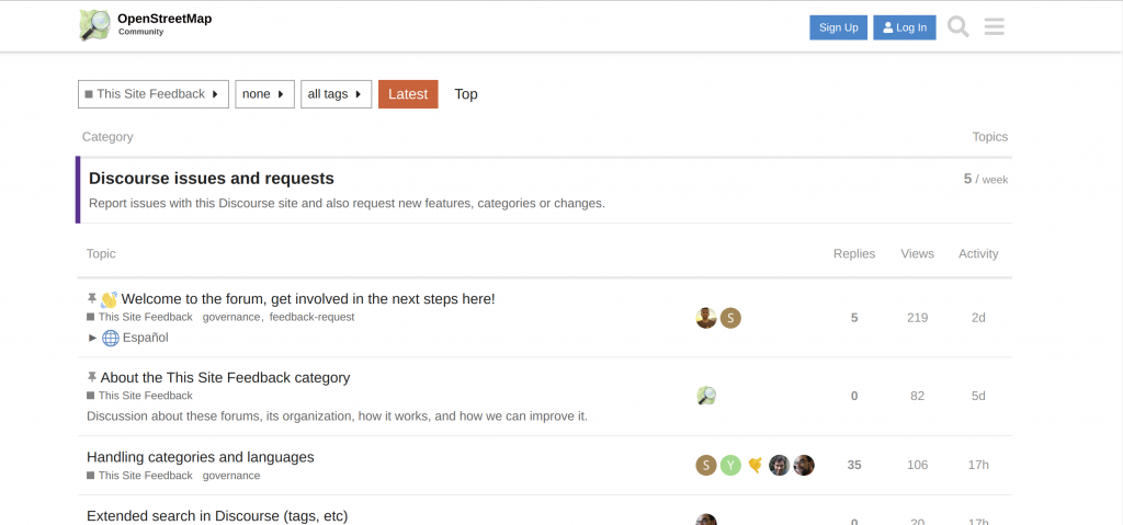
A new discussion forum for OSM

The OpenStreetMap Foundation is launching a new communication platform for the OpenStreetMap community at community.openstreetmap.org. Interested? Give it a try and find out how you can get involved with the next steps!

Screenshot of the new forum’s “feedback” category

Behind the scenes, the new space is powered by Discourse, a modern open source solution for online conversations. It is fully integrated with OSM accounts to let you log in with your existing user name. Discourse is easy to use and offers all the conveniences you would expect from social online spaces in the 2020s. At the same time, it gives power users access to optional advanced features: Write and receive posts through email, subscribe to RSS feeds, and more!

Of course, this is not the first platform dedicated to mappers’ conversations about their favourite passion. But while the new community space has been set up in parallel to the existing platforms provided by the Foundation (notably the forum, help site and mailing lists), we hope that the sub-communities on those platforms will eventually migrate to the new site. Likewise, we encourage communities currently using proprietary tools to consider adopting the new site for their communication needs. In particular, we are prepared to work with regional communities and local chapters – let us know on the Discourse forum what you need for your community to make this space your new home for discussing your local activities!

Choosing a solution that is hosted on our own infrastructure and based open-source software ties into the OpenStreetMap Foundation’s commitment to open communication channels. To ensure productive conversations and a welcoming environment, please respect our recently updated etiquette guidelines when you participate in the new forum. We hope that all members of the OSM community feel right at home at community.osm.org!

Joint statement from Quincy Morgan and the OpenStreetMap Foundation’s Board, regarding iD development

After two and a half years developing iD, Quincy wishes to pass the torch on, for personal reasons. Together with the OpenStreetMap Foundation, he will hand over iD to good hands; the Foundation is now starting the process of finding a replacement by consulting the OSM community about a planned paid position serving iD users.

To ensure continuity, Quincy will be part of an OpenStreetMap Foundation working group – a privileged environment to pass his knowledge as his successor ramps up in mastery of iD.

The OpenStreetMap Foundation remains fully committed to robust support of the editor through which 80% of OpenStreetMap users contribute to the common edifice.

The Foundation thanks Quincy for his great work on iD.

OSMF and OpenCage – Joint press release

OpenCage is a silver level corporate member of the OpenStreetMap Foundation, entitling them to this joint press release. If your organisation would like to support the OSMF more, please consider joining the OSMF as a corporate member, or read about other ways to give back.

Geocoding is the process of converting between addresses or placenames and geographic coordinates (longitude and latitude). Geocoding is a core geospatial functionality; an underlying building block that is critical to developing location based services.

OpenStreetMap Foundation corporate member OpenCage operates a highly-available, enterprise level geocoding API based on OpenStreetMap. We’re pleased to announce that OpenCage recently increased their commitment to the OpenStreetMap Foundation by upgrading to silver level corporate membership.

“For years our service has built on OpenStreetMap. We’re delighted to increase our ongoing support of the worldwide OSM community by increasing our level of commitment to the OpenStreetMap Foundation.” said Ed Freyfogle, OpenCage co-founder.

“It’s a nice milestone that the business has grown to the point that we could upgrade from Bronze to Silver. But beyond financial support the main work we do is opening the eyes of our customers – most of whom arrive knowing simply that they need geocoding, and without a detailed understanding of open data – to open data’s many benefits. Our customers around the world are proof that OpenStreetMap is commercially usable not in some distant theoretical future, but today” continued Freyfogle.

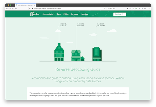
An example of that type of educational work is OpenCage’s recently published Reverse Geocoding Guide, which details the technical challenges of ongoing operation of a reverse geocoding service, while also documenting the advantages of using open data as the underlying data foundation for such a service.

OpenCage offers open source SDKs for accessing their geocoding API for over 30 different programming languages.

In addition to being corporate members of the OSMF, OpenCage are proud members of the UK (the business was started in the UK) and German (the business is currently based in Germany) local chapters, co-sponsor and contribute to the open source development of Nominatim (the primary OpenStreetMap geocoding software), and regularly sponsor OpenStreetMap events.

GEOMOB logo

OpenCage also encourages geoinnovation by running Geomob, a regular series of in-person and online events with the goal of promoting geoinnovation in any and all forms – whether for “fun or profit”, as the event tagline says. Now in its thirteenth year, Geomob has become an established feature of the European geo event landscape, and regularly features projects using OpenStreetMap.

Early in 2020 the Geomob podcast was launched. The weekly conversations provide a chance to reflect on geo industry trends, discuss interesting new geo technology, and interview Geomob speakers. Podcast guests have included many members of the OpenStreetMap community, including Allan Mustard (chairperson of the OSMF Board), Tyler Radford (executive director of the Humanitarian OpenStreetMap team), Sarah Hoffmann (maintainer of the geocoding tool Nominatim, which powers search on osm.org), several founders of businesses building on top of OpenStreetMap, and many more.


What is OpenStreetMap?

OpenStreetMap was founded in 2004 and is a international project to create a free map of the world. To do so, we, thousands of volunteers, collect data about roads, railways, rivers, forests, buildings and a lot more worldwide. Our map data can be downloaded for free by everyone and used for any purpose – including commercial usage. It is possible to produce your own maps which highlight certain features, to calculate routes etc. OpenStreetMap is increasingly used when one needs maps which can be very quickly, or easily, updated.
What is the OpenStreetMapFoundation?

The OpenStreetMap Foundation is a not-for-profit organisation, formed to support the OpenStreetMap Project. It is dedicated to encouraging the growth, development and distribution of free geospatial data for anyone to use and share. The OpenStreetMap Foundation owns and maintains the infrastructure of the OpenStreetMap project, is financially supported by membership fees and donations, and organises the annual, international State of the Map conference. The OSMF supports the OpenStreetMap project through the work of our volunteer Working Groups. Please consider becoming a member of the Foundation.

Message from OSMF Board Chair on mailing list behavior

To the OpenStreetMap and OSMF communities:

I convey the following information on behalf of the Board of Directors of the OpenStreetMap Foundation.

An outcome of the current controversy on the osmf-talk mailing list over misogynistic language is a decision by the Board as follows:

The Board will find partners to help instate a moderator team for the OSMF-talk and talk mailing lists.  These moderators need to have the trust of the community subject to the moderation (consent of the governed) by some kind of approval mechanism. 

This moderator team will start to work on enforcing the current Etiquette guidelines as soon as possible. We will also start work on updating/replacing our Etiquette rules, which must focus on balancing all participants’ interests.

We have asked the Local Chapters and Communities Working Group (LCCWG) to take the lead on this and to work with signatories of the open letter to the Board as well as members of the Diversity and Inclusion Special Committee to produce proposals for the Board to consider at its January meeting.  The LCCWG has accepted this task.  This issue will be on the agenda of the January meeting of the Board of Directors, exact time and date yet to be determined, though as is customary it will be posted to the Foundation’s website well in advance.

Members of the OSM community are, as always, welcome to share their opinions and any relevant information on this matter, either publicly via osmf-talk, or privately in direct communications to the LCCWG.  I feel compelled to remind all members of the community that a Code of Etiquette has existed since June 2011 and shall be observed by all community members.

Very best regards to all,

Allan Mustard

OSMF and Cesium joint press release: OpenStreetMap, a map of buildings!

Note: Cesium is a silver level corporate member of the OpenStreetMap Foundation, entitling them to this joint press release. If your organisation would like to support the OSMF more, please considering joining the OSMF as a corporate member, or read about other ways to give back.

Despite our project having “Street” in the name, there are 4 times as many buildings in OpenStreetMap as roads!

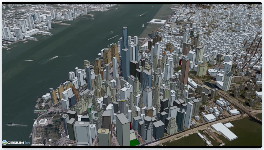
The newly released Cesium OSM Buildings from one of our newest corporate members Cesium is a global 3D building layer of more than 350 million 3D buildings derived entirely from OpenStreetMap. Cesium OSM Buildings is served as 3D Tiles, an open standard format for streaming 3D datasets, originally developed by Cesium.

Image © Cesium.

“OpenStreetMap has amazing 3D building data in cities around the world. It’s a testament to the skill and hard work of mappers in this community,” said Mikel Maron of the OpenStreetMap Foundation Board. “We appreciate Cesium’s support and advocacy of the project as a corporate member, and by adding OpenStreetMap data to their platform, they further advance our mission to ensure that OSM data is as widely used as possible.”

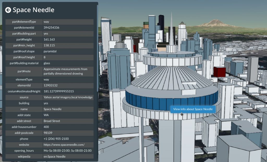
OpenStreetMap means rich metadata in most cities, like building name, address, and opening hours. Image © Cesium.

Cesium, which began as a project at an aerospace software company, has been maintaining its open-source virtual globe, CesiumJS, since 2011. CesiumJS recently surpassed 1 million downloads and its developer community has built thousands of applications in dozens of industries.

Cesium’s offering joins a vibrant community of projects which make use of building data from OSM. The OSM Buildings project is a free and open source web viewer for 3D buildings based on OSM. Open 3D rendering software based on OSM also exists for Blender, and in many other projects. OpenBuildingMap is a building focused window to OpenStreetMap, providing a filtered subset of OSM data with just the building data.

There are many tools for adding building data to OSM, from the popular building_tools and Kendzi3D plugins for JOSM, to StreetComplete, which helps our large contributing community survey building details. You can also read how buildings are mapped (“tagged”) in OSM. Our annual conference (State of the Map 2020), had a presentation on “Buildings are the new streets”.

OpenStreetMap – more than buildings
OpenStreetMap is a international project to create a free map of the world. To do so, we, thousands of volunteers, collect data about roads, railways, rivers, forests, playgrounds,
benches, fire hydrants and a lot more worldwide. Our map data can be downloaded for free by everyone and used for any purpose – including commercial usage. It is possible to produce your own maps which highlight certain features, to calculate routes etc. OpenStreetMap is increasingly used when one needs maps which can be very quickly, or easily, updated.
Proposal for Software Dispute Resolution Panel

Summary

Following community and membership consultations via the OSM-talk and OSMF-talk channels respectively, and in response to needs expressed by iD developers, the OSM Foundation Board proposes to create a small panel, the Software Dispute Resolution Panel (“Panel”), that will on request seek to resolve disputes that arise over features of the iD editor. Other OSM-related software products may also use this Panel if they choose to opt-in. We ask that comments on the proposal below be made on the OSM-talk mailing list (register to OSM-talk).

Background

Although relatively rare, compared to the total volume of updates, modifications, and enhancements made to the iD editor over time, such controversies as have arisen over changes to iD have threatened the project due to the emotional responses of some involved in the disputes. These controversies are undesirable and cannot be allowed to harm OSM or the OSM community. Hence, at the suggestion of iD developers, the OSM Foundation seeks a method of amicably resolving any disputes that may arise via a mechanism that is ultimately under the control of the OSM community.

Proposal

The OpenStreetMap Foundation (“Foundation”) Board will create a Software Dispute Resolution Panel (“Panel”) consisting of five members. Any Foundation member may be nominated to serve on the Panel. Self-nominations (volunteers) are specifically permitted. The Board will select five persons from among the nominees.

Initially, the Panel will deal solely with disputes over changes to the iD editor. If subsequently developers of other OSM-related software wish to use the Panel, they may request inclusion in the Panel’s remit. Opting into cooperation with the Panel is voluntary and will not, for example, factor into OSMF decisions related to funding.

Once a software product has been included in the Panel’s remit, the Panel shall be the venue for resolving disputes over that software without exception, that can not otherwise be resolved in the everyday discussion and governance of the project. Developers may request dispute resolution at any time. Members of the community may, after having made their issues known to the developers and working through their processes in good faith, request dispute resolution from the Panel. The Panel may decline to handle any requests where community discussion on the issue is still in progress, or requests that it deems abusive, repetitive, frivolous or spurious. Members may appeal to the OSMF board if they consider a resolution process was unjustly declined.

The Panel will be empowered to enlist assistance of subject-matter experts to study and resolve disputes, such as tagging presets. The Panel will examine all sides of any dispute and render a judgment. For tagging-related features, the Panel will advise against controversial presets or validation rules which are not based on sound and settled best practice. The panel will look at existing documentation, any recent community votes, usage numbers, and past discussions, and may convoke subject-matter experts. By having requested inclusion in the Panel’s remit, developers agree in advance to be bound by the Panel’s decisions.

Term of office

The term of office for members of the Panel shall be two years, except that in the first year of operation, two of the members shall have a term of office of one year. In this manner each year either two or three members of the panel will potentially turn over, allowing for some overlap and institutional memory. Members may be reappointed up to two times, but must step down after a maximum of three terms in a row, and may be reappointed after a one-term break.

Composition, conflicts of interest

Members of the panel must have a background as volunteer contributors to the OpenStreetMap project. In appointing members of the Panel, the Board shall strive for Panel composition (membership) that reflects all interests of the OSM community writ large. Members must not participate in cases involving software products developed, whether fully or partially, by employees of the same organization. Conflict-of-interest rules comparable to those for the OSMF board and working groups shall apply to the panel.

Transparency

Panel decisions will be recorded on the OSMF website, where the Panel will have its own page.

Evaluation

The decision to install the Panel will be evaluated by the Board and in public discussion among the Foundation’s members after one year.

Before installing the Panel, and as part of the evaluation at the one-year mark, the OSMF board will verify that existing working groups are not interested in adding this responsibility to their group’s scope.

Request for comments

We ask that comments be made on the OSM-talk mailing list (register to OSM-talk).

Allan Mustard
Chairperson, OSMF Board of Directors

Get notified about new blogposts: Subscribe to the RSS feed!

The OpenStreetMap Foundation is a not-for-profit organisation, formed to support the OpenStreetMap Project. It is dedicated to encouraging the growth, development and distribution of free geospatial data for anyone to use and share. The OpenStreetMap Foundation owns and maintains the infrastructure of the OpenStreetMap project, is financially supported by membership fees and donations, and organises the annual, international State of the Map conference. It has no full-time employees and it is supporting the OpenStreetMap project through the work of our volunteer Working Groups. Please consider becoming a member of the Foundation.

OpenStreetMap was founded in 2004 and is a international project to create a free map of the world. To do so, we, thousands of volunteers, collect data about roads, railways, rivers, forests, buildings and a lot more worldwide. Our map data can be downloaded for free by everyone and used for any purpose – including commercial usage. It is possible to produce your own maps which highlight certain features, to calculate routes etc. OpenStreetMap is increasingly used when one needs maps which can be very quickly, or easily, updated.

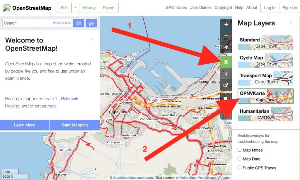
ÖPNVKarte, a new featured layer on www.openstreetmap.org

ÖPNVKarte, a new featured layer on osm.org. Tiles courtesy of MeMoMaps.

OpenStreetMap.org now has a new featured map layer displaying our rich data in a different way: ÖPNVKarte.

ÖPNVKarte is a public transport map displaying public transport routes of trains, trams, light rails, buses, ferries, subways and also points of interest for public transport travelers. Melchior Moos, the creator of the layer, hopes that the inclusion on the global site “will help and reward mappers from all over the world by making their public transport mapping efforts more visible”.

The ÖPNVKarte map key can be found on the ÖPNVKarte website https://öpnvkarte.de (also OpenBusMap.org). For those wondering about the name, it’s derived from German for “Public Transport Map”.

ÖPNVKarte is already featured on sites such as: openstreetmap.de, openstreetmap.no, Mappa-Mercia, Facilmap , OSM inspector and on some mobile applications.

The ÖPNVKarte layer is an addition to these featured layers:

  • Standard(OpenStreetMap Carto), which is the default layer on osm.org,
  • Cycle Map(tiles courtesy of Andy Allan),
  • Transport Map(tiles courtesy of Andy Allan) and
  • Humanitarian (tile style by HOT OSM, hosted by OSM France)

The OSM Operations Working Group is interested in new featured layers that highlight different aspects of OpenStreetMap and you can read about the criteria here.

OSM Operations Working Group

Do you want to translate this and other blogposts in another language..? Please send an email to communication@osmfoundation.org with subject: Helping with translations in [language]

The Operations Working group is one of the volunteer Working Groups of the OpenStreetMap Foundation. The OpenStreetMap Foundation is a not-for-profit organisation, formed to support the OpenStreetMap Project. It is dedicated to encouraging the growth, development and distribution of free geospatial data for anyone to use and share. The OpenStreetMap Foundation owns and maintains the infrastructure of the OpenStreetMap project, is financially supported by membership fees and donations, and organises the annual, international State of the Map conference. It has no full-time employees and it is supporting the OpenStreetMap project through the work of our volunteer Working Groups. Please consider becoming a member of the Foundation.

OpenStreetMap was founded in 2004 and is a international project to create a free map of the world. To do so, we, thousands of volunteers, collect data about roads, railways, rivers, forests, buildings and a lot more worldwide. Our map data can be downloaded for free by everyone and used for any purpose – including commercial usage. It is possible to produce your own maps which highlight certain features, to calculate routes etc. OpenStreetMap is increasingly used when one needs maps which can be very quickly, or easily, updated.
OSMF Microgrants Program: Congratulations to Selected Projects

After many weeks of examining the 48 submitted proposals for the OSMF Microgrants Program, the committee is pleased to announce the 12 projects which have been selected for funding. While the entire range of submissions included thoughtful proposals with potential for impact, a shortlist was formed to keep under the proposed budget of up to €5,000 per project, up to €50,000 total. The selected proposals represent the top tier of ideas that will help shape and impact the OpenStreetMap community in the coming year with microgrant funding.

The accepted proposals are:

  • Leaflets to Promote OSM
    A series of leaflets promoting OpenStreetMap aligned to our Local Chapter aims. Costs will cover the printing and distribution of the leaflets. Design work is expected to be covered by volunteer time.
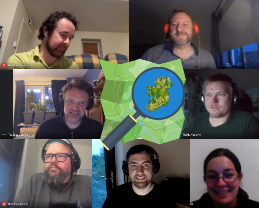
OpenStreetMap Ireland board members during recent online meeting.
Tobias Zwick, developer of StreetComplete
  • Teaching and learning OSM in Albania through LibreTech School
    Organising teaching classes for local OpenStretMap contributors with less or without experience in editing and using OSM. Volunteer’teachers’ will organize online classes with under-represented groups in Albania using amongst others explanatory videos about getting started with OSM and the OSM community.
  • Mapping Villages and Settlements in Kosovo
    Twelve mapathons are planned to be organized with high school students to map their settlements. This will be done in cooperation with ASSET (an afterschool activity project that aims to develop employability and entrepreneurial skills in youth and a positive attitude to their future ASSET).
  • HIV facilities mapping in the Philippines on OpenStreetMap
    HIV has been very rampant in the country and PLHIV are at most vulnerable specially in times of disaster and outbreak. This project aims to map out and validate all HIV facilities’ location and contact details all over the Philippines on OSM.
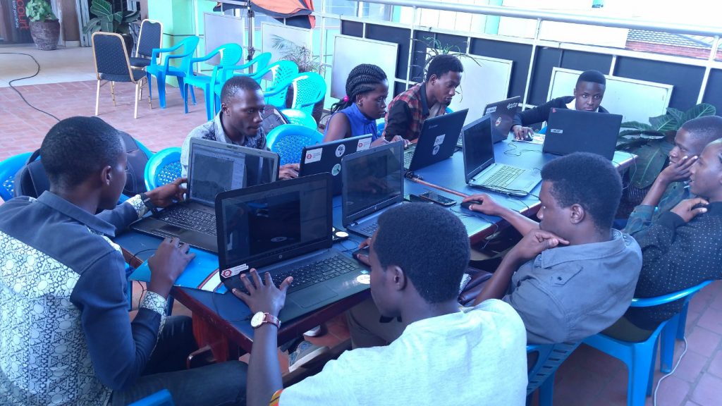
MapUganda – some of the team members.
  • Road Completion project
    Process automatically the road networks official datasets and display the comparison in a way that will help the mappers to add or fix the road network in OpenStreetMap.
  • OpenStreetMap Calendar
    OpenStreetMap Calendar simplifies event organisation and staying up-to-date on nearby events.

All projects must conclude within 12 months from their start, and should show promising results as they commence in the near future. Next steps will include final funding agreements for accountability, disbursement of funds, and kicking off the accepted projects.

A total of €42,368 is authorized by the board for this round of microgrants, although some of this will be reduced due to savings on shared video chat infrastructure and other minimal adjustments. No projects were allowed to have their nature or content modified in order to facilitate selection, but were judged on the merit of their originally submitted format. Community endorsements were considered in the selection process, and input of the OSMF Board was provided in regards to the shortlisted projects. 

The Microgrants Committee includes Christopher Beddow, Janet Chapman, Geoffrey Kateregga, Clifford Snow, and Hanna Krüger. The committee wishes to profusely thank Joost Schouppe for his advising and refereeing during the process, as well as Craig Allan and Michael Collinson who served as neutral observers in the latter half of the committee proceedings. Finally, a profound thanks goes out to all who put in the effort to build a project proposal focused on improving OpenStreetMap, a dedication which does not always come with reward, but demonstrates the spirit of volunteerism and innovation that helps the OpenStreetMap project thrive. 

The OSMF Microgrants Committee

About the OSMF Microgrants: framework, committee minutes and timeline

About photos in this post: The twelve applicants were asked for photos. The post includes those received up to the time of publication.


Do you want to translate this and other blogposts in another language..? Please send an email to communication@osmfoundation.org with subject: Helping with translations in [language]

The OpenStreetMap Foundation is a not-for-profit organisation, formed to support the OpenStreetMap Project. It is dedicated to encouraging the growth, development and distribution of free geospatial data for anyone to use and share. The OpenStreetMap Foundation owns and maintains the infrastructure of the OpenStreetMap project, is financially supported by membership fees and donations, and organises the annual, international State of the Map conference. It has no full-time employees and it is supporting the OpenStreetMap project through the work of our volunteer Working Groups. Please consider becoming a member of the Foundation.

OpenStreetMap was founded in 2004 and is a international project to create a free map of the world. To do so, we, thousands of volunteers, collect data about roads, railways, rivers, forests, buildings and a lot more worldwide. Our map data can be downloaded for free by everyone and used for any purpose – including commercial usage. It is possible to produce your own maps which highlight certain features, to calculate routes etc. OpenStreetMap is increasingly used when one needs maps which can be very quickly, or easily, updated.
A new record for daily mappers and new users!

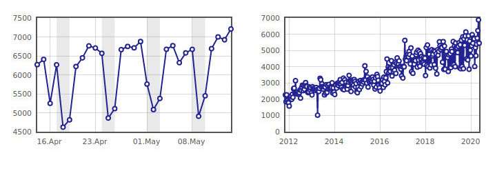
Number of daily mappers from mid-April to mid-May 2020 (left) and in recent years (right).
OpenStreetMap statistics on osmstats.neis-one.org © Pascal Neis. Screenshot supplied by Tobias Knerr. Map data © OpenStreetMap contributors.

OpenStreetMap has been breaking records in May – the record for the most daily mappers, the most newly registered mappers in a day, and the most newly active mappers have been broken numerous times. 

On May 12, a new record for daily mappers was set with 6,999, and then two days later, the record was beaten again with 7,209 mappers. There have also been records set for newly registered mappers, with 6,259 on May 14 as well as newly active mappers, 1,019 on the same day. You can see more trends from the OSM Stats site: http://osmstats.neis-one.org/?item=members

We were wondering if any of these numbers might be due to unusual activity of (e.g.) mappers who were normally mostly mapping during weekends and due to Covid-19 lockdown they now map during the week or due to increased organised editing in particular countries. For this reason, we contacted Pascal Neis and asked him whether he could provide some insight. Pascal was helpful, quickly researched the matter and provided his insights below (thanks!).

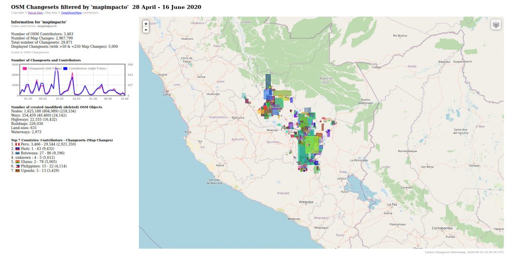
According to Pascal, the mentioned week in May had a high activity of members contributing in Peru, Botswana, Central African Republic and other countries. In particular, there was a high amount of newly registered members who started contributing to the Cusco region in Peru. It is also noticeable that the new mappers contributed mostly on weekdays.

OpenStreetMap changesets filtered by #mapimpacto. Data: 28 April – 16 June 2020.
OSM statistics on osmstats.neis-one.org © Pascal Neis.  Map data © OpenStreetMap contributors.

Pascal also took a close look at relevant hashtags and found some useful information: In Peru (not all, but) a significant amount of contributors utilized the #mapimpacto hashtag. Global Active Learning (GAL) School Peru, which received a 2020 HOT microgrant, co-ordinated HOT tasks there. In Botswana several mappers used the #COVBots hashtag. Besides this, we found that in India there was an effort by Educate Girls.

Going back to the newly registered accounts, this growth has been happening for some time — OSM has been growing for years, with about 1.5 million total contributors and more than 6.5 million registered users as of May 30. You can see detailed stats over time here.

It’s great to see new mappers joining our community. If you haven’t mapped in a while, why not take a look at your neighborhood, somewhere you’re familiar with, or somewhere new. You can see some options and learn more at https://wiki.openstreetmap.org. Also have a look at our good practice guide. And if you want to learn more about mapping with OpenStreetMap as an organization, check out the Welcome Mat at https://welcome.openstreetmap.org and remember to add any organised activities on the OSM wiki, according to the OSM organised editing guidelines.

Happy mapping!

Andrew and other CWG members, with input from Pascal Neis


Do you want to translate this and other blogposts in another language..? Please send an email to communication@osmfoundation.org with subject: Helping with translations in [language]

The OpenStreetMap Foundation is a not-for-profit organisation, formed to support the OpenStreetMap Project. It is dedicated to encouraging the growth, development and distribution of free geospatial data for anyone to use and share. The OpenStreetMap Foundation owns and maintains the infrastructure of the OpenStreetMap project, is financially supported by membership fees and donations, and organises the annual, international State of the Map conference. It has no full-time employees and it is supporting the OpenStreetMap project through the work of our volunteer Working Groups. Please consider becoming a member of the Foundation.

OpenStreetMap was founded in 2004 and is a international project to create a free map of the world. To do so, we, thousands of volunteers, collect data about roads, railways, rivers, forests, buildings and a lot more worldwide. Our map data can be downloaded for free by everyone and used for any purpose – including commercial usage. It is possible to produce your own maps which highlight certain features, to calculate routes etc. OpenStreetMap is increasingly used when one needs maps which can be very quickly, or easily, updated.
SotM 2020 is here, more ways to get involved!

Photo on the left by Manfred Stock. State of the Map 2020 logo by Ed Nicolai, CC-BY-SA 4.0

State of the Map 2020 is just a few weeks away and here are many ways you can still get involved, aside joining scheduled online sessions.

Lightning Talks

Do you want to hold a Lightning Talk during SotM 2020? Submit a pre-recorded 5 minutes video of your Lightning Talk on an OpenStreetMap related topic. Read the how to guide for pre-recorded SotM talks, upload your video here and add your session to this SotM 2020 Wikipage.

The deadline for lightning talk submissions is 28 June 2020.

Self Organized Sessions

Besides the main SotM programme we are offering space for self-organized sessions. If you have an idea for a panel or even a workshop, a self-organized session is the right place for that. The only requirement is that your topic has to be related to OpenStreetMap. We are using the SotM 2020 Wiki for the organization of such sessions so that everybody is able to jump in without any formal barrier.

Of course the Code of Conduct of SotM also applies to the self-organized sessions.

You can find more information on how to prepare and submit a self organized session for SotM 2020 here.

Volunteers

We are looking for volunteers to help in the following roles during SotM 2020:

  • Infodesk – To help answer questions on the SotM Telegram group, SotM Twitter and the IRC Channel.
  • Session Host – To announce the speakers before the talks and lead the Questions & Answers sessions after the talks.
  • Technical Assistant – To help the speaker and the session host with the video conference equipment. 
  • Broadcasting – To do the streaming during the conference. 

You can read more about these roles and add your name here if interested: https://wiki.openstreetmap.org/wiki/State_of_the_Map_2020/volunteers

Conference swag

This year everything is slightly different – including swag. Feel free to help yourself with the designs for t-shirts and stickers and don’t hesitate to share with us photos of your printed swags 🙂

The State of the Map Working Group

Do you want to translate this and other blogposts in another language..? Please send an email to communication@osmfoundation.org with subject: Helping with translations in [language]

The State of the Map conference is the annual, international conference of OpenStreetMap, organised by the OpenStreetMap Foundation. The OpenStreetMap Foundation is a not-for-profit organisation, formed in the UK to support the OpenStreetMap Project. It is dedicated to encouraging the growth, development and distribution of free geospatial data for anyone to use and share. The OpenStreetMap Foundation owns and maintains the infrastructure of the OpenStreetMap project and you can support it by becoming a member. The State of the Map Organising Committee is one of our volunteer Working Groups.

OpenStreetMap was founded in 2004 and is a international project to create a free map of the world. To do so, we, thousands of volunteers, collect data about roads, railways, rivers, forests, buildings and a lot more worldwide. Our map data can be downloaded for free by everyone and used for any purpose – including commercial usage. It is possible to produce your own maps which highlight certain features, to calculate routes etc. OpenStreetMap is increasingly used when one needs maps which can be very quickly, or easily, updated.