Yearly Archives: 2021

Online Briefings on the 2021 OSMF Community Survey

On March 10 & 11, Allan Mustard, Chair of the OpenStreetMap Foundation, will present a series of three Big Blue Button video conferences, open to the OSM community and 8 hours apart, to brief on and answer questions about the results of the 2021 OSMF community survey. The briefings will take place at 12:00 UTC and 20:00 UTC on March 10, and 04:00 on March 11 UTC (click the links to convert for your timezone). He will present some summaries of the data in graphic form, then take questions. He will use his Big Blue Button home room at https://osmvideo.cloud68.co/user/all-3t3-ekg.

Allan also plans to open an instance of Microsoft Translator and to speak into it in English, and will share the access code for the instance at the start of the presentation, so that anybody with Microsoft Translator’s app (on desktop, notebook, tablet, or smart phone) can follow his oral narrative in the language of their choosing. He will also use the Power Point 365 facility for rendering speech to text so that anyone who can read English can read subtitles as he speaks. Anyone planning to view the video conference who wishes to use the translation facility should download the Microsoft Translator app in advance and become familiar with it first.

If you would like to access the anonymized, raw results of the 2021 OSMF community survey, visit this page on the OSMF wiki.

OSMF and OpenCage – Joint press release

OpenCage is a silver level corporate member of the OpenStreetMap Foundation, entitling them to this joint press release. If your organisation would like to support the OSMF more, please consider joining the OSMF as a corporate member, or read about other ways to give back.

Geocoding is the process of converting between addresses or placenames and geographic coordinates (longitude and latitude). Geocoding is a core geospatial functionality; an underlying building block that is critical to developing location based services.

OpenStreetMap Foundation corporate member OpenCage operates a highly-available, enterprise level geocoding API based on OpenStreetMap. We’re pleased to announce that OpenCage recently increased their commitment to the OpenStreetMap Foundation by upgrading to silver level corporate membership.

“For years our service has built on OpenStreetMap. We’re delighted to increase our ongoing support of the worldwide OSM community by increasing our level of commitment to the OpenStreetMap Foundation.” said Ed Freyfogle, OpenCage co-founder.

“It’s a nice milestone that the business has grown to the point that we could upgrade from Bronze to Silver. But beyond financial support the main work we do is opening the eyes of our customers – most of whom arrive knowing simply that they need geocoding, and without a detailed understanding of open data – to open data’s many benefits. Our customers around the world are proof that OpenStreetMap is commercially usable not in some distant theoretical future, but today” continued Freyfogle.

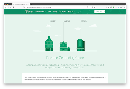
An example of that type of educational work is OpenCage’s recently published Reverse Geocoding Guide, which details the technical challenges of ongoing operation of a reverse geocoding service, while also documenting the advantages of using open data as the underlying data foundation for such a service.

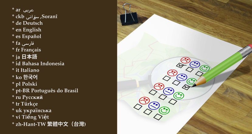
OpenCage offers open source SDKs for accessing their geocoding API for over 30 different programming languages.

In addition to being corporate members of the OSMF, OpenCage are proud members of the UK (the business was started in the UK) and German (the business is currently based in Germany) local chapters, co-sponsor and contribute to the open source development of Nominatim (the primary OpenStreetMap geocoding software), and regularly sponsor OpenStreetMap events.

GEOMOB logo

OpenCage also encourages geoinnovation by running Geomob, a regular series of in-person and online events with the goal of promoting geoinnovation in any and all forms – whether for “fun or profit”, as the event tagline says. Now in its thirteenth year, Geomob has become an established feature of the European geo event landscape, and regularly features projects using OpenStreetMap.

Early in 2020 the Geomob podcast was launched. The weekly conversations provide a chance to reflect on geo industry trends, discuss interesting new geo technology, and interview Geomob speakers. Podcast guests have included many members of the OpenStreetMap community, including Allan Mustard (chairperson of the OSMF Board), Tyler Radford (executive director of the Humanitarian OpenStreetMap team), Sarah Hoffmann (maintainer of the geocoding tool Nominatim, which powers search on osm.org), several founders of businesses building on top of OpenStreetMap, and many more.


What is OpenStreetMap?

OpenStreetMap was founded in 2004 and is a international project to create a free map of the world. To do so, we, thousands of volunteers, collect data about roads, railways, rivers, forests, buildings and a lot more worldwide. Our map data can be downloaded for free by everyone and used for any purpose – including commercial usage. It is possible to produce your own maps which highlight certain features, to calculate routes etc. OpenStreetMap is increasingly used when one needs maps which can be very quickly, or easily, updated.

What is the OpenStreetMapFoundation?

The OpenStreetMap Foundation is a not-for-profit organisation, formed to support the OpenStreetMap Project. It is dedicated to encouraging the growth, development and distribution of free geospatial data for anyone to use and share. The OpenStreetMap Foundation owns and maintains the infrastructure of the OpenStreetMap project, is financially supported by membership fees and donations, and organises the annual, international State of the Map conference. The OSMF supports the OpenStreetMap project through the work of our volunteer Working Groups. Please consider becoming a member of the Foundation.

Community survey on 2020 OSM Foundation board decisions and current topics

Would you like to provide feedback on decisions that the OSM Foundation board made in 2020 and on current topics? The board has prepared a survey and is asking for your input in order to set priorities.

You can see a copy of the questions in English here.

The survey is available in 18 languages so far. Image by D. Kazazi, CC-BY-SA 3.0. Official OSM logo by Ken Vermette, CC-BY-SA 3.0 & trademarks apply.

Languages

Thanks to volunteer translators, the survey is available in eighteen languages so far:

Helping with translations

If you would like to provide a translation to a language not on the list, or to suggest a correction in one of the translations, please email allan@mustard.net

If you would like to help with translations of non-English answers to English, future surveys or blogposts, please send an email to communication@osmfoundation.org with subject: Helping with translations in [language].

Practical

  • You need to provide an email address (to receive a token) and solve an equation in order to access the survey.
  • There are 18 questions, most are multiple-choice and mandatory.
  • There is an optional section with demographic questions.
  • There are several sections. You cannot go back to the previous section but you can resume later.
  • Please note that pages with background information linked from the survey are in English.
    • If the pages are on the OSM wiki, you are welcome to translate them.
    • If they are on the OSMF website and you would like to provide translations, please email the Communication Working Group at communication@osmfoundation.org with subject: Translating OSMF pages in [language].

Feedback

There is discussion about the survey on the “talk” mailing list, where you are welcome to provide feedback. You can register to the talk mailing list here. All past messages of the list are available here.

Privacy

  • Read the LimeSurvey privacy policy.
  • The answers can be accessed by current board members and the administrative assistant and will be processed by the board.
  • The email addresses and names (if provided) of participants won’t be published after the survey ends.

Results

The general results will be published after the survey ends. Past surveys are listed here.

Deadline for participation: 14 February 2021.

Even if you don’t participate, it would be appreciated if you spread the word about the survey.

Thank you in advance 🙂

The OpenStreetMap Foundation is a not-for-profit organisation, formed to support the OpenStreetMap Project. It is dedicated to encouraging the growth, development and distribution of free geospatial data for anyone to use and share. The OpenStreetMap Foundation owns and maintains the infrastructure of the OpenStreetMap project, is financially supported by membership fees and donations, and organises the annual, international State of the Map conference. It has no full-time employees and it is supporting the OpenStreetMap project through the work of our volunteer Working Groups. Please consider becoming a member of the Foundation.

How Joe Biden’s Ancestors helped OpenStreetMap, and OpenStreetMap helps our descendants

The Blewitt clan of Ireland is proud that one of their kin, Joe Biden, was elected the next President of the United States. His Irish roots are well known on both sides of the Atlantic. Before Biden’s great-great-great-grandfather Edward Blewitt moved his family to America to escape the Irish Famine, Edward and his brother James were surveyors whose work shaped Irish maps and municipalities, supported livelihoods, and has even been used in OpenStreetMap today.

Edward and James worked on two foundational Irish mapping projects in the 1830s–40s, the Ordnance Survey and the Griffith’s Valuation. In 1838, James corrected an error in the Ordnance survey’s calculation system that had been missed by many of the brightest mathematical minds of the day in Ireland and Britain. In the late 1840s, Edward managed public works programs that built roads, improved farming through drainage, and gave work to people suffering through the Potato Famine.

Image of the First Edition Six Inch to the Mile maps
First Edition Six Inch to the Mile maps

Their surveying work has been valuable even 150 years later. The OpenStreetMap community used the “First Edition” Ordnance Survey maps the brothers worked on to map all the townlands on the island of Ireland (see “Mapping Ireland’s 61,000 administrative boundaries” at State of the Map 2016). There are approximately 61,000 townlands in Ireland, the great majority of which have been mapped thanks to a donation of out of copyright maps from Glucksman Map Library, Trinity College Dublin, and Bodleian Libraries, University of OxfordOpenStreetMap Ireland isn’t stopping there. They are now attempting to map all the buildings in Ireland and welcome all contributors.

image of historic imagery used for editing modern day OpenStreetMap data
Historic imagery used for editing modern day OpenStreetMap data

OpenStreetMap’s freeform tagging scheme allows people to map what’s important to them. And people are mapping the historical and heritage features they care about. You can explore OpenStreetMap’s coverage of historical features on interactive maps on the HistOSM and Historical Objects websites. If you want to use OpenStreetMap data like this, it’s all available to everyone. If you see something missing, please open up your favourite OpenStreetMap editor and fix the map!

OpenStreetMap is becoming the de facto source of map data for many services and organisations, so we can help preserve our shared human heritage for years to come. Who knows, in 150 years, maybe OpenStreetMap data you enter today will be useful to someone?