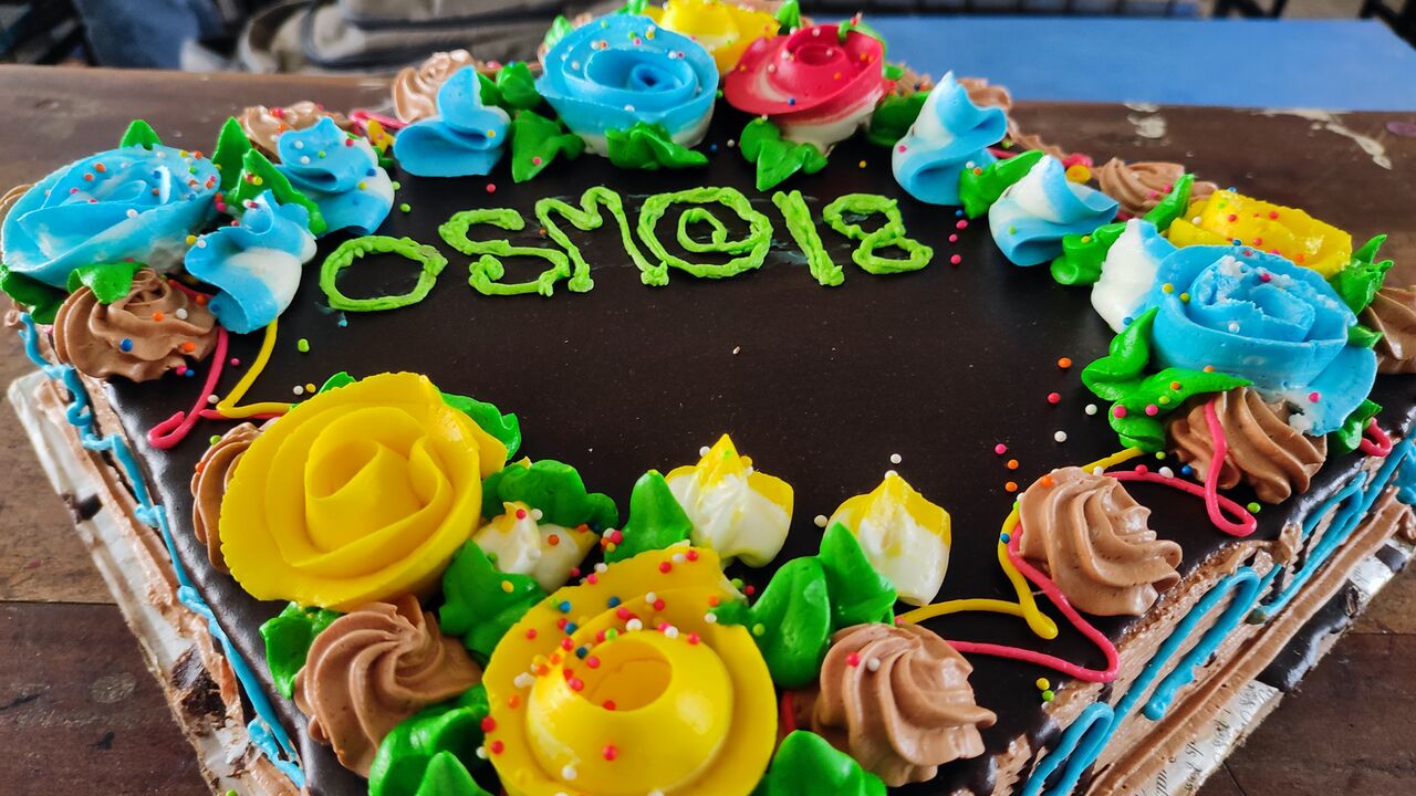
Cake for OpenStreetMap’s 18th anniversary, celebrated by OSM Bangladesh at BSMRSTU (Bangabandhu Sheikh Mujibur Rahman Science and Technology University). Photo by Sawan Shariar, CC-BY-SA 4.0
This Sunday, 7th of August 2022, we are celebrating 18 years of OpenStreetMap!
Celebrations started the previous week and will continue for one more week. So, how do you plan to celebrate? 🙂
Planning to organise an online or in-person event? Please add your event to the OSM wiki! If wiki editing isn’t your thing, email communication@osmfoundation.org with your event details and we’ll add it 🙂
You could post why you love OpenStreetMap 🙂 Remember to use the hashtag #OpenStreetMap18 on social media.
Posting photos of celebrations? If your photos are accompanied with the text “CC-BY-SA 4.0” (or another open license), we can add them to the OSM wiki (or feel free to add them yourself! ~ register here).
Or you could post a photo of yourself holding a written message 🙂
You can use your video room even after the birthday, for any OSM-related event.
Community members in low-bandwidth environments may benefit from using BigBlueButton’s low-bandwidth settings.
Please add your event to the OSM wiki! If wiki editing isn’t your thing, email communication@osmfoundation.org with your event details and we’ll add it 🙂
Join us!
Observance of the anniversary of the creation of OpenStreetMap is held on or about the 9th of August, which is the anniversary of the registration of the OpenStreetMap.org domain name. The concept of OpenStreetMap predates the domain name registration, but that seems a suitable anniversary date 🙂
Do you want to translate this and other blogposts in another language..? Please send an email to communication@osmfoundation.org with subject: Helping with translations in [language]
OpenStreetMap was founded in 2004 and is an international project to create a free map of the world. To do so, we, thousands of volunteers, collect data about roads, railways, rivers, forests, buildings, and a lot more worldwide. Our map data can be downloaded for free by everyone and used for any purpose – including commercial usage. It is possible to produce your own maps which highlight certain features, calculate routes, etc. OpenStreetMap is increasingly used when one needs maps that can be very quickly, or easily, updated.
The State of the Map working group is delighted to announce that the call for venues for 2023 is now open!
State of the Map 2022 in Florence and online is approaching. We – the State of the Map (SotM) working group – are co-working with an awesome local team based in Italy. They found the venue. Checked the technical conditions for video and more. They ordered catering. The social event is planned. Next steps will be the managing of all volunteers in all roles and shifts. Not too easy 🙂
So we take some time and start thinking about State of the Map 2023.
We are looking for a local team that wants to bring OpenStreetMap to their home town. Do you have any suitable locations in your city? Can it host 300 or 500 people? And .. this cannot be too expensive as SotM wants to stay affordable for the community. How is the catering managed? How easy can attendees and participants travel your city?
We can help you investigate and develop a suitable bid. Please contact us.
Do you want to translate this and other blog posts into your language…? Please email communication@osmfoundation.org with the subject: Helping with translations in [your language]
The State of the Map conference is the annual, international conference of OpenStreetMap, organised by the OpenStreetMap Foundation. The OpenStreetMap Foundation is a not-for-profit organisation, formed in the UK to support the OpenStreetMap Project. It is dedicated to encouraging the growth, development, and distribution of free geospatial data for anyone to use and share. The OpenStreetMap Foundation owns and maintains the infrastructure of the OpenStreetMap project. The State of the Map Organising Committee is one of our volunteer Working Groups.
OpenStreetMap was founded in 2004 and is an international project to create a free map of the world. To do so, we, thousands of volunteers, collect data about roads, railways, rivers, forests, buildings, and a lot more worldwide. Our map data can be downloaded for free by everyone and used for any purpose – including commercial usage. It is possible to produce your own maps which highlight certain features, calculate routes, etc. OpenStreetMap is increasingly used when one needs maps that can be very quickly, or easily, updated.
The OpenStreetMap Foundation board welcomes Martin Raifer, whom we contracted to work on the maintenance and development of iD, the default editor at openstreetmap.org. Below you will find his self-introduction. Martin willcontinue working for 20% of his time for HeiGIT (Heidelberg Institute for Geoinformation Technology) and he will have regular meetings with the OpenStreetMap community regarding iD. We would like to remind that any iD-related disputes will be dealt by the OSMF Software dispute resolution panel.
Hello, my name is Martin Raifer, on OSM I use the username tyr_asd. I’m happy to announce that starting with November 2021, I will take over the maintenance and continue the development of the iD editor (OSM’s default mapping web-application) as a freelancer and will be paid for that by the OSMF. I’m feeling humbled that the OSMF entrusted me with this important task!
my goals for iD
To put it simply: I want iD to be the best possible mapping tool! It should optimally fulfill its prominent, important and also delicate role of being the OSM’s default map editor.
iD should remain an intuitive tool which everyone can use, from beginners performing their first edits to the most experienced of mappers. Since many users will continue to have their first point of contact with mapping using the iD editor, there is the need for a strong focus on good usability and user experience design. At the same time, I find it also important to not neglect the needs of more advanced users who like to work efficiently and sometimes need more specialized ways to manipulate OSM data.
In many ways, iD already does a quite good job of affording people to edit the map. Of course there are always things to improve, stuff to optimize and features to change.
my background
I’m an active OSM mapper since 2009, and have been contributing to the OSM software ecosystem in various ways. Some of you might know overpass-turbo – the web front end I created for the Overpass API – or some of my other OSM-related projects. Professionally, I have worked with OSM data first at an urban bike mobility startup, then as a freelancer for a project of the Humanitarian OpenStreetMap Team, and became a research associate at Heidelberg University/HeiGIT (more about that below) where I helped organizing the State of the Map conference in Heidelberg in 2019.
In the past, I already contributed occasionally to the development of several OSM’s core software: for example the osm website, the editor-layer-index and the iD editor. For iD I helped with beta-testing in the early days, added presets, submitted bug fixes and implemented a few small features like the support for WMS backgroundlayers.
my affiliation with HeiGIT
I will continue to work for the HeiGIT (Heidelberg Institute for Geoinformation Technology at Heidelberg University) alongside my work on the iD editor to a small extent of one day per week. At HeiGIT, I will continue to collaborate on mostly OSM-related research activities, with a strong focus on data quality. In addition, I will also support some teaching activities such as lectures at Heidelberg University.
The main chunk of my time will of course go into the development of the iD editor! I will do my best to cleanly separate my activities at HeiGIT from my work for the OSMF. Should at any point in time a conflict of interest occur, I will directly report it to the OSMF and HeiGIT to resolve.
my next steps
Initially, I will prioritize fixing of bugs, publishing of updates and documenting of the status quo such that decisions about future changes can be made in an informed way. Working through the accumulated reported issues on GitHub will probably take a while.
I am open to feedback from the whole OSM community, so get in touch on iD’s issue tracker on github or through some of the many OSM communication channels (I will try to follow as many of them as possible). Of course code contributions from you are also very welcome!
Do you want to translate this and other blog posts in another language..? Please send an email to communication@osmfoundation.org with subject: Helping with translations in [language]
The OpenStreetMap Foundation is a not-for-profit organisation, formed to support the OpenStreetMap Project. It is dedicated to encouraging the growth, development and distribution of free geospatial data for anyone to use and share. The OpenStreetMap Foundation owns and maintains the infrastructure of the OpenStreetMap project, is financially supported by membership fees and donations, and organises the annual, international State of the Map conference. It has no full-time employees and it is supporting the OpenStreetMap project through the work of our volunteer Working Groups.Join the OpenStreetMap Foundation for just £15 a year or for free if you are an active OpenStreetMap contributor.
In 2020 the OpenStreetMap Foundation (OSMF) board funded 12 OpenStreetMap projects proposed by community members, groups and organisations. All the project proposals (funded or not) are visible on the OSM wiki and some of the 12 selected proposals were presented on the OSM blog. The program was overseen by the microgrants committee, whose composition was determined by the OSMF board. Initially, the program was set to fund 10 projects with a budget of up to 5000 Euros per project and for a maximum of 50.000 Euros. The policy framework can be read here.
Report by the OSMF Microgrants Committee
The trial run of the OSMF microgrants program has now ended. You can
read the detailed final report(.odt, 29 KB) by the Microgrants Committee, submitted in September 2021 to the board, and
Almost all projects have sent their final reports and you can read them on the OSM wiki. The respective project proposal is linked towards the top of each page.
The final report by the Microgrants Committee was sent recently, so at the time of writing there is no evaluation published by the board or a decision taken on whether there will be a second microgrants round.
Do you want to translate this and other blog posts in another language..? Please send an email to communication@osmfoundation.org with subject: Helping with translations in [language]
The OpenStreetMap Foundation is a not-for-profit organisation, formed to support the OpenStreetMap Project. It is dedicated to encouraging the growth, development and distribution of free geospatial data for anyone to use and share. The OpenStreetMap Foundation owns and maintains the infrastructure of the OpenStreetMap project, is financially supported by membership fees and donations, and organises the annual, international State of the Map conference. It has no full-time employees and it is supporting the OpenStreetMap project through the work of our volunteer Working Groups.Join the OpenStreetMap Foundation for just £15 a year or for free if you are an active OpenStreetMap contributor.
Any natural person may be elected to become a board member, provided that:
they have been a normal OSM Foundation member [1] (notan associate member [2]) during the full 180 days before the General Meeting (start date of normal membership before 14 June 2021), and
are willing to act as a board member, and
are permitted by law to do so.
[1] Normal members provide their full residential address and can vote on all issues. Their residential address may be disclosed to other members.
[2] Associate members provide just their country of residence - which may also be disclosed to other members - and can vote - but not on all issues. Additionally, they cannot be board candidates.
If you want to find out the type of your OpenStreetMap Foundation membership (normal or associate), please check the most recent approval/renewal membership email or email the volunteers of the Membership Working Group at membership@osmfoundation.org
Available seats in this election
The 2021 board election will have at least 4 board seats available: of M. Maron, A. R. McCann, A. Mustard and G. Rischard. The terms of T. Knerr, JM Liotier and E. A. Villar will continue.
Currently there are seven seats on the foundation board. Board members are volunteers.
What the board is/is not, rules and responsibilities and why run
A lot of the foundation’s work is done by the volunteers of our working groups, and if you want to help the foundation, you can also look at joining those.
How to nominate yourself
Update: The self-nomination window has now closed. Thank you to everyone who put their name forward!
You can create an account on the OSM wiki here and you will be able to add your name to the table that will be added on that date by editing the page here (please wait until 16 October 2021 to do so).
Resources about the 2021 board election and Annual General Meeting
The main two pages that will have the information about the 2021 board election and Annual General Meeting are:
A few of the current and past board members have mentioned that the thought of being a candidate did not cross their mind until it was suggested to them. So, you might want to think if you’d like to run for the board or to suggest being a candidate to others.
Do you want to translate this and other blog posts in another language..? Please send an email to communication@osmfoundation.org with subject: Helping with translations in [language]
The OpenStreetMap Foundation is a not-for-profit organisation, formed to support the OpenStreetMap Project. It is dedicated to encouraging the growth, development and distribution of free geospatial data for anyone to use and share. The OpenStreetMap Foundation owns and maintains the infrastructure of the OpenStreetMap project, is financially supported by membership fees and donations, and organises the annual, international State of the Map conference. It has no full-time employees and it is supporting the OpenStreetMap project through the work of our volunteer Working Groups.
To support the development of open source software around OpenStreetMap, the OSM Foundation has recently launched the Engineering Working Group (EWG). The group intends to support open source software projects with direct funding, mentorship programs, and by offering a platform for coordination.
Why this working group?
OpenStreetMap relies on a vast ecosystem of open source software. This includes the tools used by mappers to understand and contribute data, the software powering our database servers and website, the libraries and frameworks used by developers to build consumer-facing applications around OSM data, and many of these applications themselves.
The development teams creating these software products are generally independent entities, separate from the OpenStreetMap Foundation (OSMF). This is by design: The OSM community values do-ocracy and decentralization, so the OSMF does not manage software projects. However, that does not mean there is no room for the OSMF to support this vital ecosystem!
What we do
The Engineering Working Group (EWG) is charged with
Handling software development paid for by the OSMF, including the distribution of grants. This will involve putting out calls for proposals on tasks of interest, and accepting proposals on other tasks.
Offering a platform for coordination of software development efforts across the OSM ecosystem. We want to encourage standardization and shared efforts between projects by bringing together developers with similar interests. This work also includes responding to emails and directing people at other people or appropriate resources.
Managing OSM’s participation in software mentorship programs such as Google Summer of Code, which help grow the OSM developer community.
For handling paid development, “tasks” include development of new features, maintenance of code, documentation, and other tasks that improve the developer experience. When we are ready to start providing grants, we will encourage applications from skilled individuals who aren’t professional developers, professional contractors or companies, as well as those who are.
The OSMF has previously supported software projects through microgrants as well as separately with funding for Nominatim, osm2pgsql, Potlatch 2 and iD. With EWG, this kind of support will be placed on a more solid foundation.
In our first round we will look for projects that don’t need much management and focus the bulk of our efforts on core software. Like with all work paid for by the OSMF, the principles of the Hiring Framework will apply.
Whom we seek
As a group that is just getting started, we’re eagerly looking for additional working group members.
We would particularly welcome people knowledgeable about technology used in key OSM systems, such as the rails port, Ruby on Rails in general, and the cgimap implementation of the main OSM API, as well as those who can help with knowledge domains, such as user interface design, which are not well covered by the existing members.
However, you do not need to know any particular technology to participate! So if you have experience with the OSM software ecosystem, developing software, or managing software development, consider joining us!
Do you want to translate this and other blog posts in another language..? Please send an email to communication@osmfoundation.org with subject: Helping with translations in [language]
The OpenStreetMap Foundation is a not-for-profit organisation, formed to support the OpenStreetMap Project. It is dedicated to encouraging the growth, development and distribution of free geospatial data for anyone to use and share. The OpenStreetMap Foundation owns and maintains the infrastructure of the OpenStreetMap project, is financially supported by membership fees and donations, and organises the annual, international State of the Map conference. It has no full-time employees and it is supporting the OpenStreetMap project through the work of our volunteer Working Groups.
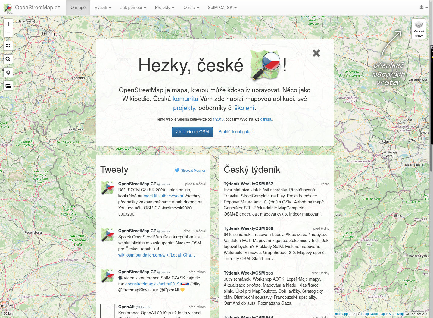
The following post was put together by several members of Czech OSM community, and the main contributor was Mikoláš Štrajt. OpenStreetMap Česká republika z.s. is one of the OSM Foundation Local Chapters.
OpenStreetMap Česká republika z.s. association was founded in 2018 with a primary aim to have a stable entity for ownership of already existing website of the local community on domains openstreetmap.cz and osmap.cz. Since 2020 the association acts as a local chapter of OpenStreetMap Foundation in the Czech Republic.
automatically, address points (operated by poloha.net project),
semi-automatically, buildings (from the RÚIAN database) and fields and meadows (from the LPIS database) using the JOSM plugin called Tracer,
we are updating post boxes according to open data by Česká pošta (Czech Post) and we report any discrepancy found,
as needed, we sometimes do collective edits. Recently, we have been for example improving the tags about recycling containers or controlling if we do not have telephone booths, which were cancelled the other day, hanging in the map.
organise the State of the Map CZ+SK conference (as part of wider OpenAlt conference or standalone action), and we are publishing video recordings of the speeches,
quarterly, call for a personal meeting of mappers – so-called “quarterly beer”,
organise mapathons,
clean up after vandals operating in the area of the Czech Republic, communicate with the newbies, state offices, and commercial subjects.
Members of our community operate their own projects, e.g.:
– MTB map – a map for mountain bike riders, – tourist maps for Garmin, other Garmin maps, – maps of the Czech Republic for applications based on the mapsforge library, – POI importer used to easily import various datasets into OSM, – Osmose backend for CZ,PL,DE,FI,DK,AT, – Taginfo for the Czech Republic, – OsmHiCheck – QA applications for hiking routes, – Archive of extracts of OSM data for the Czech Republic with very old versions, – Monthly generated map tiles for the Czech Republic starting 04.2006.
Do you want to translate this and other blog posts in another language..? Please send an email to communication@osmfoundation.org with subject: Helping with translations in [language]
The OpenStreetMap Foundation is a not-for-profit organisation, formed to support the OpenStreetMap Project. It is dedicated to encouraging the growth, development and distribution of free geospatial data for anyone to use and share. The OpenStreetMap Foundation owns and maintains the infrastructure of the OpenStreetMap project, is financially supported by membership fees and donations, and organises the annual, international State of the Map conference. It has no full-time employees and it is supporting the OpenStreetMap project through the work of our volunteer Working Groups.
OpenStreetMap is open data, available to all for free on https://planet.openstreetmap.org. We release six large files, totaling 428 GB every week. These files contain the complete OpenStreetMap data, including files with the full history of OSM.
To make it easier to share the load of downloading these files, we also supply BitTorrent files, which allow spreading the load across multiple web servers as well as using peer-to-peer file transfers.
mnalis has recently implemented RSS feeds which announce when the torrents come out. This allows users to automatically subscribe to sharing new planet files as they are produced, thus reducing the load on the planet.openstreetmap.org servers, which are bandwidth-limited.
Do you want to translate this and other blog posts in your language…? Please email communication@osmfoundation.org with subject: Helping with translations in [your language]
The OpenStreetMap Foundation is a not-for-profit organisation, formed to support the OpenStreetMap Project. It is dedicated to encouraging the growth, development and distribution of free geospatial data for anyone to use and share. The OpenStreetMap Foundation owns and maintains the infrastructure of the OpenStreetMap project, is financially supported by membership fees and donations, and organises the annual, international State of the Map conference. The OSMF supports the OpenStreetMap project through the work of our volunteer Working Groups, such as the Operations Working Group. Please consider becoming a member of the Foundation.
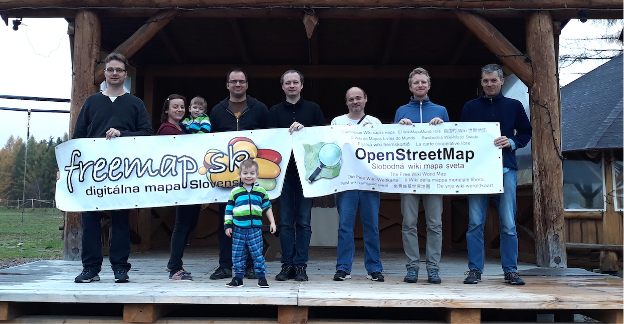
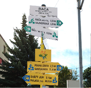
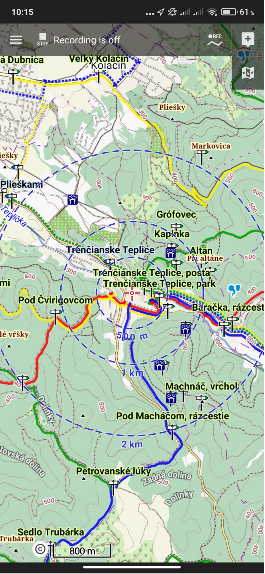
The following post was written by Freemap Slovakia, one of the OSM Foundation Local Chapters.
OpenStreetMap is represented in Slovakia by Freemap Slovakia (NGO Freemap) which was founded in 2009 and became recognized as Local OSM Chapter in 2021.
We have 13 regular and 4 registered members. Apart from the organized members, there are several hundred active mappers in Slovakia.
Over the time, we contributed to OSM in many ways and we continue to do so.
Community
General OSM discussion forum related to Slovakia
We maintain osm_sk google group, available to everyone, where all OSM contributors that deal with Slovakia in OSM are welcome to ask questions and discuss ideas.
Mapping Parties
Once, or twice a year we organize mapping parties, one of which serves as a meeting for our NGO. The parties are always held at different places in Slovakia.
In an effort that has been going for several years we continuously perform supervised bulk import of buildings and addresses from the Cadastre of Real Estate of Slovakia. For this purpose we built a JOSM plugin that allows users to visually inspect batch-imported data and upload it subsequently into the OSM database.
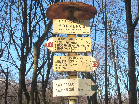
Marked Hiking Trails
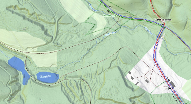
Slovakia is a mountainous country and has one of the most elaborate systems of marked hiking trails in the world with more than 100 years of history (shared with Czech Republic).
We cooperate with the Klub Slovenských Turistov (Association of Slovak Tourists) which maintains the physical trails and markings, to make sure all changes are captured in OSM as soon as possible.
Cycling Infrastructure
Slovakia enjoys steady growth of cycling infrastructure, both in physical means (e.g. dedicated cycling paths) and in terms of trail marking. We make sure the latest changes in the “physical world of Slovak cycling” are captured in the OSM database.
Rivers and streams
Rivers and streams are hard to be properly mapped by “survey”, therefore we imported most of the waterways from the Cadastre of Slovakia, open data sources of Slovak Cartography Office of Slovak Republic, INSPIRE dataset and recently from more precise Aerial Laser Scans of Terrain performed by the Geodesy, Cartography and Cadastre Authority of the Slovak Republic.
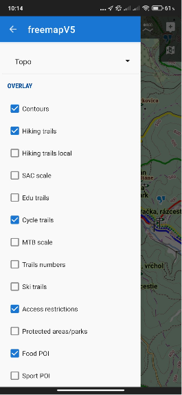
Software & Hardware
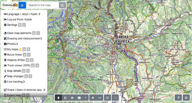
Freemap.sk Web Portal
We develop and maintain web portal freemap.sk that provides a number of features:
Source code of the portal, backend servers and many utility repositories are Open source.
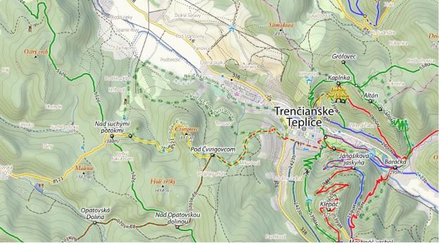
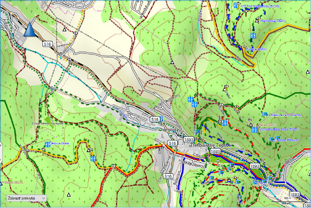
Custom Map Styles and Renderers
Due to the specific appearance of the hiking trail marking in Slovakia, we developed several custom map styles which we also render and provide publicly as tiles.
Legacy Hiking Style
This raster map style was used for many years until we developed a more recent, hi-res “outdoor style”. Some people still consider this legacy style a pinnacle in terms of balance between colours, information and general aesthetics, and therefore the style is still available in the portal.
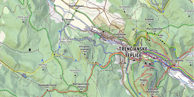
Recent Outdoor Style
A new hi-res raster map style has been in development since 2019, with a more “busy” appearance, as it displays hiking, cycling, cross-country skiing and horse riding marked trails all at once.
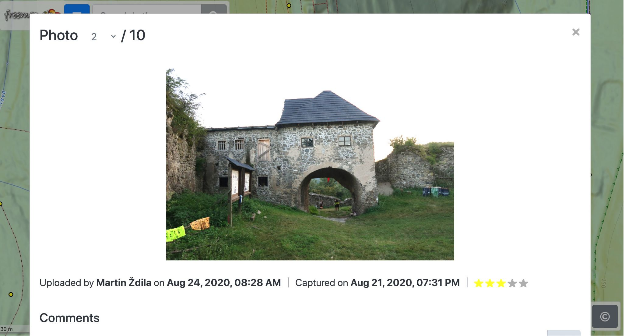
We empower users of freemap.sk to upload and view photos. Our photo gallery contains almost 300 000 photos, including more than 10 000 photos of hiking and cycling guideposts.
Rendering Maps and Hosting Tiles
We render our own map styles and expose the map tiles for public use. This way, anyone can easily use our raster map tiles in their websites, or smartphone apps.
We also provide offline vector maps for the Android smartphone app Locus and other devices:
Garmin Exports
Twice a week we export the freemap-style map into a format suitable for Garmin devices.
Other
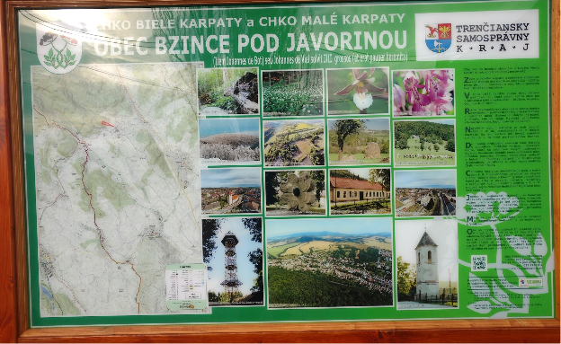
Printed maps
We create custom vector maps for large prints on information boards. Freemap.sk users can also easily export their own raster maps in print quality through the Export Map feature.
OSM License Compliance
Maps generated from the OSM data are frequently used by various NGOs in Slovakia on information boards and printed maps. When we encounter OSM-based maps missing appropriate attribution, we communicate with creators of those maps to make sure the text is included. In almost all cases such the situation is caused by lack of knowledge and not by malicious intent and the problem is usually resolved by adding a sticker to the board containing the attribution text.
Awards
The Openstreetmap Foundation Greatness in mapping award was granted to our member Martin Ždila in 2016.
Funding
Our largest expenses are for hosting the freemap.sk portal and the map rendering servers. These costs are covered with income from annual fees paid by our members, by donations, and via the Slovak government-run 2% income tax donation schema.
Vision for Upcoming Years
In the near future we will be busy with the following:
we believe that as a community, we succeeded in creating the best outdoor map of Central Europe, with an unmatched level of detail, precision, and frequency of updates. We plan to continue in this effort
grow the OSM community in Slovakia and make the existing tools more accessible for non-English speaking mappers.
as mostly technology-centric group of people, we realize the need for recruiting new members, who could help us put a more human face on our effort through social media, or by organizing mapping-propagating events for lay people
continue importing data into the OSM database from datasets published by various Slovak government agencies. This also includes cleanup of data that was previously imported from less precise datasets.
work on further development of the freemap.sk web portal, the outdoor map style and a custom routing service, most likely based on GrapHopper
try to raise more funds, which would allow us to grow the area covered by our map even further
oma.sk – partner portal build on top of OSM data and Freemap.sk maps
nabezky.sk – partner portal for cross-contry skiing using Freemap.sk maps
If you would like to contact us
Write us via osm_sk google group, or through Facebook page, or send us an email to freemap@freemap.sk
Do you want to translate this and other blog posts in another language..? Please send an email to communication@osmfoundation.org with subject: Helping with translations in [language]
The OpenStreetMap Foundation is a not-for-profit organisation, formed to support the OpenStreetMap Project. It is dedicated to encouraging the growth, development and distribution of free geospatial data for anyone to use and share. The OpenStreetMap Foundation owns and maintains the infrastructure of the OpenStreetMap project, is financially supported by membership fees and donations, and organises the annual, international State of the Map conference. It has no full-time employees and it is supporting the OpenStreetMap project through the work of our volunteer Working Groups.
Would you like to provide feedback on decisions that the OSM Foundation board made in 2020 and on current topics? The board has prepared a survey and is asking for your input in order to set priorities.
You can see a copy of the questions in English here.
The survey is available in18 languages so far. Image by D. Kazazi, CC-BY-SA 3.0. Official OSM logo by Ken Vermette, CC-BY-SA 3.0 & trademarks apply.
Languages
Thanks to volunteer translators, the survey is available in eighteen languages so far:
If you would like to provide a translation to a language not on the list, or to suggest a correction in one of the translations, please email allan@mustard.net
If you would like to help with translations of non-English answers to English, future surveys or blogposts, please send an email to communication@osmfoundation.org with subject: Helping with translations in [language].
Practical
You need to provide an email address (to receive a token) and solve an equation in order to access the survey.
There are 18 questions, most are multiple-choice and mandatory.
There is an optional section with demographic questions.
There are several sections. You cannot go back to the previous section but you can resume later.
Please note that pages with background information linked from the survey are in English.
If the pages are on the OSM wiki, you are welcome to translate them.
If they are on the OSMF website and you would like to provide translations, please email the Communication Working Group at communication@osmfoundation.org with subject: Translating OSMF pages in [language].
Feedback
There is discussion about the survey on the “talk” mailing list, where you are welcome to provide feedback. You can register to the talk mailing list here. All past messages of the list are available here.
The answers can be accessed by current board members and the administrative assistant and will be processed by the board.
The email addresses and names (if provided) of participants won’t be published after the survey ends.
Results
The general results will be published after the survey ends. Past surveys are listed here.
Deadline for participation: 14 February 2021.
Even if you don’t participate, it would be appreciated if you spread the word about the survey.
Thank you in advance 🙂
The OpenStreetMap Foundation is a not-for-profit organisation, formed to support the OpenStreetMap Project. It is dedicated to encouraging the growth, development and distribution of free geospatial data for anyone to use and share. The OpenStreetMap Foundation owns and maintains the infrastructure of the OpenStreetMap project, is financially supported by membership fees and donations, and organises the annual, international State of the Map conference. It has no full-time employees and it is supporting the OpenStreetMap project through the work of our volunteer Working Groups. Please consider becoming a member of the Foundation.