Author Archives: OpenStreetMap

About OpenStreetMap

Posts written "by OpenStreetMap" were written collaboratively by the Communication Working Group and/or other OpenStreetMap Foundation folks.

Can you help make OpenStreetMap.org faster in Brazil, or Australia/New Zealand?

CDN of tile delivery caching servers.

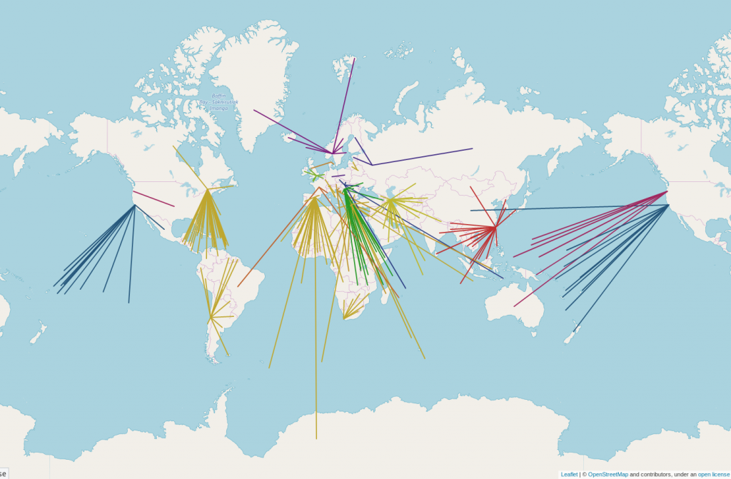
A big use of the OpenStreetMap data is the web map on OpenStreetMap.org. Along with our hard working team of volunteer sysadmins who keep it going, we are helped by many donated tile cache servers around the world, which speed up the map in various regions.
We are always open to more servers, but the Operations Working Group is currently looking for servers in Brazil, and Australia/New Zealand. If you or your organisation would like to donate a cache server and hosting, we’re ideally looking for a physical server or powerful VM with 8GB+ RAM and at least 146GB of storage. Read more details.

Please email operations@osmfoundation.org if you are interested.

Our peak Brazil traffic is currently around 65 Mbps. Our peak Australian and New Zealand traffic is currently around 20 Mbps. See the full country breakdown in bits per second.

Some more information:

  • Brazil has the 10th highest traffic and is the largest country without a cache in it or nearby.
  • Worldwide peak traffic is 2300 Mbps.
  • Antarctica and Australia are the two continents we do not have caches on.

We fully manage the software and operating system. All config is managed via our chef recipes. We also run a local firewall on each server. If physical hardware, we monitor using it SMART, hp-health, etc and report any hardware issues back to the hosting organisation.

Will you help us and join the people and organisations that support OpenStreetMap? Thank you!

The OpenStreetMap Foundation is a not-for-profit organisation, formed in the UK to support the OpenStreetMap Project. It is dedicated to encouraging the growth, development and distribution of free geospatial data for anyone to use and share. The OpenStreetMap Foundation owns and maintains the infrastructure of the OpenStreetMap project. Volunteers, like the indefatigable team of server administrators, keep all of this hardware working. 

OpenStreetMap tiles are free for everyone to use, but should be used with moderation. If you are a high traffic site you should look at switch2osm.org to find out how to use the data and keep the tiles available for everyone.

If you can’t donate server hosting, you can always make a financial donation to the OSMF.
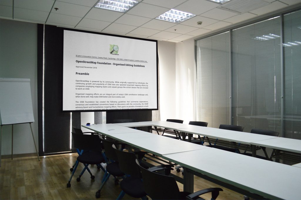
Organised editing guidelines

OpenStreetMap is powered by its community. While originally supported by individuals, the continuing growth and popularity of OSM have also spawned organised mapping efforts by companies employing mapping teams and unpaid groups like school classes that are directed to work on OSM. 

Organised mapping efforts are an integral part of today’s OSM contribution landscape and, when done well, help make OSM better and more widely used. 

The OSM Foundation has created the Organised Editing Guidelines that summarise expectations, consensus and established conventions based on discussions with the community, members of the OSMF advisory board and humanitarian mapping efforts. Their goal is to provide a framework to both organised mapping initiatives and the communities to encourage good organised mapping. They are not meant to apply to community activities like mapping parties between friends or doing a presentation on OSM at a local club. If you’re not sure whether you should apply them, contact the local community for advice.

The Organised Editing Guidelines can be found here: 
https://wiki.osmfoundation.org/wiki/Organised_Editing_Guidelines

The guidelines have been developed thanks to volunteers of the OSMF Data Working Group, with various rounds of feedback from the wider community, and have been approved by the Board of Directors. Unofficial translations are found here: https://wiki.openstreetmap.org/wiki/Organised_Editing_Guidelines 
You can add your translation there, or contact the Communication Working Group at communication@osmfoundation.org

Sometimes edits made as part of an organised exercise can be problematic, or their accuracy/quality may be disputed by others in the community. As with other disputes, the Foundation’s Data Working Group will respond to organised edits that have gone wrong. While they will intervene for edits that are problematic, not following the guidelines per se is not treated an offense. The overall goal of the guidelines is to provide a framework for ‘sizeable, substantial’ activities: “We wanted something that doesn’t scare casual events off while letting us regulate a geography class gone berserk or a misguided volunteer mapathon.”

Look for the monkey

We – the State of the Map working group and the local team of Heidelberg –  are already working on SotM 2019. In December we launched the website

https://2019.stateofthemap.org/

The local team prepared a wonderful logo and an appropriate conference motto “Bridging the Map” which not only applies to the basics of OSM community but also to our host city Heidelberg:

State of the Map 2019 logo by Michael Auer
Right next to the old bridge in Heidelberg there lives a curious little statue – a bronze monkey. In its hand, it holds a mirror to remind anyone crossing the bridge to look back from where they came from and remember who they are. For the 2019 SotM in Heidelberg we want to take the role of that little monkey and remind everyone that no matter where we are going and what we are doing with OSM, we should never forget that we all come from the same origin: a little map that anyone can modify and use. Whether you are a hobby mapper, a scientific researcher, a humanitarian, an NGO, a government agency, a small business or a global company — we want to bridge the gap between us, or better yet, we want to Bridge the Map.

Our estimated timeline for 2019 is

15 Feb – Call for Scholars
28 Feb – Call for Abstracts (general and academic)
30 Mar – Deadline of Call for Scholars
24 Apr – Deadline of Call for Abstracts
16 May – Start Early Bird ticket sale
20 Jun – Program Announcement
04 Jul – Switch to regular ticket prices
21-23 Sep – State of the Map in Heidelberg/Germany

Open open open

Apart from the daily work of conference preparation, we have spent considerable efforts in order to use more FOSS tools. We started by moving our meetings from Hangout to Mumble. We use HOT’s Mumble server which already serves the OSMF board and other OSMF working groups. So it was already proven that Mumble is smart and works on all platforms.Our next step was much more challenging. We moved our email communication from Google Mail to the OpenStreetMap mailing list server. We couldn’t move our domain yet as there were too many constraints for a rigorous cut. So we decided to keep the Google account with the stateofthemap.org MX until everything is sorted out. At the moment the mail address “team@stateofthemap.org” is still valid, but it is forwarded to sotm@openstreetmap.org.
Tom – thank you so much! – has set up a number of private mailing lists for all our needs:

sotm@openstreetmap.org
program-sotm@openstreetmap.org
academic-sotm@openstreetmap.org
scholar-sotm@openstreetmap.org
sponsor-sotm@openstreetmap.org

All these lists are private. Only members of the SotM working group or the appropriate teams are able to read the emails addressed to these lists. For example progam-sotm@openstreetmap.org is read by the program committee and used for all internal communication. At the same time everybody (from outside) can write to this email address send their questions to the program committee using this email address.

Our next step will concern the submission form for the conference contributions – the “Call for Abstracts”. We will move from Google forms to Pretalx, which is Open Source software. It is already used by FOSSGIS (the German local chapter). So we know about advantages and limitations.

We still have some proprietary tools in use, and switching from a proprietary to an Open Source tool takes additional work – not only for us but also for the operations working group. In the past few months we could spend some time on this, but during the hot phase of SotM preparation there will not be enough capacity. Also, the Open Source tools are sometimes less comfortable than the proprietary equivalent, and it needs a lot of communication to persuade all the affected people to make this additional effort. The State of the Map working group supports the idea of Open Source software, and we think this goal is worth the extra effort (even if the path is sometimes rocky).

State of the Map working group
Sign up for event updates


Academic Track at SotM 2019 – Let’s get started!

SotM 2019 logo, by Michael Auer, on a round table © CC-BY-SA 4.0 OSMF CWG

Following the successful initiation of the Academic Track at State of the Map 2018 in Milan [1], this Track will be included again in the program of State of the Map 2019, to be held in Heidelberg on September 21-23, 2019.

The main purpose of the Academic Track is to bring together and foster interactions between the OpenStreetMap community at large (contributors, developers, users, etc.) and the academic/scientific community of researchers from all over the world.

A designated Leading Team would be in charge on the organization of the Academic Track, co-chaired by Marco Minghini (on behalf of the OSMF  State of the Map Working Group) and Yair Grinberger (on behalf of the  Heidelberg local team). We hereby issue a call for applications,  inviting all interested individuals to apply to join the Leading Team.  This team will be in charge of:

  • writing and publishing the call for abstracts/papers for State of the Map 2019
  • designing and managing the review process of the submitted  abstracts, deciding which ones to accept for oral presentation or poster  presentation
  • defining the Academic Track schedule at State of the Map 2019, by  working in close contact with the Programme Selection Committee
  • planning and managing possible publication outputs, e.g. conference proceedings or a Special Issue in a scientific journal

In agreement with the OSMF State of the Map Working Group and the local team, it was decided that the Academic Track Leading Team will be composed by Marco and Yair plus 3 additional people that would be selected through this open call. Thus, we invite applications for researchers or academics to be part of the Academic Track Leading Team. The call is open to everyone interested. Applications shall be made exclusively by sending an e-mail to the OSM science mailing list science@openstreetmap.org (this requires registering for the list at https://lists.openstreetmap.org/listinfo/science), and filling the following template:

Name and Surname 
Please enter your name and surname.

Affiliation
Please enter your (current) full affiliation.

Academic experience, in particular on OpenStreetMap
Please enter a short description of your main academic interests and  contributions, especially related to OpenStreetMap. A full list of  OpenStreetMap-related publications (or a link to it) is appreciated.

Editorial experience
Please enter a short description of your editorial experience, e.g.  as a Member of the Editorial Board of scientific journals, Guest-Editors  of Special Issues, reviewer for scientific journals. Place the focus on  OpenStreetMap, when relevant.

Participation in State of the Map 2019
Despite it is not required that you are attending State of the Map  2019, please inform us whether you plan to attend (if selected as a  member of the Academic Track Leading Team).

Only applications submitted according to this procedure and only self-nominations will be considered.

The deadline for applications is January 3, 2019.

Applications will be assessed by the OSMF State of the Map Working  Group and the Heidelberg local team. The three available seats of the  Academic Track Leading Team will be assigned based on the candidate’s personal merit and according to the overall goal of forming a diverse and Interdisciplinary Team. In absence of candidates who are meeting the expectations, the OSMF State of the Map Working Group and the  Heidelberg local team reserve the right to select less than three people, or nominate additional persons by invitation.

Best regards,
Yair and Marco – on behalf of the OSMF State of the Map Working Group and the State of the Map 2019 Heidelberg local team.

[1] See the call for abstracts for 2018 and the program of the Academic Track on Sunday, 29 July, room S1.3 (https://2018.stateofthemap.org/program)

RFQ: GDPR-related changes to the Rails API and CGIMap

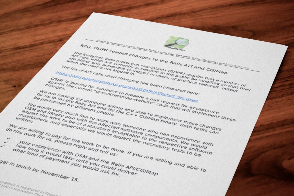
RFQ © CC-BY-SA 4.0 OSMF Communication Working Group

The European data protection regulations (GDPR) require that a number of API calls which are currently accessible to the public be modified so that they are either only accessible to logged-in users, or produce reduced output when the user is not logged in.

The list of API calls need changing has been prepared here:
https://wiki.openstreetmap.org/wiki/GDPR/Affected_Services

OSMF is looking for someone to prepare a pull request for acceptance against the current “openstreetmap-website” code that will implement these changes.

We are looking for someone willing and able to implement these changes for us to (a) the Rails API and (b) the C++ CGIMap binary. Both tasks can be performed by different people.

We would very much like to work with someone who has experience with OSM and ideally also with the affected software components. We would expect the work to be of a standard acceptable to the respective software maintainers, and especially we would expect the necessary tests to be written.

We are willing to pay for the work to be done. If you are willing and able to do this work for us, please reply and tell us:

  • your experience with OSM and the Rails API/CGIMap
  • how long it would take until you could deliver
  • what kind of payment you would ask for.

Please get in touch by November 15. Update 20th December: the call is still open and we welcome expressions of interest.

Introducing the Belgium Local Chapter

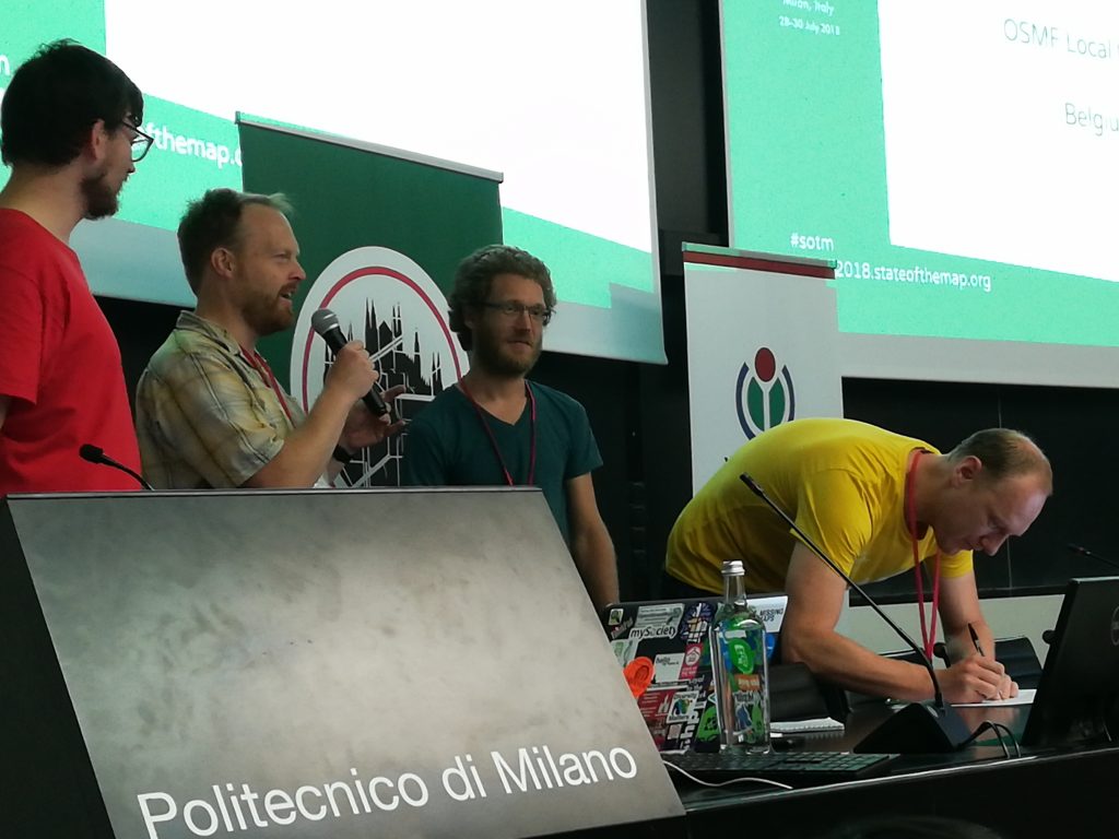
Signing the Local Chapter agreement, during State of the Map 2018 in Milan. © CC-BY-SA 4.0 OSMF Communication Working Group

If you have followed the State of the Map news, you will know that OpenStreetMap Belgium has become the newest Local Chapter of the OpenStreetMap Foundation!

Introducing them, in their own words:

“OpenStreetMap Belgium started as a tiny group of mappers doing meetups. Over the years more and more people started showing up and with the increasing usage and visibility of OpenStreetMap it was time to start organizing ourselves better. The invitation from Open Knowledge Belgium to join them as a working group, giving us the structure we needed without all the overhead, came at the perfect time. From then until now we have been actively supporting OpenStreetMap by co-organizing FOSS4G Belgium, the Open Belgium yearly conference, meetups, mapathons and many other OSM related events. This all escalated a bit with the organizing of SotM in 2016, which was a great boost for our community. We are very happy to be able to join the OSMF as a local chapter and we hope we can have continued positive impact on the OpenStreetMap project both on a local level and internationally.

The OpenStreetMap Belgium chapter is for outreach. www.osm.be was built with this in mind. We offer free tiles for Belgium to help with the switch to OSM. We promote open source by doing projects with the Open Summer of Code, for example building a mapping tool that shows local government that their data was successfully integrated into OSM. We are also a “single point of contact” for people outside the community, making it easier for them to communicate with the project. At the same time, being an official voice helps to get the project be taken more seriously. As part of the wider OpenStreetMap movement, we try to support international friends in other countries – directly or through Missing Maps and related projects.”

We welcome them aboard!

Are you interested in establishing a Local Chapter? You might want to check the OSMF website and join the Local Chapters mailing list.

en.osm.town: Announcing a new Mastodon instance for OSM (en)

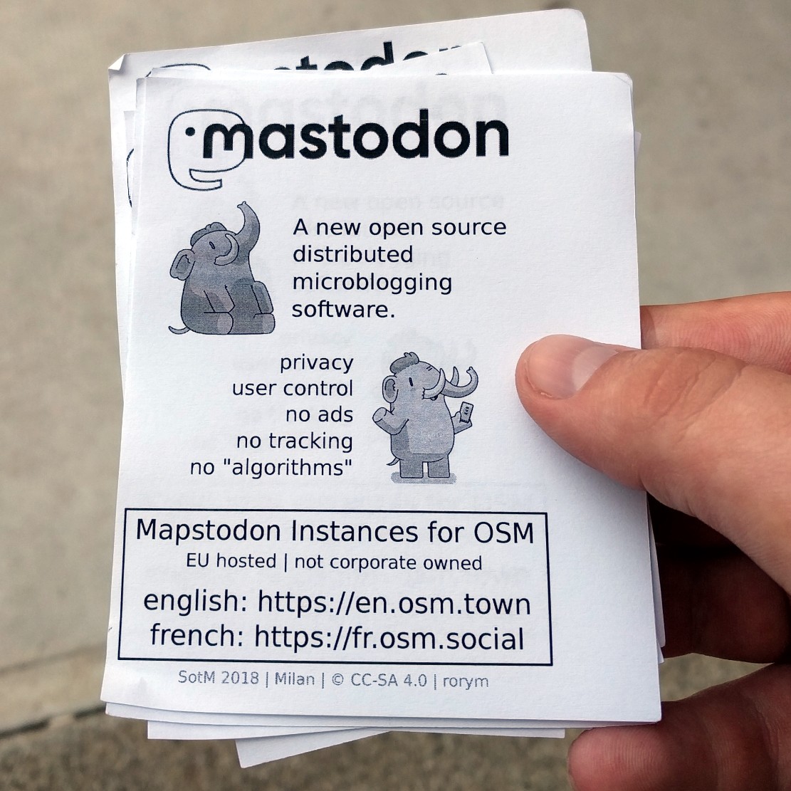
en.osm.town flyer at State of the Map 2018. Photograph by Rory cc-by-sa 4.0

Mastodon is an open source, federated micro-blogging system, with more than a million users. It is similar to Twitter, but open source and spread across many servers. https://en.osm.town/ is a new instance/server focused on OpenStreetMap (there’s already fr.osm.social for francophone OSMers). Like email, this server (“instance”) talks to other servers, so anyone on the “fediverse” can follow and interact with anyone on this server & vice versa. The “local timeline” will only show toots (= tweets) from everyone on the server, so will be full of OSM related stuff. The server was set-up by community member Amᵃᵖanda, who we’d like to thank 🙂

Let’s use something open, and under our control! No adverts, no analytics, no “algorithmic” promoted tweets. 500 characters. Let’s connect on mapstodon! Follow us on https://en.osm.town/@openstreetmap

Other official OSM announcement channels:

OSM condemns recent anti-semitic vandalism

Earlier today news surfaced of various online maps displaying an anti-semitic term instead of the label “New York”. Unfortunately we have to confirm that this data originated with our editable map project. This vandalism was detected and fixed within 2 hours, and the vandal was blocked from contributing further to OpenStreetMap.

On behalf of our organisation and community, OpenStreetMap condemns this kind of antisemitic hate speech without hesitation. We are disappointed that our project, which is devoted to sharing knowledge, was turned into a vehicle for the expression of ignorance, and hate. How did it happen?

Part of the “Open” of OpenStreetMap, is being openly editable. It is a wiki-style, crowd sourced, collaboration in which users all around the world can contribute and make edits. As with wikis, like Wikipedia, all changes are published immediately, and we put tools into the hands of our community to monitor each other’s changes and revert vandalism. This “soft security” approach may sound surprising, but over the years we’ve found, as something of a triumph of human nature, that the vast majority of editors want to come together to help build something great, and these massively outnumber the few bad apples. OpenStreetMap is a not-for-profit good cause, and the map data is “owned by” the community. On the whole people tend to have respect for that.

In fact this vandalism happened a month ago, but delayed processing of data updates by some companies downstream, in this case Mapbox, which presents our maps to thousands of apps and websites –means that this vandalism was seen quite widely today. Mapbox has posted their response to the incident here. There is on-going work within the OpenStreetMap community to develop better quality assurance tools, to detect and deal with this sort of issue faster. Mapbox has been spearheading these initiatives both in terms of developing vandalism detection software, and committing staff toward the efforts of monitoring and reverting bad edits. Unfortunately human error in their processing pipeline led to this incident in OSM-based maps that Mapbox provides to companies like Snapchat.

If you see vandalism on our map, you can help. Read more about vandalism here. We will continue to work with our community and data consumers to make our map even stronger.

Making the most of State of the Map

Photo CC-BY-NC Mariano Mantel

There is a great program of talks and workshops for this year’s State of the Map, but as people gather from around the world we want to help you make the most of this in-person time together.

Travel tips

To help you travel stress free we have added useful info to our website. For example, once in Milan, the easiest way to get to State of the Map is to take the M2 (green) subway line to Piola.

Flying in to Malpensa Airport? Buying tickets online saves money only if you buy a Malpensa Express Return Ticket 30 Days – you pay 20€ instead of 26€. The departure and the return journeys can be made within 3 hours of the time of train you select and the ticket is sent to an email address.

View the attendee list

OpenStreetMap communities form an integral part of OpenStreetMap. We interact online throughout the year but seldom have an opportunity to meet those that live far from us. As we come together at State of the Map we have made the attendee list available to help you make connections, meet old friends and form new ones.

Run a session

Check out the program for this year’s selection of talks. Perhaps something new has happened since the deadline for proposing talks, perhaps you didn’t have the idea quite worked out.

Throughout the 3 days we have spare rooms for you to host a break out session (Birds of a feather session). And on Monday we have some extra Lightning Talk slots available. These are quick five-minute talks that don’t need to have slides.

You can sign up for both by visiting the registration desk at State of the Map. Keep an eye on the board to see what other people have added; you wouldn’t want to miss something amazing!

Join in from home

Not able to attend this year’s State of the Map? We will be live streaming the main rooms throughout the event. Keep an eye on our website for the links.

You can also follow us on Twitter @sotm and use the hashtag #sotm. And new this year, we have created a telegram group for the conference. Join us here.

Your State of the Map team

Bing Streetside imagery now available in OpenStreetMap iD editor

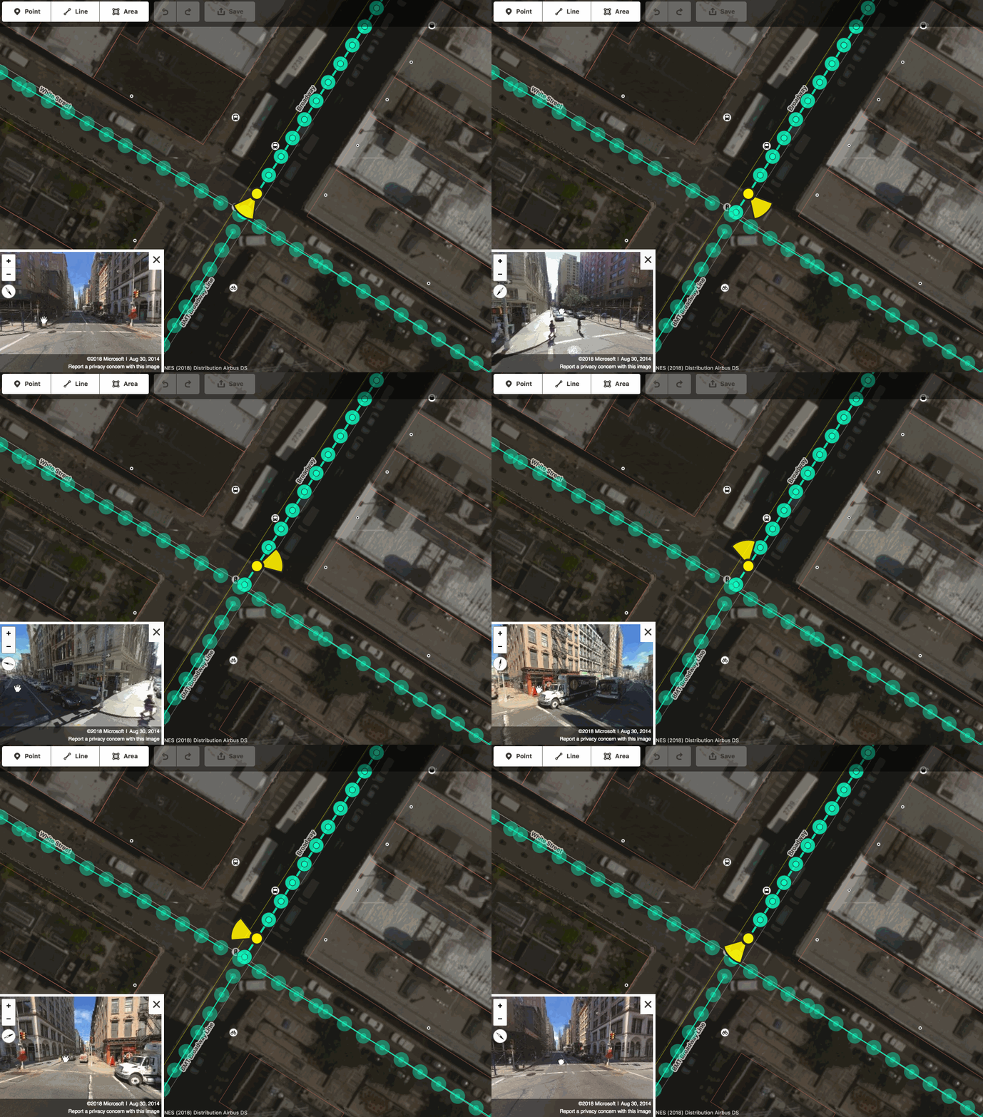
Interactive Bing Streetside viewer embedded in the iD editor © CC-BY-SA

We are excited to announce that you can now use Bing Streetside photographs when you edit OpenStreetMap using the web-based editor iD! This is the same imagery currently visible on Bing Maps. You can activate the Bing Streetside layer in iD by opening the Map Data pane (shortcut F). The new layer provides 360-degree panoramic imagery across large regions of the United States, United Kingdom, France, and Spain. The massive imagery dataset covers approximately 1.6 million kilometers and takes nearly 5PB of storage! Thank you, Microsoft.

Go on – try it!

Other street-level imagery datasets in iD
This street-level imagery dataset in an addition to the existing ones provided in iD by OpenStreetCam and Mapillary, which you can also activate by opening the Map Data pane (shortcut F).

If you find street photography helpful for OpenStreetMap editing, you can also contribute your own photographs, using the Mapillary and OpenStreetCam smartphone applications. These are developed by companies independent from the OpenStreetMap Foundation.

A reminder about photomapping
Are you a new mapper excited about photomapping? Please remember that on-the-ground survey is always superior, as photographs represent a specific time snapshot. Feel free to improve the map using photographs, just keep in mind that the photos might be old. Before changing someone else’s edits, consider contacting the mapper first.

Street-level imagery in other OSM editors
Street-level photographs are also available for improving the map in other popular OpenStreetMap editors, such as JOSM. The Bing Streetside imagery will probably become available in some of these editors soon, so stay tuned!

Happy mapping!

About iD
The iD map editor is an open source project. You can submit bug reports, help out, or learn more by visiting the project page on GitHub.