Category Archives: Uncategorized

Law and the GeoWeb

I’ll be there…

Law and the GeoWeb
==================

A workshop on “Intellectual Property and Geographic Data in the
Internet Era” sponsored by Creative Commons and the United States
Geological Survey (USGS) in conjunction with the annual meeting of
AAG, April 11, 2011, Seattle, Washington. The workshop will be held at
the campus of Microsoft Research, and will be streamed live on the
Internet.

This workshop will focus on intellectual property issues with
geographic data, exploring situations when users and creators ranging
from individuals to local, state and federal agencies as well as
private companies and non-profits create, share and reuse geographic
information from different sources over the Internet in their
projects.

For more information, please see http://punkish.org/geoweb/index.html
or search on Twitter for #lawandgeoweb

Rationale
=========

U.S Copyright Law protects tangible original works with creative
content but the law also ensures that facts, that is, data that are
discovered rather than invented, remain free for everyone’s benefit.
This ideas/expression dichotomy creates a lot of issues in the
Internet age when information is very easily created, shared, used and
reused.

With inexpensive computing and networking power available to everyone,
geographic datasets are increasingly being created, shared and used by
individuals, grassroots organizations, and private corporations. These
data come with different expectations with regards to how they may be
used resulting in a hodgepodge of licensing and contractual
obligations that hinders data interoperability. Mixing data of
different provenance creates new data with typically more restrictive
licensing conditions. Public agencies may be unable to mix licensed
data with government data due to restrictive licensing terms of the
resultant dataset, and thus, may be unable to capitalize on and
benefit from user-generated content.

Workshop Structure
==================

The current line-up of speakers from federal, state and local
agencies, Creative Commons, grassroots agencies, intellectual property
lawyers, the geospatial industry, and research and academia includes:

* Ed Arabas, National States Geographic Information Council
* Greg Babinski, King County, State of Washington
* Michael Brick, Microsoft Legal, Bing Maps
* Steve Coast, Founder, OpenStreetMap 
* Kari Craun, Director, National Geospatial Technical Operations, USGS
* Ed Parsons, Chief Technologist, Google Maps, Google
* Diane Peters, General Counsel, Creative Commons
* Tim Trainor, Bureau Chief, Geography Division, US Census Bureau
* Paul Uhlir, Director, Board for Research, Data and Information, NRC

The format of the workshop will encourage discussion and participation.

Participate
===========

To ensure those directly involved in the topic get a chance to attend
the workshop, attendance is based on a short application form
accessible at http://punkish.org/geoweb/participate/in_person/index.html.
Deadline for applying for the workshop is December 18, 2010. Selected
applicants will be informed by January 15, 2011.

Attendees will also be able to submit longer papers for publication in
a special issue of the peer-reviewed, completely free and open access
online journal “International Journal of Spatial Data Infrastructure
Research” published by the Joint Research Centre of the European
Commission.

Logistics
=========

The workshop is organized in conjunction with the AAG annual meeting.
The workshop will be held on the campus of Microsoft Research, and run
from 1 PM to 5 PM on Monday, April 11, 2011.

There is no fee for this workshop and participants do not have to
register for the AAG Annual Meeting. The workshop is limited to 50
participants to facilitate discussion.

Proceedings of the workshop and selected longer papers will be
published in a special issue of the open-access International Journal
of Spatial Data Infrastructure Research published by the Joint
Research Centre of the European Commission.

Contact
=======

Please contact either Puneet Kishor, Creative Commons
[punkish@creativecommons.org] or Barbare Poore, USGS
[bspoore@usgs.gov] if you have any questions.

Weekly OSM Summary #2

11/14/2010 – 11/21/2010

Every week a lot of things are happening in the OpenStreetMap world. New map renderings are created, new services are released and the map gets better and better every day. It can be hard to keep track of all the different communication channels and don’t miss any important news. Since we read most of those channels anyway, we decided to collect all the things we find newsworthy enough to list them at the end of the week here. To every news we’ve attached a short description and you can always find more information on the linked websites. Enjoy!

For more news, especially regarding new tags and wiki pages, you can check-out the community-updates over here.

Authors: PascalJonas, Matthias & Brice.
We missed something? You want to help us collecting the news for next week’s issue? 
You can contact us via mail or Twitter.


Project of the Week: Project Hotspot

The goal/purpose of Project HotSpot is to get major U.S landmarks
mapped out to a level of detail beyond commercial map data providers.
We’re starting with a top 10 list of places asked for by users of the
commercial MapQuest.com website.

If we can get these ten places looking very spiffy, then MapQuest will
feature the OSM maps of these places as “Premium Maps” of these
locations when they are returned as Search Results for our approximate
50 million monthly unique visitors to MapQuest.com

This Project of the Week is submitted by Antony Pegg. Ant is the head
of the Open Initiative at MapQuest and has a friendly bet with his
boss that OSMers can make better maps of landmark locations than
commercial mapping companies can. Read more about Ant’s friendly bet,
and objects of interest when mapping a landmark, in the Project
Hotspot wiki entry for this Project of the Week.

http://wiki.openstreetmap.org/wiki/Project_of_the_week/2010/Nov_17

This is your Project of the Week. Make suggestions. Inspire other
mappers. What is it about contributing to OpenStreetMap that
interests you? Postboxes? Bowing alleys? Share your OpenStreetMap
interests by contributing a Project of the Month.

http://wiki.openstreetmap.org/wiki/Project_of_the_week/Proposals

Amusement park photo by Patrick Mcgarvey http://www.flickr.com/photos/intamin10/
is licensed CC-By-ND http://creativecommons.org/licenses/by-nd/2.0/deed.en

Image of the Week: OpenStreetMap in mayor campaign

Media_httpwikiopenstr_pgtat

The recent municipal election cycle in Toronto included OpenStreetMap.
Mayoral candidate, Sarah Thomson had a bicycle policy as part of her
platform. That policy, called Bike City was illustrated with two
images of planned bicycle infrastructure on OpenStreetMap base maps
with proper license and attribution.

Ms. Thomson did not win the election. You can see the OSM images in
context on her old campaign page.

http://sarahthomson.ca/blog/sarah-thomsons-bike-city

This is a Featured image, which means that it has been identified as
one of the best examples of OpenStreetMap mapping, or that it provides
a useful illustration of the OpenStreetMap project.

If you know another image of similar quality, you can nominate it at

http://wiki.openstreetmap.org/wiki/Featured_image_proposals

Weekly OSM Summary #1

11/06/2010 – 11/13/2010

Every week a lot of things are happening in the OpenStreetMap world. New map renderings are created, new services are released and the map gets better and better every day. It can be hard to keep track of all the different communication channels and don’t miss any important news. Since we read most of those channels anyway, we decided to collect all the things we find newsworthy enough to list them at the end of the week here. To every news we’ve attached a short description and you can always find more information on the linked websites. Enjoy!

  • “New search” with live suggestions built-in, based on Nominatim and the Google Closure framework. You can try out the search here or read Martijn’s blog post here.
  • PocketNavigator is an Android app based on OSM data that uses tactile feedback to guide you through your way.
  • Fabian Schmidt has created a map that highlights ODbL licensed streets by color. Green streets would still be available after the switch to the new license, red ones wouldn’t. Yellow ones were edited by users who have agreed to the new Contributor Terms AND users who haven’t yet agreed. This map is updated with new data daily.
  • MapQuest has released its own Bicycle routing service based on OSM data.
  • Elevation Service based on SRTM data, for example to combine with OSM Routers MapQuest DevBlog
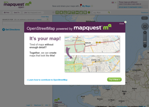
  • When you visit any of the open.mapquest websites right now, you’re greeted with a splash page that promotes MapQuest’s use of OSM data.
  • Want to attend the upcoming SOTM-EU 2011 in Vienna? You can add your name into the wiki here.
  • Computerteddy created a new OSM Map for Garmin Devices that is optimized for cars.
  • Want to use OSM Maps in iPhoto 09 or 11? MacPad provides a small HowTo.
  • Sven Geggus wrote a blogpost about creating a WMS-Server in about 100 lines of python code.

For more news, especially regarding new tags and wiki pages, you can check-out the community-updates over here.

Authors: Pascal, Jonas & Dennis.
We missed something? You want to help us collecting the news for next week’s issue?
You can contact us via mail or Twitter.

[If you like this summary, be sure to tell Pascal, Jonas and Dennis.  If you don’t like it, tell them how it can be improved!]


FREE Webinar on OpenStreetMap!

Curious about OpenStreetMap? Haven’t made it to one of the famous beer drinking, I mean *mapping* parties?

Well here’s your chance to learn more about the project (sans beer):


Hurricane Coast is co-hosting a FREE webinar about OpenStreetMap.
This Wednesday November 17th at 2PM EST, join in on the fun that is open source mapping!

Kitty_mac

Photo by Kevin Steele (cc by sa Flikr)

 
It’s a great introduction to the project with some background information, stories of why OSM is groovy (think crisis mapping) as well as a mini “make your first edit” presentation.
 

It is co-hosted by Depiction, a company who uses OpenStreetMap data for base maps, routing and much more! Depiction puts powerful mapping, simulation and collaboration tools in the hands of everyday people, in a package that is both easy to use and affordable. 

Sign up today, it’s fun!


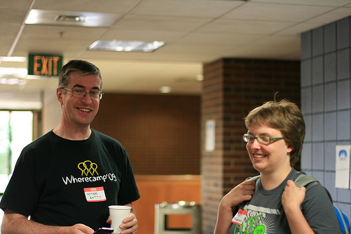
WhereCamp5280 November 19th, 2010

Join like minded friends and geo geeks at this years WhereCamp5280 in Denver, Colorado on Friday, November 19th. WhereCamps are unconferences – loosely structured days of talks around a common theme of maps! 

Pete_and_kate

(Photo CC by Robotbrainz Flickr)

There are three days of events planned, from a special USGS tour and a hack day on Thursday November 18th, to a mapping party in Winter Park, Colorado on Saturday the 20th. Check out the schedule here

WhereCamp5280 is free to attend thanks to generous sponsors!

Sponsors