Category Archives: Corporate Members

Microsoft Pledges $150k to Support OpenStreetMap

The OpenStreetMap Foundation Board is delighted to announce a $150k gift from Microsoft to benefit the OpenStreetMap project and community. This substantive support will go directly to the improvement of OSM operations and infrastructure, as well as to funding OSM community activities such as local, regional, and global State of the Map events.

At Microsoft, we are fully committed to supporting OpenStreetMap, not only through financial contributions but also by fully embracing and encouraging open map data and actively participating in the community via volunteering and development efforts.

-Marko Panić, Principal Lead Product Manager at Microsoft

The funds from this gift will be allocated in the following ways:

Importantly, Microsoft supports OSM through ‘in-kind’ gifts, as well as monetary contributions. It has donated technical expertise and engineering resources; helped build awareness of the importance of OSM amongst other companies, nonprofits, and other entities; and played an important consulting role on the OSM Advisory board.

The OSM Advisory Board is a unique group within the OSM community that brings companies and local communities together.  It builds positive connections between companies who use and contribute to OSM and the local communities who know the local guidelines, spearhead development projects, and bring OSM mappers together through education and events.

— Mikel Maron, OSMF Board Member

Microsoft, through its representatives, donations, and other help, has provided significant support for the maintenance of the iD editor, is working on improvements to OSM’s sign-up flow, and has introduced OSM to a wider user base through Bing’s Map builder.  The OSMF board is grateful for the many contributions to the success of OpenStreetMap.

The OSMF welcomes in-kind support, as well as financial support for OSM’s technical development, operations, and community: 


The OpenStreetMap Foundation is a not-for-profit organisation, formed to support the OpenStreetMap Project. It is dedicated to encouraging the growth, development and distribution of free geospatial data for anyone to use and share. The OpenStreetMap Foundation owns and maintains the infrastructure of the OpenStreetMap project, is financially supported by membership fees and donations, and organises the annual, international State of the Map conference. Our volunteer Working Groups and a very small core staff are the primary support for the OpenStreetMap project. Join the OpenStreetMap Foundation for just £15 a year or for free if you are an active OpenStreetMap contributor.

OSM Foundation Announces New Membership Guidelines for Corporate Sponsorship

The OpenStreetMap Foundation (OSMF) has released new guidelines for companies and organizations who use OpenStreetMap (OSM) data in their products and services. The new guidelines clarify the rights and responsibilities between OSM and the entities who use and edit its data, as well as offer guidance on how they can support the map financially and in advisory capacities.

Highlights include:

  • Corporate members at the Bronze level and higher will now have a seat on the OSMF advisory committee
  • The fee for an annual membership has increased by 50% across the tiers
  • An OSMF-facilitated ‘consultation’ has been added as a benefit to the highest, “Platinum” tier
  • There is new guidance on what is the appropriate membership level. 

A Tradition of Supporting OSM with Tools, Editing, Sponsorship, and Donations

Mikel Maron, a long time member of the OSMF Board, noted that opening up access to the advisory committee to corporate members at the Bronze level and higher is a direct result of the value that the committee provides to the community: “The ability to engage with organizations who use and improve OSM is a valuable source of insight in our planning and operations. We especially appreciate those who go above and beyond in their willingness to both consult and contribute financially. Many of these organizations have served as co-developers and friends to the project over the long term.” Maron also noted that changes to the guidance and pricing for OSMF corporate memberships is part of an overall commitment to improving OpenStreetMap’s financial management.

The ability to engage with companies who use and improve OSM is a valuable source of insight in our planning and operations. We especially appreciate companies who go above and beyond in their willingness to both consult and contribute financially. Many of these organizations have served as co-developers and friends to the project for the long term.” –Mikel Maron, OSMF board member

The many companies who support OSM through a corporate membership include TomTom, who became its first Platinum member in 2023, and current Gold members Mapbox, Esri, Gojek, Grab, Graphhopper, Meta, and Microsoft. A warm welcome also goes out to the first OSMF corporate member to sign up under the new guidelines: StadiaMaps:  

See a complete list of OSM Corporate Members

The Financial State of the OSMF in 2024 and Beyond

In the Board’s draft version 2.0 of their Strategic Plan, there are several important financial goals, including:

  • Deliver updated revenue strategy
  • Establish financial management policy
  • Provide financial support to communities
  • Fortify financial infrastructure

In the Preamble to the Plan, the board has noted that the size and scale of OSM necessitates a new approach, saying “The main focus of the OSMF must be to ensure that the infrastructure is available…[and for] OSM to remain a project that is driven by its volunteers, we need to be careful to not overstrain them. The OSMF can help through financial and operational support.

The current scale of the OSM project cannot be overstated. OSM volunteers have contributed eight billion data points to the map over the past two decades, and there are hundreds of millions of API calls each month. The use cases for OSM data include building smarter cities, reducing traffic congestion, solving supply chain issues, powering climate change research, and helping people grow food, find clean water, reach medical and other kinds of help, and build local businesses. OSM editors also help millions of people through hundreds of humanitarian use cases. Accenture has estimated that its data provides billions of euro of value to companies and governments. 

The use cases for OSM data include building smarter cities, reducing traffic congestion, solving supply chain issues, powering climate change research, and helping people grow food, find clean water, reach medical and other kinds of help, and build local businesses. OSM mappers also help millions of people through hundreds of humanitarian use cases

The financial costs for a project of this global scale are comparatively small. The OSMF runs as an extremely lean nonprofit with just one full time employee, a part-time small staff, and an all-volunteer board. The need for more sys admins, project management, and resources to help local communities, as well as funds to cover infrastructure and cloud costs is significant. 

Learn more about the financial governance of the OSMF

How Organizations and Individuals Can Help OpenStreetMap

If you and/or your organization would like to help OpenStreetMap, please visit the following links:


The OpenStreetMap Foundation is a not-for-profit organisation, formed to support the OpenStreetMap Project. It is dedicated to encouraging the growth, development and distribution of free geospatial data for anyone to use and share. The OpenStreetMap Foundation owns and maintains the infrastructure of the OpenStreetMap project, is financially supported by membership fees and donations, and organises the annual, international State of the Map conference. Our volunteer Working Groups and small core staff work to support the OpenStreetMap project. Join the OpenStreetMap Foundation for just £15 a year or for free if you are an active OpenStreetMap contributor.

Welcome TomTom, our first Platinum Corporate Member

We are happy to announce that TomTom is joining us as our first platinum tier corporate member. Their contribution provides crucial direct financial support to our operations and infrastructure, which is essential to accompany the growth and ensure the long-term sustainability of the world’s largest crowdsourced geospatial project.

People create data in OpenStreetMap, excited that open map data will be widely useful and used. Many more people will be interacting with OpenStreetMap data through TomTom’s user base, and some of them will be curious about our community and interested to help make it better. We welcome all such contributions, whether someone is fixing a small issue on the map affecting them, or as the first step of a life long mapping passion.

We are grateful for the wide extent of TomTom’s support of OpenStreetMap, which extends beyond financial contributions: they actively participate in working groups, the Advisory Board, and local OpenStreetMap communities. TomTom’s recognition of the importance of the OpenStreetMap data they use is a testament to the value our project provides. We hope this inspires other corporate partners to join as members to support OpenStreetMap.

Read more from TomTom on their announcement.

OSMF and OpenCage – Joint press release

Note: OpenCage is a silver level corporate member of the OpenStreetMap Foundation, entitling them to this joint press release. If your organisation would like to support the OSMF more, please consider joining the OSMF as a corporate member, or read about other ways to give back.

OpenStreetMap Foundation corporate member OpenCage is pleased to announce a new collaboration with popular geospatial podcast MapScaping to help encourage the growth of small OpenStreetMap-based projects.

OpenCage has purchased four episodes worth of MapScaping advertising slots, and will donate these slots to small OpenStreetMap projects. Each selected project will receive a 30 second ad read, a presence on the MapScaping website, and promotion via social media. The definition of “OpenStreetMap projects” is intentionally left vague to encourage a wide spectrum of applications. Examples of the types of projects OpenCage and MapScaping could imagine supporting with the initiative include: open source tools seeking developers, OSMF volunteers recruiting volunteers, start-ups looking to make their service more widely known, or local OSM communities advertising new initiatives.

Full details of the initiative and application process are laid out in a post on the OpenCage blog. Applications are open until the 15th of October. Preference will be given to projects that, due to their newness or non-commercial nature, don’t have the resources to advertise themselves.

“Our service has depended on OpenStreetMap since the day we first started eight years ago. While we’ve always done our best to give back to the OSM community – for example by sponsoring events, and becoming corporate members of the foundation – we specifically wanted to find a way to help smaller, up and coming projects. Working with MapScaping gives us a great tool to help these projects accelerate,” said Ed Freyfogle, OpenCage co-founder.

Daniel O’Donohue, founder and host of MapScaping said, “We’re delighted to provide a platform to help the OpenStreetMap community grow by sharing these projects with our global audience. OpenStreetMap has been a key ingredient in the explosion of geospatial innovation over the last decade, and I’m looking forward to working with creative projects that are at the leading edge of that innovation.”

About OpenCage

OpenCage operates a highly-available, enterprise level geocoding API based on OpenStreetMap and other open datasources. In addition to being corporate members of the OSMF, OpenCage are proud members of the UK and German local chapters, co-sponsor and contribute to the open source development of Nominatim (the primary OpenStreetMap geocoding software), and regularly sponsor OpenStreetMap events. 

About MapScaping

The MapScaping Podcast is a weekly podcast for the geospatial community. Started in 2019, MapScaping has grown rapidly to become a leading independent media voice in the global geospatial discussion. The show profiles innovative geo projects and technologies, and provides a forum to discuss issues facing the geospatial community. 

What is OpenStreetMap?

OpenStreetMap was founded in 2004 and is a international project to create a free map of the world. To do so, we, thousands of volunteers, collect data about roads, railways, rivers, forests, buildings and a lot more worldwide. Our map data can be downloaded for free by everyone and used for any purpose – including commercial usage. It is possible to produce your own maps which highlight certain features, to calculate routes etc. OpenStreetMap is increasingly used when one needs maps which can be very quickly, or easily, updated.

What is the OpenStreetMap Foundation?

The OpenStreetMap Foundation is a not-for-profit organisation, formed to support the OpenStreetMap Project. It is dedicated to encouraging the growth, development and distribution of free geospatial data for anyone to use and share. The OpenStreetMap Foundation owns and maintains the infrastructure of the OpenStreetMap project, is financially supported by membership fees and donations, and organises the annual, international State of the Map conference. The OSMF supports the OpenStreetMap project through the work of our volunteer Working Groups. Please consider becoming a member of the Foundation – you can become a member for free, if you are an active OpenStreetMap contributor.

OSMF and OpenCage – Joint press release

OpenCage is a silver level corporate member of the OpenStreetMap Foundation, entitling them to this joint press release. If your organisation would like to support the OSMF more, please consider joining the OSMF as a corporate member, or read about other ways to give back.

Geocoding is the process of converting between addresses or placenames and geographic coordinates (longitude and latitude). Geocoding is a core geospatial functionality; an underlying building block that is critical to developing location based services.

OpenStreetMap Foundation corporate member OpenCage operates a highly-available, enterprise level geocoding API based on OpenStreetMap. We’re pleased to announce that OpenCage recently increased their commitment to the OpenStreetMap Foundation by upgrading to silver level corporate membership.

“For years our service has built on OpenStreetMap. We’re delighted to increase our ongoing support of the worldwide OSM community by increasing our level of commitment to the OpenStreetMap Foundation.” said Ed Freyfogle, OpenCage co-founder.

“It’s a nice milestone that the business has grown to the point that we could upgrade from Bronze to Silver. But beyond financial support the main work we do is opening the eyes of our customers – most of whom arrive knowing simply that they need geocoding, and without a detailed understanding of open data – to open data’s many benefits. Our customers around the world are proof that OpenStreetMap is commercially usable not in some distant theoretical future, but today” continued Freyfogle.

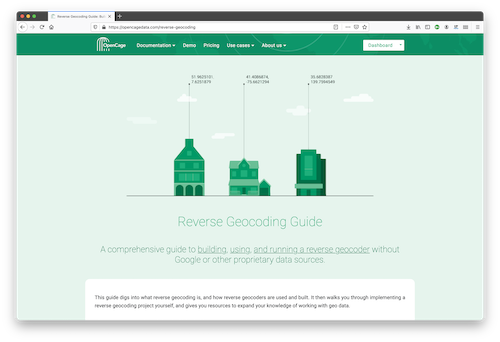
An example of that type of educational work is OpenCage’s recently published Reverse Geocoding Guide, which details the technical challenges of ongoing operation of a reverse geocoding service, while also documenting the advantages of using open data as the underlying data foundation for such a service.

OpenCage offers open source SDKs for accessing their geocoding API for over 30 different programming languages.

In addition to being corporate members of the OSMF, OpenCage are proud members of the UK (the business was started in the UK) and German (the business is currently based in Germany) local chapters, co-sponsor and contribute to the open source development of Nominatim (the primary OpenStreetMap geocoding software), and regularly sponsor OpenStreetMap events.

GEOMOB logo

OpenCage also encourages geoinnovation by running Geomob, a regular series of in-person and online events with the goal of promoting geoinnovation in any and all forms – whether for “fun or profit”, as the event tagline says. Now in its thirteenth year, Geomob has become an established feature of the European geo event landscape, and regularly features projects using OpenStreetMap.

Early in 2020 the Geomob podcast was launched. The weekly conversations provide a chance to reflect on geo industry trends, discuss interesting new geo technology, and interview Geomob speakers. Podcast guests have included many members of the OpenStreetMap community, including Allan Mustard (chairperson of the OSMF Board), Tyler Radford (executive director of the Humanitarian OpenStreetMap team), Sarah Hoffmann (maintainer of the geocoding tool Nominatim, which powers search on osm.org), several founders of businesses building on top of OpenStreetMap, and many more.


What is OpenStreetMap?

OpenStreetMap was founded in 2004 and is a international project to create a free map of the world. To do so, we, thousands of volunteers, collect data about roads, railways, rivers, forests, buildings and a lot more worldwide. Our map data can be downloaded for free by everyone and used for any purpose – including commercial usage. It is possible to produce your own maps which highlight certain features, to calculate routes etc. OpenStreetMap is increasingly used when one needs maps which can be very quickly, or easily, updated.

What is the OpenStreetMapFoundation?

The OpenStreetMap Foundation is a not-for-profit organisation, formed to support the OpenStreetMap Project. It is dedicated to encouraging the growth, development and distribution of free geospatial data for anyone to use and share. The OpenStreetMap Foundation owns and maintains the infrastructure of the OpenStreetMap project, is financially supported by membership fees and donations, and organises the annual, international State of the Map conference. The OSMF supports the OpenStreetMap project through the work of our volunteer Working Groups. Please consider becoming a member of the Foundation.