Author Archives: HarryWood

About HarryWood

Posting mostly in a Communication Working Group capacity (and often with text written collaboratively among CWG and others) About me on the OSM wiki

OpenStreetMap Featured Images

Every week we choose a new OpenStreetMap “featured image”. Here’s our images of April, May and June:

2017 2017 2017 2017 2017 2017 2017 2017 2017 2017 2017 2017 2017

(click to view bigger images and explanations)

An OpenStreetMap Featured Image (otherwise known as “Image Of The Week”) is chosen each week. Recently we’ve been putting them out on twitter and facebook, so you’ll most likely have seen them there. We’re still a little behind on posting them, so consider this a preview! But featured images also appear each week on the wiki main page.

If you come across an image which you would like to put forward as image of the week (either your own image or somebody else’s), head over to “Featured image proposals” and edit that page to make your suggestion there. Anyone can join in with the process of investigating, improving and discussing the suggestions, and picking an OpenStreetMap image of the week each week. If wiki editing is difficult for you, just email CWG with your suggestions.

New and renewed corporate members

Last October we introduced the new OSMF Corporate Membership tiers. We’d like to thank the following organisations who have entered or renewed onto the new corporate membership tiers:


Toursprung         NextGIS


Your organization can become a Corporate Member for as little as €500 for ‘Supporter’ level, all the way up to €20,000 for ‘Platinum’ level. The above all opted for ‘Bronze’ level, except Toursprung and NextGIS who are ‘Supporters’. Coming soon we’ll bring you news of some new ‘Gold’ level members! Each level has different benefits but the biggest benefit of all is the knowledge that your organization is doing its part to support the growth and sustainability of the OpenStreetMap project. So thanks again to all our Corporate Members!

OpenStreetMap Featured Images

As well as putting out an April fools day joke, there’s another thing we should remember to do when we’re three months into the year. Every three months we roll over to a new page of our archive of OpenStreetMap “featured images”. Here’s our images of January, February and March:

Mabel laser cutter.jpg Pic4Carto mapstats.png OSM-in-German-Tech-Museum.jpg Osmviz.jpg Ateljekartan.com green paris poster.jpg Ramani Huria STEM boot camp school students.jpg OSMLanduse.png OSM Mapathon in Albania 07.jpg Lauri Vanhala Helsinki map.jpg Taipei meet-up Discussing notes.jpg Osm-in-opendataday-2017.jpg Noahmapping-statsimage.jpg FOSSGIS 2017 group photo.jpg

(click to view bigger images and explanations)

An OpenStreetMap Featured Image (otherwise known as “Image Of The Week”) is chosen each week. Recently we’ve been putting them out on twitter and facebook, so you’ll most likely have seen them there. Actually we’re a little behind on posting them, so consider this a preview! But featured images also appear each week on the wiki main page.

If you come across an image which you would like to put forward as image of the week (either your own image or somebody else’s), head over to “Featured image proposals” and edit that page to make your suggestion there. Anyone can join in with the process of investigating, improving and discussing the suggestions, and picking an OpenStreetMap image of the week each week. If wiki editing is difficult for you, just email CWG with your suggestions.

Version 2 of the iD editor

Version 2 of the “iD” editor recently went live. New features include better support for right-to-left languages, authenticated calls to OpenStreetMap servers, and an updated Mapillary viewer.

Viewing street-level Mapillary photos within the iD editor, also super hi-res imagery appearing by default in Cape Town

Viewing street-level Mapillary photos within the iD editor (also super-hi-res imagery appearing by default in Cape Town)

Behind the scenes the editor code has been made more modular, helping future development and customisation. Bryan Housel has been leading the development effort. Read more on his blog post here. Big thanks to him and all the developers involved.

iD is the default editor appearing on the OpenStreetMap website when you click ‘edit’. Never tried? You’ll need to get signed up and logged in first. Follow the ‘walkthrough’ to learn how ‘iD’ works. This is improving all the time, but there’s also a range of desktop or mobile app alternatives. See the list of editors.

New Local Chapter: Swiss OpenStreetMap Association

We’d like to welcome the Swiss OpenStreetMap Association (sosm.ch) as our latest official OpenStreetMap Foundation Local Chapter.

sosm-handshake

Paul Norman and Simon Poole (centre) officially finalising the paperwork for the new local chapter at the State Of The Map conference last month in Brussels

With this formal agreement SOSM and the OSM Foundation have declared that we “shall seek to mutually support the activities of the other”. It doesn’t entail any drastic changes, but from a practical standpoint, it does mean SOSM have “official” status which may help them in any dealings with government and political/advocacy groups. It also means they are formally permitted to use the OpenStreetMap trademarks.

Of course we hope to see other countries formalising their foundation status in this way. Switzerland may also serve as an inspirational example in the way this group has been established in support of the local community. As described on their about page “SOSM was created to further the goals of the OpenStreetMap movement, to strengthen the contacts with authorities and industry, to facilitate the activities of OSM community members in Switzerland and to represent the Swiss OSM community in other organisations … providing some structure when needed and remaining as lightweight and as unobstrusive as possible”, which seems like an excellent way to orientate a local OpenStreetMap organisation.

You can also read more about the Swiss OpenStreetMap community on this OpenCaged data interview with Simon Poole about OSM in Switzerland, and you can follow SwissOSM on twitter.

State Of The Map, Thanks!

600px-state_of_the_map_2016_group_photo

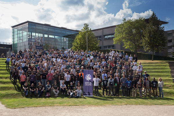
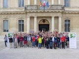
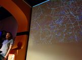
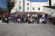
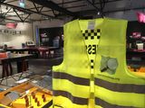
Thanks to everyone who made it to the international State Of The Map conference in Brussels two weeks ago. With around 400 attendees from 52 different countries, this was a fantastic event bringing our community together.

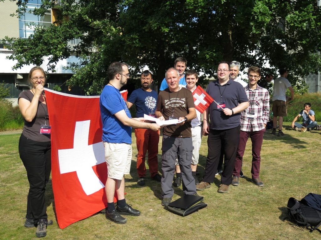
Huge thanks to the team of organisers, and local volunteers in Belgium who helped make it such a success. We saw some of these people up on stage at the end of the conference:

IMG_3242

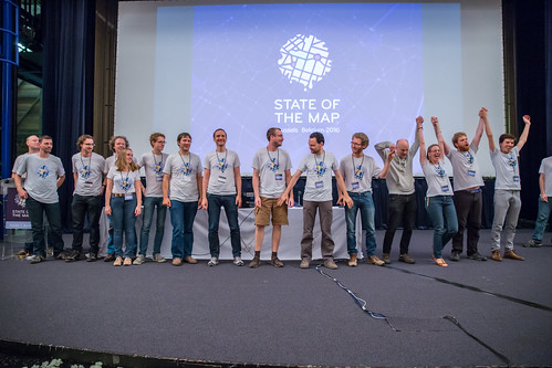
…but also thanks to those working behind the scenes. A special thank you to Ben Abelshausen and Rob Nickerson who played leading roles in organising the event from on the ground and remote support respectively. There is a list of folks on the SOTM team page, but this will be updated soon because…

The early steps of organising the State Of The Map 2017 are in progress! We’ll bring you an announcement soon about the choice of host country for next year, and of course there will be an opportunity to help with organising and sponsorship. Start thinking about it. Earlier the better!

Video from all the main auditoriums at the Brussels conference can be found at the conference website. We’ll be bringing you the edited per-session versions of these talks soon. More photos from Brussels can be found in this set from Tatiana the official conference photographer, and also on the sotm2016 flickr tag.

We previously congratulated the winners of the OpenStreetMap awards. In addition to that, here are a few links to blogs by attendees with write-ups and ruminations about the conference:

If you attended the conference please check your inbox for a State of the Map: Feedback Survey email. The organising team would appreciate your feedback to help make it even better the coming year.

During the conference we launched a new OpenStreetMap fundraising drive. In the past, the conference itself provided a significant annual source of funding for the foundation, but as the project grows we need more reliable funding sources. Your donations help will ensure continuity and continued independence of OpenStreetMap. Please help us reach our fundraising goal by donating and sharing the link: donate.openstreetmap.org, our fundraising site.

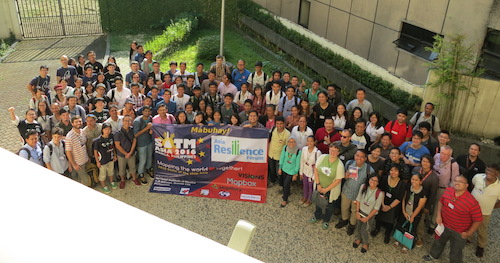
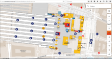
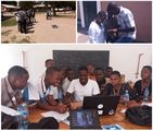
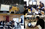
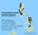
Finally if you couldn’t make it to Brussels for the annual international OpenStreetMap conference, remember there’s a whole range of events large and small happening all over the world (see the calendar). Just last weekend there was “State Of The Map Asia“, the second “local” conference for the asian continent, which took place this time in Manilla, Philippines!

State of the map Asia 2016 group photo

Getting involved in the Operations Working Group

OpenStreetMap has a map display, and more importantly a database of raw map data, and more importantly than that a community of map contributors! All of these things require servers. Big computer systems crunching lots of data and handling lots of internet traffic. This is the realm of the “Operations Working Group“, who make the decisions and take the actions that keep these servers ticking, and keep OpenStreetMap (the map, the database, and the community) up and running.

Difficult technical work which only a few people are directly involved in. But today Andy Allan blogged about how they’re working on getting more people involved in the Operations Working Group.

openstreetmap server diagonalThe OpenStreetMap project is nearly 12 years old, and we’ve been very lucky to have a small team of talented volunteer system administrators doing a fantastic job over that time, spending donated money wisely and meeting some huge scaling challenges for the core infrastructure.

“There’s a pride in keeping OpenStreetMap humming along and not causing too much of a fuss”

But increasingly OWG have been quietly enhancing their server configuration management approaches. All code/configuration scripts are maintained openly in github, and recently the team are looking to make this easier to test, so more people can feel confident in proposing improvements to the server set-up.

“The goal is to allow future developers to improve each cookbook using only their own laptops”

You can donate to the OpenStreetMap foundation, which will help fund our servers. But you can also get involved in improving the server set-up, and it’s gradually getting easier to be more directly involved. If you can help, read Andy Allan’s blog post to learn more. Thanks to Andy and the rest of the Operations Working Group for all their hard work.

FOSSGIS 2016

FOSSGIS 2016The FOSSGIS conference (Free and Open Source Software for Geographical Information Systems) takes place annually, usually in Germany. This year it takes place in Salzburg, Austria. Tickets are still available. Register here. Registration is free for OSM contributors.

This big conference has included OpenStreetMap as a large part of the programme, and has welcomed OpenStreetMap community attendees throughout the history of our project. We gave a round-up of local SOTM conferences previously. Essentially FOSSGIS is the local “State Of The Map” conference for the German-speaking part of the world. With over 400 attendees last year, this is a big event in general, and a big event on the OpenStreetMap calendar!

This year the conference also features a special “OSM Sunday” in the run up to the main conference. Sunday July 3rd is a day dedicated to OpenStreetMap topics. Don’t miss it! On top of that, around half of the presentations, lightning talks and workshops during the week at the conference will be on OpenStreetMap topics (other topics being around open source geo software). And don’t forget the big social event on Tuesday, July 5th.

Planned server outage – 9th May

The Operations Working Group are in the process of planning some hardware moves as a result of maintenance at our primary datacentre. The plans are subject to change, but these moves are expected to take place on Monday 9th May (a week from today), and this will mean a period of read only operation lasting for up to 24 hours (into Tuesday).

The read-only period will mean the OpenStreetMap website and map is still available, but no map editing will be possible during this time.

The ‘2016 May server maintenance’ wiki page has some more technical details, and will be updated with more precise timing information as the plans are finialised in the coming days.

We’re putting out this announcement to give some advanced notice, but we appreciate some people will be wanting to know more about the exact timings of the read-only period. Please have patience. The Operations Working Group are busy making plans, and will aim to firm things up in the coming days.

SOTM CZ, SOTM FR, SOTM JP, SOTM US

State Of The Map Event Websites

A whole bunch of local OpenStreetMap community conferences have recently been announced:

State Of The Map CZ+SK, the Czetch & Slovakian conference, is coming up soon on May 21st in Brno.

State Of The Map France will also take place May 20th-22nd in Clermont-Ferrand.

State Of The Map Japan will take place August 6th in Tokyo.

State Of The Map US will take place in July 23rd to 25th in Seattle, Washington.

State Of The Map Latin America will be in November in Sao Paulo, Brazil (exact date to be finalised)

These national conferences, large and small, are organised by local OpenStreetMap communities. If your country is not on the list, you’re welcome to get together with fellow OpenStreetMappers to organise something

…but don’t forget, the main get-together for all of the community, is the international OpenStreetMap conference “State Of The Map“, which will be taking place September 23 – 25 in Brussels.