Version 2 of the “iD” editor recently went live. New features include better support for right-to-left languages, authenticated calls to OpenStreetMap servers, and an updated Mapillary viewer.
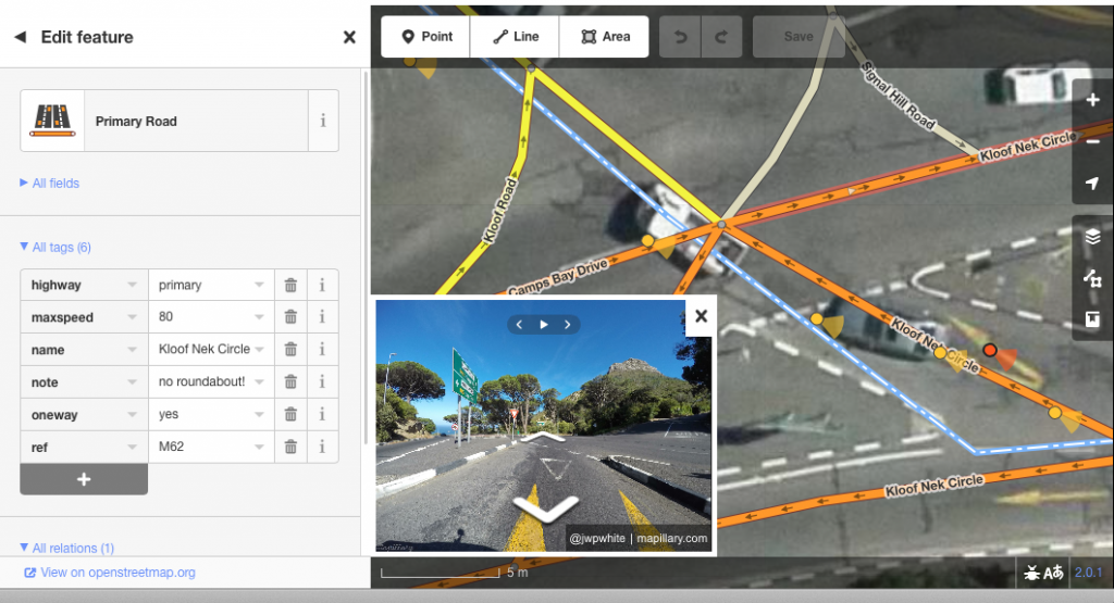
Viewing street-level Mapillary photos within the iD editor (also super-hi-res imagery appearing by default in Cape Town)
Behind the scenes the editor code has been made more modular, helping future development and customisation. Bryan Housel has been leading the development effort. Read more on his blog post here. Big thanks to him and all the developers involved.
iD is the default editor appearing on the OpenStreetMap website when you click ‘edit’. Never tried? You’ll need to get signed up and logged in first. Follow the ‘walkthrough’ to learn how ‘iD’ works. This is improving all the time, but there’s also a range of desktop or mobile app alternatives. See the list of editors.
Pingback: weeklyOSM 331 | weekly – semanario – hebdo – săptămânal – haftalık – 週刊 – týdeník – edisi
Pingback: weekly – semanario – hebdo – săptămânal – haftalık – 週刊 – týdeník – edisi