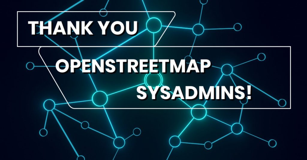
Today is System Administrator Appreciation Day and we would like to thank our sysadmins for the awesome work that they are doing! 🙂
Get notified about new blog posts: Subscribe to the RSS feed!
Today is System Administrator Appreciation Day and we would like to thank our sysadmins for the awesome work that they are doing! 🙂
Get notified about new blog posts: Subscribe to the RSS feed!
As more and more maps are built on OpenStreetMap data, OSM is becoming the most compelling way for public organisations and other data owners to get their information out to the greatest number of people.
Two local councils in the UK, Oxfordshire County Council and Buckinghamshire Council, were recently funded by the Open Data Institute to investigate using and contributing to crowdsourced open map data – like OSM.
As part of this, I worked with the two councils to draw up a straightforward how-to guide for other organisations that want to contribute their data to OSM. The guide covers all the prerequisites – working with the community, compatible licensing, and ongoing maintenance – as well as explaining the different approaches for integrating data, and discussing which approach will be most suitable in each context. It covers the issues most frequently raised by data owners over the lifetime of OSM so far, and shows where to find more help if you need it.
I hope it will serve as a useful reference for the many organisations who express an interest in working with OpenStreetMap, and encourage more successful schemes in the future. Many thanks to the ODI and both councils for their support!
Richard Fairhurst
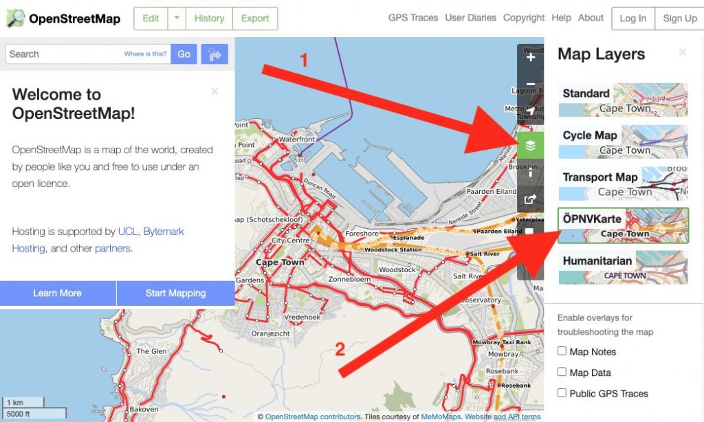
OpenStreetMap.org now has a new featured map layer displaying our rich data in a different way: ÖPNVKarte.
ÖPNVKarte is a public transport map displaying public transport routes of trains, trams, light rails, buses, ferries, subways and also points of interest for public transport travelers. Melchior Moos, the creator of the layer, hopes that the inclusion on the global site “will help and reward mappers from all over the world by making their public transport mapping efforts more visible”.
The ÖPNVKarte map key can be found on the ÖPNVKarte website https://öpnvkarte.de (also OpenBusMap.org). For those wondering about the name, it’s derived from German for “Public Transport Map”.
ÖPNVKarte is already featured on sites such as: openstreetmap.de, openstreetmap.no, Mappa-Mercia, Facilmap , OSM inspector and on some mobile applications.
The ÖPNVKarte layer is an addition to these featured layers:
The OSM Operations Working Group is interested in new featured layers that highlight different aspects of OpenStreetMap and you can read about the criteria here.
OSM Operations Working Group
Do you want to translate this and other blogposts in another language..? Please send an email to communication@osmfoundation.org with subject: Helping with translations in [language]
The Operations Working group is one of the volunteer Working Groups of the OpenStreetMap Foundation. The OpenStreetMap Foundation is a not-for-profit organisation, formed to support the OpenStreetMap Project. It is dedicated to encouraging the growth, development and distribution of free geospatial data for anyone to use and share. The OpenStreetMap Foundation owns and maintains the infrastructure of the OpenStreetMap project, is financially supported by membership fees and donations, and organises the annual, international State of the Map conference. It has no full-time employees and it is supporting the OpenStreetMap project through the work of our volunteer Working Groups. Please consider becoming a member of the Foundation.
OpenStreetMap was founded in 2004 and is a international project to create a free map of the world. To do so, we, thousands of volunteers, collect data about roads, railways, rivers, forests, buildings and a lot more worldwide. Our map data can be downloaded for free by everyone and used for any purpose – including commercial usage. It is possible to produce your own maps which highlight certain features, to calculate routes etc. OpenStreetMap is increasingly used when one needs maps which can be very quickly, or easily, updated.
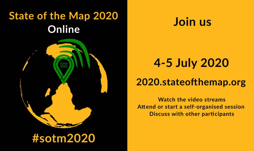
State of the Map is the annual, international conference of OpenStreetMap.
State of the Map 2020 is organised by the volunteers of the SotM Working Group and is streamed by the Chaos Computer Club Video Operation Center.
The State of the Map Organising Committee is one of the volunteer Working Groups of the OpenStreetMap Foundation. The OpenStreetMap Foundation is a not-for-profit organisation, formed in the UK to support the OpenStreetMap Project. It is dedicated to encouraging the growth, development and distribution of free geospatial data for anyone to use and share. The OpenStreetMap Foundation owns and maintains the infrastructure of the OpenStreetMap project and you can support it by becoming a member.
OpenStreetMap was founded in 2004 and is a international project to create a free map of the world. To do so, we, thousands of volunteers, collect data about roads, railways, rivers, forests, buildings and a lot more worldwide. Our map data can be downloaded for free by everyone and used for any purpose – including commercial usage. It is possible to produce your own maps which highlight certain features, to calculate routes etc. OpenStreetMap is increasingly used when one needs maps which can be very quickly, or easily, updated.
After many weeks of examining the 48 submitted proposals for the OSMF Microgrants Program, the committee is pleased to announce the 12 projects which have been selected for funding. While the entire range of submissions included thoughtful proposals with potential for impact, a shortlist was formed to keep under the proposed budget of up to €5,000 per project, up to €50,000 total. The selected proposals represent the top tier of ideas that will help shape and impact the OpenStreetMap community in the coming year with microgrant funding.
The accepted proposals are:

All projects must conclude within 12 months from their start, and should show promising results as they commence in the near future. Next steps will include final funding agreements for accountability, disbursement of funds, and kicking off the accepted projects.
A total of €42,368 is authorized by the board for this round of microgrants, although some of this will be reduced due to savings on shared video chat infrastructure and other minimal adjustments. No projects were allowed to have their nature or content modified in order to facilitate selection, but were judged on the merit of their originally submitted format. Community endorsements were considered in the selection process, and input of the OSMF Board was provided in regards to the shortlisted projects.
The Microgrants Committee includes Christopher Beddow, Janet Chapman, Geoffrey Kateregga, Clifford Snow, and Hanna Krüger. The committee wishes to profusely thank Joost Schouppe for his advising and refereeing during the process, as well as Craig Allan and Michael Collinson who served as neutral observers in the latter half of the committee proceedings. Finally, a profound thanks goes out to all who put in the effort to build a project proposal focused on improving OpenStreetMap, a dedication which does not always come with reward, but demonstrates the spirit of volunteerism and innovation that helps the OpenStreetMap project thrive.
The OSMF Microgrants Committee
About the OSMF Microgrants: framework, committee minutes and timeline
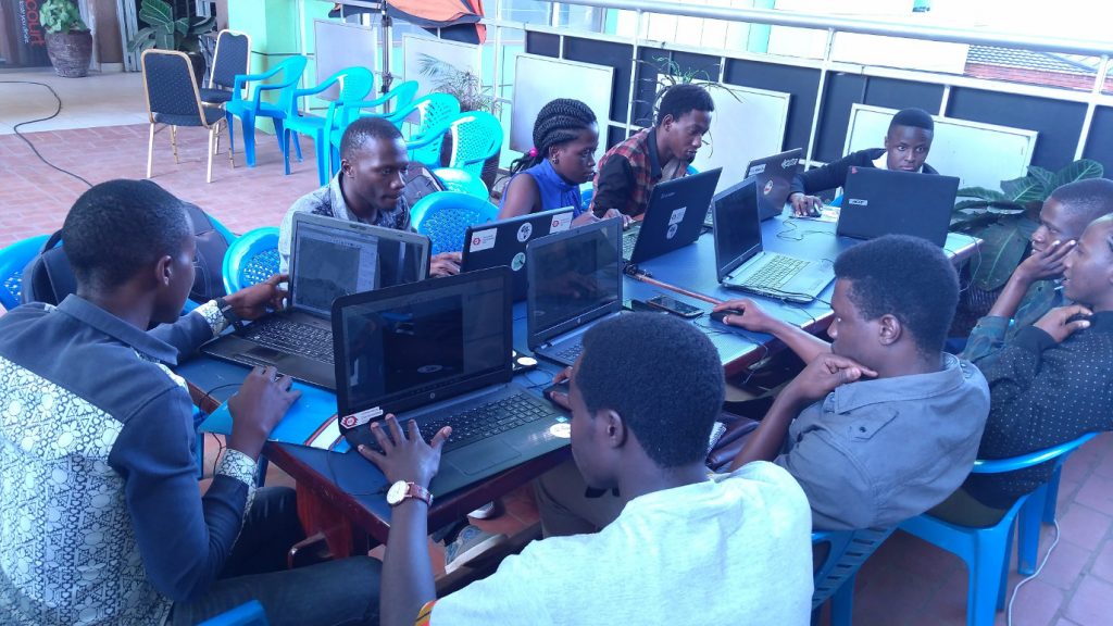
About photos in this post: The twelve applicants were asked for photos. The post includes those received up to the time of publication.
Do you want to translate this and other blogposts in another language..? Please send an email to communication@osmfoundation.org with subject: Helping with translations in [language]
The OpenStreetMap Foundation is a not-for-profit organisation, formed to support the OpenStreetMap Project. It is dedicated to encouraging the growth, development and distribution of free geospatial data for anyone to use and share. The OpenStreetMap Foundation owns and maintains the infrastructure of the OpenStreetMap project, is financially supported by membership fees and donations, and organises the annual, international State of the Map conference. It has no full-time employees and it is supporting the OpenStreetMap project through the work of our volunteer Working Groups. Please consider becoming a member of the Foundation.
OpenStreetMap was founded in 2004 and is a international project to create a free map of the world. To do so, we, thousands of volunteers, collect data about roads, railways, rivers, forests, buildings and a lot more worldwide. Our map data can be downloaded for free by everyone and used for any purpose – including commercial usage. It is possible to produce your own maps which highlight certain features, to calculate routes etc. OpenStreetMap is increasingly used when one needs maps which can be very quickly, or easily, updated.