Monthly Archives: February 2015

OpenStreetMap events in 2015

The OpenStreetMap Foundation has been organising the annual State of the Map (SotM) conference since 2007. These events have proved popular with our community and beyond, and have grown from a few dozen attendees to a high of 300 attendees at SotM 2013. This year we had two good bids to host SotM 2015, but issues beyond our control caused concerns about whether we could make this into a success. The SotM working group, with the support of the OSMF board, has therefore agreed that there will be no OSM Foundation organised conference this year.

As the OpenStreetMap community has grown over the last 10 years, so has the conference scene. Even without OSMF organising a conference this year, there will still be a number of OSM-centered conferences, including SotM US at the UN’s New York headquarters in June, and SotM-Scotland in October. There are also many webinars, mapping parties, hack events and socials planned for 2015.

UN General Assembly hall

SotM-US will be held at the UN headquarters in New York, 6-8 June 2015
(image CC-BY 2.0 Dan McKay)

The StateoftheMap Organizing Committee has taken on a number of new members to support our efforts in 2015, 2016 and beyond. We are currently drafting a proposal on the future of SotM in which we are looking at the role of SotM within the project and how the OSMF SotM relates to the various regional events. We already have some views but we encourage you to share yours in the comments below.

Preparations for State of the Map 2016 will be starting soon and we encourage local groups who may be interested in hosting SotM in their home country to contact us early.

Blog post by the StateoftheMap Organizing Committee
OpenStreetMap Foundation Face2Face Meeting: Day 1

Today was the first Face to Face(F2F) meeting I’ve participated in as a OSMF board member. Though I had met the rest of the board, this was the first time I’ve been together with them since my own election. In today’s day of video conference, IRC, Skype, Etherpad and many other forms of remote collaboration, it is still great and productive to be together. Allen Gunn (Gunner) of Aspiration Tech has been facilitating us. This is the first F2F in recent memory that has been facilitated, but I can’t compare it to the previous one. Having someone help us focus on outputs and avoiding getting stuck on topics however has been invaluable.

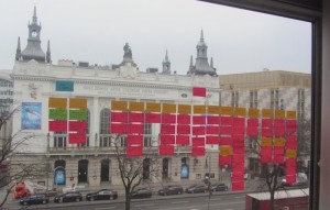
There were multiple key exercises today that helped us both realize where we agree/disagree as well as prioritizing efforts for the board over the next year. We started off the day with an exercise where a line is set-out in a room and participants stand on a point of their choosing in response to a stated proposition – one end is “strongly agree” the other end is “strongly disagree”. What became clear is really there is not the extreme differences we may have thought we had. I think if the membership of the foundation were to ever meet and do this we’d discover the same thing.

Photo Credit: Paul Normal

Photo Credit: Paul Norman

The other exercises were on specific topics. We used similar techniques to list, prioritize and evaluate the outputs. The topics we worked on were: what we see as our core values, what we want to accomplish over the next year, what is/is not working in OSM, and what is the responsibility of the OSMF board vs the OSMF Foundation as a whole. We’ll be sharing this information out with the community in a more robust feedback this week. First we need to finish transcribing our Post-it Notes. I’m excited about our initial results so far and I’m feeling energized and excited to continue.

Routing on OpenStreetMap.org

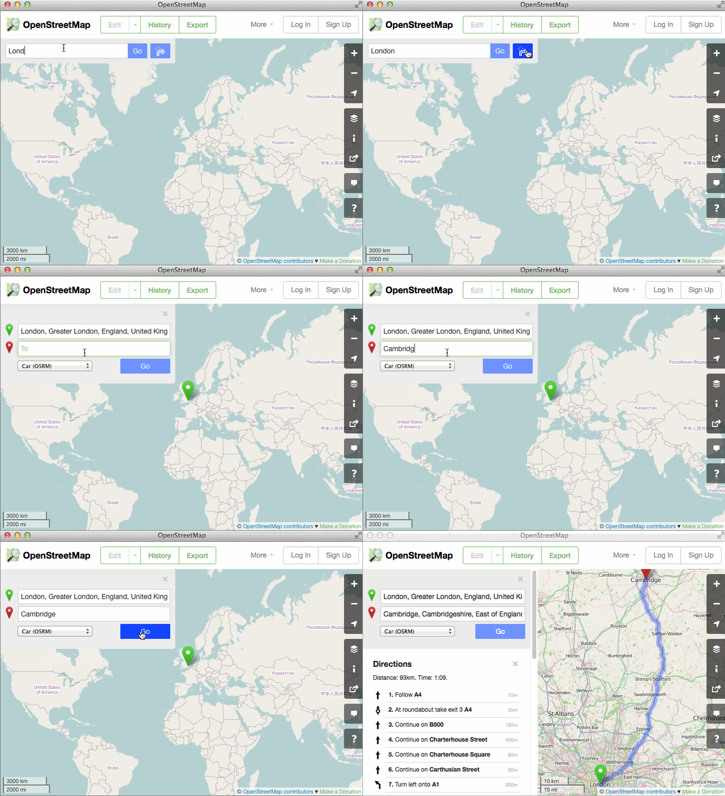
Good news for OpenStreetMap: the main website now has A-to-B routing (directions) built in to the homepage! This will be huge for the OSM project. Kudos to Richard Fairhurst and everyone who helped get this up and running.

osm-routing

You might be thinking, “Why would this be huge? Isn’t it just a feature that other map websites have had for years now?” Well, the first thing to note is that the philosophy of OpenStreetMap is not to offer a one-stop-shop on our main website, but to create truly open data to empower others to do great things with it. So there has already been fantastic OSM-based travel routing for many years, on excellent websites such as OSRM, Mapquest, Graphhopper, Cyclestreets, Komoot, cycle.travel… the list goes on and on.

But all of those things are on other websites and apps, so people don’t always realise that OpenStreetMap has this power. What this latest development has done is really neat: the OSM website offers directions which are actually provided by third-party systems, but they are included in the main site via some crafty JavaScript coding. So as well as being really handy in itself to have directions available, it helps “first glancers” to see all the things they can do with OSM.

But that’s not what makes it huge.

What makes it huge is the difference it will make to OpenStreetMap’s data by creating a virtuous feedback loop. One of the main reasons we show a “slippy map” on the OpenStreetMap homepage is because people can look at it, see a bridge that needs naming or a building to add, click “Edit” and fix it straight away. That feedback loop is what allowed OpenStreetMap to build up what is now the most complete map of many regions around the world.

But we have a saying: “what gets rendered, gets mapped” – meaning that often you don’t notice a bit of data that needs tweaking unless it actually shows up on the map image. Lots of things aren’t shown on our default rendering, so the feedback loop offers less incentive for people to get them correct. And that goes doubly for things that you never “see” on the map – subtle things like “no left turn” at a particular junction, or “busses only” access on a tiny bit of road, or tricky data issues like when a footpath doesn’t quite join a road that it should join on to. Now that people can see a recommended route directly on the OSM homepage, they have an incentive to quickly pop in and fix little issues like that. The end effect will be OSM’s data going up one more level in terms of its quality for routing. This will empower everyone to do great things with geographic data and getting from A to B.

So find yourself some directions today!


Blog post by Dan Stowell

OpenStreetMap Local Chapters – Welcome Iceland

The OpenStreetMap community has a wide array of different local groups forming in different corners of the globe. It’s time to formalise the idea of “local chapters”. We now have a definition and a process, and we have our first official OpenStreetMap Foundation Local Chapter!

openstreetmap-iceland-website

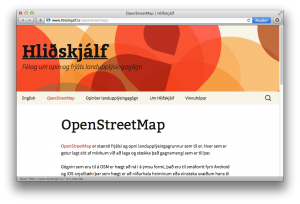
OpenStreetMap á Íslandi” is a subgroup of Hliðskjálf, an Icelandic society for open and free geographic information data. Well done to Jóhannes from Hliðskjálf who went through the process of getting this organisation set up as an OpenStreetMap Chapter.

Of course we have always had local OpenStreetMap groups forming all around the world, small groups of collaborating mappers, but also groups on a bigger country scale. These organisations help to present OpenStreetMap in a particular language, and engage a community with consideration for local culture and customs.

The idea of local chapters has long been discussed, as a name for these groups. We’re borrowing this idea from the Wikimedia foundation. And now we are formally introducing local chapters as a way of establishing a relationship between regional OpenStreetMap organisations and the OpenStreetMap Foundation. This is a hugely important step in the development of the OSMF.

The actual definitions, requirements and processes have been laid out. Read these, and more information, on the Local Chapters page.