Category Archives: Uncategorized

Project of the Week: At a Crossroads

They are the literal markers along a way; we can go three blocks then
turn north. Crossroads are also the metaphorical points of decision in
our lives; we can come to a fork in the road in deciding between two
job offers. Crossroads are all about decisions; left or right; hold,
raise or fold; ketchup or mustard. This week we map our decisions.

Feel free to map your literal or metaphorical crossroads.

Details and suggestions on the Project of the Week wiki page

http://wiki.openstreetmap.org/w/index.php?title=Project_of_the_week/2010/Oct_06

This is your Project of the Week. Submit your own projects or offer
suggestions.

http://wiki.openstreetmap.org/wiki/Project_of_the_week/Proposals

Signpost photo by Matt Brown
http://www.flickr.com/photos/londonmatt/
Licensed CC-By-SA
http://creativecommons.org/licenses/by/2.0/deed.en_CA

Chair of OSMF Data Working Group Steps Down

Mikel Maron has resigned his position of Chair of the Data Working
Group at OpenStreetMap Foundation. The Data Working Group assists OSM
contributors in matters of vandalism, copyright violation, editing
disputes and data policy. Mikel has served as Chair since the
formation of the DWG. OSMF Board thank Mikel for his service on DWG
and his continued service on OSMF Board. See Mikel’s announcement on
the OSMF Blog.

http://blog.osmfoundation.org/2010/10/06/mikel-maron-steps-down-from-dwg-chair/

OSM Founder Steve Coast Leaves CloudMade

Media_httpfarm4static_fdfmf

OSM founder, CloudMade co-founder and founder of OpenGeoData, Steve
Coast has resigned from CloudMade. Announced moments ago on his blog,
Steve said, in part:

I’d like to thank everyone I worked with in any capacity
at CloudMade, and I wish CloudMade, it’s employees, investors Sunstone
& Greylock and it’s operating companies Progression Partners &
Cogniance all the best in the future and I will continue to support
the company as a shareholder.

As for me, I’ll be taking some time off to think about the future and
perhaps get some more hangliding in.

But you should really read his full announcement.

I’m envious of his hangliding opportunities and we all know that
whatever is next on Steve’s list will be Fantastic.

http://blog.stevecoast.com/ive-resigned-from-cloudmade

I wish you “good lift” my friend.

Photo of the former CloudMade team by Shaun McDonald
http://www.flickr.com/photos/smsm1/
is licensed cc-nc-sa
http://creativecommons.org/licenses/by-nc-sa/2.0/deed.en_CA

New OSM Quality Tool

Media_httpimgurcomegs_dinjg

Jochen Topf has announced his latest project. It is a tool to explore
the OSM database, inspired by Tagwatch, Taginfo and OSMdoc. This is a
nice addition to the tools we use to check and improve OpenStreetMap
data quality. His announcement, in part, reads:

For the last months I have been working on a software called Taginfo that
brings together information about OSM tags from the OSM database, the wiki
and other places. Somewhat like Tagwatch, Tagstat, and OSMdoc, but more
ambitious. 🙂

I am happy to announce that the beast is now available at

http://taginfo.openstreetmap.de

There are still some bugs and lots of missing features, but its already
usable. Updates are currently done manually, but I will do automatic daily
updates soon.

More details and background in Jochen’s blog entry at:

http://blog.jochentopf.com/2010-10-05-introducing-taginfo.html

He’s made taginfo entirely Free Software / Open Source. You can find
the Taginfo code, under GPL v2 at github:

http://github.com/joto/taginfo

Image of the Week: Marburg Mapping Party

Media_httpimgurcomn3a_twteb

Mapping Party Marburg, Germany, 28.2.2010. Blind and seeing mappers
discover a tactile model of the Elisabethkirche.

See the full size image here.

This is a Featured image, which means that it has been identified as
one of the best examples of OpenStreetMap mapping, or that it provides
a useful illustration of the OpenStreetMap project.

If you know another image of similar quality, you can nominate it at

http://wiki.openstreetmap.org/wiki/Featured_image_proposals

Usabilla shoutout

I want to give a shoutout to usabilla.com who’re helping OpenStreetMap with visual feedback on our user experience testing and design.

The concept behind usabilla is super simple, throw anything from full fledged designs to mockups in front of potential users and get click-based feedback. Users get to click on things and leave notes around specific features and parts of a page. So rather than trawling through a list of feedback, you get a more visual and engaging experience from both the testee and the testers perspective. And a whole lot more, check out the intro video below:

[youtube http://www.youtube.com/watch?v=d6Xi8IdQLik?wmode=transparent]

OSM User Testing

I’ve written previously about OSM usability studies, and now it’s happening. Nate Bolt from the fantabulous Bolt|Peters is going to help OSM run usability tests and we need your help.

The timeline looks something like this: This week or next we’re going to switch on some javascript on the OSM signup page that invites a percentage of signups to help OSM run a user survey. Those people fill out a form and are invited later to use some simple online screen capturing software while asked to do some simple tasks and this is where you come in. We need to think of some simple tasks for new users to complete, and we’ll put them together over on this wiki page. Add a street? Find a mailing list? Add a point of interest? What should they do? That’s up to you.

Also, if you’re running a mapping party we can give you a super secret link where you can send new users to do the same tasks with screen recording. You mustn’t help them on the first go, as that’s exactly what we’re trying to find out – what goes wrong.

Then on December 8th (tentative) at the Bolt|Peters office in San Francisco, OSMers together with the UX wizards will analyze the videos and make some joint suggestions on how to push things forward. Anyone in SF, or can be in SF around then, please drop me a mail.

Project of the Month: Drinking Water

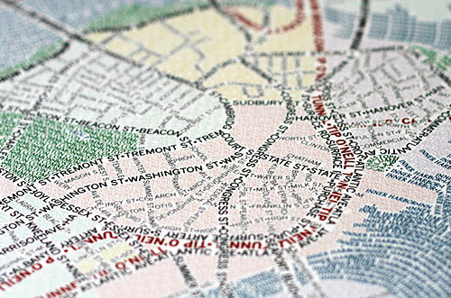
How about a nice drink of water? Refreshing on a warm day, especially
nice when one has worked up a sweat by collecting information for
OpenStreetMap. We can sometimes forget that we need water to live.
Sadly, not everybody can take for granted reliable access to safe
drinking water.

On 28 July 2010, the UN General Assembly adopted a resolution that
declares “the right to safe and clean drinking water and sanitation as
a human right that is essential for the full enjoyment of life and all
human rights.” In 2005, more than 3.5 Million people died of
water-borne illness.

This Project of the Week is also the first Project of the Month. Add
drinking water locations to the map. In some places we’ll be adding
public water fountains as a courtesy to outdoor exercisers, in others
we’ll be adding the critical public water access points.

Put drinking water on the map.

Find out more about how to add drinking water locations to
OpenStreetMap on the project wiki page.

http://wiki.openstreetmap.org/wiki/Project_of_the_week/2010/Sep_29

This is the first Project of the Month. Project of the Week returns
next week, while PotM will continue until November. These projects
inspire mappers to contribute data they might not have considered
previously, and allow us to be inspired by the projects of other
mappers.

This is your Project of the Month. Make suggestions. Inspire other
mappers. What is it about contributing to OpenStreetMap that
interests you? Postboxes? Bowing alleys? Share your OpenStreetMap
obession by contributing a Project of the Month.

http://wiki.openstreetmap.org/wiki/Project_of_the_week/Proposals

Water glass photo by Kyle May http://www.flickr.com/photos/kylemay/
is licensed CC-By http://creativecommons.org/licenses/by/2.0/deed.en

Image of the Week: Merida Venezuela

Media_httpimgurcomdx4_wpbce

OSM map of Merida, Venezuela. Data by Fundacion GeoHorizontes de
Venezuela. Data collected by HernanRamirez.

This is a Featured image, which means that it has been identified as
one of the best examples of OpenStreetMap mapping, or that it provides
a useful illustration of the OpenStreetMap project.

If you know another image of similar quality, you can nominate it at

http://wiki.openstreetmap.org/wiki/Featured_image_proposals