The OpenStreetMap Awards were held for the 3rd time on 30th of July at the State of the Map conference. Beforehand nominations were provided and shortlisted by community voting, and at the closing session of the conference, the community came together and applauded all the nominees as the winners were revealed (Video of this session)
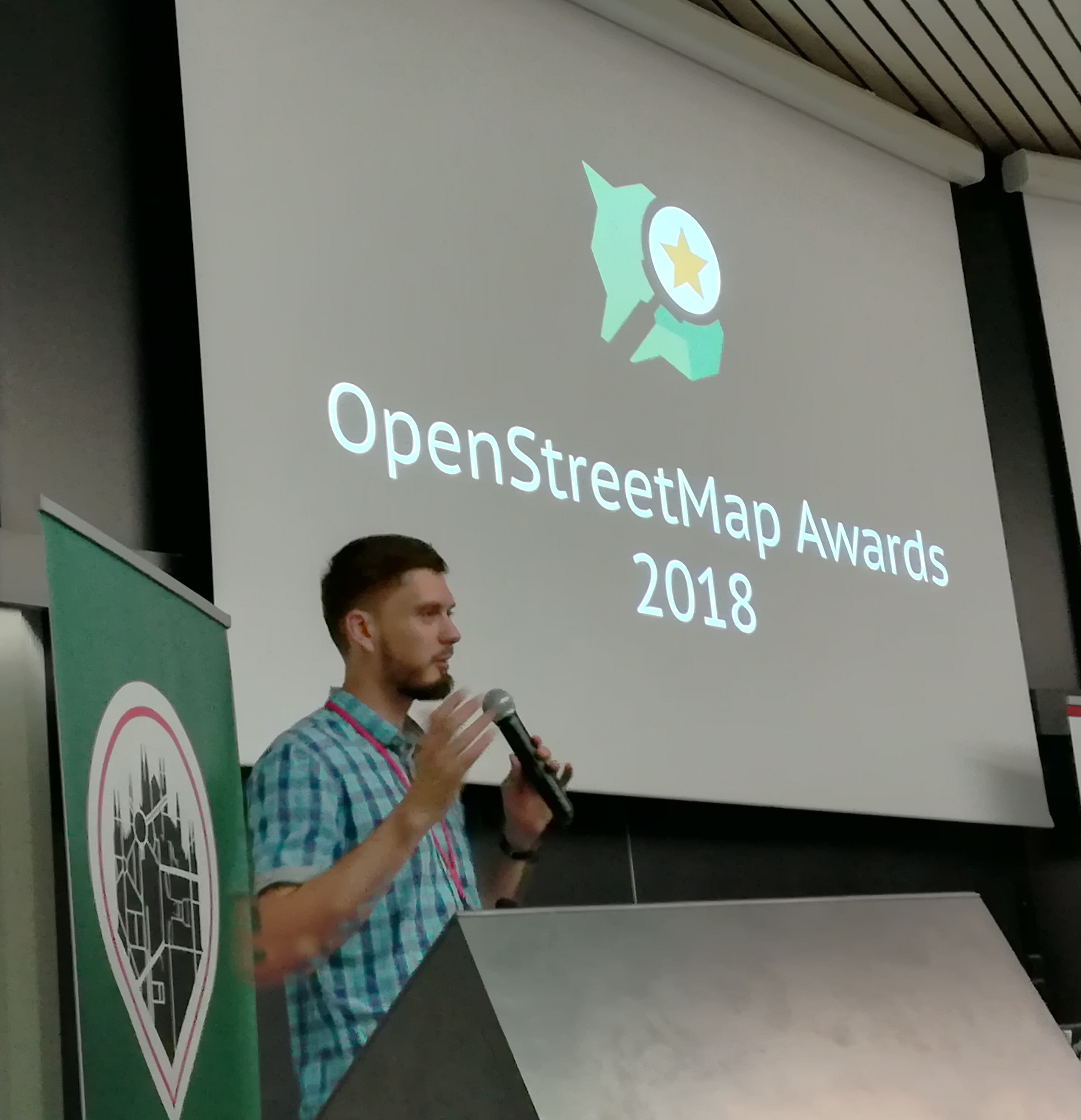
Ilya Zverev presenting the OSM awards © CC-BY-SA 4.0 OSMF Communication Working Group
There were nine nominations in each of the nine categories. Find out more about each of them on the awards site and on the wiki. All nominees are very deserving of awards, but here are this year’s winners:
- The Core Systems Award went to Sarah Hoffmann who leads the development of nominatim, the open source search tool.
- The Innovation Award went to Wikimedia Foundation Collaboration Team who have developed an impressive mapping stack for the Wikimedia projects, including features like the map internationalization.
- The Influential Writing Award went to Christoph Hormann who has been examining many mapping style choices, enlightening us on satellite imagery processing and generally sharing his opinion on mailing lists and the blog.
- The Greatness in Mapping Award went to Tshedy The work of Tshedy (Mats’eliso Thobei) is well known in the OSM Community. She is popularly known as “Lesotho Mapping Queen”. She is an avid writer, trainer, and mapper.
- The Expanding the Community Award went to Christine Karch. Christine who is a part of the State of the Map Working group has contributed in expanding both the developer and the general OSM Community worldwide through hack weekends and other events.
- The Improving the Latin America Award went to Natalia da Silveira Arruda, a professor at the University of Antioquia (UdeA) who runs a Youthmappers chapter at the University in the city of Cartagena de Indias/ Colombia. So far this has trained >200 students.
- The Improving the Africa Award went to Crowd2Map Tanzania, a volunteer-run mapping project that unites over 2000 remote mappers worldwide with over 600 community mappers on the ground in Tanzania. Since 2015, they have mapped schools, hospitals, roads, buildings and villages across rural Tanzania.
- The Improving the Asia Award went to State of the Map Asia 2017 organizing team who successfully brought 200 open mapping enthusiasts from Asia and beyond to this conference held in Nepal.
- The Ulf Möller Memorial Award went to Richard Fairhurst. He is a longstanding shining light of the OpenStreetMap community, and developer of key software such as the Potlach editor, an entry point to OpenStreetMap for many.
We congratulate all the award winners and everyone else whose hours and hours of contribution have made OpenStreetMap the map it is! Finally thanks to Ilya Zverev for his hard work in running the awards, and thanks to all those who nominated and voted. Please continue the good work, and prepare to nominate each other for the next year’s awards!


 In parallel to the standard sessions, this year