Monthly Archives: March 2023

Local Chapters Congress – Live & Online in 2022!

By: Local Chapters & Communities Working Group (LCCWG) 

The Local Chapters & Communities Working Group (LCCWG) tries to organize a yearly in-person and a yearly virtual Local Chapters Congress. For obvious reasons, events in 2020 and 2021 could only happen virtually. But in 2022 we managed to do both! This post covers about both the virtual and IRL (in real life) congresses.

State of the Map Florence – Community Meet IRL!

On August 19, at the State of the Map in Florence, Italy, the LCCWG hosted an in-person (woo hoo!) mini-Congress. If you missed it, here are some of the ideas that arose from a fruitful and fun discussion. We hope you will consider joining the next session in late 2023!

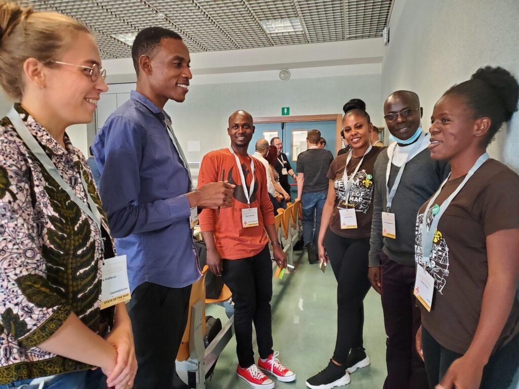
We started the session by dividing up into continents – and every continent was represented! It turned out many people from the same regions didn’t know one another. 
Next we heard Allan Mustard, Tobias Knerr and Jean-Marc Liotier talk about the role of chapters from the OpenStreetMap Foundation perspective. 
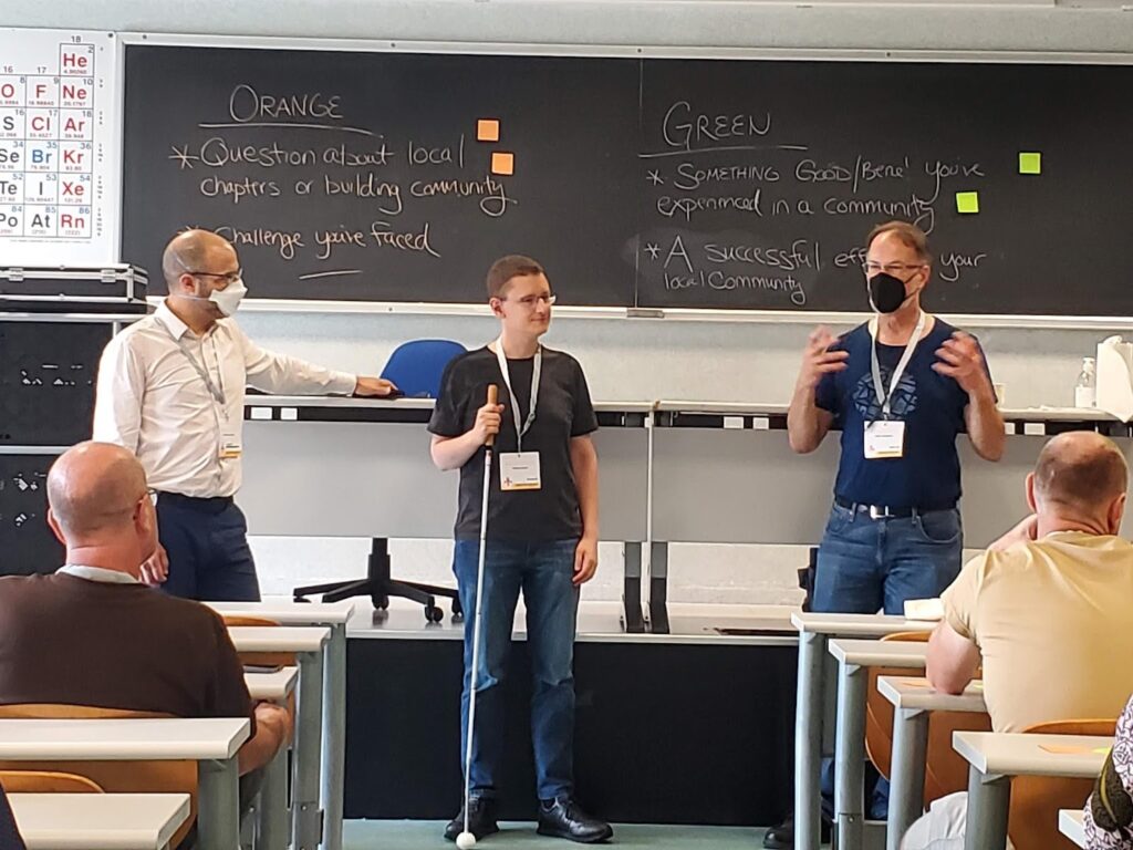
Next we passed out two colors of sticky notes and asked participants to share things that have worked in their communities or challenges they have faced. There were many great answers, and many common threads.

Where have you seen success gathering community?

In terms of having an organization, some groups found that having several dedicated chat rooms on specific topics helpful. Other groups found it simpler to move organizational stuff to open source software like Collabora, LibreOffice, LimeSurvey. Many folks had success linking with their local government and holding local events, like State of the Map. Other common threads were around community building and mapping projects. Community building around the world seems to have more success when the focus is on building relationships, working together with other communities and having regular informal meetings. All participants strive to keep their spaces open and welcoming. 
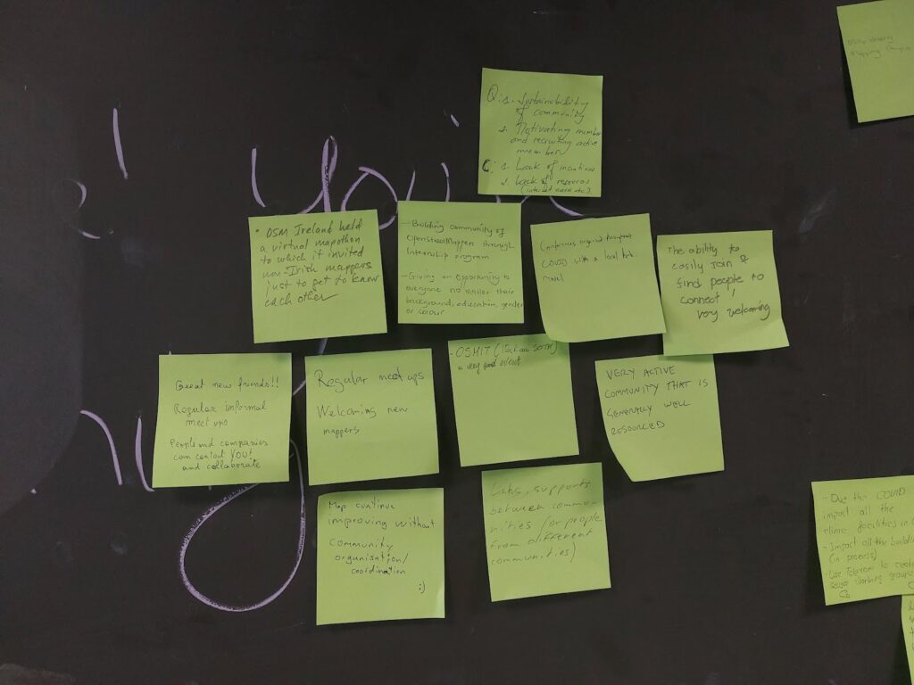
Often communities are contacted by local authorities who want to help keep OSM data up to date. This can lead to partnerships for mapping projects, such as mapping health infrastructure for covid, mapping buildings and addresses, following up on Notes and just new mappers heading out to contribute on their own. 

What’s Difficult About Organizing Community?

On the other sticky note, folks shared things that were more difficult. A general theme seemed to be growing pains – how do you get started? Once you have a little group, how do you formalize? When you become a Local Chapter, how do you find new goals for the community to work towards? In some regions, getting volunteer work at all is difficult. In others, it’s mostly about keeping people on board for longer.
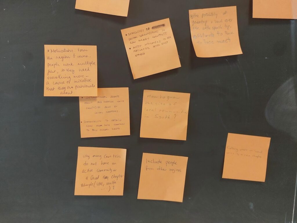
Another common difficulty was the institutional and financial challenges associated with having a local group. How do you finance your organization? How do you handle commercial activities? In our session there were discussions about the limits to paid mapping by local chapters, the growing pains moving from an informal to a formal group, the procedure to become a Local Chapter and when requests from outsiders or handling management as a volunteer can be too time consuming. 

Other challenges included how to decide between open channels Vs closed channels (where many folks tend to be already, like WhatsApp), having too many different channels, getting visas to attend global events, engaging volunteers in low income countries, and reconvening in-person after COVID.

When it comes to mapping – often that’s the least of a Chapter’s worries! Though in some countries, incentives for volunteers and lack of resources like decent internet connections are a barrier. Another challenge can be to get people facing the same direction to achieve common mapping goals, or to decide on which mapping tools to use. And there’s more and more quality open data that allows you to improve OpenStreetMap – but it is so much work to put it to use.

Local Chapters Congress – Community Meets Online

On November 12, 2022 the global OSM community gathered for the 3rd annual virtual Local Chapters and Communities Congress 2022. Leaders and members of various OSM communities, whether they are officially recognized Local Chapters of the OSM Foundation or just a regular user group of OSM mappers, came together to share stories and learn from each other.

There were lightning talks, presentations by LCCWG members and lots of great discussions. OSM Italia presented a fun video about the SotM in Florence. Adrés Gómez talked about how the Colombia community is successfully dealing with huge amounts of Notes – and how the project is expanding to other countries. Janet Chapman talked about Crowd2Map Tanzania. Then we heard about the new Discourse forum that lives at community.openstreetmap.org. To close off, we heard from a bunch of communities from around the globe.

You can check out the full agenda on the wiki and watch presentations from the day on this youtube  playlist


The OpenStreetMap Foundation is a not-for-profit organisation, formed to support the OpenStreetMap Project. It is dedicated to encouraging the growth, development and distribution of free geospatial data for anyone to use and share. The OpenStreetMap Foundation owns and maintains the infrastructure of the OpenStreetMap project, is financially supported by membership fees and donations, and organises the annual, international State of the Map conference. Our volunteer Working Groups and small core staff work to support the OpenStreetMap project. Join the OpenStreetMap Foundation for just £15 a year or for free if you are an active OpenStreetMap contributor.

Join OSM Open Source Development with GSoC 2023

In 2023, OpenStreetMap will participate once more as a mentoring organization in Google Summer of Code, a program to bring new contributors into Open Source software development. Originally targeted at students, the program now also accepts people new to Open Source in general.

We particularly welcome potential participants who are already involved with OpenStreetMap. You ideally have done some mapping and had an opportunity to get to know the community. You have used some of the software around OpenStreetMap and would now like to get involved in its development.

With the support of an experienced mentor, you will, over the course of a few months, add features to one of the Open Source tools which power the OSM ecosystem. Your work will improve software used daily by the OSM community, and Google will provide you with an attractive stipend for the summer. You will find more information about the program in general on the Google Summer of Code 2023 website.

Because of OSM’s diverse software ecosystem, you can choose from projects involving a variety of tools, technologies and programming languages. OSM tools planning to participate this year include editing software such as iD or JOSM, routing software such as OSRM or Valhalla, and the Nominatim search engine.

Applications are open March 20 to April 4 – but please get in contact with your mentors early so you can use the chance to improve your application. Visit our GSoC 2023 wiki page to learn what we’re looking for and browse our project ideas.

Learn more about GSoC 2023 with OSM


The OpenStreetMap Foundation is a not-for-profit organisation, formed to support the OpenStreetMap Project. It is dedicated to encouraging the growth, development and distribution of free geospatial data for anyone to use and share. The OpenStreetMap Foundation owns and maintains the infrastructure of the OpenStreetMap project, is financially supported by membership fees and donations, and organises the annual, international State of the Map conference. Our volunteer Working Groups and small core staff work to support the OpenStreetMap project. Join the OpenStreetMap Foundation for just £15 a year or for free if you are an active OpenStreetMap contributor.

Welcome TomTom, our first Platinum Corporate Member

We are happy to announce that TomTom is joining us as our first platinum tier corporate member. Their contribution provides crucial direct financial support to our operations and infrastructure, which is essential to accompany the growth and ensure the long-term sustainability of the world’s largest crowdsourced geospatial project.

People create data in OpenStreetMap, excited that open map data will be widely useful and used. Many more people will be interacting with OpenStreetMap data through TomTom’s user base, and some of them will be curious about our community and interested to help make it better. We welcome all such contributions, whether someone is fixing a small issue on the map affecting them, or as the first step of a life long mapping passion.

We are grateful for the wide extent of TomTom’s support of OpenStreetMap, which extends beyond financial contributions: they actively participate in working groups, the Advisory Board, and local OpenStreetMap communities. TomTom’s recognition of the importance of the OpenStreetMap data they use is a testament to the value our project provides. We hope this inspires other corporate partners to join as members to support OpenStreetMap.

Read more from TomTom on their announcement.

International Women’s Day: Meet Geoladies PH

Tomorrow is International Women’s Day (IWD)–the perfect time to celebrate* the many women in OSM, as well as the contributions they make to the map and the community. And what better way to do this than to put a couple of these ladies in the spotlight: Geoladies PH.

(*Psssst: want to join other members of the community in honoring IWD? Scroll down to the end of this post for a list of celebratory mapping events you can still sign up for.)

The Philippine Geoladies group was established in 2019, when they held their first workshop at the Pista ng Mapa conference in Dumaguete. They “advocate for community diversity, collaborative participation, and affirmative spaces, especially for women and under-represented communities”. We had a chat with the core team to learn about all the activities they’re doing to work towards this goal.

Charmyne Mamador is leading Ausome Maps, a project funded by She Leads and She Inspires (SLSI). The SLSI program was launched by the Humanitarian OpenStreetMap Team’s (HOT) Open Mapping Hub – Asia Pacific at the end of 2021 and helped 100 women in multiple countries grow as leaders within their open mapping communities. Over the course of 6 months, they received training, mentoring and guidance in creating and leading a community project. At the end of the program, ten of these projects received funding, including Ausome Maps. The goal of Ausome is to map schools with special education (SPED) classes and therapy clinics in the Philippines. This will help the families of differently abled children find the support they need.

Another core member of Geoladies PH is Leigh Lunas, known as the group’s drone expert. She teaches students how to code and fly drones. Currently she is involved in the Bahaghari Maps initiative, aimed at creating usable trail maps for Philippine hikers.

Feye Andal is Geoladies’ Disaster Response Mapper and serves as a Regional Ambassador for YouthMappers in the Asia Pacific region. (Fun fact: in 2022, 45% of YouthMappers were women.) Recently Feye has been working with the UPRI (University of the Philippines Resilience Institute) YouthMappers on mapping and validating the areas affected by the Turkey and Syria earthquake.

Next up is Geolady Jen Alconis. One of her main projects has been to map all publicly accessible breastfeeding stations in the Philippines. This way, she could give back to her breastfeeding support group, but also to fellow mothers in general.

Geoladies PH member Andi Tabinas is the founder of Mental Health AWHEREness PH, a non-profit organization promoting mental health awareness through information, education, communication, and mapping mental health facilities and services.

Last but not least is Arnalie Vicario. Like her fellow ladies, she’s an advocate for diversity and inclusion, as well as for sustainable living and, at the end of 2022, she was one of the women elected to the OpenStreetMap Foundation Board.

Interested in learning even more about Geoladies PH? Check out their Facebook page.

Feel like meeting the ladies in real life? They regularly organize sessions and workshops to empower women to map. Tomorrow, on International Women’s Day, you will find them at the YouthMappers-organized Everywhere She Maps event in Manila (as well as online).

Of course, this is not the only mapping event dedicated to IWD. Below are some more opportunities to celebrate our female community members.

Want to find out how the rest of the world is honoring this special day? For the third year, Geochicas and Feminist International have created a global map of actions and activities around International Women’s Day. If you would like an event to be added, please share the details including the exact location with the Geochicas Twitter account.

Who map the world? Girls!