Monthly Archives: April 2021

State of the Map 2022 – Call for Venues Open

The Call for Venues for State of the Map 2022 is now open!

https://wiki.openstreetmap.org/wiki/State_of_the_Map_2022/Call_for_venues

Read the guidelines and selection criteria on the OSM Wiki page and start planning your application for next year’s conference venue. Build a team, shape your idea, and submit your proposal specifying your city as the host for SotM 2022!

This early call gives you the greatest flexibility over dates you can pick in 2022. Please observe when other OpenStreetMap-related events (like FOSS4G and local SotMs) will take place in order to avoid possible clashes with other relevant conferences for the community.

The deadline for venue proposals for SotM 2022 is 15 August 2021, the selected host will be announced in October 2021.

Looking for some help? The SotM Working Group is available for any fruther clarificication! We encourage you to contact us on sotm@openstreetmap.org as early as possible so that we can provide guidance, if required.

SotM Organising Committee

Sign up for event updates and follow us @sotm!

Do  you want to translate this and other blog posts in your language…? Please email communication@osmfoundation.org with subject: Helping with translations in [your language]

The State of the Map conference is the annual, international conference of OpenStreetMap, organised by the OpenStreetMap Foundation. The OpenStreetMap Foundation is a not-for-profit organisation, formed in the UK to support the OpenStreetMap Project. It is dedicated to encouraging the growth, development and distribution of free geospatial data for anyone to use and share. The OpenStreetMap Foundation owns and maintains the infrastructure of the OpenStreetMap project. The State of the Map Organising Committee is one of our volunteer Working Groups.

OpenStreetMap was founded in 2004 and is an international project to create a free map  of the world. To do so, we, thousands of volunteers, collect data about  roads, railways, rivers, forests, buildings and a lot more worldwide.  Our map data can be downloaded for free by everyone and used for any  purpose – including commercial usage. It is possible to produce your own  maps which highlight certain features, to calculate routes etc.  OpenStreetMap is increasingly used when one needs maps which can be very  quickly, or easily, updated.
Joint statement from Quincy Morgan and the OpenStreetMap Foundation’s Board, regarding iD development

After two and a half years developing iD, Quincy wishes to pass the torch on, for personal reasons. Together with the OpenStreetMap Foundation, he will hand over iD to good hands; the Foundation is now starting the process of finding a replacement by consulting the OSM community about a planned paid position serving iD users.

To ensure continuity, Quincy will be part of an OpenStreetMap Foundation working group – a privileged environment to pass his knowledge as his successor ramps up in mastery of iD.

The OpenStreetMap Foundation remains fully committed to robust support of the editor through which 80% of OpenStreetMap users contribute to the common edifice.

The Foundation thanks Quincy for his great work on iD.

Celebrating Earth and Space in Maps

April brings two international commemorative days that offer fun ideas for mapping. Earth Day on April 22 demonstrates support for environmental protection, and the less well-known International Day of Human Space Flight on April 12, which was created by the United Nations fifty years after Yuri Gagarin’s first human space flight.

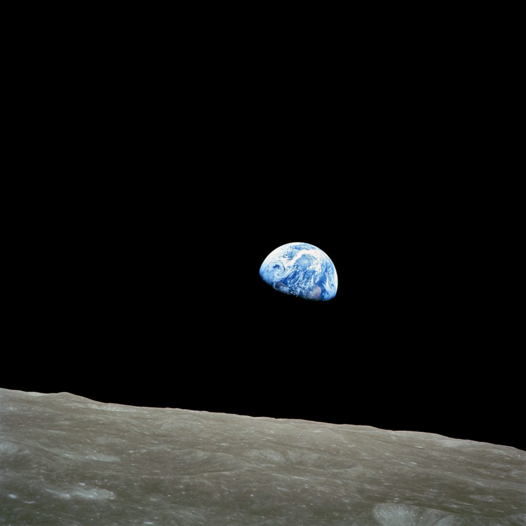
These celebrations are intricately intertwined in the famous “Earthrise” image, which helped spark global environmental consciousness and led to the first Earth Day in 1970. The increasing availability of earth observation imagery since then has directly helped OpenStreetMap for the entire globe.

The Earth from the Moon, by NASA

There are plenty of opportunities for mapping related to Earth Day. You could map natural areas, reserves and parks, recycling facilities, and many other kinds of features mentioned in the Environmental OSM project.

And for the International Day of Human Space Flight, while OSM doesn’t map in outer space (yet), you can map terrestrial features related to space flight, like launch sites, space-related facilities, historic sites and museums, or even just things named for outer space.

Mapping Earth

The Environmental OSM project has a lot of great ideas, from the local to the global.

You could take a look at recycling-related tags and features, such as public recycling bins or recycling centres, and see if any are missing around you.

You could help map your favorite green space or natural area, whether it’s wilderness, a park, or something else. National parks and nature reserves are among many included in boundary=protected_area, or you could try mapping land use, wetlands, or mangrove forests. There are also clean energy facilities like wind power — are there any near you that aren’t mapped? Other ideas include cycling and hiking trails, or you could look to see if any polluting industries near you need to be mapped.

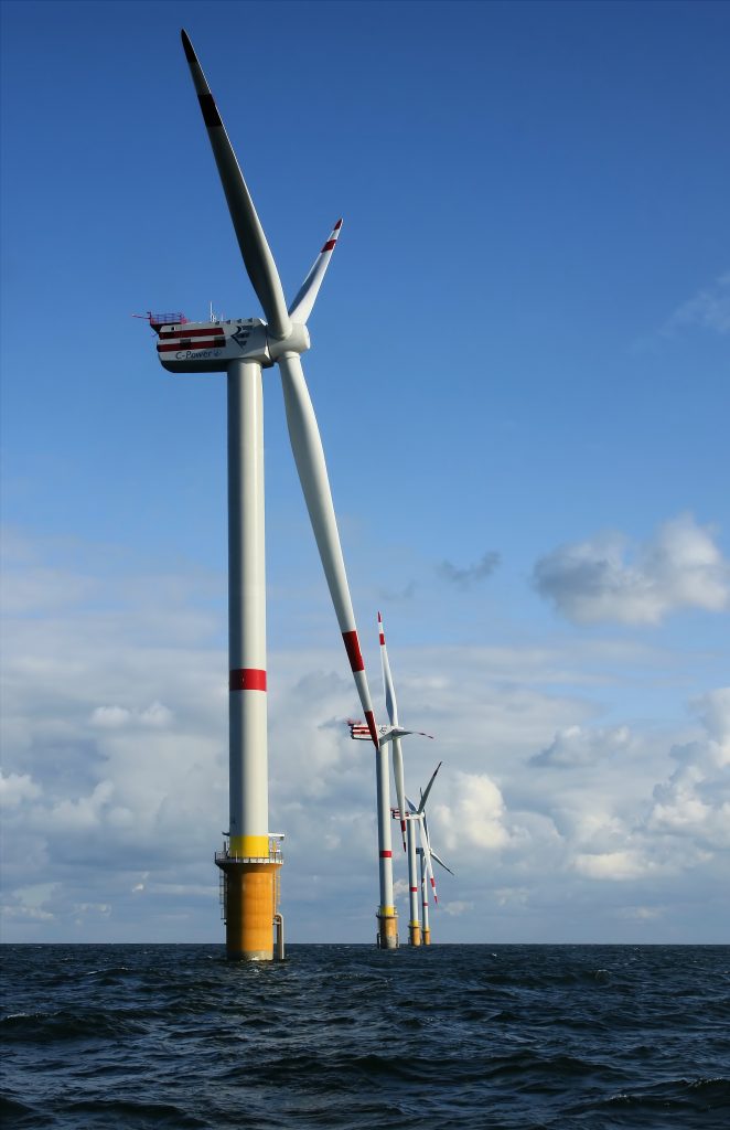
A windmill in the ocean

The Tasking Manager also has projects from various nonprofits related to environmental issues, such as mapping places with climate change-related risk.

Or you can take a look at places related to the environment: the United Nations Environment Programme is headquartered in Nairobi, Greta Thunberg’s first School Climate Strike took place at the Swedish Riksdag, and there’s even an Earth Day monument in Orlando, Florida.

Mapping Space Flight

There are many Earth-bound options for mapping space flight! OSM has tags for spaceports and launchpads and Wikipedia has a list of rocket launch sites including latitude and longitude coordinates. There are spaceports around the world too (via Overpass). You could take a look at some near you and make sure everything is mapped and tagged properly around them — or see if any are missing around the world. (Make sure to follow local tagging guidelines, though.)

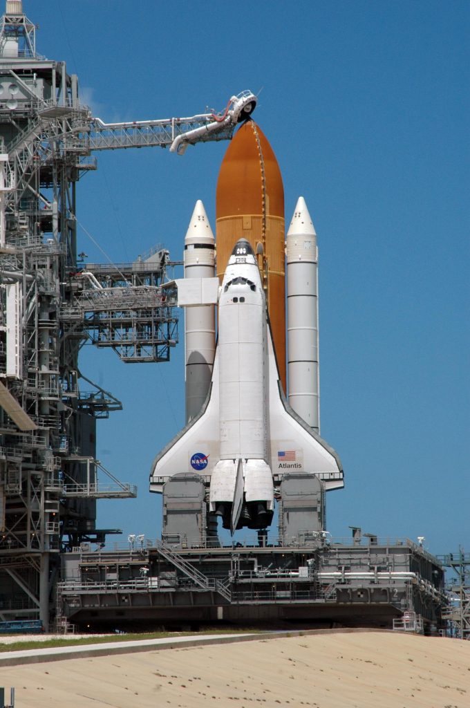
A NASA launchpad

You also could make sure planetariums or space museums near you are mapped.

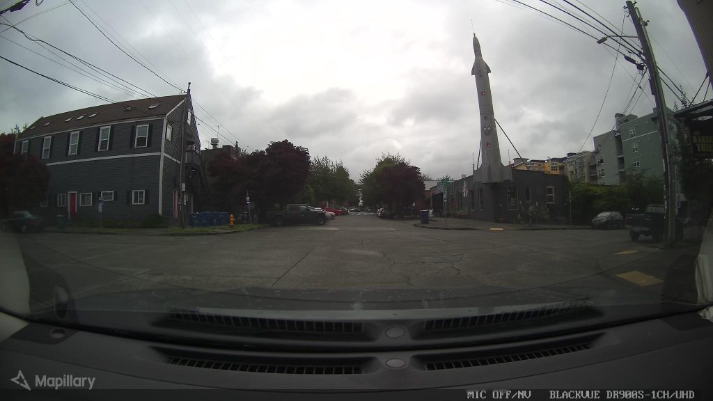
And there are some more amusing spaceflight-related places: for example, the Fremont Rocket sculpture in Seattle, USA and pubs like the Rocket in London and in Jena, Germany.

And of course, there are planty things related to non-human space flight, such as the UFO incident in Roswell, New Mexico, USA where there’s the International UFO Museum & Research Center, the Rendelsham Forest UFO landing sites in the UK and the flying saucer-shaped water tower Nave do ET (ET’s Ship) in Varginha, Brazil.

the Fremont Rocket in Seattle

Let us know what you map — and tell us about any upcoming days you think would be interesting for an OSM blog post.

Photo credits:

Earthrise: William Anders/NASA, public domain
Windmill: © Hans Hillewaert / CC BY-SA 4.0
Space Shuttle: NASA, public domain
Fremont Rocket: damnitgetmybeer/Mapillary, CC BY-SA 4.0

Call for participation in moderation subcommittee

Volunteers from across the OpenStreetMap community are coming together to improve how we communicate in our central spaces, and we want your help! The Local Chapters and Communities Working Group Moderation Subcommittee invites your participation in the process.

The subcommittee has created a Scope of Work to help you understand what work is being undertaken and an Implementation Plan that outlines a step by step approach, including how you can get involved and the different types of contribution that community members can sign up for.

Please take a minute to share your ideas and any interest in participating in the process via this form. And help spread the word! Please share this form with anyone who might be interested. Form closes April 10, 2021. Thank you!

Academic Track Call for Abstracts – State of the Map 2021

academic_track_2021

The call for abstracts for the Academic Track for State of the Map 2021 is now open!

This year’s State of the Map conference will feature the fourth edition of the Academic Track – a full day of sessions dedicated to academic research about, and with, OpenStreetMap (OSM).
The Academic Track sessions provide a bridge to connect members of the OpenStreetMap community and the academic community through an open passage to exchange ideas, communication and opportunities for increased collaboration. We expect empirical, methodological, conceptual, or literature-review-based contributions addressing any scientific aspect related to OSM, in particular, but not limited to, the following:

  • Extrinsic or intrinsic quality assessment of OpenStreetMap data
  • Analysis of contribution patterns in OpenStreetMap
  • Generation of new and scientifically valuable datasets from OpenStreetMap
  • Assessments of data import procedures and their impacts on data and community
  • Integration between OpenStreetMap and other data sources (authoritative, user-generated, or otherwise valuable to OSM)
  • Analysis/comparison of available software for scientific purposes related to OpenStreetMap
  • New approaches to facilitate or improve data collection and/or data quality in OpenStreetMap (e.g. through gamification or citizen science approaches)
  • Artificial Intelligence / Machine Learning and OpenStreetMap (e.g. AI-assisted mapping)
  • Open research problems in OpenStreetMap and challenges for the scientific community
  • Cultural, political, and organizational aspects of data production and usage practices in OpenStreetMap
  • Studies using OpenStreetMap data in scientific domains
  • Reviews of any scientific aspect connected to OpenStreetMap

Guidelines for submission:

  • Abstracts should be between 800 and 1200 words and are to be submitted online in plain-text format (no images or figures).
  • Abstracts must be scientifically rigorous and the content should be logically structured as follows (without the need to include subsections): introduction/background, where the problem addressed is introduced; main aim or purpose of the study; brief description of the methodology and findings achieved; final discussion highlighting the scientific contribution of the study and its practical benefits/implications.
  • Submission should be done using the dedicated Pretalx submission system (https://pretalx.com/sotm2021-academic/cfp)

Submission deadline
25 April 2021, 23:59 (UTC)

Abstracts will be evaluated by the scientific committee. Authors of selected abstracts will be invited to deliver an oral presentation during the Academic Track sessions at the online conference or to present a poster (in case a virtual poster session will be organised).

Submit your proposal today! https://pretalx.com/sotm2021-academic/cfp

Learn more about the requirements and the scientific committee (https://2021.stateofthemap.org/calls/academic/#committee) on the official State of the Map 2021 website: https://2021.stateofthemap.org/calls/academic/

State of the Map Working Group

Do  you want to translate this and other blog posts in your language…? Please email communication@osmfoundation.org with subject: Helping with translations in [your language]

The State of the Map conference is the annual, international conference of OpenStreetMap, organised by the OpenStreetMap Foundation.  The OpenStreetMap Foundation is a not-for-profit organisation, formed  in the UK to support the OpenStreetMap Project. It is dedicated to  encouraging the growth, development and distribution of free geospatial  data for anyone to use and share. The OpenStreetMap Foundation owns and  maintains the infrastructure of the OpenStreetMap project, and you can  support it by becoming a member. The State of the Map Organising Committee is one of our volunteer Working Groups.

OpenStreetMap was founded in 2004 and is an international project to create a free map  of the world. To do so, we, thousands of volunteers, collect data about  roads, railways, rivers, forests, buildings and a lot more worldwide.  Our map data can be downloaded for free by everyone and used for any  purpose – including commercial usage. It is possible to produce your own  maps which highlight certain features, to calculate routes etc.  OpenStreetMap is increasingly used when one needs maps which can be very  quickly, or easily, updated.