Many of the coastlines in OSM came from an import of the PGS coastline
data. It was a fantastic benefit to be able to add this coastline
data to OSM, and we’re better off having had it. And there are many
places that have aerial imagery that is now good enough to improve on
PGS coastlines. So that is the project of the week for 28 March,
2010, check your favorite bit of coastline and improve what you can
with overhead imagery.
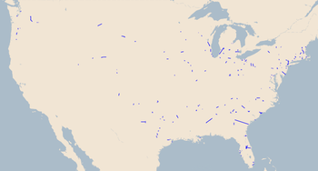
Those without a favorite bit of unimproved coastline might take a look
at the crenelated coasts of North America for examples of what can be
improved. This
http://www.openstreetmap.org/edit?lat=41.044&lon=-72.1591&zoom=14 is a
portion of Long Island with aged PGS coastline that fails to meet our
current standards for Good Coastiness. Sure, it will be fixed up by
the time the second reader gets to it, but have a look at that area in
the original bulk import form,
http://www.openstreetmap.org/browse/changeset/693806 . Okay, perhaps
we can make our current imports a little friendlier to view.
And now a sea change
Let’s improve the Project of the Week while we’re improving the map.
Let’s increase participation. If you are participating in potw,
consider posting some of your before and after shots of the areas you
are mapping. Reply with your comments and links to your good work.
Consider adding “potw” to your changesets. It’s nice to know if you
find a project of the week interesting.
Propose a Project of the Week.
Write it up and add it to the Proposals page, or email me directly.
http://wiki.openstreetmap.org/wiki/Project_of_the_week/Proposals
Make general or specific suggestions regarding potw on the discussion page.
http://wiki.openstreetmap.org/wiki/Talk:Project_of_the_week/Proposals
Share your project!
Detailed, written potw proposals are very warmly welcomed. Tell us
what you are doing, show us how it is making a difference, and let us
know how we can help you with your project locally, or by replicating
it in our neighborhood. Give some example tags and guidelines if you
can.
The massively successful Image of the Week project has been running
since 2006, and is now a flipbook history of What Was New In OSM.
Plus a couple of entertaining April Fool images. Part of the strength
of the IotW is the indefatigable leadership of User:Ojw who has kept
it running for five years. Much of the strength of IotW comes from the
community interest. Folks do something interesting, make an image,
and share it with IotW.
Let’s see if we can make potw at least half as interesting and
informative as IotW. Join in, won’t you?
If you haven’t seen IotW (What? Is that possible?!?!) You must see it
now. Prepare to spend an hour learning the visual history of OSM.
http://wiki.openstreetmap.org/wiki/Featured_images
The Beautiful fish on the reef photo is cc-by Alain76 on Flickr.
The Crashing waves photo is cc-by Wonderlane on Flickr.