Category Archives: Operations

Hardware and system administration related posts. Anything related to the Operations Working Group

A Year of Infrastructure Progress: Site Reliability Engineer 2023/2024 Update

As the OpenStreetMap Foundation’s Senior Site Reliability Engineer (SRE), my focus in the OpenStreetMap Operations Team over the last year has been on driving efficiency, improving resiliency, and scaling our infrastructure to support the continued growth of the OpenStreetMap project. From cloud migration to server upgrades, we’ve made several improvements since last year to better position OpenStreetMap’s infrastructure to meet these resiliency and growth challenges.

Improving User Facing Services

Upgraded Rendering Services

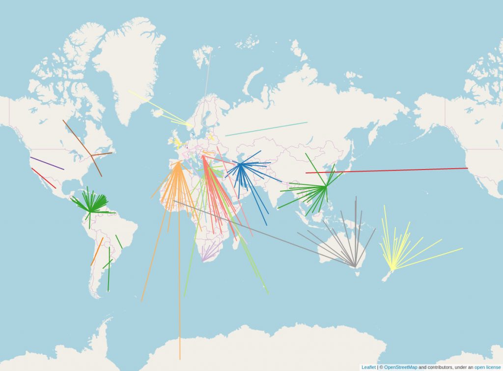
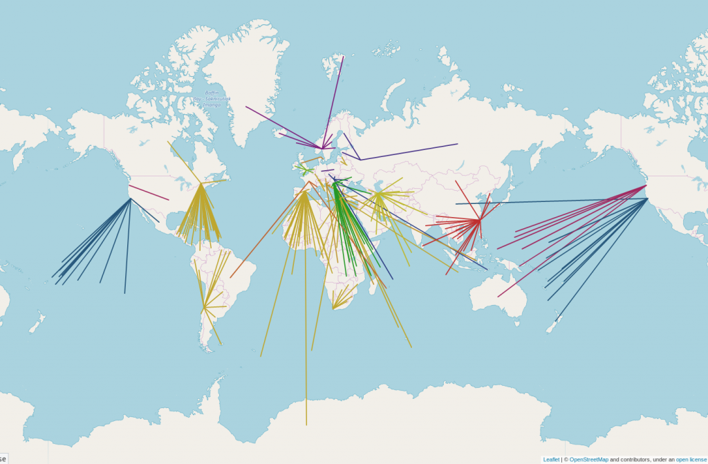
The tile rendering infrastructure saw notable upgrades, including hardware and software optimisations, faster tile cache expiry to address vandalism, and automation to block non-attributing users. We now re-render low-zoom tiles daily, improving both performance and allowing a faster mapper feedback loop. The tile service is widely used and keeping up with demand is an ongoing challenge.

New Aerial Imagery Service

Launched a new aerial imagery service that supports GeoTIFF COGs. The service now hosts aerial.openstreetmap.org.za which is backed by 16TB of high-resolution imagery. The new service makes it easier to host additional imagery in the future.

Transition to Gmail Alternative & Spam Mitigation

After facing significant spam issues with the OSMF’s Google Workspace, I migrated OSMF email services to mailbox.org. This has reduced the spam volume and improved administrative efficiency. We’re also in the process of transitioning historical OSMF Google Docs data to a self hosted service.

Dealing with DDoS Attacks and Vandalism

This year, we faced several Distributed Denial of Service (DDoS) attacks, including a major DDoS for ransom incident, which was reported to law enforcement. These attacks tested our infrastructure, but we’ve implemented measures to strengthen our resilience and better protect against future threats.

We also dealt with large-scale vandalism that affected OpenStreetMap services. Thanks to the swift response and adjustments made by the Operations team, we’ve reinforced our infrastructure to better handle abuse and ensure continuous service.

Planet Data Hosting on AWS S3

With the OpenStreetMap Operations Team I’ve moved our planet data hosting to AWS S3 with mirrors in both the EU and US, allowing us to fully reinstate the back catalog of historical data. Through AWS’s OpenData sponsorship, replication diffs and planet data are now more accessible.

Making Systems Easier to Manage

Full AWS Infrastructure Management Using OpenTofu

With the OpenStreetMap Operations Team I’ve successfully migrated all manually managed AWS resources to Infrastructure-as-Code (IAC) using OpenTofu (formerly Terraform). This transition allowed us to improve cost efficiency, enhance security by adopting a least privilege IAM model, and gain better visibility into expenditures through detailed billing tags. Additionally, we’ve integrated S3 Storage Analytics to further optimise our costs, set up additional backups, and implemented enhanced lifecycle rules.

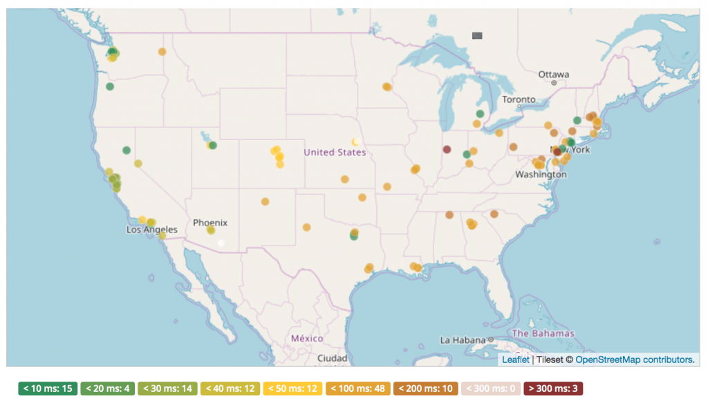
Improved Service Outage Alerting

We implemented SMS-based alerting for critical service outages, alongside a sponsored PagerDuty account. These improvements ensure quicker response times and better coordination during outages, with full integration with Prometheus/Alertmanager and Statuscake in the works.

Technical Debt reduction

This year, we made progress in reducing technical debt by moving several legacy services to more maintainable solutions. For instance, we containerised old services, including legacy State of the Map websites that were previously running poorly maintained WordPress installations. This transition has improved the scalability, security, and long-term maintainability of these services.

Additionally, we replaced our custom source installation of OTRS with a Znuny package installation from Debian. This shift simplifies upgrades and reduces the maintenance burden, ensuring the system remains up to date and secure without custom modifications.

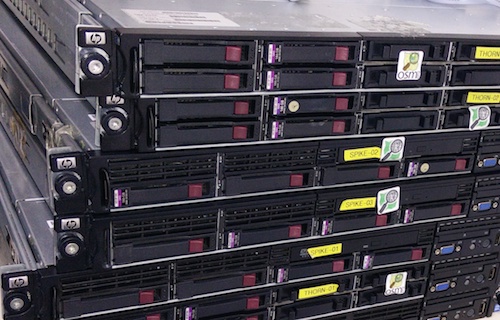
Ensuring Infrastructure Resilience Despite Hardware Failures

Over the past year, we’ve maintained a resilient infrastructure even in the face of hardware failures. We replaced numerous disks and RAM, ensuring minimal disruption to services. Our bespoke monitoring system allows us to detect early signs of hardware failure, enabling us to act quickly and replace faulty components before they cause significant issues. This proactive approach has been key to maintaining system uptime and reliability.

Upgrading Infrastructure

Cross-Site Replication of Backups

To ensure robust disaster recovery, I’ve established cross-account, cross-region replication for AWS S3 backups, enabling point-in-time recovery. This safeguards critical data and services, even in the face of major failures, providing long-term peace of mind.

High Availability Infrastructure

Key hardware upgrades in our Amsterdam, Dublin, and OSUOSL sites improved performance, storage capacity, and network reliability. New switches were installed in 2022, and we’ve now finished setting up a high availability (HA) configurations to ensure improved service, which we have continued improve the setup by moving to dual diverse uplinks to our ISP for better resilience.

Debian Migration

We are migrating from Ubuntu to Debian 12 (Bookworm) as our standard distribution. All new servers now run on Debian. Our chef configuration management has been updated with test code to ensure ongoing compatibility. This transition marks a shift towards greater long-term stability and security. Mastodon post celebrating the transition.

Looking Ahead

The year ahead brings exciting new opportunities as we build on our progress. Key priorities for 2024 / 2025 include:

Engaging

Community Engagement & Outward Communication: Enhancing collaboration with the Communication Working Group (CWG) and improving our public-facing communication around service status and outages.

Improving Documentation and Onboarding: We’ll enhance onboarding documentation and conduct dedicated sessions to help new contributors get involved in operations more easily. This includes improving the reliability and coverage of our testing processes, ensuring smoother contributions and reducing the learning curve for new team members.

Planning and Optimizing

Capacity Planning for Infrastructure Growth: As OpenStreetMap and the demand on our services grow, we will ensure we can scale to meet demand. By anticipating future needs and balancing performance with cost-effective growth, we aim to maintain the service quality and availability our community expects.

Ongoing Cost Optimisation: We’ll continue to find ways to reduce costs by leveraging sponsorships like the AWS OpenData programme, ensuring sustainable operations.

Continuing to Reduce Technical Debt: We will continue simplifying our infrastructure by reducing the maintenance burden of legacy systems, such as increasing the use of containers. This will help streamline management tasks and allow us to focus on other improvements, making the infrastructure more efficient and scalable over time.

Continue Infrastructure Improvements

Implementation of High Availability Load Balancers: Rolling out the HA (VRRP + LVS + DSR) configuration for load balancers to improve system reliability and reduce potential downtime.

Finalising Prometheus Integration with PagerDuty: Completing the integration of Prometheus for monitoring and PagerDuty for streamlined alerting and incident response.

Complete the Transition to Full Debian Environment: Migrating all remaining services from Ubuntu to Debian for increased stability and security.

Enhancing Disaster Recovery & Backup Strategies: Further refining our recovery documentation and introducing additional backup measures across critical services are protected and recoverable in the event of failure.


OAuth 1.0a and HTTP Basic Auth shutdown on OpenStreetMap.org

In 2024, the OSMF Operations Working Group (OWG) is retiring OAuth 1.0a and HTTP Basic Auth on OpenStreetMap.org. These are technical ways for applications to authenticate users with the OSM website or API. OAuth 1.0a and HTTP Basic Auth have been deprecated since 2023, as OAuth 2.0 is now the standard authorization method for most systems.

There are three key dates in the transition process:

  • March 1st, 2024: New OAuth 1.0a application registrations were disabled. Existing applications were not impacted. HTTP Basic Auth was not impacted.
  • May 1st, 2024: System administrators will start brownouts to find applications that are still using OAuth 1.0a or HTTP Basic Auth.
  • June 1st, 2024: OAuth 1.0a and HTTP Basic Auth will be shut down.

Retiring these authentication methods is necessary because of security concerns, and the complexity of maintaining so many authorization implementations, including ones that rely on unmaintained components.

How does this impact me as a developer?

If you are a developer of an application using OAuth 1.0a or HTTP Basic Auth to log in to the OpenStreetMap.org website, you might need to make some changes to switch to OAuth 2.0. Fortunately, this is a well-supported industry standard.

If your application only makes read calls to the API, authorization is optional. For rate-limiting purposes, it is still a good idea to add authorization to your requests, but it is not required. If your application is a website using OSM for logins, making use of OAuth 2.0 is much easier as it is much better supported because so many other sites use it. It also avoids problems like users ending up with many tokens in their list on the website.

If you are developing software that edits using the API and is run locally, you may need to make code changes. All common languages have libraries that deal with OAuth 2, and libraries are the preferred choice for any authorization. You can also use Zverik’s library for command-line tools, or write your own shell script of about a dozen lines.

You should be able to find lots of examples online of OAuth 2 client implementations in your language. If you want to get more detailed information or ask technical questions, please use the GitHub ticket. Here, the OWG also tracks the applications requiring modification to use OAuth 2.0.

How does this impact me as a mapper?

Most mappers will notice no change. The transition will not affect how you log in to your OSM account or use the website. iD and JOSM have supported OAuth 2.0 as the default authentication method for some time. If you use your OSM account to log in to a third-party site like the HOT Tasking Manager, MapRoulette, or HDYC, you will not be impacted as those sites have already moved to OAuth 2.0. Read-only API access does not require authorization at all.


The OpenStreetMap Foundation is a not-for-profit organisation, formed to support the OpenStreetMap Project. It is dedicated to encouraging the growth, development and distribution of free geospatial data for anyone to use and share. The OpenStreetMap Foundation owns and maintains the infrastructure of the OpenStreetMap project, is financially supported by membership fees and donations, and organises the annual, international State of the Map conference. Our volunteer Working Groups and small core staff work to support the OpenStreetMap project. Join the OpenStreetMap Foundation for just £15 a year or for free if you are an active OpenStreetMap contributor.

Powering OpenStreetMap’s Future: A year of improvements from OpenStreetMap Foundation’s Site Reliability Engineer

Just over one year ago, I joined the OpenStreetMap Foundation (OSMF) with the goal of enhancing the reliability and security of the technology and infrastructure that underpins OpenStreetMap. Throughout the past year, I have worked closely with the Operations Working Group, a dedicated team of volunteers. Together, we have made significant progress in improving our processes and documentation, ultimately strengthening our collective effectiveness. I am immensely grateful for the support and collaboration within this group, and I am delighted to witness the remarkable strides we have taken in building a solid foundation for the future of OpenStreetMap.

I’ll go into a little detail below about what’s transpired. At a high level, I made it easier to manage deployment of the software running on our servers; hardened our network infrastructure through better redundancy, monitoring, access, and documentation; grew our use of cloud services for tile rendering, leveraging a generous AWS sponsorship; improved our security practices; refreshed our developer environments; and last but definitely not least, finalised migration of 16 years of content from our old forums to our new forums.

If you want to hear more from me over the course of the work last year, check out my talk at State of the Map 2022 and my interview on the GeoMob podcast. And I’d love to hear from you, email me at osmfuture@firefishy.com.

2022-2023 Site Reliability Details

Managing software on our servers

Containerised small infrastructure components (GitHub Actions for building)

I have containerised many of our small sites which were previously built using bespoke methods in our chef codebase as part of the “Configuration as code” setup. Moved the build steps to Github Actions. Setup a base for any future container (“docker”) based projects going forward. These are our first container / docker based projects hosted on OSMF infrastructure.

Our chef based code is now simpler, more secure and deploys faster.

Improved chef testing (ops onboarding documentation)

We use chef.io for infrastructure (configuration) management of all our servers and the software used on them. Over the last year the chef test kitchen tests have been extended and now also work on modern Apple Silicon machines. The tests now reliably run as part of our CI / PR processes. The tests add quality control and assurance to the changes we make. Adding ARM support was easier to add because we could use test kitchen before moving onto ARM server hardware.

Having reliable tests should help onboard new chef contributors.

Hardened our network infrastructure

Network Upgrades @ AMS (New Switches, Dual Redundant Links, Dublin soon)

Our network setup in Amsterdam was not as redundant as it should have been. The Cisco Small Business equipment we used we had out-grown. We had unexpected power outages due to hardware issues. The equipment was also limiting future upgrades. The ops group decided to replace the hardware with Juniper equipment which we had standardised on at the Dublin data centre. I replaced the equipment with minimal downtime in a live environment (<15mins).

Both Dublin and Amsterdam data centres now use a standardised and more security configuration. Each server now has fully bonded links for improved redundancy and performance. The switches have improved power and network redundancy. We are awaiting the install of the fully resilient uplinks (order submitted) in the next month.

Out of Band access to both data centres (4G based)

I built and installed an out-of-band access devices at each site. The devices are hard wired to networking and power management equipment using serial consoles. The out-of-band devices have resilient 4G link to a private 4G network (1NCE). The out-of-band access devices are custom built Raspberry PIs with redundant power supplies and 4x serial connectors.

Documentation of Infrastructure to easy maintenance (Racks / Power)

I documented each rack unit, power port (Power Distribution Unit), network connection and cable at the data centres. This makes it easier to manage the servers, reduces errors and allows us to properly instruct remote hands (external support provider) to makes any chances on our behalf.

Oxidized (Visibility of Network Equipment)

Our network and power distribution configuration is now stored in git and changes are reported. This improves visibility of any changes, which in turn improves security.

Config is continiously monitored and any config drift between our sites is now much easier to resolve.

Terraform Infrastructure as Code (improve management / repeatability)

Terraform is an infrastructure-as-code tool, we now use it for managing our remote monitoring service (statuscake) and I am in the process of implementing it to manage our AWS and Fastly infrastructure.

Previous these components were all managed manually using the respective web UIs. Infrastructure-as-code allows the Ops team to collaboratively work on changes, enhances visibility and the repeatability / rollback of any changes.

We manage all domains DNS using dnscontrol code. Incremental improvements have been made over the last year, including add CI tests to improve outside collaboration.

Grew our use of cloud services

AWS in use for rendering infrastructure. Optimised AWS costs. Improved security. Improved Backup. More in pipeline

Ops team have slowly been increasing our usage of AWS over a few years. I have built out multiple usage specific AWS accounts using an AWS organisation model to improve billing and security as per AWS best practise guidelines. We generously received AWS sponsorship for expanding our rendering infrastructure. We built the experimental new rendering infrastructure using ARM architecture using AWS Graviton2 EC2.
We haven’t previously used ARM based servers. As part of improvements to our chef (configuration as code) we had added local testing support for Apple Silicon (ARM), only small additions were required to add the required compatibility for ARM servers to chef.

We were impressed by the performance of AWS Graviton2 EC2 instances for running the OSM tile rendering stack. We also tested on-demand scaling and instance snapshotting for potential further rending stack improvements on AWS.
We have increased our usage of AWS for data backup.

Improved our security

Over the last year a number of general security improvements have been made. For example: Server access is now via ssh key (password access now disabled). We’ve also moved from a bespoke gpg based password manager for the ops team to using gopass (feature rich version of https://www.passwordstore.org/ ), gopass improves key management and sharing the password store.

Additionally we have also enhanced the lockdown of our wordpress instances by reducing installed components, disabling inline updates and disabling XMLRPC access. We are also working to reduce the users with access and removing unused access permissions.

Documented key areas of vulnerability requiring improvement (Redundancy, Security, etc)

Documentation on technical vulnerability: I am producing a report on key areas of vulnerability requiring improvement (Redundancy, Security, etc). The document can be used to focus investment in future to further reduce our expose to risks.

Refreshed our developer environments

New Dev Server

We migrated all dev users to a new dev server in the last year. The old server was end of life (~10 years old) and was reaching capacity limits (CPU and storage). The new server was delivered directly to the Amsterdam data centre, physically installed by remote hands and I communicated the migration, and then migrated all users and projects across.

Retired Subversion

I retired our old svn.openstreetmap.org code repository in the last year. The code repository was used since the inception of the project, containing a rich history of code development in the project. I converted svn code repository to git using a custom reposurgeon config, attention was made to maintain the full contribution history and correctly link previous contributors (350+) to respective github and related accounts. The old svn links were maintained and now link to the archive on github https://github.com/openstreetmap/svn-archive

Forum Migration

The old forum migration, we migrated 1 million posts and 16 years of posts to discourse. All posts were converted from fluxbb markdown to discourse’s flavour of markdown. All accounts were merged and auth converted to OpenStreetMap.org “single sign-on” based auth.

All the old forum links redirect (link to the imported) to correct content. Users, Categories (Countries etc), Thread Topics, and individual posts.

Meet Grant Slater, the OpenStreetMap Foundation’s new Senior Site Reliability Engineer

Thanks to the support of corporate donors, the OpenStreetMap Foundation has been able to hire its first employee, who is starting on 1 May 2022. Grant Slater and Guillaume Rischard, the Foundation’s chairman, sat down for a virtual chat.

Hi! Tell us about you?

Hi! I’m Grant Slater, and I’m the new Senior Site Reliability Engineer (SRE) working for the OpenStreetMap Foundation. I’m originally from South Africa, and now live in London (UK) with my wife Ingrida and our son Richard.

What do you do in OSM? Where do you like to map?

I’ve been mapping since 2006, mostly in the Southern Africa and in the United Kingdom. I have a strong interest in mapping the rail network of South Africa; holidays “back home” often involve booking railway trips across the country, with a GPS in hand.

My latest toy is an RTK GPS base station and rover. I’ll soon be mapping my neighbourhood with centimetre-level accuracy.

For the last 15 years, I’ve been part of the volunteer OpenStreetMap Operations Team who install and maintain the servers and infrastructure which runs the OpenStreetMap.org website and many other related services.

What are your plans for the new SRE job?

My main objective will be helping improve the reliability and security of the project’s technology and infrastructure.

One of my goals will be to improve the project’s long-term stability as we grow. OWG can’t work without volunteers, and I will be improving the Operation Team’s bus factor by also improving our processes, documentation, and by smoothing the path to onboarding new team members.

I will be helping to drive forward modernising the project’s infrastructure by reducing complexity, paying-down technical debt, and reducing our need to maintain undifferentiated heavy lifting, by tactically using Cloud and SaaS services, where suitable.

Is there anything else you’d like to say?

With time, I would like to see OpenStreetMap introduce new tools and services to improve our mappers’ access to opted-in passively collected data to improve the mappers’ ability to map and detect change.

Gamification! OpenStreetMap should always remain a fun and gratifying experience for all. We’re building an invaluable and unique dataset with far-reaching consequences for which we should be incredibly proud. Happy Mapping!

I would like to hear your feedback and suggestions, please email me osmfuture@firefishy.com

Grant gave a talk at State of the Map US (2013) – OSM Core Architecture and DevOps and is hoping to give an updated talk at State of the Map 2022 in Florence, Italy 19–21 August 2022.

https://www.openstreetmap.org/user/Firefishy
https://twitter.com/firefishy1
https://github.com/firefishy

OpenStreetMap RSS/Torrent functionality for planet files

OpenStreetMap is open data, available to all for free on https://planet.openstreetmap.org. We release six large files, totaling 428 GB every week. These files contain the complete OpenStreetMap data, including files with the full history of OSM.

To make it easier to share the load of downloading these files, we also supply BitTorrent files, which allow spreading the load across multiple web servers as well as using peer-to-peer file transfers.

mnalis has recently implemented RSS feeds which announce when the torrents come out. This allows users to automatically subscribe to sharing new planet files as they are produced, thus reducing the load on the planet.openstreetmap.org servers, which are bandwidth-limited.

 More information is available on:
 https://wiki.openstreetmap.org/wiki/Planet.osm#BitTorrent_RSS.2FAtom_feed

Operations Working Group, Mnalis


Do  you want to translate this and other blog posts in your language…? Please email communication@osmfoundation.org with subject: Helping with translations in [your language]

The OpenStreetMap Foundation is a not-for-profit organisation, formed to support the OpenStreetMap Project. It is dedicated to encouraging the growth, development and distribution of free geospatial data for anyone to use and share. The OpenStreetMap Foundation owns and maintains the infrastructure of the OpenStreetMap project, is financially supported by membership fees and donations, and organises the annual, international State of the Map conference. The OSMF supports the OpenStreetMap project through the work of our volunteer Working Groups, such as the Operations Working Group. Please consider becoming a member of the Foundation.

Thanks to our new tile cache and domain name sponsors

Content Delivery Network of tile delivery caching servers.

The OpenStreetMap Foundation Operations Working Group wants to thank all the recent donations of nodes for our tile cache CDN: 

Tile cache nodes allow us to serve all users by answering map tile requests closer to the user, giving a faster response time, reducing rendering server load, and saving international bandwidth.

Caches added in 2019

In 2019, thanks to sponsors, caches have been hosted in the following countries:

Australia

Brazil

France

Germany

New Zealand

Sweden

Switzerland

Ukraine

United States


Chinese Dragon by Nyo, public domain

OpenStreetMap has an internal server naming theme based on fictional dragons, as in “here be dragons“.

Full list of tile caches here and on a map.

Would you like to host a tile cache?

If you operate an internet exchange, host company, or otherwise have a site with good internet connectivity and high regional bandwidth, you can look at the tile CDN node requirements. We welcome hosting of tile caches elsewhere, and are particularly looking for tile caches in Africa and Asia. If you are interested, please contact us.

Domain name sponsoring by Gandi

Gandi, in addition to hosting the new tile cache server Gackelchen in Bissen, Luxembourg and supporting OpenStreetMap France (an OSM Foundation Local Chapter) are now very generously sponsoring many of our domain names. We would like to thank them for their support.

Operations Working Group

Do you want to translate this and other blogposts in your language..? Please send an email to communication@osmfoundation.org with subject: Helping with translations in [your language]

The OpenStreetMap Foundation is a not-for-profit organisation, formed to support the OpenStreetMap Project. It is dedicated to encouraging the growth, development and distribution of free geospatial data for anyone to use and share. The OpenStreetMap Foundation owns and maintains the infrastructure of the OpenStreetMap project, is financially supported by membership fees and donations, and organises the annual, international State of the Map conference. It has no full-time employees and it is supporting the OpenStreetMap project through the work of our volunteer Working Groups. Please consider becoming a member of the Foundation.

OpenStreetMap was founded in 2004 and is a international project to create a free map of the world. To do so, we, thousands of volunteers, collect data about roads, railways, rivers, forests, buildings and a lot more worldwide. Our map data can be downloaded for free by everyone and used for any purpose – including commercial usage. It is possible to produce your own maps which highlight certain features, to calculate routes etc. OpenStreetMap is increasingly used when one needs maps which can be very quickly, or easily, updated.

Can you help the Operations Working Group?

Image by Dorothea Kazazi, CC-BY-SA 3.0
OSM logo by Ken Vermette, CC-BY-SA 3.0 & trademarks apply.

The OSM Operations Working Group is a volunteer group, responsible for running of the servers owned by the OpenStreetMap Foundation. 
We are always keen to find new members and we are particularly looking for people who:

  • can analyse our server infrastructure
  • make plans
  • forecast future hardware needs
  • draw up budgets

This does involve a certain level of technical expertise but it’s not writing code, for example, and OWG membership doesn’t grant access to any of the servers – that’s for our Sysadmins. If you would like to join us, have a read of our membership policy, and please get in touch!

Some additional information:

  • OWG’s main communication channels are Github and email. We rarely have meetings.
  • Estimate of hours per week: 1-3

Email us at operations@osmfoundation.org
We are also on Twitter @OSM_Tech

If you have the technical expertise and experience to be a sysadmin, read our sysadmin membership policy and get in touch.

OSM Operations Working Group

Do you want to translate this and other blogposts in your language..? Please send an email to communication@osmfoundation.org with subject: Helping with translations in [your language]

The OpenStreetMap Foundation is a not-for-profit organisation, formed in the UK to support the OpenStreetMap Project. It is dedicated to encouraging the growth, development and distribution of free geospatial data for anyone to use and share. The OpenStreetMap Foundation owns and maintains the infrastructure of the OpenStreetMap project, is financially supported by membership fees and donations, and organises the annual, international State of the Map conference. It has no full-time employees and it is supporting the OpenStreetMap project through the work of our volunteer Working Groups. Please consider becoming a member of the OSM Foundation.

OpenStreetMap was founded in 2004 and is a international project to create a free map of the world. To do so, we, thousands of volunteers, collect data about roads, railways, rivers, forests, buildings and a lot more worldwide. Our map data can be downloaded for free by everyone and used for any purpose – including commercial usage. It is possible to produce your own maps which highlight certain features, to calculate routes etc. OpenStreetMap is increasingly used when one needs maps which can be very quickly, or easily, updated.

Can you help make OpenStreetMap.org faster in Brazil, or Australia/New Zealand?

CDN of tile delivery caching servers.

A big use of the OpenStreetMap data is the web map on OpenStreetMap.org. Along with our hard working team of volunteer sysadmins who keep it going, we are helped by many donated tile cache servers around the world, which speed up the map in various regions.
We are always open to more servers, but the Operations Working Group is currently looking for servers in Brazil, and Australia/New Zealand. If you or your organisation would like to donate a cache server and hosting, we’re ideally looking for a physical server or powerful VM with 8GB+ RAM and at least 146GB of storage. Read more details.

Please email operations@osmfoundation.org if you are interested.

Our peak Brazil traffic is currently around 65 Mbps. Our peak Australian and New Zealand traffic is currently around 20 Mbps. See the full country breakdown in bits per second.

Some more information:

  • Brazil has the 10th highest traffic and is the largest country without a cache in it or nearby.
  • Worldwide peak traffic is 2300 Mbps.
  • Antarctica and Australia are the two continents we do not have caches on.

We fully manage the software and operating system. All config is managed via our chef recipes. We also run a local firewall on each server. If physical hardware, we monitor using it SMART, hp-health, etc and report any hardware issues back to the hosting organisation.

Will you help us and join the people and organisations that support OpenStreetMap? Thank you!

The OpenStreetMap Foundation is a not-for-profit organisation, formed in the UK to support the OpenStreetMap Project. It is dedicated to encouraging the growth, development and distribution of free geospatial data for anyone to use and share. The OpenStreetMap Foundation owns and maintains the infrastructure of the OpenStreetMap project. Volunteers, like the indefatigable team of server administrators, keep all of this hardware working. 

OpenStreetMap tiles are free for everyone to use, but should be used with moderation. If you are a high traffic site you should look at switch2osm.org to find out how to use the data and keep the tiles available for everyone.

If you can’t donate server hosting, you can always make a financial donation to the OSMF.

New Tile Render Server in the USA

We have a new Tile Render server in the United States! The hardware has been kindly provided by OpenStreetMap US and hosted by the Oregon State University Open Source Lab. Big thanks to them, and to Ian Dees who coordinated this response to the Operation Working Group’s request.

Our distributed tile serving infrastructure brings the “standard” map tiles to your browser wherever you are in the world in a reasonably fast fashion, resulting in a pleasant map viewing experience on the OpenStreetMap.org front page, and with new map edits reflected a few minutes after they are made. It should always be noted that this is far from the only way of using our maps, and we encourage developers to take our data, render it, and otherwise make it available to users in a new ways. However, we do like the front page map to work well. We have a set of “rendering” servers doing the hard work of creating and refreshing raster map tiles, and a larger set of caching servers. With the introduction of a new rendering server in the United States (the first outside of Europe) tiles will load faster. The server itself is fast, and for users in the United States we expect to remove about 100 milliseconds of latency for people viewing the map.

Network latency for requests to the new tile server from various locations in the USA

Details of this new server (which we’ve named “Pyrene”) can be found on the hardware.openstreetmap.org site.

We’re still building our tile serving infrastructure, with a lot of help from people and organisations donating resources. If you are in a position to help with this sort of thing, a caching server – or better yet a rendering server – in India would make a huge performance improvement for people there. Learn more about the kind of servers we need at our wiki page and contact the Operations Working Group.

Server moves: Goodbye Imperial. Hello Equinix Amsterdam

Servers de-racked and ready to move

Some of our servers are moving to a new home. Quite a few of our important servers have been housed at Imperial College in London for the past few years, but it’s time to move on from there as they look to reclaim some space for offices. We’d like to thank Imperial for our time together!

We continue to be thankful to University College London, and Bytemark who are still generously providing hosting for some other keys servers, not to mention our many Tile Cache hosts around the world. If you’re interested in server details you can see the full list on our hardware page.

That list is set to change very soon, as Imperial machines are powered down and moved. The move is being carried out this week by volunteers from the OWG/OSMF.

Where are we moving these servers to? We sought proposals for a new home (thanks to all those who replied), and Equinix Amsterdam has been selected as our new data centre provider. This brings a little more diversity of locations for our servers (many of the others being in the UK), but it’s still not a million miles away, in case our operations team need to visit. Equinix Amsterdam provide excellent “smart hands”, removing the need for physical visits on a regular basis. That being said, the Operations Working Group are seeking someone to help in Amsterdam who can visit the data centre if we need. To quote the OWG folks this volunteer would “need to be trusted, competent and did I say trusted”!

As ever, we owe a big thanks to OWG volunteers for all the hard work going into managing these server moves.