Monthly Archives: February 2024

Welcome OpenStreetMap Belgium, the newest (and returning) OSMF Local Chapter

by Arnalie Vicario

We would like to congratulate OpenStreetMap Belgium on becoming an OpenStreetMap Local Chapter (again)!

The past year was a rebuilding year for OSM.be. Regaining Local Chapter status was the cherry on top. The official status confers a seriousness and professionalism when working with outside organizations, and fosters leadership opportunities for OSM.be members when it comes to OSM Foundation policy making.

In a statement for this blog post, the OpenStreetMap Belgium Board noted that:

We had a tough 2023 when we had to reinvent ourselves as a separate organization. The good thing about that is that we’re now a much less complex organization. Furthermore, our bylaws now have legal standing, and we were able to set rules that better fit OSM-style leadership.

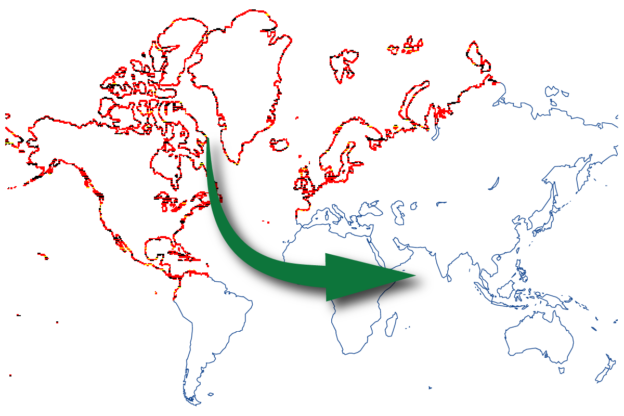
OSM.be’s goals for 2024 include promoting important mapping tasks and supporting member projects. They will also continue their camera grant project and keep working with Mapillary to distribute more 360° cameras across Europe. Another exciting project is to set up a Panoramax instance for Belgium. This project is in the relationship building stage as they seek to partner with governments and universities on servers.

Background

OpenStreetMap Belgium first became a Local Chapter on May 24th 2018. At that time, OSM Belgium was operating under Open Knowledge Foundation Belgium (OKFN). The Local Chapter agreement was terminated in September 2023 after OSM Belgium had resigned from OKFN Belgium. In November 2023, OSM Belgium re-applied for Local Chapter status as an independent organisation. The OpenStreetMap Foundation Board approved the application on January 25th 2024.

from https://openstreetmap.be/

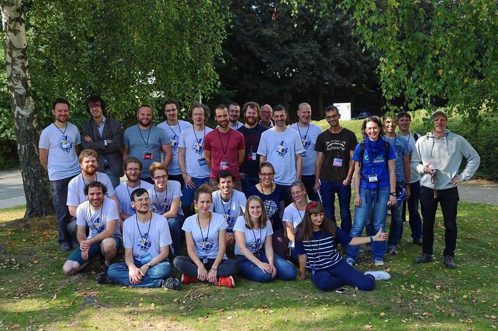
Thank you to the OpenStreetMap Belgium community for spreading the good word about OSM, and educating people about the power of open data, local knowledge and community!

Interested in Becoming a Local Chapter?

Reach out to the Local Chapters and Communities Working group via email local@osmfoundation.org, or post any questions you may have in the community forum thread: Local Chapters: What To Know and How to Join.

Learn more about OSMF Local Chapters here:


The OpenStreetMap Foundation is a not-for-profit organisation, formed to support the OpenStreetMap Project. It is dedicated to encouraging the growth, development and distribution of free geospatial data for anyone to use and share. The OpenStreetMap Foundation owns and maintains the infrastructure of the OpenStreetMap project, is financially supported by membership fees and donations, and organises the annual, international State of the Map conference. Our volunteer Working Groups and small core staff work to support the OpenStreetMap project. Join the OpenStreetMap Foundation for just £15 a year or for free if you are an active OpenStreetMap contributor.

Mappers, Universities, Companies, and nonprofits Contributed Over £373,000 to Support OSM in 2023

Last year, the global OpenStreetMap community, together with OSM’s corporate members and partners, donated an astounding £373,000 to support the map.

In an extraordinary show of support for OSM’s 19th birthday, the mapping community contributed over £113,000 through small donations. This enthusiastic broad base of community support resulted in approximately 3,089 donations from all over the world averaging £36 each. The OSM fundraising committee is especially grateful for the social media shares and the kind and encouraging comments on supporting.openstreetmap.com, in addition to the gifts. The positive response to the birthday fundraising campaign was a  highlight of the year. Thank you! 

OSM’s corporate partners also played a pivotal role, with total corporate memberships reaching £201,074. Additional, generous gifts, above and beyond corporate membership fees, from Microsoft, NextGIS, Smoca, and Elasticsearch helped bring us to the £373,000 total. We are also grateful to the corporate Advisory Board for their advice and collaboration which has been essential to the success of our partnerships.Thank you!

A special note of thanks goes out to NextGIS, which has pledged 10% of its profits from data sales to OSM, setting an impressive standard for its commitment to the project.  

In an extraordinary show of support for OSM’s 19th birthday, the mapping community contributed over £113,000 through small donations. This enthusiastic broad base of community support resulted in approximately 3,089 donations from all over the world, averaging £36 each.

OSM is fortunate to be the recipient of mission critical, “in kind” support through donations hardware and other infrastructure. We are grateful to Fastly, who provide the content delivery network for the file service, and many others, including TomTom, Bytemark, AWS and University College London, as well as AARNet, AWS,Academic Computer Club, Umeå University, Appliwave, Bytemark, Equinix Amsterdam, Equinix Dublin, Exonetric, INX-ZA, NetAlerts, OSUOSL, OVH, and Scaleway and everyone else who contributes to OpenStreetMap.

We’d also like to add a special note of thanks to  Kevin Bushaw, who gave us a steep discount on our new website, supporting.openstreetmap.org.

The funds raised  in 2023 will go toward enhancing infrastructure, supporting our critical support staff including our SSRE, and helping build OSM into the future.

On behalf of OSM’s local communities, the OSMF board would like to thank the companies who sponsored SotMs in 2023, both regional and local. This kind of support is very important to local communities, because the OSMF itself cannot promise companies that their funding goes towards regional events, except where the money is earmarked as part of a Sponsorship Distribution Agreement. Companies who directly support regional events are making a positive difference for the community and the quality of the map.

Lastly, we want to point out that any generosity toward OpenStreetMap is generosity to the broader open source software and data community, not just the OSM project. The impact of your gifts extends far beyond the financial; it is a commitment to a world where open data serves as a cornerstone for creativity, problem-solving, and community building.

Thank you for supporting OpenStreetMap!


The OpenStreetMap Foundation is a not-for-profit organisation, formed to support the OpenStreetMap Project. It is dedicated to encouraging the growth, development and distribution of free geospatial data for anyone to use and share. The OpenStreetMap Foundation owns and maintains the infrastructure of the OpenStreetMap project, is financially supported by membership fees and donations, and organises the annual, international State of the Map conference. Our volunteer Working Groups and small core staff work to support the OpenStreetMap project. Join the OpenStreetMap Foundation for just £15 a year or for free if you are an active OpenStreetMap contributor.

2024: announcing the year of the OpenStreetMap vector maps

OpenStreetMap will take a large leap forward with the introduction of vector tiles on openstreetmap.org this year. This is the first of a series of blog posts where we will share our progress.

To lead our vector tiles project, the OpenStreetMap Foundation has hired Paul Norman, a renowned figure in cartography and open data, whose journey with OpenStreetMap began in 2010 with a chance encounter on the xkcd forums. His role in the community took off with his work on OpenStreetMap Carto in 2013. His volunteer involvement with the OSM Foundation, including contributions to several working groups and a tenure on the OSMF board, highlights his commitment to the project. Professionally, he has held various influential positions at MapQuest, CartoDB, Wikimedia Foundation, and Amazon. Billions have seen the products of his work. To read more from Paul, visit his blog for technical deep dives into vector tiles, follow him on Mastodon or on Twitter.

Vector tiles represent a significant advancement in how map data is processed and presented. Unlike traditional raster tiles, which are static images with pixels, vector tiles are like the ‘SVGs’ of the mapping world: you get lines and points. This stores geodata in a format that allows for dynamic styling and interactivity, enabling the user to adapt the visual appearance of the map without altering the data. If that sounds like what you’ve seen on other maps, you are right! Vector tiles have become industry standard in interactive maps that, unlike openstreetmap.org, don’t get updated often, and where you can simply recalculate your whole database occasionally.

But the map displayed on openstreetmap.org are quite uniquely different! They get updated incrementally and constantly, a minute after you edit; it’s a critical part of the feedback loop to mappers – and how the author of this blog post got hooked in the first place. This is why we have to invest in our own vector tile software stack.

In the direct future, for users, this will mean a new, modern-looking map style with seamless zoom on openstreetmap.org. Looking further ahead, the most exciting part is what this vector tile project will make easy for volunteers and tile users: 3d maps, more efficient data mixing and matching and integration of other datasets, thematic styles, multilingual maps, different views for administrative boundaries, interactive points of interest, more accessible maps for vision-impaired users, and I’m sure many other ideas that no one has come up with yet. This technology is not just a leap in aesthetics, but also in functionality, enhancing the overall user experience.

In the 2021 community survey (page 15), there was no clear sentiment on what the foundation should do on vector tiles. We noticed a split in preferences: some advocated for volunteer-led development, others for professional engagement. The ecosystem has evolved since then, making it easier to build on top of existing software bricks. We see our project as a reasonable balance between the two most popular answers. Investing in core software is also part of our multi-year strategic plan.

The OpenStreetMap Foundation depends on donations to finish this project. If you would like to support our year of vector tiles specifically, you can donate and leave ‘vector tiles’ in the donation message. Every contribution, large or small, directly supports our ability to ensure that OpenStreetMap can be open, accessible and dynamic for all. Your support is not just a donation; it’s an investment in the future of open-source mapping.

We’re just at the beginning of this exciting journey. Stay tuned as we will delve deeper into the schema and style aspects in future blog posts.

OSM Named as a Digital Public Good by UN-affiliated Agency

by Craig Allan

OpenStreetMap has applied for and has now been registered as a “Digital Public Good” by the Digital Public Goods Alliance (DPGA), which is a multi-stakeholder United Nations-endorsed initiative. The designation is an important step in making sure that OpenStreetMap is recognized for its positive role in global economic development.

By formally registering with the DPGA, the OSM project has now gained further legitimacy and an internationally raised profile tied to the advancement of the UN Sustainable Development Goals.

What are Public Goods?

The phrase “public goods” was invented by economists to describe things that are free, inexhaustible, and non-competitive. Sunshine is a pretty good example – it costs nothing, it never runs out, and if your neighbour uses lots of it your own supply is not diminished at all.

Like sunshine, OSM data is free, you can use it as much as you want, and even if your neighbour uses a lot of it, too, your own supply doesn’t run out. Note that it’s the data that is a public good, not the servers – our server computers are not free and are a limited resource.

Making the World a Better Place

A panel of experts was convened by the United Nations panel in 2019 to look at digital co-operation in support of global development. Their report on “The Age of Digital Interdependence” had five main recommendations. All five are great proposals, but proposal five is particularly relevant for OSM as it says that the United Nations should foster global digital co-operation. The exact text is:

“Digital public goods are essential in unlocking the full potential of digital technologies and data to attain the Sustainable Development Goals, in particular for middle and low income countries”.

This means that the United Nations is promoting the use of free open software and data as a tool for middle- and low-income counties to allow them to advance and meet the United Nation’s agreed development goals. This promotion is especially important because free data pairs well with free software and the pair can be widely used by even the poorest governments. Plus, free data and apps allow governments to advance their development without diverting scarce resources to pay license fees to companies from wealthy nations.

The UN then created the Digital Public Goods Alliance as its implementing agency for proposal five, with a mandate to advance the development and use of digital public goods for development.

The DPGA has created a register for approved open systems, open applications and open data that is accessible by all for the advancement of global development.

Why is This Important for OSM?

OSM is a large but in some ways unrecognised force in global development. It underlies many humanitarian efforts, supports academic research of many different specialisations, and is a component of much software development, especially in geographic and navigation applications. OSM data is also already widely used by the United Nations agencies, international NGOs and governments at all levels around the world.

By formally registering with the DPGA the OSM movement has now gained further legitimacy and an internationally raised profile tied to the advancement of the UN Sustainable Development Goals. More simply put, and this is something most of us knew all along – the UN thinks that OSM is a great tool to make the world a better place for all.

This registration boosts the legitimacy and profile of OSM and its partners and creates new opportunities. One important area lies in the governmental work environment. OSM’s status as a Public Good, could be used to open doors and promote an increased use of OSM by government organisations at national, regional and local levels. This could then give OSM an opportunity to gain access to government-held data, and/or to government funds to boost our mapping community and/or to a range of resources to reinforce our delivery systems, benefitting everyone.

(Note that OSM Foundation has not yet developed a strategy to encourage and facilitate the use of OSM in government spaces; this is still in the idea phase.)

The boost to the profile and legitimacy of OSM and its partners can also help us make the case for philanthropic investment in OSM.

A final wry thought at the possibilities of this opportunity is that OSM was originally created by Steve Coast as a response to controls on government mapping. It would be very satisfying indeed, if free and open mapping grows to be the basis of much government mapping.