Monthly Archives: March 2012

OpenStreetMap layer added to Yahoo! JAPAN Local

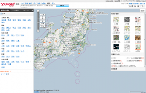
March 29, 2012 – The OpenStreetMap Foundation Japan (OSMFJ) and The OpenStreetMap Foundation (OSMF) announce the release of a new OpenStreetMap layer for Yahoo!JAPAN map services. The new OSM layer is available on Yahoo! JAPAN Local (see the map here)

New OpenStreetMap layer on Yahoo!Loco

2011 Yahoo! JAPAN data donation

On March 6th, 2011, Yahoo! JAPAN handed over nation-wide map data to OSMF Japan. The data was originally owned by ALPS corporation, which merged with Yahoo!JAPAN. The OSM community got permission to import and use this data.
Note that the Yahoo! JAPAN ALPS data is not the map data used by Yahoo.com or Yahoo.co.jp. The maps at Yahoo.com and Yahoo.co.jp are not permitted for use by OSM (see the ‘YahooJapanALPS Data’ wiki page).

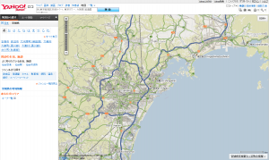
OpenStreetMap layer showing Sendai area

Mobile maps

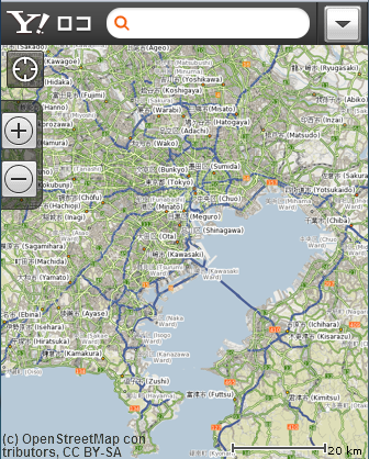
The new OSM layer is also available for Yahoo! JAPAN Local mobile. OSM with its frequently updated data is very useful for many map users.

OpenStreetMap Yahoo! JAPAN Local layer mobile site.

About OpenStreetMap Foundation

The OpenStreetMap Foundation is a UK-registered not-for-profit organization that supports the OpenStreetMap Project. The OpenStreetMap Project based at OpenStreetMap.org, is the worldwide mapping effort that includes more than 500,000 volunteers around the globe. The foundation consists of members from around the world who elect its board of directors. Much of the foundation’s extensive work is done in the background, yet is critical to the ongoing functioning and growth of the OpenStreetMap Project.

About OSM Foundation Japan

The OpenStreetMap Foundation Japan (OSMF Japan) is an organisation that performs fundraising and supports the Japanese community; it does not control the project or “own” the OSM data. It is dedicated to encouraging the growth, development and distribution of free geospatial data and to providing geospatial data for anybody to use and share.

http://www.osmf.jp/news/pressrelease20120329

Service schedule March – April 2012

The long awaited and eagerly anticipated license upgrade is coming soon, the conclusion of a multi-year process. To minimise disruption to OpenStreetMap mappers and users, we’re taking the opportunity to install our new database server (funded by your generous contributions) at the same time – reducing the total amount of downtime needed.

Please be aware of the following service schedule and the list of dates further on in this article. The license upgrade will start with the database server migration. All times and dates are subject to change: our volunteers are working flat out on this, so thanks in advance for your patience and support.

Mappers

There will be a several-day period of limited API availability. The API will be Read Only while the database is moved to the new database server, ramoth. This new database server was funded by your contributions during the December 2011 fund raising campaign. No map editing will be possible while the API is Read Only.

During the remainder of the upgrade, the API should operate normally. Please postpone bulk edits where possible, until after the license upgrade is complete. As always with system improvements, your patience while you find items to refine is appreciated. Consider monitoring the friendly OSM IRC chat channel, #osm on irc.oftc.net, if you have questions.

We would ask mappers who have not yet agreed (or otherwise) to the new terms to log into OSM before the downtime starts on 1st April (0800 UTC) and signal their intention. We are pleased that the vast majority of OSM data will be unaffected by the license change, and thank all the mappers who have thus far consented to their data being distributed under the new license.

Data consumers

The typical planet file scheduled for this week has been postponed. The final old license planet file will be created from 01 April 2012 data. It will be published once the planet file generation completes which may be delayed by a few days.

The old license replication diff service will stop when the database goes to Read Only mode for the server migration. A new license replication diff service will begin at the completion of the license upgrade from a new address. There will be another message with details for using the new diffs when you are ready to start consuming them.

Important Dates

These dates and times are subject to change without notice.

  • 1st April: Enter Read-only mode. 8am UTC
  • 4th April: End of downtime. Enter Read-write mode on new server. Our estimate is that this will be in the morning, but could be subject to change.
  • 5th-6th April: bbox-based live-data tests of rebuild logic.
  • 7th April: Start automated processing of all remaining non-clean objects.
  • 9th April: Progress report and estimation of remaining license upgrade time.
  • To be Determined: On completion of the processing, subject to satisfaction with the outcome we can re-declare the dataset to be ODbL. Immediately afterwards, a first new license planet file will be generated/published, and diff creation will resume.

Thanks

Thanks, as always, to the many people who make OpenStreetMap great. These people include: the countless mappers who have improved the data, the operations volunteers who make so many things “just work”, the programmers who make participating in OSM easier every day, the donors who provide the hardware and hosting we rely upon.

Many of you ‘overlap’ in more than one of these areas. Please be aware that the thanks are cumulative. 🙂

[As excerpted from Dermot McNally’s announcement. Context added from additional sources.]

Weekly OSM Summary #39

March 12th, 2012 – March 26th, 2012

A summary of all the things happening in the OpenStreetMap (OSM) world.

  • There are new aerial images for Australia available online now.
  • A new wiki page has been created to give more details about the expected changes in API behavior due to the license change. Read more here.
  • Some OSM coastlines are affected by the license change. A new tool helps you to get ODbL-clean coastlines.
  • See the „Current OSM Activity“ on the following website: http://openstreetmap.us/live/
  • The Humanitarian OSM Team (HOT) has entered an idea for the “Knight News Challenge”. Read more about their plan. And a Report about the first HOT Activation Working Group meeting can be found here.
  • There have been a variety of articles and blog posts on the collaboration between the World Bank and Google. Some more can be found here.
  • The http://shortestpathtree.org website shows routing based on OSM vector tiles.
  • The Open Source Routing Machine (OSRM) project, which offers very fast routing based on OSM data, has a new server and a new website. Read the full announcement here.
  • WIWOSM (Wikipedia where in OSM) is a new project which shows geometric objects in OSM for corresponding articles on Wikipedia.
  • OSM has been accepted for the Google of Summer Code 2012.
  • There is a new web application for the visualization and use of OSM Points of Interests.
  • A blog post by Martijn van Excel shows you how to create a self-updating OSM database.
  • A new article about the growth of OSM street data over the past two years.
  • A blog post about Steve Coast and his idea of creating OpenStreetMap.
  • New OSM map styles by Stamen Design.
  • The OpenSeaMap project provides vector maps for the built-in Garmin Chartplotter of the GPSMAP series.
  • OSMapTuner is a mobile editor for OSM running on Android-based smartphones and Tablet PCs. Read more on their website.

Did we miss something? You can contact us via weekly.osm@googlemail.com

Authors: Pascal & Dennis – (thx @ “Wochennotiz”)

A weekend of Potlatch

P2_hack_weekend_small

We usually talk about data on this blog, but OpenStreetMap wouldn’t happen without code, too. Running the world’s biggest user-editable map (and, increasingly, one of the world’s biggest maps, full stop) requires thousands upon thousands of lines of code… from the low-level stuff that keeps the servers flying along, via the API and editing software that enables you to contribute, to the programs and stylesheets that turn all this raw data into pretty maps.

Much of this work happens in isolation, co-ordinated by IRC conversations or mailing lists. But we also have ‘hack weekends’, where developers – experienced and newcomers alike – come together to share knowledge and bounce ideas off each other.

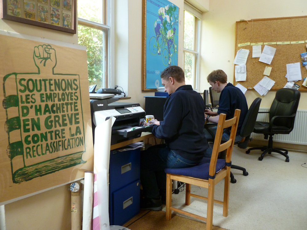
Last weekend saw a major hack weekend in Toronto, attracting developers from the US, Britain, and the Netherlands as well as Canada. This weekend saw a rather smaller gathering in Charlbury, a tiny town in the Cotswolds, England, which coincidentally is home to the lead developers of both Potlatch (our online editing software) and Mapnik (the ‘renderer’ which turns OSM data into map images).

The focus for this weekend was Potlatch, with a vast list of improvements undertaken over the two days. The theme was “little things that mean a lot”, so when the new version goes live soon, you’ll notice quicker loading, neater appearance, more reliable operation, and so on. (Those of a technical bent can see the long list of code changes.)

OpenStreetMap’s users are hungry for new features and our existing developers are run off their feet keeping up. So if you have technical skills, come and join in. Whether your knowledge is Ruby, JavaScript or design (the openstreetmap.org website), ActionScript (Potlatch), C++ (various site components) – or whatever it might be – we’d love to have you aboard. Check out the mailing lists (osm.org site, Potlatch, full list) and the #osm-dev IRC channel, and find out how you can get involved.

Donation from Esri

Esri are market leaders in GIS technology. Their software is used in more than 300,000 organizations wordwide, and their customers know the value of geodata. That’s why they are, of course, interested in OpenStreetMap. We’ve seen Esri incorporate our maps as a basemap option within ArcGIS online and the ArcGIS Editor for OpenStreetMap is a plugin letting users contribute to OSM from within this software. Esri have also sponsored our conference

And today we would like to thank them for a very generous monetary donation to the OpenStreetMap foundation!

This is a great boost to foundation funding, which will help us in our not-for-profit mission to support the OpenStreetMap project, creating and providing free map data for the whole world. We would like to say a big Thank You!

You will no doubt hear more about this donation if you attend the Esri developer summit in Palm Springs, California, next week. The founder of OpenStreetMap, Steve Coast, will be speaking on Tuesday March 27th.

Weekly OSM Summary #38

February 27th, 2012 – March 12th, 2012

A summary of all the things happening in the OpenStreetMap (OSM) world.

  • Foursquare switched to OSM. Some additional thoughts on that topic in a blog post by Andrew Turner. Also, Apple iPhoto uses some “old” OSM data now too. Read more about it in the OSM Foundation blog.
  • The new OSM Foundation (OSMF) servers are up and running. Also, say welcome to the two new system admins: Ian Dees and Sarah Hofmann!
  • Simon’s Cleanmap, which can be used for the remapping process, has a new layer “UNDELETE_IT”. You can find some more information here.
  • The OSM Inspector License View now supports Relations too. Here is the announcement.
  • An article about the Humanitarian OSM Team (HOT) in Indonesia.
  • On OSMstats you can find new statistics for “Edits Per Country“.
  • MapBox.com offers a new mapstyle called “Streets” with global coverage based on OSM data.
  • The “LightMap” created by the University of Heidelberg is a transparent overlay which highlights streets that include street lights. A second layer shows the type of street light.
  • The Open Mapquest Map has been updated. For instance, street signs are now included.
  • A tutorial by Till Nagel about “TileMill for Processing“.
  • mapbook: a PDF map book creator” which uses the mapnik renderer.
  • The Overpass API now supports permanent IDs to OSM objects.
  • A new Open Source framework to create vector maps: Kartograph
  • A new rule-based OSM renderer called “Smrender” has been officially released.
  • Jochen Topf released a new tool to extract coastline data from an OSM planet file.

Did we miss something? You can contact us via weekly.osm@googlemail.com

Authors: Pascal & Dennis – (thx @ “Wochennotiz”)

OSM database downtime 20 March 2012

On Tuesday 20th of March 2012 between 13:45 and 16:15 (GMT / UTC) the
primary database server will unavailable due to emergency maintenance.

The following services WILL be affected:
* www.openstreetmap.org web site will not allow user login or edits
(Potlatch). [1]
* API and map database editing (using JOSM, Merkaartor etc.) will be
unavailable.
* planet.openstreetmap.org will be available but no new diffs will be
generated during the outage.
* Forum (no logins)
* trac (bug-tracker, no logins)
* help.openstreetmap.org (no logins)

Other services will NOT be affected – all of the following are
expected to function normally:
* tile serving (“View The Map” & “Export”)
* Wiki
* Nominatim (search)
* mailing lists
* subversion and git (source code repositories)
* donate.openstreetmap.org

Technical: Database Server Smaug: Replacing faulty motherboard.
Supplier Engineer Onsite. We have contingency hardware available.

1: Maps will still be viewable on the openstreetmap.org homepage and
on other people’s websites.

Sincerely
Grant Slater
On behalf of the OpenStreetMap sysadmin team

Database downtime – 20 March 2012

On Tuesday 20th of March 2012 between 13:45 and 16:15 (GMT / UTC) the
primary database server will unavailable due to emergency maintenance.

The following services will be affected:

  • www.openstreetmap.org web site will not allow user login or edits (Potlatch). [1]
  • API and map database editing (using JOSM, Merkaartor etc.) will be unavailable.
  • planet.openstreetmap.org will be available but no new diffs will be generated during the outage.
  • Forum (no logins)
  • trac (bug-tracker, no logins)
  • help.openstreetmap.org (no logins)

Other services will not be affected – all of the following are
expected to function normally:

  • tile serving (“View The Map” & “Export”)
  • Wiki
  • Nominatim (search)
  • mailing lists
  • subversion and git (source code repositories)
  • donate.openstreetmap.org

Technical: Database Server Smaug: Replacing faulty motherboard.
Supplier Engineer Onsite. We have contingency hardware available.

1: Maps will still be viewable on the openstreetmap.org homepage and
on other people’s websites.

Sincerely
Grant Slater
On behalf of the OpenStreetMap sysadmin team

New imagery for Australia

Grant has done some work to make new imagery available for Australia. It’s grayscale imagery for all of Australia at 2.5 metre resolution.

AGRI imagery zoomed out

Read more about this on the talk-au mailing list, and load the imagery into your editor as follows:

JOSM tms url: tms:http://agri.openstreetmap.org/{zoom}/{x}/{y}.png (or just pick it from the ‘available default entries’)

Potlatch background url (Background > Edit> Add): http://agri.openstreetmap.org/$z/$x/$y.png (It will be added to Potlatch imagery default in a few days.)