Monthly Archives: March 2012

Welcome, Apple!

Yesterday Apple launched iPhoto, its photo management app, for the iPad and iPhone… and we’re rather pleased to find they’re the latest to switch to OpenStreetMap.

The desktop version of iPhoto, and indeed all of Apple’s iOS apps until now, use Google Maps. The new iPhoto for iOS, however, uses Apple’s own map tiles – made from OpenStreetMap data (outside the US).

If you don’t have iPhoto, you can view the maps using this unofficial viewer  from Dair Grant or a transparent comparison from Iván Sánchez.

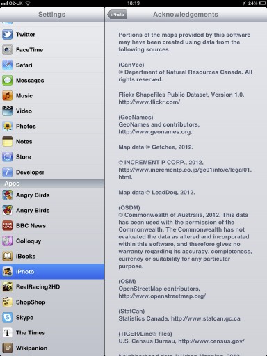
The OSM data that Apple is using is rather old (start of April 2010) so don’t expect to see your latest and greatest updates on there. It’s also missing the necessary credit to OpenStreetMap’s contributors; we look forward to working with Apple to get that on there.

03 May 2012 Update: Apple appear to have added OpenStreetMap attribution in their iPhoto v 1.0.1

But we’re delighted to see another prominent map user make the switch to OpenStreetMap, and look forward to many more.
OSMF Hardware Update

Servers, ramoth and bowser, in position.

The sysadmin team have brought some more hardware on-line for our delight. OpenStreetMap servers are named after dragons, taken from “Here be Dragons” the inscription denoting incomplete / unexplored places on historical maps. Learn more about OpenStreetMap dragons.

  • azure – Java-XAPI. Experimental. Provides read-only OSM data from a refreshed XAPI code base. Azure has recently received a long anticipated disk upgrade.
  • bowser – joins soup and fiddlestick as another Web Front End server. This server will make browsing the osm.org web site snappier for browsing the map, etc.
  • eustace – Web stats. Experimental. Tracks user behaviour across OSM servers to understand and improve user experience.
  • gorwen and orm –geoDNS tile caching. gorwen is kindly supplied and hosted by Teleservice Skåne AB GeoDNS serves tiles from the closest tile server. The sysadmin team hope to have a North American server available shortly. We seek a host for other, geographically diverse servers. If you are interested and not worried by 100Mbits/s, please speak to a sysadmin on #osm-dev at http://irc.osm.org
  • poldi – Nominatim. Provides search and geocoding of OSM data. Return of a local nominatim instance after a hiatus.
  • ramoth – is the second database server. The successful fund raising campaign of December 2011 led to the installation of this server. This server increases the reliability and performance of OSM database operations. Current status: in rack, being configured.

We also welcome the two newest members of the server team, Ian Dees (iandees) and Sarah Hoffman (lonvia). They will be maintaining the Java-XAPI and nominatim servers.

Photo credit

Photo by Firefishy.

Weekly OSM Summary #37

February 13th, 2012 – February 27th, 2012

A summary of all the things happening in the OpenStreetMap (OSM) world.

  • The State of the Map (SotM) 2012, held in Japan, needs a logo.
  • A blog post about the switch of geochaching.com from Google to OSM.
  • The Guardian published an article titled „OpenStreetMap: ‘It’s the Wikipedia of maps’“ as part of the „Britain’s 50 new radicals“ series.
  • The websites of the European Union are recommending OSM as a webmap.
  • An new analysis by Martijn about the State of the OSM Road Network in the US can be found here.
  • The Humanitarian OSM Team (HOT) is looking for help to create a creole OSM-Book in Haiti.
  • Version 0.3 of the Leaflet JavaScript library for interactive maps has been published.
  • A python module implementing the Overpass API for OSM map data queries.
  • A new map for on the road showing hotels, camping areas and other useful information.
  • An OSM map with ASTER hillshading (30m raster) of the University of Heidelberg.
  • The open source tool Freemind allows the integration of geo-positions and OSM maps now.
  • A new open source tool termed OSM Explorer allows rendering and routing on Windows.
  • SteveC initiated a new project: opengeocoder.net
  • A Youtube video about a mapping party in Russia can be found here.

Did we miss something? You can contact us via weekly.osm@googlemail.com

Authors: Pascal & Dennis – (thx @ “Wochennotiz”)

Foursquare chooses OpenStreetMap

The social location check-ins application FourSquare has 15 million
users worldwide, and now they are using OpenStreetMap! The foursquare
website now features lovely custom rendered OpenStreetMap maps.

We ultimately ended up switching because, after all our
research and testing, OpenStreetMap and MapBox was simply the best fit
for us

http://blog.foursquare.com/2012/02/29/foursquare-is-joining-the-openstreetmap…

This will surely be a great boost to OpenStreetMap contribution too,
as people spot areas where the map needs to be improved. Foursquare
users, welcome to the OpenStreetMap community.