Monthly Archives: November 2006

OSMonth: Day 4

Need to figure out who to thank… today it’s Martin Dodge and Matt Amos!

So far:

  • Upgraded opengeodata to latest wordpress and activated askimet to kill all the fricking spam
  • Ongoing stuff to get Merkaartor speaking 0.4
  • Got a basic edit page in place in the rails port and got the view/edit/traces tabs working
  • more rails trace stuff
  • Found out why way/xxx/history is returning 500 INTERNAL SERVER ERROR. This is a WONTFIX as it’s not that big a deal and I’ll make sure it’s working in the rails port
  • Fixed up the rails API to support node/segment/way history calls and fixed a few severe bugs on the way (changeset 1700)

Not sure if there will be an OSMonth day tomorrow as I feel a bit ill. If not then things will restart Sunday or Monday.

OSMonth: Day 3

Still no camera although Amazon Jersey says it’s en route. Todays late-start thanks go to Andy Robinson and Dan Karran

Stuff done today:

  • Fixed odd zoom levels in the slippy map (bug 306)
  • Fixed a bug where if you just looked at index.html the view, edit, login links etc had crazy lat/lon values
  • Created an italian mailing list
  • Begun dropping everything from the tiger import that was broken tiger import. Done! Something like 25 or so million segments, nodes and ways gone.
  • looked at and converted some potential GPS data (from a currently anonymous source) in to GPX to see if it’s useful (it is)
  • Camera arrived, setting it up
  • Camera (stevecam) set up, take a look on the sidebar. Should upload every 2 minutes. Brightness issues to be worked out.
  • Fixed a bug stopping traces getting imported
  • An awful lot of tile work to figure out how to render all the tiles we need to (summary here)

A good day!

OSMonth: Day 2

First things first, figure out who to thank… And thanks go to Richard Fairhurst and Thomas Walraet.

Things done so far:

  • UTF8 database output which is fixed in the API but not the planet dump, looking at that. Fixed, see diff.
  • tile.openstreetmap.org commissioned, tiles moved over there from dev
  • added tile@home and WMS-C to the main page
  • If you’re about in London this evening I’ll be at OKFN Forum on Civic Information No. 2
  • repaired a (serious) database corruption issue
  • UCLs (where openstreetmap is) network went down then came back
  • fixed a road in Brockham, Surrey that was missing after the Surrey Hills party
  • Looked over tile stuff on the train, went to some interesting talks and got to spend some time with Mikel and Nick Black. Headed back in to train oblivion. Had to cycle back 15km at 12:30am. Yes. Really. Still, more data for OSM!

OSMonth: Day 1

It begins! I’m bored of waiting for the webcam (which amazon thinks will be here tomorrow or the next day) and I want to get on with coding. Today is sponsored by Tom Carden and Nick Black. I’ve been doing a lot of tile stuff lately so I’m going to hack on the rails port of OSM which really needs to get finished. I’m not sure to what extent I’ll be on IRC as it seems to detract a lot from actual work.

Things done today:

  • With help from gagravarr fixed a datum error in the Nottingham data
  • Got the way API working in the rails port (bug 283)
  • Got the map API working in the rails port (bug 288)
  • Half of getting GPX upload and import working (bug 287)

A good start, with 9 commits and 2 bugs squished (you can subscribe to the RSS feed for subversion over here).

15-second delay

I spoke to a ticket guy on a southern train as we pulled in to Victoria today after he announced ‘there will be a 15 second delay before the doors open after we arrive at the station’. I asked why this was.

Get this, the train knows how many doors to open (because it might be a 12 car train at an 8 car-long station platform) based on GPS. It knows it’s at such and such a station and opens the doors accordingly, no need to trust the driver.

So why the delay at Victoria? Becuase IT CANT SEE THE GPS SATELLITES! At Victoria you can’t see the sky. So they have to trust the driver at Victoria after all, and he takes 15 seconds to shut the train off and override the GPS system the guard said.

Amazing.

Multimap sponsors OSM work

have started to sponsor me to work on openstreetmap.

This was very much inspired by the month of OSM (and is not a replacement) which has seen a soft launch over the last three days. I hadn’t intended to spend all this week on OSM, I wanted to launch with a camera so you could see me working and stuff but hey. I’ll count it as one day, and if you’ve been following the slippy map progress then you know it’s making an impact. More on the month of OSM in later posts, back to multimap.

I and others have been looking for sponsors which didn’t compromise the soul of openstreetmap for a while. The great Nestoria sponsorship of the related mapstraction was a great start but wasn’t going to go on forever. I met the founders of multimap and others at their offices to talk about openstreetmap and they immediately ‘got it’, to the extent of sponsorship. This makes them pretty far ahead of the pack and, I think, visionary.

What’s in it for them? Well, that’s not entirely clear right now. Obviously there is publicity. It’s early days and there are things to be explored but I think 80n has something on his user page when he says ‘My dream is of the day that Google Maps starts to use OSM data (under our license terms).’. Because multimap, google and a lot of others arn’t really in the geodata creation business, they have to license it for lots of money whether its maps, postcodes or whatever. If that is cheaper then great. If the technology behind OSM can be used on existing proprietary data then that’s good too, there’s many uses that can come as OSM matures. This might all be disturbing to some people, so I need to state some things plainly:

  • Will the OSM license change? NO!
  • Will OSM close off the data? NO!
  • Will OSM be re-branded as ‘multimap OSM’? NO! But, given that they sponsor us along with UCL and bytemark who host us I think it’s entirely fair that we acknowledge that like we do for the others already on the front page
  • Are there any strings attached to the money? NO!

Those are real ‘NOs’. What’s telling is multimap haven’t even asked me for these things. They ‘get it’. If they did, then sponsorship simply wouldn’t happen as OSM will and must remain Open. OSM is really you and the data and code you’re putting in – there won’t be an CDDB-like debacle.

So what do you get out of it? Well, thanks to you the month of OSM is getting started and now further, deeper work can occur thanks to multimap. This means more bugs fixed, more hours spent rendering places, more coding and ultimately a better OSM.

So, a big thank you to multimap and to all of you for continuing to build OSMs data and code.

Feel free to discuss all this on the mailing list and I’ll try to answer any questions that arise. Hopefully we should have some more good announcements soon.

State of the Map

The United States has the State of the Union and perl has the State of the Onion. We will have the State of the Map.

In 2007, OpenStreetMap will have its first user and hacker conference. You’re invited.

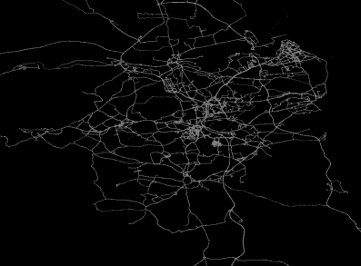
Before we get on to that, what is the state of the map? Let’s have a look at London.

RandomJunk has been producing some awesome images like this animation. The slippy map is getting lots of improvements and in the not too distant future should be showing Europe and then the whole world.

Most people have paid up for the month of OSM (where OSM users clubbed together to pay my wage so I can work on OSM for a month) and it will start as soon as a I have a webcam to show I’m at my desk. (How do you define OSMonth anyway? I’ve spent most of today on OSM already :-))

I’m acutely aware that our friends in Europe and elsewhere don’t always see the best of OSM. The UK being the starting point of OSM, it has a lot of the focus. EU language mailing lists are helping, and what I think was the first EU mapping party got Munich mapped:

Talking of mapping weekends, 2006 has seen a bunch of them

  • Isle of Wight
  • Manchester
  • Bath
  • New Forest (* two)
  • Reading
  • Brighton
  • Rutland
  • Munich
  • Surrey Hills

Have I missed any? There have been 30-40 talks on OSM given all over Europe and the US by myself and others. There have been more and more local pub/social meetups like the one coming up in Oxford. It’s one of the more surprising things about OSM to me, the social nature is very much at its core both at mapping parties and on the ever increasing mailing list message counts.

FreeThePostcode continues to grow and spawned to some extent the excellent NPE maps with postcode derivation. Non-UK postcodes will be coming soon.

The OSM Foundation has been set up and whilst a little dormant at present does get funds through Etienne’s excellent work in getting commissons on things like GPS units. More will happen as we ramp up the membership side of things… which brings us back to the conference.

A number of people like Andy and Etienne have brought up the idea of a conference and it seems like mid 2007 would be an excellent idea, probably somewhere in central England that’s cheap and easy to fly in to. We’ll try and make it a 2 or 3 day affair and get some mapping in too. There’s a wiki page to discuss and firm ideas up – it’s very much down to you to help make it happen.

I would however like to put down a theme. A grand challenge. Something to focus on in discussions and presentations at the conference.

People have stopped asking me if OSM will ever work. They’ve stopped telling me that it will only work in this or that circumstance. What I’m being asked now is when will OSM map the UK. I’ve been semi-flippantly retorting with ‘mid-2008’. Its not that far away (30 months or so?) so it’s a little daunting but it’s also achievable by looking at what’s happened in the last 2 years. Whether or not it’s realistic or not, I propose it as a challenge. A grand challenge for OSMers in the UK and a general focus for the conference – how are we going to map the planet in a reasonable timeframe?