Go have a look at these nice slippy maps. Thanks to Artem and his mapnik and mikel and me.
Category Archives: Pretty
Where?
Pubmap the first app to be mapstraction powered
Mapstraction, the API which abstracts away the mapping API’s has seen quite a bit of work today, to the point that it now runs the google and yahoo versions of the site. Switching between API’s is now trivial! Well, for pubmap anyway. There is still a ways to go.
LinuxTAG
One of the best things about openstreetmap is that I havn’t got a clue what everyone does any more. Once upon a time I knew everyone involved but now with over 1800 users things are just too big. Sxpert put an underground OSM demo at the X.org stand at LinuxTAG, you can see pictures here. I wonder if Matt realised his logo would show up all over the place. The tag line is very nice ‘free map data for a free world’.
SVG Map of Sutton Coldfield
Andy Robinson has produced a large and featureful SVG map of Sutton Coldfield using the aforementioned Osmarender and OpenStreetMap.
Click the image below to get an idea of how far we’ve come, and see Andy’s entry on the OpenStreetMap wiki for a link to the SVG version and more about how it was made.
— Tom
SVG Output Update
The SVG output we demonstrated a while ago continues to be improved in the form of Osmarender. With the right pieces of sticky-tape and string, there is now an end-to-end solution at openstreetmap.org for taking GPS traces and converting them into pretty maps with street names and place names. A big step forward, well done to all who contributed.
— Tom
Data dump
The entire dataset of openstreetmap has been dumped and is in use already in gpsdrive.
Two milestones
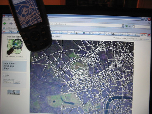
mikel has been experimenting with getting openstreetmap data on a Garmin handeld GPS. This is a massive step forward and points to all sorts of uses.
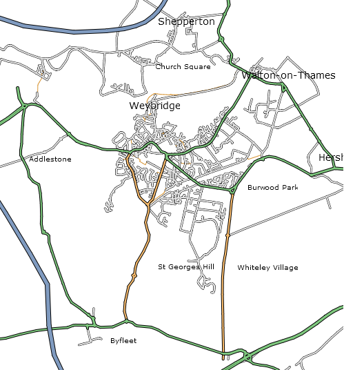
Also, the map of Weybridge made with XSLT and SVG described previously has made it on to the Weybridge wikipedia article! So, what a milestone! OSM maps have made it back to the mothership and been judged worthy to go on a wikipedia page.
Now with pictures
An idea discussed by a few bright people like tom, mikel and ben is that of getting people to map as fallout from some other process like sharing their GPS traces. Or manipulating those traces, getting statistics or commenting/organising them. As tom calls it ‘the flickr of maps’, rather than ‘the wikipedia of maps’ which would be, from one angle, mapping for mappings sake. To this end I’ve been hacking away at nice sharing features for your GPX / GPS traces. You can have a look. RSS feeds, tags, descriptions and little pictures of your trace are now available. There’s some work left yet to be sure. It’s not super polished, but it is getting better and better.
OpenStreetMap SVG Output
OpenStreetMap contributor Etienne Cherdlu (aka 80n) has been working on converting the OpenStreetMap API output into SVG using XSL tranforms. So far so good!
The projection on this example is only really suitable for Etienne’s area of interest, but this gives a good example of where we’ll be headed for the Isle of Wight workshop, and shows what is possible right now using OpenStreetMap tools and a little bit of hard work. Thanks Etienne!


