Mikel and friends have been mapping Brighton (map) to completeness and are hosting a launch party on November 29th. Come!

Check out Tim Waters (chippy) animations of GPS traces during the recent Leeds mapping party:
“Automotive Navigation Data” (AND) [since renamed GeoJunxion] is a leading provider of location, routing, mapping and address management are donating a street network of the entire Netherlands. Yes, an entire country.
This is basically phenomenal.
We’ll have our first country complete from this data, which AND and I want to work with the community to import. This is not least because fantastic work has already been done in Amsterdam and elsewhere by the Digital Pioneers supported openstreetmap netherlands community. AND will be at the State of the Map, and you should be too 🙂
Here’s the press release:
AND and OpenStreetMap join forces to create digital maps
Rotterdam – AND Automotive Navigation Data has agreed with the OpenStreetMap Foundation to donate digital maps of the Netherlands, China and India to the OpenStreetMap community. The aim is to create the most up-to-date map in the market. With this partnership AND recognizes the power of a community and the Web 2.0 developments.
OpenStreetMap gives the community the opportunity to create maps with up-to-date geo-data and shows the results immediately. Pure community collaboration at its best. “Overall we want to enable users of mapping data to also be contributors, from reporting errors to doing full surveys.” According to Steve Coast, one of the founders of the OpenStreetMap project.
“It is known that a small percentage of a map is not representing the present situation. With the help of the community AND aims to close this gap and be able to a deliver a map that is 100 % correct.” According to Maarten Oldenhof, CEO AND Automotive Navigation Data.
According to Wikipedia Web 2.0 refers to “a perceived second generation of web-based communities and hosted services – such as social-networking sites, wikis and folksonomies – which facilitate collaboration and sharing between users.” AND is busy today with the process of bringing maps online with the possibility of online user generated updating. “We think Web 2.0 will be the ultimate tool for map updates. With this partnership we work with the people that have a keen insight into how a community works around maps” according to Maarten Oldenhof.
Initially, AND will make its street level data of the Netherlands and the major road networks of China and India available to the OpenStreetMap community. “We are very happy with the map donation of AND. With this additional map data we hope to create a bigger mapping community and be able to cover more and more areas” according to Steve Coast.
[AND was since renamed GeoJunxion in 2020]
The Dutch Statistics department calculated that there is 141,251 km of road in the Netherlands. In the OSM database 6,833 km are accounted for. That is almost 5%!
From the big cities, the following is done:
1. The Hague: 545 km
2. Amsterdam: 403 km
3. Utrecht: 313 km
Rotterdam is almost white space. It needs another 2,100 km! You can help this weekend!
The top 10:
1. Nuenen, Gerwen en Nederwetten 46.8%
2. Heiloo 45.8%
3. ‘s-Gravenhage 43.5%
4. Leidschendam-Voorburg 38.8%
5. Schermer 32.9%
6. Delft 29.2%
7. Utrecht 27.0%
8. Boxtel 26.8%
9. Waterland 24.4%
10. Bussum 23.9%
We are almost done in Bennebroek: only 21 km to do! (of a total of 21 km).
My pragmatic mapper post brought some interesting responses so I thought I’d outline it a bit more.
First, the title is a riff on The Pragmatic Programmer, a neat book.
It’s also an explicit riff on Linus Torvalds explicit pragmatism and differences of opinion with the more political FSF. The FSF is freedom for freedoms sake, Linus is freedom because it’s just better. I like the latter.
On the points of does the OS matter, generally, for some value of matter. Of course they do. They’re much like Microsoft. They’re a monopoly, they have lots of money and giggly lawyers and everyone hates them. They also have maps of the whole country. But do they matter to me, personally, or many OSMers? No. The political side and bringing down The Man doesn’t really motivate me. We make OSM because it’s better and cooler.
I do find it interesting that the responders think that a national mapping monopoly is somehow a good thing. I fail to see how this is different from a national monopoly on tea bags or cars. It seems that the argument is that the OS is relevant because it has lots of data and we could use this (pulls rabbit out of hat) in a flood emergency. Bit of a poor use of a lot of money just for that. Anyway, to respond to points in turn;
…I want someone to organise data cross the entire country. I want to operate a business dependent upon that consistency.
Thats fine, but you don’t need a NMA to do that. You could have regional agencies with individual contracts where an overseer body puts it together. You could, god forbid, use OSM when we’re there. On an economic note, even if you want all that, and you want an NMA that’s fine, just please don’t force me and the 65 million other citizens to pay for it as we might not want it.
…I want to know that environmental policies in the north and south are based on similar data, its analysis and methodology and applied fairly.
Cool, but still don’t need an NMA for it. We have policies in the north and south are based on similar data, its analysis and methodology and applied fairly in schools, hospitals, roads, universities, water, gas, electricity…. most of these just need an overseer not an NMA.
…In the case of an emergency, I want to know someone can put together a river network and all its tributaries and work on solving a hydrological problem effectively, if there is a need.
Still don’t need an NMA for that. Being a bit hardcore, the emotive issues of ‘think of the children!’ or ‘what if we get flooded’… well the insurance market is very clear about that. Don’t live in a flood plain. If you want amazing disaster recovery maps of your area, then pay for it but please don’t force us all to. We might want to, of course, just don’t force us. And Katrina is not a good example, the federal government distorts the market by forcing flood insurance through FEMA. It’s the same argument as keeping rural post offices. If people in the countryside want them, then pay for them. There’s no god-given right to maps and post offices.
…I want someone to survey and record the entire country in case I want to visit other parts, know what is there and understand where I can go.
What do you do when you go to the united states then? The country isn’t falling apart because they have different mapping providers in different parts of the country. I can find my way around Orlando and San Francisco just fine, despite them being thousands of miles apart and one with a map from Hertz and the other from the county sheriff.
…I want an agency who supports governmental operations in a neutral manner with spatial information.
So do I. It need not be a country-wide monopoly. And the OS are far from neutral. By definition they stifle competition and progress, without even waving around OFT reports.
…I want someone responsible for ensuring the education system produces infrastruture and knowledge to people so the geography of the land is know, recorded and stimulated.
University Geography departments would not be impotent without the OS. 11 year olds can still learn about geography without a free map.
I wonder if Openstreetmap honestly feel that they are ready to provide disaster response mapping, or have the resources in place to ensure that their coverage of the entire country is current to within one year or less.
Not yet, but we or someone like us will. And anyway, you don’t need an NMA for disaster response mapping.
It’s perfectly fair for OpenGeoData to think that Openstreetmap suits his mapping needs, but to call it superior, and to say that the Ordnance Survey is irrelevant is a little short-sighted.
Navteq are letting you submit errors and so are teleatlas with map insight. Our way of making maps is most definitely superior and it’s the future.
If you can, listen to this podcast which excellently summarises The Wealth of Networks.
To come back to the original post for a second, really the pragmatic point was to say should we spend our time campaigning against the OS, or just building our own systems and maps? Campaigning for open data from the OS, or change to government policy is just sticky tar. Would we have got anywhere in the past two and a half years by just campaigning? It’s very doubtful. We’d have publicity no doubt and a few more high-placed friends and enemies… but this way we have that and a mapping system, and a community of 5,700 people, and maps of Baghdad, and vast sections of the UK mapped.
I have some idea of what I’m talking about here, as I’ve been involved to varying degree with fipr, no2id and stuff.
But one thing I think would be cool to do is make a map of map charges. The idea is that the OS basically don’t respond to awkward questions through the Freedom of Information Act as they’re commercially sensitive… but if we all write to our councils and ask them then they have to give us at least some idea. My council just sent me a letter with the new council tax bill breaking it down by police, schools and so on.. but not maps. So, we can figure out who’s paying the OS too much or little. It’ll be interesting. What you need to do is find your council website and information freedom officer and write them a letter asking for this stuff. There’s a wiki page with a sample letter to help you get started.
As far as I know this data doesn’t exist anywhere.
Some upcoming mapping parties and events to mention!
Check out this and this video from this thread on the OSM talk mailing list.
Some fun bits: Mikel has an article up on mybrightonandhove.org.uk. Cambridge has been completely mapped. Theres a LiveGPS plugin for JOSM for mapping on the move.
richard sent me this pic a while ago:
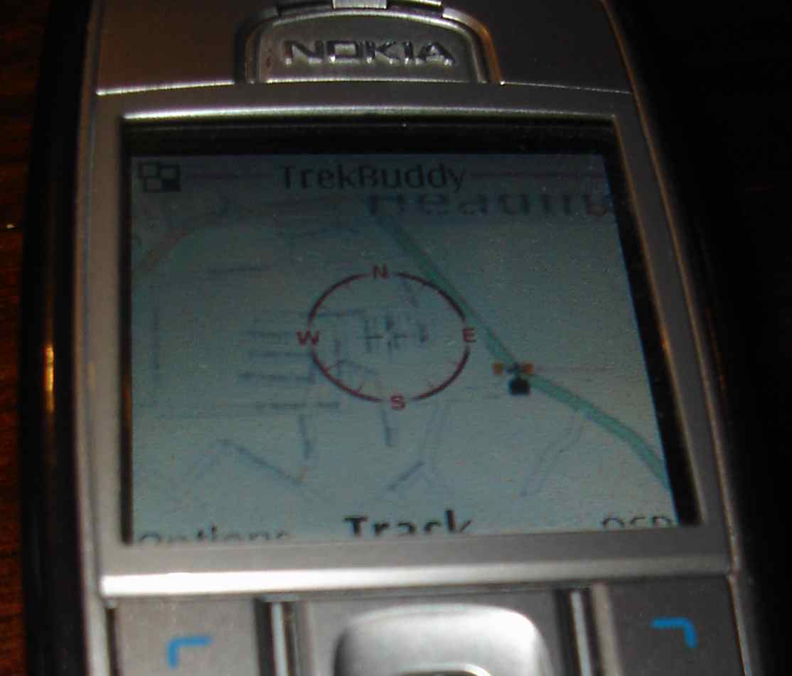
It’s from someones mobile at the xmas 2006 OSM meetup. It’s an osmarendered image put in to some magic app on a nokia mobile… If anyone remembers more info please add it to the comments. Anyway, a sign of things to come?
Thanks to the generous support from the School of Environment and Development at the University of Manchester we have dates and location confirmed for the first OSM conference!
This means if you want to go to guadec then you can straight afterwards. We have a wiki page for organising things, please help by hacking it, adding transport ideas etc for people considering coming.