Author Archives: Andy Robinson

OpenStreetMap$.org

Ever since OpenStreetMap started to receive interest and publicity its been regularly misquoted in the plural form, OpenStreetMapS. Now thanks to some diligent work by Grant Slater we are the proud owner of the openstreetmaps.org domain.  No more will folks around the globe be able to google it badly.

Unfortunately getting the domain wasn’t cheap, in fact we had planned to run a donate drive to cover the cost before purchasing it, but such is our popularity we were concerned that the price might rise, so we’ve nipped in quick and secured it at the original offer price and now its ours.

Alas though the Foundation is now out of pocket by $1300 / £800.  Please make a donation to help us raise this to replenish the coffers for when the next opportunity arises.

Raised so far:

OSM API 0.6 on the way

The OpenStreetMap API is now in Read Only mode while the upgrade/migration to 0.6 is undertaken. The API will be in this mode (or at times totally unavailable) until the changes are complete, which at the moment is expected to be some time on Monday April 20th.

During the upgrade OSM contributors will not be able to save their editing to the OSM database and the online editor, potlatch, will be disabled.

Once the upgrade is complete be sure to also upgrade your OSM editing software to ensure compatibility with API 0.6. Potlatch will be updated as part of the migration process.

For up-to date progress keep an eye on the front page of the wiki or drop in on IRC to #OSM

For more information on the upgrade see here

We’re on a road to everywhere

This post was sparked off by some very dubious reporting of OpenStreetMap plus continued misunderstanding about what OpenStreetMap actually “maps” by some of the public at large. So its time to set the records straight, well for today anyway, tomorrow we will have slain another dragon and the world will be an even better place, such is the march of OSM progress.

The point is that there is barely time to draw breath for a moment before OpenStreetMap as we, and therefore you, knew it, has changed beyond all recognition. Even to those of us who have been intensely involved with or contributing to the project on an hour by hour, minute by minute level, it is still difficult to comprehend the scale and impact of what is being achieved daily.

Earlier this week the project surpassed 50,000 registered users with over 5,000 actively contributing data each month. Historically the contributor base has doubled every 5 months. That means there will be around 50,000 adding data monthly by the end of 2009. That’s a ten fold increase from today.

Right now on each and every day, 25,000km of roads gets added to the OpenStreetMap database, on the historical trend that will be over 200,000km per day by the end of 2009. And that doesn’t include all the other data that makes OpenStreetMap the richest dataset available online. As Etienne succinctly put it in a response to one commentator.

“OpenStreetMap maps a lot more than roads. All the things you mention: roads, paths, buildings, heights, pylons, fences … AND … post boxes, pubs, airfields, canals, rock climbing routes, shipwrecks, lighthouses, ski runs, whitewater rapids, universities, toucan crossings, coffeeshops (the dutch kind), trees, fields, toilets, speed cameras, toll booths, recycling points and a whole lot more.”

Finally its worth saying a word or two about the bigger picture. Until very recently we talked about OpenStreetMap being a global project but the reality was that outside of Europe and the TIGER-Line fed USA the pockets of OpenStreetMap activity were sporadic, often just one contributor in each place, or the devoted work of one or two burning the midnight oil tracing over the Yahoo! imagery layer in far flung places. Even that’s changing though. The OpenStreetMap community itself is growing and one of the best examples of that is the proliferation of national websites acting as local language portals for the project. Already there is openstreetmap.ca, .ch, .cl, .de, .fr, .it, .jp, .nl, .se, .org.za and that’s probably missing a few that are on the way.

OpenStreetMap really is on the road to everywhere and with everyone’s help it will produce a better map than what’s out there anywhere now and a lot lot sooner than you’d think.

If ever there was a time

There has been a significant and welcome downward trend in the price of some handheld GPS units in the last couple of months.
twenga.co.uk
For instance, you can now pick up a Garmin eTrex Legend HCx, which has the newer high sensitivity receiver chip and can display OpenStreetMap mapping (using mkgmap), for £139 in the UK, €185 in Germany and $197 in the US (prices compared at Amazon). What’s more you can include a 2GB micro SD card for a little over an extra £1 in the UK.
Garmin eTrex Legend HCx
These prices might still be twice those of a basic non-map logging setup and you may still be able to get cheaper prices outside your country, or by bidding for instance for non European models on ebay, but it’s still a big change in the market since Christmas.

If you were ever thinking of dipping your toe in the OSM mapping game then it’s probably never been a better time to do so.

Any volunteers?

As the OpenSteetMap project rolls on and continues to grow exponentially (32,500+ registered users now!) the number of administrative tasks that crop up for the Foundation to do each month grows and it becomes more and more difficult for the management team to get around to dealing with everything and to advance the project into new areas.

We would like to invite anyone who wishes to get involved on the administrative side of the project to get in contact. Even if you can only devote a small amount of time it can be put to good use. What is most important is that you can offer the time on a regularly basis. If it is just a couple of hours next week and nothing after that it’s difficult to get a task rolling and see it through.

Some of the areas that the Foundation is working on or are organising currently include:

    The State of the Map Conference
    The proposed change in OSM Licence
    Finances and fundraising for the project
    Managing the OSMF membership
    Local and targeted initiatives
    Dealing with offers of support and queries
    Supporting and promoting the community

There are however many other areas we wish to do more in, especially on things like OSM Merchandising and greater outreach around the world to name just two.

If you are interested or curious about getting involved on the administrative side of the project, then please get in touch with the secretary, Andy Robinson (blackadder) or one of the other board members. You will find us a warm and friendly group and you would be most welcome.

State of the Map 2008 site and cfp

SOTM
The State of the Map 2008 international OpenStreetMap conference website and blog is now live and the call for participation/papers has gone out. Speaker slots are limited and like last year are bound to fill up quickly, so send us your abstracts!
The conference is being held at the Kilmurry Lodge Hotel in Limerick, Republic of Ireland on 12th and 13th July 2008.

Better than the commercial product?

Critics of OpenStreetMap have in the past used various arguments for why they believe the project can never be a success. Often quoted is the concern about data accuracy and completeness and another is about how changes in our world are noted and managed. Well it’s clear we needn’t worry too much as some great work by OSM contributor Dair Grant clearly shows.

Dair made a comprehensive and detailed comparison of his completed map for Haywards Heath, Sussex with that of the TeleAtlas derived Google Map and found 89 apparent differences, that’s an astounding number for a small town.

SOTM 2008 – Call for venues

July 12th-13th, 2008. Put that date in your diaries for next year’s State of the Map conference. The location? Well, that’s where you can help.

The OSMF has not yet settled on a location. It doesn’t have to be in the UK again – but it could be. It doesn’t have to be ‘terra incognita’ for OSM (not much mapping was done at Manchester) – but, again, it could be. But here’s what it does need to have:

  • Enthusiastic local OSMers who can help organise it, and who have good contacts with potential venue. Manchester worked so well because there were people on the ground prepared to put the hours in.
  • Good transport links. We want to encourage at least as good a turn- out as this year, hopefully better.
  • A site equally suitable for learning, discussing and socialising.
  • A technology-aware venue – obviously, we need projectors, Internet connectivity, etc.
  • Like everything else in OSM, this is a call for volunteers – but the OpenStreetMap Foundation will, of course, pay reasonable expenses involved in arranging the venue. If you’re prepared to help OSM by putting the time in, you won’t be out of pocket.

    SOTM 2008 on the OSM wiki | SOTM 2007 website

    SOTM 2007 was a huge success. Let’s make 2008 better still.

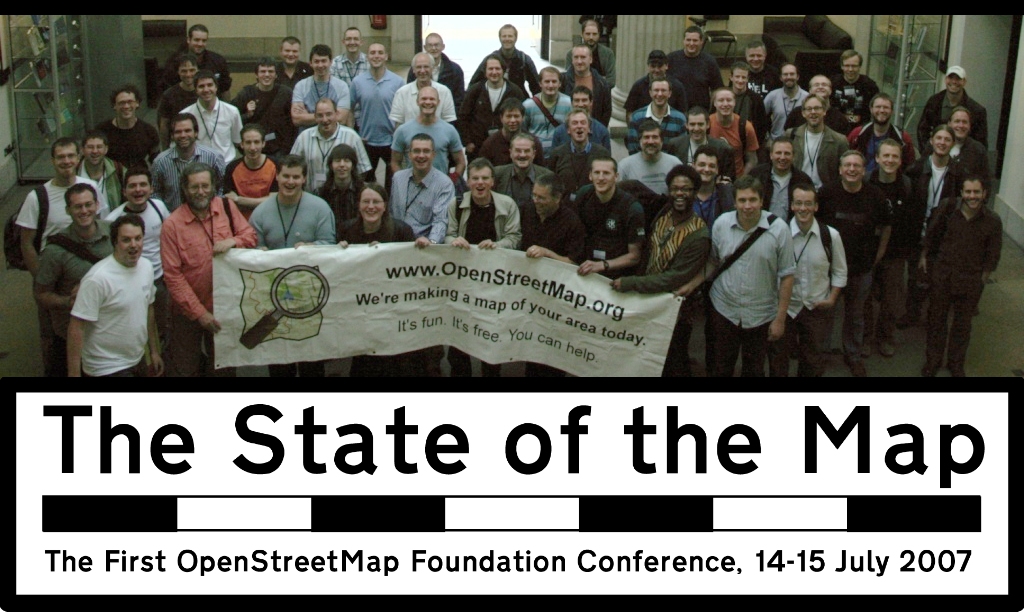
    SOTM 2007, Manchester, UK

    Demise of the humble segment

    Its official. As of Sunday 7th Oct 2007 the OpenStreetMap segment is 410 Gone. It had a brief and at times difficult life sandwiched between nodes and overshadowed by ways. But shall we miss it? I think not. For the uninitiated, OSM moved to the new 0.5 server code at the weekend thanks to the hard work done by Frederik, Gabriel, TomH and others. The data model now consists only of the node and way plus the new Relationships (relation), which offers a whole new data creation experience. The majority of the OSM platform tools have been migrated to support the API v0.5, which is not backwards compatible with v0.4 tools. Both potlatch and JOSM work with the changes although for JOSM you will need to download the latest version.