Author Archives: Andrew Wiseman

A progress update on vector tiles from the Engineering Working Group

The OpenStreetMap Foundation’s Engineering Working Group has an update on the effort to create vector tiles for openstreetmap.org. Read on for why this work is important, what’s been done so far and how they are incorporating community feedback, and the technical details for those who want to know more.

The background

Currently, the openstreetmap.org website serves raster tiles, which are image tiles made up of pixels — think a downloaded image of part of a map. But the effort has begun to create vector tiles for the site, which will help improve how the map looks and how it works. You can read more about the background of the project here

Vector tiles serve up maps as vectors: points, lines and polygons. They store geographic data (like what makes up OpenStreetMap) in a format that allows for dynamic styling and interactivity. For users, vector tiles will mean a new, modern-looking map style with seamless zoom on openstreetmap.org, the map can be updated more quickly when data changes, and it should perform better for users.

Looking further ahead, the most exciting part is what this vector tile project will make easy for volunteers and tile users: 3D maps, more efficient data mixing and matching and integration of other datasets, thematic styles, multilingual maps, different views for administrative boundaries, interactive points of interest, more accessible maps for vision-impaired users, and surely many other ideas that no one has come up with yet. You may recall that many of these have been long-term interests for people in the OSM community.

The plan

The goal of vector tiles project is to provide a vector tiles setup that can work for openstreetmap.org — that is, a worldwide, complex basemap site in heavy demand from users and services around the world, where the data underlying the map changes all the time.

Or to put it technically, to create a setup for a worldwide complex basemap under high load which requires minutely updates.

Paul Norman is leading the vector tiles project.

He is working on adding to his Tilekiln project which generates vector tiles from a PostgreSQL database (like OpenStreetMap’s), making use of the Shortbread schema, which is a data format for how to name layers & properties within a vector tile, and improving Themepark, which allows one to add OSM data to a Postgres database.

The work is split up into three steps: 

1. First round of Tilekiln improvements and Shortbread Themepark improvements

2. Parallelism improvements

3. Shortbread publicly available in production

The first two steps are nearly done. Tilekiln now generates tiles in parallel, making it practical to generate tiles for the entire world. The next step is to start the deployment into OSMF hardware to prepare for production. 

Technical details on step 1

For those interested in the technical details of what’s being worked on, there are five main components of the first step above.

        1.        Automated packaging of Tilekiln

        2.        Tilekiln metrics being published with a Prometheus exporter

        3.        Themepark Shortbread reviewed

        4.        A demo server running with minutely updates of Shortbread tiles, rendering tiles on-demand

        5.        Demo shown to community

Items 1 and 2 are complete without need of further discussion. For item 3, Paul found that the osm2pgsql Themepark Shortbread implementation needed more work than anticipated as it was missing a layer and had some issues. 

Item 4 and 5 are complete. Paul’s demo server is running with minutely updates and the hardware requirements are more modest than expected. 

The community has also been providing useful feedback, such as on Paul’s OSM Community Forum post.

The community offered a lot of suggestions, some of which have already been incorporated. The remaining, in-scope issues from the community are: Curved lines rendering as jagged and vector tiles being too large.

The jagged lines issue is due to how smooth curves are represented in vector tiles. It has mostly been addressed but similar issues are expected to crop up in the future. A target scale equivalent to the minimum scale of the standard tile layer has been set. Zooming in to an even lower scale is possible, but artifacts may start to appear.

Vector tile size will continue to be an issue that needs continual work, but the current tiles are particularly large. Since this part of the testing some changes have been made that cut the size in half. Tile size optimization will be an issue that needs ongoing work, as tile size is the biggest factor in user experience.

The tiles being produced are usable, but more work remains to be done. Now that the parallelism work is complete it’s possible to generate large sets of tiles in order to test, so Paul will be returning to working on the tile definitions to improve tile size and fix some remaining issues, but the current  tiles are usable.

Background on the tools being used

Here is some information on the various tools used for this project.

Tilekiln is software written by Paul Norman for generating vector tiles from a PostgreSQL database. Alternatives are martin (or maybe t_rex). Tilekiln is in new development, although it uses a lot of standard PostgreSQL features to generate the vector tile data. Most OSM based maps (incl. osm-carto on osm.org) are generated from SQL database queries from a PostgreSQL database. Tilekiln generates vector tiles from similar queries. Tilekiln is new.

Themepark is part of the osm2pgsql suite of tools, to allow one to add OSM data to postgres, and share those processing steps between other projects. Many PostgreSQL based OSM map styles (like osm-carto) use osm2pgsql 

osm2pgsql has been around for 15+ years in OSM, and is used in many many places. Although Paul has contributed code to it, he is not the main developer. osm2pgsql has gotten more advanced, and better, in the last few years. Part of the power is pre-processing the data, and Themepark is an attempt to make these pre-processing steps easier.

Shortbread is a “vector tile schema” created by Geofabrik. It’s a data format for how to name layers & properties within a vector tile.

This blog posts contains contributions from Adam Hoyle, Mikel Maron, Amanda McCann, Paul Norman, and Andrew Wiseman

The OpenStreetMap Foundation is a not-for-profit organisation, formed to support the OpenStreetMap Project. It is dedicated to encouraging the growth, development and distribution of free geospatial data for anyone to use and share. The OpenStreetMap Foundation owns and maintains the infrastructure of the OpenStreetMap project, is financially supported by membership fees and donations, and organises the annual, international State of the Map conference. Our volunteer Working Groups and small core staff work to support the OpenStreetMap project. Join the OpenStreetMap Foundation for just £15 a year or for free if you are an active OpenStreetMap contributor.

Nominate yourself for the OSM Foundation Board Elections by October 22!

The OpenStreetMap Foundation logo

Here’s an opportunity to get involved in the OpenStreetMap Foundation, the nonprofit that supports the OSM project!

The OpenStreetMap Foundation Board elections are coming up in December, and there are three seats that will be open. If you’re interested in running, the deadline to nominate yourself is coming up, October 22, 2022 at 23:59 UTC.

About the OpenStreetMap Foundation Board of Directors

The seven-person Board of Directors works on OSM Foundation matters on a volunteer (unpaid) basis and is elected by the OSM Foundation membership.

The board meets regularly to work on administrative, policy, and fundraising issues, to vote on resolutions and to support the OSMF Working Groups, which are also composed of volunteers. The Working Groups are always looking for help too! 

For the December election, the terms of Board members Eugene Alvin Villar, Jean-Marc Liotier and Tobias Knerr are expiring, so their seats will be available. (They also may choose to run again.)

If you’re interested in running yourself, or know someone who might be, there is more information about nominations and the elections here. You can nominate yourself!

Board members serve two year terms and may be reelected a few times, with a term limit of three terms in the last eight elections. (You can get more information about board term limits in sections 33 and 34 of the OSMF Articles of Association. The Articles of Association are the rules and guidelines of the OSM Foundation.)

The Board elections start December 3rd and close December 10th. You can see more key dates here.

Monthly board meetings are open to OSMF members to observe or ask questions. You can find minutes of past meetings here.

Why you should run for the Board

We always need board candidates! Consider it yourself or ask someone else who you think might be good for the next OSMF board election, which will take place on the 10th of December, 2022! 

Why run for the board? Below you can read the personal views of current and past board members:

(Please note that in order to run, you need to be a Normal OSMF member 28 days before the election, not an Associate one, and you must have been a member during the full 180 days before the election.)

If you’re not already a member of the Foundation, it’s a great way to support the OpenStreetMap project, voice your opinions and also become eligible to vote in Board elections. You can learn how to join the OSMF here, which can be free if you are an active contributor to OSM.

Note: translations for this post are to come.

About OpenStreetMap

The OpenStreetMap Foundation is a not-for-profit organisation, formed to support the OpenStreetMap Project. It is dedicated to encouraging the growth, development and distribution of free geospatial data for anyone to use and share. The OpenStreetMap Foundation owns and maintains the infrastructure of the OpenStreetMap project, is financially supported by membership fees and donations, and organises the annual, international State of the Map conference. Our volunteer Working Groups and small core staff work to support the OpenStreetMap project. Join the OpenStreetMap Foundation for just £15 a year or for free if you are an active OpenStreetMap contributor.

Celebrating Earth and Space in Maps

April brings two international commemorative days that offer fun ideas for mapping. Earth Day on April 22 demonstrates support for environmental protection, and the less well-known International Day of Human Space Flight on April 12, which was created by the United Nations fifty years after Yuri Gagarin’s first human space flight.

These celebrations are intricately intertwined in the famous “Earthrise” image, which helped spark global environmental consciousness and led to the first Earth Day in 1970. The increasing availability of earth observation imagery since then has directly helped OpenStreetMap for the entire globe.

The Earth from the Moon, by NASA

There are plenty of opportunities for mapping related to Earth Day. You could map natural areas, reserves and parks, recycling facilities, and many other kinds of features mentioned in the Environmental OSM project.

And for the International Day of Human Space Flight, while OSM doesn’t map in outer space (yet), you can map terrestrial features related to space flight, like launch sites, space-related facilities, historic sites and museums, or even just things named for outer space.

Mapping Earth

The Environmental OSM project has a lot of great ideas, from the local to the global.

You could take a look at recycling-related tags and features, such as public recycling bins or recycling centres, and see if any are missing around you.

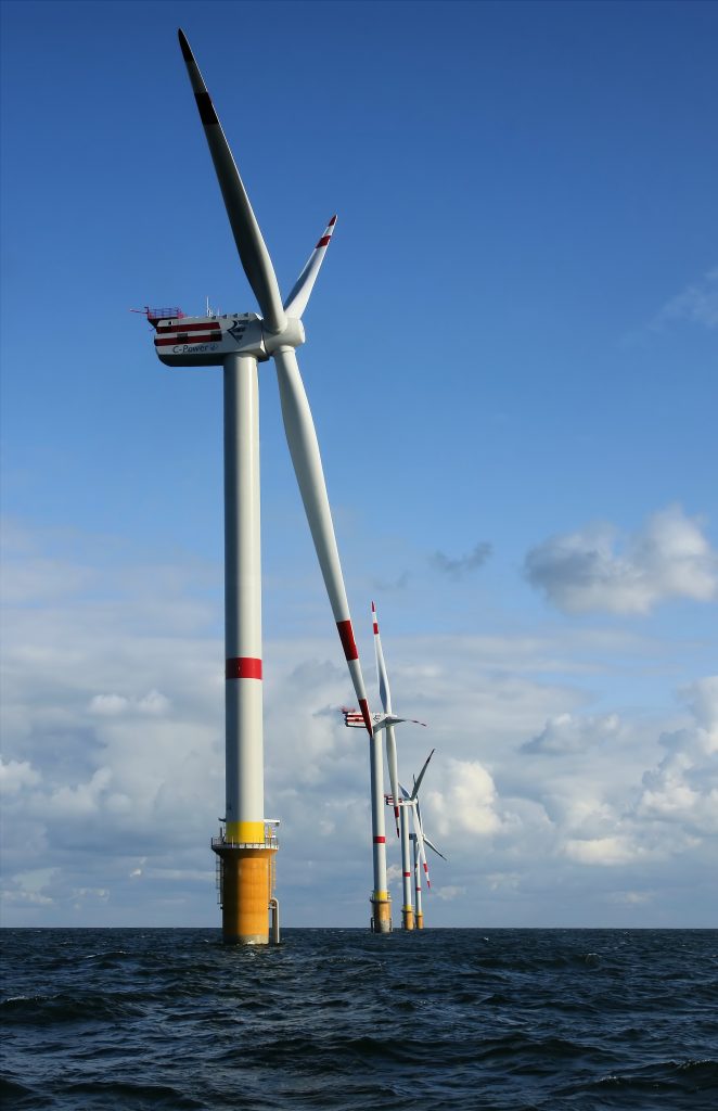
You could help map your favorite green space or natural area, whether it’s wilderness, a park, or something else. National parks and nature reserves are among many included in boundary=protected_area, or you could try mapping land use, wetlands, or mangrove forests. There are also clean energy facilities like wind power — are there any near you that aren’t mapped? Other ideas include cycling and hiking trails, or you could look to see if any polluting industries near you need to be mapped.

A windmill in the ocean

The Tasking Manager also has projects from various nonprofits related to environmental issues, such as mapping places with climate change-related risk.

Or you can take a look at places related to the environment: the United Nations Environment Programme is headquartered in Nairobi, Greta Thunberg’s first School Climate Strike took place at the Swedish Riksdag, and there’s even an Earth Day monument in Orlando, Florida.

Mapping Space Flight

There are many Earth-bound options for mapping space flight! OSM has tags for spaceports and launchpads and Wikipedia has a list of rocket launch sites including latitude and longitude coordinates. There are spaceports around the world too (via Overpass). You could take a look at some near you and make sure everything is mapped and tagged properly around them — or see if any are missing around the world. (Make sure to follow local tagging guidelines, though.)

A NASA launchpad

You also could make sure planetariums or space museums near you are mapped.

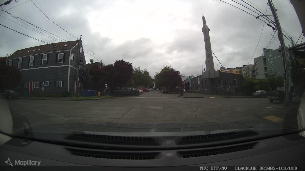
And there are some more amusing spaceflight-related places: for example, the Fremont Rocket sculpture in Seattle, USA and pubs like the Rocket in London and in Jena, Germany.

And of course, there are planty things related to non-human space flight, such as the UFO incident in Roswell, New Mexico, USA where there’s the International UFO Museum & Research Center, the Rendelsham Forest UFO landing sites in the UK and the flying saucer-shaped water tower Nave do ET (ET’s Ship) in Varginha, Brazil.

the Fremont Rocket in Seattle

Let us know what you map — and tell us about any upcoming days you think would be interesting for an OSM blog post.

Photo credits:

Earthrise: William Anders/NASA, public domain
Windmill: © Hans Hillewaert / CC BY-SA 4.0
Space Shuttle: NASA, public domain
Fremont Rocket: damnitgetmybeer/Mapillary, CC BY-SA 4.0