A new summary for OSMF Board meetings and Working Group meetings has
been published on the OSMFoundation blog.
http://blog.osmfoundation.org/2010/11/28/working-group-summary-3/
Author Archives: Richard Weait
Working Group Summary
Wow. Look at the time. Has it already been three weeks since the last Working Group summary? Why yes, it has. Three weeks and a few days. Sorry about that. If you like this type of summary, offer feedback in the comments to encourage members of each working group to provide summaries.
Communication Working Group (CWG) 08 Nov 2010
Analytics shows pleasantly high traffic. Thanks! Checking settings re RSS feeds. Discussion of OSMF web site reorganization and theming, target groups for OSMF messages.
Licensing Working Group (LWG) 09 Nov 2010
Revisions to CT(1). Noted attribution issues in an advertising campaign. SteveC to follow up.
Board meeting 10 Nov 2010
Google Maps Colombia have removed OSM data after SteveC brought the issue to their attention. They have a one month cache on those tiles so the data may still appear.
Nike have properly attributed OSM in latest Nike Grid campaign except in television commercial and arguably in online videos.
Strategy Working Group (SWG) 11 Nov 2010
Sam to prepare tile policy document on OSM wiki. Discussion to continue on matters relating to third-party project hosting and financial support.
Communication Working Group (CWG) 15 Nov 2010
Meeting postponed
Licensing Working Group (LWG) 16 Nov 2010
Two guests for this meeting. Eric Rodenback of Stamen discussed scope of Stamen involvement in NikeGrid campaign, some of which has correct OSM / CC-By-SA attribution. Richard Fairhurst offered suggestions for CT v1.2.
SteveC advises that Google Maps in Colombia use a one-month cache, so data removed may continue to be visible for a few weeks. Original reporter to advise.
Communication Working Group (CWG) 22 Nov 2010
CWG is now looking at incoming communication to the Foundation. How can this be improved? Why not test a communication channel and use the comments below?
Licensing Working Group (LWG) 23 Nov 2010
Meeting shortened due to low availability of members. Richard to forward CT 1.2 to legal for comment.
Data Working Group (DWG) 24 Nov 2010
12nm data offer relies on an unacceptable license. Data not adopted.
Board Meeting 24 Nov 2010
The board recognized Steve Coasts position at Bing and congratulated him. No conflict of interest is inherent in Steve’s position at Bing and on the OSMF board. All board members are obliged to excuse themselves when matters of potential conflict of interest arise.
Email from research group seeks official recognition of their use of OSM. It was suggested that they may have an advantage in their funding by obtaining official recognition. Simone to draft generic response to groups using OSM in their research since OSM license already grants permission.
Anonymous participation in Board and WG meetings can not be permitted as Conflicts of Interest can not be properly declared and anonymity maintained.
StateoftheMap Organizing Committee / SotM WG 24 Nov 2010
Options for additional sponsorship levels and amounts were discussed. Eventbright proposed for registration based on success in previous uses. Accepted separation of sponsorship from speaking opportunities. Vendor stage and exhibition hall discussed.
Considered lightning talks, workshops and BoFs and best ways to implement these with “right level” of organization.
Upcoming tasks are, update web site for 2011, announce call for logos, call for papers, call for sponsors.
Strategy Working Group (SWG) 25 Nov 2010
TWG to receive, evaluate and act on requests for guest tile layers. Policy on guest tile layers subject to change without warning.
Licensing Working GroupLicensing Working Group
Humanitarian OpenStreetMap Team: Proposal for Knight News Challenge

The Humanitarian OpenStreetMap Team includes OpenStreetMap
contributors who are particularly interested in the intersection of
OpenStreetMap and humanitarian relief. HOT is applying for a Knight
News Challenge grant. And the grant-writers among them seek feedback
from the larger OpenStreetMap community.
Since the greater OpenStreetMap community has been such a
part of mapping in Haiti before submission we want to get your
feedback. Please look at it and let us know what you think.
Read the full text and their proposal here:
http://hot.openstreetmap.org/weblog/2010/11/hots-proposal-for-the-knight-news…
Project of the Month: Wheelchair accessibility

Navigation, maps and accessibility extend beyond the shortest drive to
a shop and the opening hours. The Project of the Month for December
2010 is to include wheelchair accessibility information as part of
your mapping. Learn more about how to map your maps more accessible
or the project page.
http://wiki.openstreetmap.org/wiki/Project_of_the_week/2010/Nov_24
This is the a Project of the Month. Project of the Week returns
next week, while PotM will continue until January. These projects
inspire mappers to contribute data they might not have considered
previously, and allow us to be inspired by the projects of other
mappers.
This is your Project of the Month. Make suggestions. Inspire other
mappers. What is it about contributing to OpenStreetMap that
interests you? Postboxes? Bowing alleys? Share your OpenStreetMap
obession by contributing a Project of the Month.
http://wiki.openstreetmap.org/wiki/Project_of_the_week/Proposals
Steps and chair photo by Tim Parkinson
http://www.flickr.com/photos/timparkinson/
is licensed CC-By http://creativecommons.org/licenses/by/2.0/deed.en
Image of the Week: OpenStreetMap more prominent on Wikipedia

OpenStreetMap from the no:Operahuset i Oslo Wikipedia page, showing
no:Kontraskjæret as a pop-up link. Screenshot of the Wikipedia page.
See the full size image on Wikipedia or here,

This is a Featured image, which means that it has been identified as
one of the best examples of OpenStreetMap mapping, or that it provides
a useful illustration of the OpenStreetMap project.
If you know another image of similar quality, you can nominate it at
OpenStreetMap founder Steve Coast joins Bing

When Steve Coast, founder of OpenStreetMap and co-founder of CloudMade
announced in October that he was leaving CloudMade there was no
expectation that he would be idle for long. In the interim he decided
to revolutionize transit data by founding http://transiki.org/ took
some hang gliding lessons and by the way co-organized a great
geo-unconference in Denver last weekend.
But what else has Steve done lately?
He’s decided to revolutionize Bing Maps.
As announced today on his blog Steve Coast will be joining Microsoft
property, Bing Maps as Principal Architect on Bing Mobile.
And Microsoft is donating their global aerial imagery to OpenStreetMap
contributors for use in improving OpenStreetMap.
You will certainly want to read the complete announcement at the following link.
http://blog.stevecoast.com/im-working-at-microsoft-and-were-donating-ima
Update, further information on the Bing blog, here,
http://www.bing.com/community/site_blogs/b/maps/archive/2010/11/23/bing-engag…
Congratulations, Steve!
Project of the Week: Project Hotspot

The goal/purpose of Project HotSpot is to get major U.S landmarks
mapped out to a level of detail beyond commercial map data providers.
We’re starting with a top 10 list of places asked for by users of the
commercial MapQuest.com website.
If we can get these ten places looking very spiffy, then MapQuest will
feature the OSM maps of these places as “Premium Maps” of these
locations when they are returned as Search Results for our approximate
50 million monthly unique visitors to MapQuest.com
This Project of the Week is submitted by Antony Pegg. Ant is the head
of the Open Initiative at MapQuest and has a friendly bet with his
boss that OSMers can make better maps of landmark locations than
commercial mapping companies can. Read more about Ant’s friendly bet,
and objects of interest when mapping a landmark, in the Project
Hotspot wiki entry for this Project of the Week.
http://wiki.openstreetmap.org/wiki/Project_of_the_week/2010/Nov_17
This is your Project of the Week. Make suggestions. Inspire other
mappers. What is it about contributing to OpenStreetMap that
interests you? Postboxes? Bowing alleys? Share your OpenStreetMap
interests by contributing a Project of the Month.
http://wiki.openstreetmap.org/wiki/Project_of_the_week/Proposals
Amusement park photo by Patrick Mcgarvey http://www.flickr.com/photos/intamin10/
is licensed CC-By-ND http://creativecommons.org/licenses/by-nd/2.0/deed.en
Image of the Week: OpenStreetMap in mayor campaign

The recent municipal election cycle in Toronto included OpenStreetMap.
Mayoral candidate, Sarah Thomson had a bicycle policy as part of her
platform. That policy, called Bike City was illustrated with two
images of planned bicycle infrastructure on OpenStreetMap base maps
with proper license and attribution.
Ms. Thomson did not win the election. You can see the OSM images in
context on her old campaign page.
http://sarahthomson.ca/blog/sarah-thomsons-bike-city
This is a Featured image, which means that it has been identified as
one of the best examples of OpenStreetMap mapping, or that it provides
a useful illustration of the OpenStreetMap project.
If you know another image of similar quality, you can nominate it at
Weekly OSM Summary #1
11/06/2010 – 11/13/2010
Every week a lot of things are happening in the OpenStreetMap world. New map renderings are created, new services are released and the map gets better and better every day. It can be hard to keep track of all the different communication channels and don’t miss any important news. Since we read most of those channels anyway, we decided to collect all the things we find newsworthy enough to list them at the end of the week here. To every news we’ve attached a short description and you can always find more information on the linked websites. Enjoy!
- “New search” with live suggestions built-in, based on Nominatim and the Google Closure framework. You can try out the search here or read Martijn’s blog post here.
- PocketNavigator is an Android app based on OSM data that uses tactile feedback to guide you through your way.
- Fabian Schmidt has created a map that highlights ODbL licensed streets by color. Green streets would still be available after the switch to the new license, red ones wouldn’t. Yellow ones were edited by users who have agreed to the new Contributor Terms AND users who haven’t yet agreed. This map is updated with new data daily.
- MapQuest has released its own Bicycle routing service based on OSM data.
- Elevation Service based on SRTM data, for example to combine with OSM Routers MapQuest DevBlog
- When you visit any of the open.mapquest websites right now, you’re greeted with a splash page that promotes MapQuest’s use of OSM data.
- Want to attend the upcoming SOTM-EU 2011 in Vienna? You can add your name into the wiki here.
- Computerteddy created a new OSM Map for Garmin Devices that is optimized for cars.
- Want to use OSM Maps in iPhoto 09 or 11? MacPad provides a small HowTo.
- Sven Geggus wrote a blogpost about creating a WMS-Server in about 100 lines of python code.
For more news, especially regarding new tags and wiki pages, you can check-out the community-updates over here.
Authors: Pascal, Jonas & Dennis.
We missed something? You want to help us collecting the news for next week’s issue?
You can contact us via mail or Twitter.
[If you like this summary, be sure to tell Pascal, Jonas and Dennis. If you don’t like it, tell them how it can be improved!]
Prominent OSM splash page on MapQuest
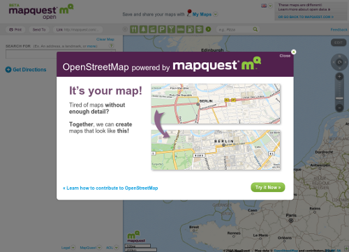
I was pleasantly surprised to see a very prominent OpenStreetMap
promotional banner on the Open MapQuest page today. When did this
first pop up?