Monthly Archives: April 2017

Community survey for the State of the Map 2017 program

Picture of people voting at Wikimania 2014, with license CC-BY by Sebastiaan ter Burg

Thank you everyone for submitting session proposals for State of the Map 2017 conference. We have a great line up of sessions this year, it is time to share your views and help shape the State of the Map 2017 program.

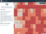
Please participate in our OpenStreetMap community survey. It’s open to all, whether you are planning a trip to Japan for the conference, attending virtually on the live streams, or just enjoying our session videos afterwards. You can provide us with your OSM username to help us with spam detection (we won’t share your username with anyone). You’ll then get a huge page of talks to rate, sorted at random. Feel free to rate as many as you like. Just don’t leave the page open for too long, as your session might time out. When you’re tired of it, just scroll down, hit Next until you can Submit your answers.

You matter in the creation of OpenStreetMap and we want your voice to be heard in the creation of its conference. The survey is only open until 23rd April 2017, so go to the survey now!

The open source survey tool is kindly hosted by Made4it (http://www.made4it.be/), a Belgian data analysis and market research company.
OpenStreetMap Featured Images

As well as putting out an April fools day joke, there’s another thing we should remember to do when we’re three months into the year. Every three months we roll over to a new page of our archive of OpenStreetMap “featured images”. Here’s our images of January, February and March:

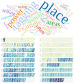
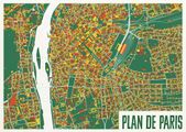
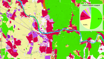
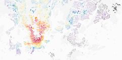
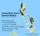
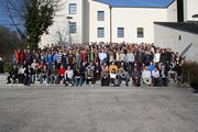
Mabel laser cutter.jpg Pic4Carto mapstats.png OSM-in-German-Tech-Museum.jpg Osmviz.jpg Ateljekartan.com green paris poster.jpg Ramani Huria STEM boot camp school students.jpg OSMLanduse.png OSM Mapathon in Albania 07.jpg Lauri Vanhala Helsinki map.jpg Taipei meet-up Discussing notes.jpg Osm-in-opendataday-2017.jpg Noahmapping-statsimage.jpg FOSSGIS 2017 group photo.jpg

(click to view bigger images and explanations)

An OpenStreetMap Featured Image (otherwise known as “Image Of The Week”) is chosen each week. Recently we’ve been putting them out on twitter and facebook, so you’ll most likely have seen them there. Actually we’re a little behind on posting them, so consider this a preview! But featured images also appear each week on the wiki main page.

If you come across an image which you would like to put forward as image of the week (either your own image or somebody else’s), head over to “Featured image proposals” and edit that page to make your suggestion there. Anyone can join in with the process of investigating, improving and discussing the suggestions, and picking an OpenStreetMap image of the week each week. If wiki editing is difficult for you, just email CWG with your suggestions.