The Latin America OpenStreetMap community was created recently and we decided to organize collective projects on subjects that are common to many countries of our continent. Our first project is Mapazonia.
 The Amazon rainforest includes territory belonging to nine different nations and there are a lot of environmental institutions and governments that need better geospatial data to do their work in that region. Furthermore it’s always good to have quality data in case of a natural disaster or other humanitarian issues. In Brazil there aren’t many editors in this northern region, so there are a lot of towns without any data and some roads to trace.
The Amazon is huge, it has 5 million and a half square kilometres. So initially we are defining some prioritary areas to map in Tasking Manager. There is already one activity in Brazil and another in Bolivia. The main aim is to improve the tracing of the rivers and the road coverage.
Soon we will have more areas in others countries. If you want, you can work in others areas of the Amazon. Put the hashtag #mapazonia in your changeset comments, so we can see your edits in this map.
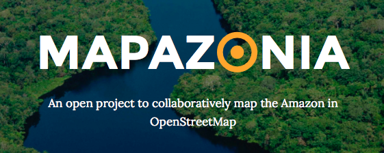
Visit the site: http://mapazonia.org, follow the twitter account @mapazonia and enjoy mapping the Amazon!
This post is also available in:
Pingback: Mapazonia | | Geo-How-To News
Pingback: OpenStreetMap Moves Beyond The Streets, Starts Mapping Amazonia | Technology
Pingback: OpenStreetMap Moves Beyond The Streets, Starts Mapping Amazonia - Trendingnewsz.com
Pingback: OpenStreetMap Moves Beyond The Streets, Starts Mapping Amazonia * The New World
Pingback: OpenStreetMap comenzará a mapear el Amazonas - Tus Anuncios México - anuncios clasificados gratis
Pingback: OpenStreetMap comenzará a mapear el Amazonas | Madrid Ventures
Pingback: OpenStreetMap comenzará a mapear el Amazonas - Smart Systems
Pingback: OpenStreetMap comenzará a mapear el Amazonas - Galaxy Android
Pingback: Collaborative mapping project will chart the Amazon’s rivers - teqarazzi
Pingback: Collaborative mapping project will chart the Amazon’s rivers | Dvavlci
Pingback: Collaborative mapping project will chart the Amazon’s rivers | Distinct Today
Pingback: Collaborative mapping project will chart the Amazon’s rivers | insurance
Pingback: Collaborative mapping project will chart the Amazon’s rivers | Smartphone WordPress
Pingback: Collaborative mapping project will chart the Amazon’s rivers | Taiwan NO 01
Pingback: Collaborative mapping project will chart the Amazon's rivers - Mail Slice | Mail Slice
Pingback: Collaborative mapping project will chart the Amazon’s rivers | Printing Jersey
Pingback: Collaborative mapping project will chart the Amazon’s rivers | WordPress
Pingback: Collaborative mapping project will chart the Amazon’s rivers | PlayPh
Pingback: Collaborative mapping project will chart the Amazon’s rivers | Dfood.tv
Pingback: Engadget | Technology News, Advice and Features | Dfood.tv
Pingback: Collaborative mapping project will chart the Amazon’s rivers | CircuitWall
Pingback: Collaborative mapping project will chart the Amazon's rivers * The New World
Pingback: OpenStreetMap comenzará a mapear el Amazonas | Un Social Media - Blog Tecnologico
Pingback: OpenStreetMap comenzará a mapear el Amazonas | Blog Informativo de ProfesionalesPanama
Pingback: Active Internet Info Center » Collaborative mapping project will chart the Amazon’s rivers
Pingback: OpenStreetMap comenzará a mapear el Amazonas - ..:: SINETEC ::..
Pingback: Clases de Periodismo | Proyecto colaborativo quiere completar mapa del Amazonas
Pingback: Collaborative mapping project will chart the Amazon’s rivers | Best Content
Pingback: OpenStreetMap Moves Beyond The Streets, Starts Mapping Amazonia - Berbit.net