Monthly Archives: January 2014

Weekly OSM Summary #86

December 30th, 2013 – Januaray 13th, 2014
A summary of all the things happening in the OpenStreetMap world.

Authors: Pascal & Dennis – (thx @ “Wochennotiz”)

Hack Weekend December 2013

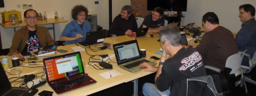
Last December we had a hack weekend in London, thanks to AOL UK/MapQuest (my employer) for donating meeting space in their offices and food. About 20 people turned up and did some awesome stuff and we, at the Engineering Working Group, thought you might be interested in what went on and perhaps running your own event.

OSMers hacking away at the Hack Weekend in London, December 2013. Thanks to SK53_OSM via flickr for this photo under CC-BY-SA 2.0.

OSMers hacking away at the Hack Weekend in London, December 2013. Thanks to SK53_OSM via flickr for this photo under CC-BY-SA 2.0.


Continue reading

Buenos Aires hosts SotM14

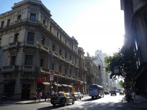
buenosaires_benontherun.com_ccbyncsaAfter being in Europe, North America and Asia, it is time to explore yet another continent. We’re happy to announce that the 8th international State of the Map 2014 conference will be held in Buenos Aires, Argentina (map) on November 7th – 9th.

OSM is a truly global project with people all over the globe. Having SotM14 in Argentina is a great way to show the world what’s going on in South America regarding OSM and it can help strengthen the local OSM communities there.

If you haven’t made holiday plans for this year yet, why not consider Argentina in the spring? (yes, it will be spring there)

In case you live in Europe or North America and you feel Argentina is too far away? You’re still invited to join SotM-EU (Karlsruhe, June 13 – 15) or SotM-US (Washington DC, April 12 and 13).

More details about SotM14 will follow later this month. Stay tuned.

[UPDATE: Lots more details can be found at stateofthemap.org]

(image by benontherun.com cc-by-nc-sa 2.0)

Weekly OSM Summary #85

December 16th, 2013 – December 30th, 2013
A summary of all the things happening in the OpenStreetMap world.

  • The call for presentations for the upcoming State of the Map Europe (SotM-EU) is available here.
  • A new version of the JOSM OSM editor has been published. For Windows users switching to JAVA version 7 is recommended.
  • Simon Poole updated the “Street Name Completeness Statistics” for Switzerland.
  • SK53 wrote a blog post about mapping off-piste OSM ski routes for freeriding.
  • Steven Vance wrote a blog post about his work to ensure a proper bike routing in the Chicago Bike Guide.
  • The Hiking and Trail Riding map got a small redesign and is now again available in English. Give it a try here.
  • OSM contributor MorbZ published an iOS app for displaying and editing opening hours of OSM shops, bars, restaurants and more.

Authors: Pascal & Dennis – (thx @ “Wochennotiz”)

Weekly OSM Summary #84

December 2nd, 2013 – December 16th, 2013
A summary of all the things happening in the OpenStreetMap world.

Authors: Pascal & Dennis – (thx @ “Wochennotiz”)

Weekly OSM Summary #83

November 18th, 2013 – December 2nd, 2013
A summary of all the things happening in the OpenStreetMap world.

  • A redesign of OpenStreetMap.org is live since the beginning of December, 2013. You can find additional information in a blog post here.
  • A set of improvements has been pushed to uMap. With uMap you can create a map with OpenStreetMap layers within a minute and embed them into your website.
  • Seth Vincent wrote an introduction to leaflet. Additionally, Chris Hill published a tutorial (1 & 2) on using leaflet. Leaflet is an open-source JavaScript library for mobile-friendly interactive maps.
  • During the #hackess hackathon in Paris, a route planning prototype for wheelchair users has been implemented based on OSRM and OSM data. A demo is online here.
  • A number of Spanish video tutorials showing how to use the OSM JOSM editor.
  • A blog post by Peter Karich on how to set up your own OSM graphhopper routing service.
  • OSM France started a quality study around French OSM administrative boundaries.
  • Rafa Gutierrez wrote a blog post on how to create GoPro video maps.
  • OSM contributor Belecker published a new JOSM plugin (Tracer2) to extract areas, with focus on buildings from graphics (no photos). Read more in the OSM wiki.
  • Adam Jordanek created a website which shows bars, pubs, restaurants and other facilities with their corresponding opening hours. Give it a try here.
  • SK53 wrote a blog post about the last OSM hack weekend in London.

Authors: Pascal & Dennis – (thx @ “Wochennotiz”)

Goodbye 2013, Hello 2014

simon-poole

Simon Poole
OpenStreetMap Foundation Chairman

It’s customary at the end of the year and at the start of a new to reflect on what has been achieved and highlight noteworthy events in the past year. For OpenStreetMap 2013 would seem to me to be the year in which using our data is no longer extraordinary, but normal.

Over the course of the year we have seen devices from Bosch, Garmin and others being announced or delivered ex factory with OSM based maps, and we’ve seen a number of media houses switch to using OSM for their online publications. None of these seemed to be perceived as earth shattering, just matter of fact. The downside is that we have to actively remind ourselves that we, a small free and open project, are achieving astounding inroads in to an area of activity otherwise open only to governments and multi-billion dollar corporations.

For old hands 2013 is more likely to be noteworthy for two quite visible changes. One was the introduction of the new default editor iD. I would like to take the opportunity and specially thank the authors of previous default Potlatch 1 and 2  that are so closely coupled to the success of OpenStreetMap and which have served us, and continue to do so, well over many years.

The other change  naturally was the deployment of the web site redesign replacing the sidebar and tab layout with the current design. If archive.org is to be believed the previous layout had been with us since December 2005  and it was not a surprise that there was some turmoil and emotions accompanying the change.

At the end of the year our special thanks should also go to the volunteers that keep our infrastructure running and further to all contributors big and small that make OpenStreetMap what it is.

From the perspective of the OpenStreetMap Foundation among our goals for 2014 are  formalizing the relationship with our national and thematic organisations and to stabilizing our funding model going forward.

The project as a whole continues to show healthy growth both in coverage, participants, quality and usage. If I was personally asked what we need to consciously add more of, instead of just doing what we always do, I would point to address collection. While we added up to an incredible 1 million addresses per month in 2013 we really need to increase this a bit and while, naturally, some of this will come from imports, just walking around a block and jotting down the house numbers every time we are somewhere new could greatly increase the rate at which we approach the goal of including a free address dataset in the OSM data.

On this note, I wish everybody a happy new year and have a fun 2014 mapping.