Yearly Archives: 2011

Weekly OSM Summary #10

02/01/2011 – 02/14/2011

A summary of all the things happening in the OpenStreetMap world:

  • Bing launched an experimental service, which automatically traces ways from aerial images; A JOSM plug-in can be found here (JOSM-Plugin) and a demo without Silverlight here (Demo). More information about the official announcement and the method that is being used can be found at Andrew Turner’s blog post: “Automatic Road Detection – the Good and the Bad” and at Microsoft’s project member Ido Omer’s post at OSM-Talk.
  • The openstreetmap.de map has a new style! It is the result of collaboration work between Beate Braun’s bachelor-thesis and Geofabrik. The design is based on the Mapnik-Style and has a few new adjustments.
  • OpenCycleMap gets some small updates too – Here you can read more in Andy’s blog.
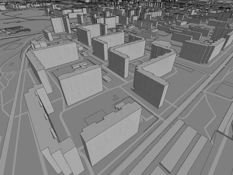
  • A new program visualizes OSM in 3D. A lot of developers that are currently working on topics that include OSM and 3D can meet at an OSM Wiki page now.
  • A flow animation of hiring bikes in London based on OpenStreetMap.
  • The future of Tiles@Home and how it could go on. Up to now the server and clients are not active yet and still under development.
  • New blog post by the Working Groups of the OSM-Foundation.
  • A User has been banned from the OSMF by the Data Working Group. He was tracing data from Google Maps. All his edits in OpenStreetMap have been deleted. Read more in the OSMF-talk mailing list.
  • Matthias Meißer is working on a worldwide Map of OSM usergroups. Germany has already such a map at openstreetmap.de.
  • A new project, OpenDEM, would like to collect an “Open Digital Elevation Model (OpenDEM)” of the world.
  • New Zealand starts its own OSM portal: www.openstreetmap.org.nz.
  • Really nice “Point-of-Interest (POI)” map-demo for Paris: http://demo.3liz.fr/osminterest
  • SPOT donates images of the Ivory Coast for HOT.
  • You can register for the next SotM now! The conference will take place in Denver, Colorado from September 9th until September 11th,2011; some early registration discounts are available here (link). More Information can be found in the Wiki. Also, the winner of the Logo competition has been announced. Congratulation!
  • The upcoming WhereCampEU will take place in Berlin (May 27th and 28th).
  • February 16th, 2011 is a public HOT conference call.
  • The next “Open Knowledge Conference” (OKCon 2011) will be held in Berlin from June 30th till July 1st (via Talk-de).
  • Christoph Eckert wrote a blog post about the OSM-booth at the “Horizont Outdoor“ in Karlsruhe.

Authors: Pascal, Jonas & Dennis
Did we miss something? Do you want to help us collecting the news for next week’s issue? 
You can contact us via mail or Twitter.


Project of the Week: Florist

Has the weather looked a bit monochromatic lately? Let’s brighten
things up a bit by mapping something colorful. How about a flower
shop? Flowers, bouquets, corsages and arrangements for events are
available from a florist shop.

http://wiki.openstreetmap.org/wiki/Project_of_the_week/2011/Feb_09

This is your Project of the Week. Make suggestions. Inspire other
mappers. What is it about contributing to OpenStreetMap that
interests you? Postboxes? Bowing alleys? Share your OpenStreetMap
interests by contributing a Project of the Week.

http://wiki.openstreetmap.org/wiki/Project_of_the_week/Proposals

Florist photo by Lenore Edman http://www.flickr.com/photos/lenore-m/
is licensed CC-By http://creativecommons.org/licenses/by/2.0/deed.en_CA

There is an interesting story about the neon florist sign.

Image of the Week: University of Delaware goes OSM

Media_httpwikiopenstr_fnxsg

University of Delaware has rolled out a campus map that is based on
OpenStreetMap.

This is a Featured image, which means that it has been identified as
one of the best examples of OpenStreetMap mapping, or that it provides
a useful illustration of the OpenStreetMap project.

If you know another image of similar quality, you can nominate it on
Featured image proposals.

http://wiki.openstreetmap.org/wiki/Featured_image_proposals

Automatic road detection from imagery

Steve Coast has been busy since his arrival at Bing a while back. They
have rolled out a neat, automated road finder service. Have a look at
the demonstration video here:

http://magicshop.cloudapp.net/

And the announcement and more details here:

http://www.bing.com/community/site_blogs/b/maps/archive/2011/02/03/automatica…

Road image by Nicholas_T http://www.flickr.com/photos/nicholas_t/
is licensed CC-By http://creativecommons.org/licenses/by/2.0/deed.en_CA

Working Group Summary

We’ve fallen behind on the Working Group Summaries as the snow got deeper.  Let’s try again.  These summaries do not replace the formal minutes of the working groups, they are intended to be a quick and easy summary of recent topics before the working groups.

Data Working Group

The Data Working Group met most recently on 20 January 2011. They responded to a report of inappropriately sourced data in Ecuador.  In the end that data was removed and the Ecuadoran community was notified on talk-ec@.

Technical Working Group

TWG met on 26 Jan 2011. Tile server loads are increasing. One major cause is the continued growth of data in well-mapped areas. A node moved in central Berlin, for example, causes re-rendering of a very complex meta-tile.  TWG is considering 5 minute expiry time to reduce the amount of re-rendering during an editing session. A new power supply is required for one server.  Most equipment has been transitioned to the new power management hardware.

The TWG also updated the near-, mid- and long-term hardware maintenance plan.

State of the Map Working Group

SotMWG met on 26 Jan 2011 and have released their Call for Papers for Denver.  The SotMWG is still accepting members.  Would you like to help organize the OpenStreetMap conference this year?   In particular, please offer your help to team@stateofthemap.org if you can help translate the Call for Papers. The SotM logo contest ends soon.

Communication Working Group

The CWG meeting of 24 Jan 2011 was canceled due to scheduling issues.

License Working Group

The LWG meeting of 25 Jan 2011 was canceled due to illness.

Strategic Working Group

The SWG met on 27 Jan 2011 and formalized the initial membership and operating practices of the SWG.  There was a review of the proposed budgeting process.

Project of the Week: Confectionery

It was a magical place when we were younger. A place full of sweet
scents, that lead to sticky fingers and perhaps a bit of stray sugar
on a cheek. It was exciting to be going there and disappointing to
have to leave.

You can make an excuse to revisit that place of happy memories, new
flavor discoveries and a tiny little bit of sugar-inspired energy.
The Project of the Week is to map your local candy store. Find out
how to add your local candy store to the map, and watch the results as
other mappers do the same.

http://wiki.openstreetmap.org/wiki/Project_of_the_week/2011/Feb_02

This is your Project of the Week. Make suggestions. Inspire other
mappers. What is it about contributing to OpenStreetMap that
interests you? Postboxes? Bowing alleys? Share your OpenStreetMap
interests by contributing a Project of the Week.

http://wiki.openstreetmap.org/wiki/Project_of_the_week/Proposals

Candy display photo by http://www.flickr.com/photos/ume-y/
is licensed CC-By-SA http://creativecommons.org/licenses/by-sa/2.0/deed.en_CA

Weekly OSM Summary #9

01/19/2011 – 02/01/2011

Every week a lot of things are happening in the OpenStreetMap (OSM) world. It can be hard to keep track of all the different communication channels and don’t miss any important news. That’s why we’ve created a short summary of all the news here. Enjoy! (Sorry, we couldn’t keep the weekly schedule because we’re still only two authors who are busy with other stuff too 🙁 )

  • MapQuest donated 50,000$ to the OpenStreetMap Foundation (OSMF). The money will primarily be used for upgrading and maintaining the hardware resources of the OSM project.
  • Nominatim was subject to some improvements that should improve the search quality, especially in the US.
  • Gregory Marler has written a small How-to for using Chrome’s Omnibox to search on http://openstreetmap.org.
  • The new Java XAPI was online for a first public test last week. Due to hardware problems it’s now down again. A new graphical user interface for creating queries is also in development.
  • MapQuest has released three new services: Open Guidance Service, Open JavaScript SDK and Open Tiles Service.
  • “Orebro is Sweden’s first municipality to release geodata under an ODbl license, requiring attribution and ‘share alike’.” Link to the news article.
  • The Humanitarian OpenStreetMap Team (HOT) has chosen its new logo.
  • OpenStreetMap has reached 350,000 registered users.
  • “Geo-Analytics on OpenStreetMap Road Data”: OpenStreetMap is adding about 90,000km of roads a week at the moment. More analytics here.
  • User:SK53 has created a map that shows the density of pubs for every 5 square kilometer in the UK.
  • Ito World improved its OSM Analysis service and made some analysis on the completeness of OpenStreetMap in Great Britian.
  • Nick Whitelegg updated OpenTrailView and Freemap UK.
  • FortiusOne developed a new map layer tool called Acetate. It allows one to compile several different map layers (roads, road names, POIs, place names) in a custom order and insert their own mashup data in between.
  • Maps4Mac is an app for Mac OS X that is rendering OSM data on demand with Mapnik from a database.
  • The before mentioned 3D globe – rendered with WebGL in your web browser – is now live.
  • WheelMap is now available in Japanese too. They are also looking for translators to make it available in Portugese, Icelandic and more languages.
  • Liberation, a French daily newspaper has started to use OSM as a base map on their website. Here’s an example article.

For more news, especially regarding new tags and wiki pages, you can check-out the community-updates over here.

Authors: Pascal & Jonas
We missed something? You want to help us collecting the news for next week’s issue? 
You can contact us via mail or Twitter.