Author Archives: Richard Weait

Wolfram Alpha is using OpenStreetMap data

Media_httpimgurcomdx7_jtafi

Frank Sautter reports on osm-talk that Wolfram|Alpha is using
OpenStreetMap data.

So if you search for, Girona, as in the example above, their reply
includes a map based on OSM data, like below.

Media_httpimgurcomybx_bvnis

So why would you search for “Girona” on Wolfram|Alpha? Because Girona
is where State of the Map will be held in just a few short weeks. You
really should attend. It will be informative and fun. And it will be
both in large measures.

Register now for State of the Map

http://stateofthemap.org/register/

L.A. Times: Digital map of the world is the product of a large-scale volunteer effort

Media_httpimgurcom5m8_dhghj

OpenStreetMap user “Beej” is quoted widely in the L.A. Times article
on OpenStreetMap.

Digital map of the world is the product of a large-scale volunteer effort
With the help of more than 240,000 volunteer cartographers worldwide,
OpenStreetMap is trying to create an Internet map of every street in
every city and village on the planet.
June 09, 2010|By Mike Swift

SAN JOSE, Calif. — — When Brian “Beej” Hall first heard
about an ambitious volunteer effort to create an Internet map of every
street and path in every city and village on the planet, he was
hooked. At the time, the nascent effort had only a few American
members, and the U.S. map was essentially a digital terra
incognita.

Read the whole article here:

http://articles.latimes.com/2010/jun/09/business/la-fi-digital-maps-20100609

Image of the Week: Indian Railway Network on OSM

Media_httpimgurcomrsi_obifk

This visualization of Indian Railway Network was created by Arun
Ganesh. Arun has even includind instructions on how the image was
created. http://commons.wikimedia.org/wiki/File_talk:Indian_Railway_Network_Coverage_on_OSM.png

This is a Featured image, which means that it has been identified as
one of the best examples of OpenStreetMap mapping, or that it provides
a useful illustration of the OpenStreetMap project.

If you know another image of similar quality, you can nominate it on
Featured image proposals.
http://wiki.openstreetmap.org/wiki/Featured_image_proposals

Photo is CC-by-sa Arun Ganesh, National Institute of Design Bangalore

http://creativecommons.org/licenses/by-sa/3.0/deed.en

OSMF Annual General Meeting and Board Elections Announced

http://www.flickr.com/photos/51035644987@N01/2941880596/

Official notice arrived from the Secretary of the OpenStreetMap
Foundation today. The OSMF AGM will be held in Girona at SotM 2010.
Elections to the OSMF board will be held at the AGM.

The official announcement was sent by email to OSMF members. You can
find details on the OSM wiki.
http://wiki.openstreetmap.org/wiki/Foundation/AGM10

Those who choose to stand for election to the OSMF board of directors
must join OSMF first. Nominations will be listed on the OSM wiki as
well. http://wiki.openstreetmap.org/wiki/Foundation/AGM10/Election_to_Board

Ballot photo by D’Arcy Norman http://www.flickr.com/photos/dnorman/
is licensed cc-by http://creativecommons.org/licenses/by/2.0/deed.en_CA

Project of the Week: Another Roadside Attraction

This road trip is dragging on for hours. Highway construction slowed
your progress through the last town and there is a funny smell coming
from the air conditioner. The family is getting hungry, fuel is
getting low, and it isn’t just the car that needs a pit stop at this
point. Fortunately, the billboards have been telling you about an
approaching roadside oasis every five miles for the last fifty. A
place to stop and unwind, let the dog run around and walk the kids. A
place for food and fuel and maybe even a photo with the oversized
roadside attraction.

This week’s project is to map roadside attractions. They are the huge
fibreglass apple or World’s biggest lobster or an oversized Canada
goose, placed to be visible from the highway, and attached to a fast
food joint and probably a gift shop.

Learn more about this Project of the Week,
http://wiki.openstreetmap.org/wiki/Project_of_the_week/2010/Jun_13

This is your Project of the Week. Make suggestions,
http://wiki.openstreetmap.org/wiki/Project_of_the_week/Proposals

Big Apple photos by rw__ http://www.flickr.com/photos/51037673@N03/
licensed ccby http://creativecommons.org/licenses/by/2.0/deed.en_CA

License upgrade notice on the OSM wiki

As part of the ongoing OSM data license upgrade, a small notice has
been added at the top of each page on the OSM wiki,
http://wiki.openstreetmap.org/

That notice reads Find out more about OpenStreetMap’s upcoming
license change. That notice links to the license change summary
page on the OSM Foundation wiki.

http://www.osmfoundation.org/wiki/License/We_Are_Changing_The_License

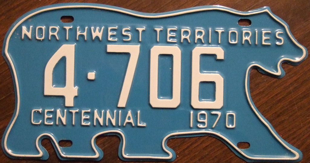
NWT license plate photo by woody1778a
http://www.flickr.com/photos/woodysworld1778
is licensed cc-by-sa http://creativecommons.org/licenses/by-sa/2.0/deed.en

Humanitarian OpenStreetMap Team: Mission 2 – Jacmel and Leogane

Dane Springmeyer has posted another field report from the
OpenStreetMap folks participating in the humanitarian response in
Haiti.
Here is a brief extract, but you’ll want to read the whole report by
following the link below.

[ … ] He had become known as the map guy simply because
he had them on his wall and the stack given to him from the Port Au
Prince OCHA office was quickly dwindling. Dane showed him
walking-papers.org, where he could easily print off PDF maps of
Leogane with up-to-date OSM data (even the Mango trees and the camp
outlines we added that morning) , and he exclaimed that this was
exactly what he needed. [ … ]

Read the full report
http://hot.openstreetmap.org/weblog/?p=5

Crossing the mountains to Jacmel photo by dbsgeo
http://www.flickr.com/photos/50235282@N07/
Licensed cc-by-sa-nc http://creativecommons.org/licenses/by-nc-sa/2.0/deed.en

Image of the Week: Brixton Mini Mapping Party

OSMers were invited to run a mini mapping party at Brixton Market as
part of a tech themed event, which in turn is part of the wider
project called Spacemakers Brixton. Passersby were able to mark
improvements on the map with pins and yarn.

http://wiki.openstreetmap.org/wiki/Spacemakers_Brixton_mini_mapping_party

Brixton pin map is by Ciarán Mooney http://www.flickr.com/photos/20156581@N03/
and licensed cc-by-sa http://creativecommons.org/licenses/by-sa/2.0/deed.en

Introducing the Strategic Working Group

Long time OpenStreetMap contributor, OSMF board member and OpenGeoData
contributor, Mikel Maron[1] has launched a Strategic Working Group for
the OpenStreetMap Foundation. If you are not familiar with Mikel by
name or through his participation on the OSMF board since 2007, you
might know him as one of the driving forces behind
http://mapkibera.org/

The Strategic Working Group is in the very earliest stages of planning
for itself and for the future of OpenStreetMap. In fact, it should be
no surprise if you have heard little of the Strategic Working Group
before now. Thus, this introduction.

To date, Mikel is the only member[2] of the Strategic Working Group,
and also serves as its chair. Points of contact for the Strategic
Working Group are the mailing list[3] and the beginnings of some wiki
pages[4].

The goal of the Strategic Working Group is to serve the OpenStreetMap
Foundation and community by raising funds where needed and to plan and
provide for the smooth operation and growth of OpenStreetMap.
Essentially the goal is to do those things individual mappers may not
care to do, and those things that individual mappers may not be able
to accomplish in ad-hoc groups. These goals will be refined and
formalized with time.

When this group was first announced on 21 May 2010, on the OSMF
mailing list[5], Mikel envisioned the tasks as:

I anticipate the WG would be looking at tasks like the following:

* Evaluate our current fund-raising strategies and budget allocations.
* Assess the overall needs and priorities for the Foundation, and
determine where resources are needed.
* Make recommendations for changes to the budget allocations to the Board.
* Assess the strengths and positions of funders with interest in
OpenStreetMap. Assess other fundraising methods.
* Help shape programs and draft proposals to funders.

Your thoughts on what the Strategic Working Group should be, what it
should do, and how it operate are important. Now is a great time for
you to get involved with the Strategic Working Group.

There has already been some interest in the SWG from members of the
OSMF mailing list. On the Strategic Working Group mailing list you’ll
see some business people who are OSM consumers, you’ll see some of the
usual community faces you’ll see some of the developers and admins who
keep OSM running.

To be successful, the the Strategic Working Group will need more than
a few business people, a few OSM folks and good intentions. To be
successful, the SWG needs to perform the tasks that you assign to it.
Now and in the future, the SWG needs to listen to the community and
remove the obstacles that hinder mappers.

To be successful, the SWG needs to make sure that OpenStreetMap keeps
getting better. An ideal SWG would be indistinguishable from a magic
lamp; if mappers make a wish, the SWG should provide. You can help by
participating. What do you wish?

What are the problems that the SWG should solve? How should the SWG
best communicate with you? How will the SWG know that their goals
have been reached?

* Is it impossible to edit OSM in your preferred language?
* Does it take too long to save data edits?
* Is your connection to OSM servers irregular?

[1] http://wiki.openstreetmap.org/wiki/User:Mikel
[2] http://www.osmfoundation.org/wiki/Working_Groups#Stragegy_Working_Group
[3] http://lists.openstreetmap.org/listinfo/strategic
[4] http://wiki.openstreetmap.org/wiki/Strategic_working_group
[5] http://lists.openstreetmap.org/pipermail/osmf-talk/2010-May/000891.html